Uruguay - República Oriental del Uruguay La República Oriental del Uruguay es un estado de América del Sur, el segundo más pequeño del subcontinente con una superficie de 176.215 km². Limita al norte y al este con Brasil, al oeste y suroeste con Argentina (límites: Río Uruguay y Río de la Plata) y al sureste con el Océano Atlántico. Se encuentra segundo en la lista de percepción de la corrupción dentro de Latinoamérica, justo después de Chile.
Português
Uruguai - República Oriental do Uruguai O Uruguai é o menor país da América do Sul, localizado no centro-sul do subcontinente é limitado ao norte pelo Brasil, ao sul pela Rio da Prata que o separa da Argentina, que também divisa-o a oeste, e a leste pelo Oceano Atlântico. Sua capital e maior cidade é Montevidéu. A língua portuguesa também goza de estatuto diferenciado, sendo idioma obrigatório nas escolas uruguaias.
The Eastern Republic of Uruguay, or the Republic East of the Uruguay (River), is a nation located in the southeastern part of South America. It is bordered by ► Brazil to the north, the Uruguay River to the west, the estuary of the Río de la Plata (literally "River of the Silver", but commonly known in English as "River Plate") to the southwest, with ► Argentina on the other bank of both, and finally the South Atlantic Ocean to the southeast. About half of its people live in the capital and largest city, Montevideo.
Short name
Uruguay
Official name
Eastern Republic of Uruguay
Status
Independent country since 1825, recognized in 1828
This section holds a short summary of the history of the area of present-day Uruguay, illustrated with maps, including historical maps of former countries and empires that included present-day Uruguay.
Map of the United Provinces of South America, 1816
Map of the Province Oriental
Old maps
This section holds copies of original general maps more than 70 years old.
Rio de la Plata and Paraguay 1600 by Jodocus Hondius
Map of the lands under control of Paraguay and Buenos Aires, anno 1752
Satellite maps
Satellite map
Satellite map
Notes and references
General remarks:
The WIKIMEDIA COMMONS Atlas of the World is an organized and commented collection of geographical, political and historical maps available at Wikimedia Commons. The main page is therefore the portal to maps and cartography on Wikimedia. That page contains links to entries by country, continent and by topic as well as general notes and references.
Every entry has an introduction section in English. If other languages are native and/or official in an entity, introductions in other languages are added in separate sections. The text of the introduction(s) is based on the content of the Wikipedia encyclopedia. For sources of the introduction see therefore the Wikipedia entries linked to. The same goes for the texts in the history sections.
Historical maps are included in the continent, country and dependency entries.
The status of various entities is disputed. See the content for the entities concerned.
The maps of former countries that are more or less continued by a present-day country or had a territory included in only one or two countries are included in the atlas of the present-day country. For example the Ottoman Empire can be found in the Atlas of Turkey.


.png)
 Location department Artigas
 Location department Canelones
 Location department Cerro Largo
 Location department Colonia
 Location department Durazno
 Location department Flores
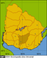 Location department Florida
 Location department Lavalleja
 Location department Maldonado
 Location department Montevideo
 Location department Paysandú
 Location department Río Negro
 Location department Rivera
 Location department Rocha
 Location department Salto
 Location department San José
 Location department Soriano
 Location department Tacuarembó
 Location department Treinta y Tres
.png)
.png)
.png)
.png)
.png)
.png)
.png)
.png)
.png)
.png)
.png)
.png)
.png)
.png)
.png)
.png)
.png)
.png)
.png)


