Atlas of Slovenia
Specific status: Akrotiri and Dhekelia‡ · Faroe Islands · Gibraltar · Bailiwick of Guernsey · Isle of Man · Jersey · Svalbard – Limited recognition: Abkhazia‡ · Gagauzia · Kosovo · South Ossetia‡ · Transnistria · Northern Cyprus‡
‡: partly located in Europe

|
Wikimedia Commons Atlas of the World The Wikimedia Atlas of the World is an organized and commented collection of geographical, political and historical maps available at Wikimedia Commons. Discussion • Update the atlas • Index of the Atlas • Atlas in categories • Other atlases on line |
|
| ||||||||||||||||||||||||||||||||||||||||||||


General maps

|
Map of Slovenia |

|
Map of Slovenia in Slovenian |

|
Topographic map of Slovenia |

|
Map of Slovenia |

|
Map of Slovenia in the colors of the Flag of Slovenia. |
| Blank map |

|
Blank map |

|
Statistical Regions |

|
Statistical Regions |

|
Municipalities of Slovenia |

|
Traditional regions |

|
Traditional historical regions |
History maps
This section holds a short summary of the history of the area of present-day Slovenia, illustrated with maps, including historical maps of former countries and empires that included present-day Slovenia.

|
Possible extent of (proto-)Celtic influence 800-400 BC Die Kelten in Europa. Ocker: Kernbereich Nordwestalpine Hallstattkultur (ca. 750–500/450 v. Chr.) grün: Ausbreitung La-Tène-Kultur, bzw. orange: der keltischen Sprache (3. Jh. v. Chr.) |

|
Territorial development of the Roman Empire 264 BC-192, including the conquest of present day Slovenia |

|
Roman Republic 100 BCE |

|
Map of the Roman Empire in 50 |

|
The extent of the Roman Republic and Roman Empire; 133 BC 44 BC (late Republic, after conquests by republican generals) AD 14 (death of Augustus) 117 (maximum extension)
|

|
Camps of the Roman Legions in 80 |

|
Map of the Roman Empire in 116 |

|
Noricum in the Roman Empire (116) |

|
Pannonia in the Roman Empire (116) |

|
Dalmatia in the Roman Empire (116) |

|
Roman Empire in 117 |

|
Territory of Slovenia within Roman Empire, 1-300 AD |

|
Roman Empire divided 395, showing the dioceses and praetorian prefectures of Gaul, Italy, Illyricum and Oriens (east), roughly analogous to the four Tetrarch zones of influence after Diocletian's reforms. |

|
The division of the Empire after the death of Theodosius I, ca.395 AD superimposed on modern borders. |

|
Invasions of the Roman Empire 100-500 |

|
Invasions of the Roman Empire 100-500 |

|
Division of the Roman Empire in 406 |
.PNG)
|
Eastern Roman Empire and Western Roman Empire, c.476 |

|
Migration of the Slavs, 5th-10th century |

|
Suabes in 550 AD |

|
Slavic lands in Europe, 6th-7th century |

|
Slavic lands in Europe, 7th-8th century |

|
Tribal Kingdom of Samo, 631 AD |

|
Samo's Realm, 7th century |

|
Samo's Realm, 7th century |

|
Valuk's Carantania, 7th century |

|
Slavic lands in Europe in 700 AD |

|
Slavic lands in Europe, 8th-9th century |

|
Carinthia and Rise of the Frankish Empire, 8th-9th century |

|
Slovenian principalities in 800 |

|
Slovenian principalities in 800 |

|
Carniola around 800 |

|
Carantania in 800 |

|
Carinthia within Carolingian Empire around 800 |

|
Carolingian Empire (in French) |

|
Carinthia and Carniola in Europe in 814 Europa im Jahre 814 |

|
Carinthia during the Treaty of Verdun (843) and Treaty of Meerssen (870) |

|
Carinthia during the division of the Frankish Empire after 870 |

|
Carantania in 880 |

|
Frankish Lower Pannonia, 9th century |

|
Pannonian Slavic Duchy (Balaton Principality) in the 9th century |

|
Pannonian Slavic Duchy (Balaton Principality) in the 9th century |

|
Pannonian Slavic Duchy (Balaton Principality) in the 9th century |

|
Principality of Braslav in the 9th century |

|
Slavic lands in Europe in 900 |

|
Map of Karantania / Carinthia, 10th century |

|
Marks of Carniola, Carinthia and Istria in the 10th century |

|
Carinthia and Carniola in Central Europe 919-1125 |

|
Great duchy of Carantania / Carinthia in 952-1180 |

|
Duchy of Carantania / Carinthia in 990 |

|
Carinthia in 1000 |

|
Carinthia in 1084 |

|
Czech Kingdom under king Přemysl II, 1253-1271 |

|
Styria, Carinthia and Carniola under Habsburgs, 13th-16th century |

|
Principality of Celje, 15th century |
-en.png)
|
Carinthia, Carniola and Styria in the map of the Holy Roman Empire and its circles in 1512 |

|
The (Habsburg) Empire of Charles I/V. Castile Aragon Burgundy Habsburg
|

|
Carinthia, Carniola and Styria in the (Habsburg) Empire of Charles I/V in 1547 |

|
Carniola in 1560 |

|
The religious situation in central Europe about 1618 |

|
Area controlled by the Holy Roman Empire around 1630 |

|
Map of the Duchy of Carniola, Windic March and Istria in 1714 |

|
Illyrian Provinces of the French Empire in 1810 |

|
Illyrian Provinces of the French Empire in 1811 |

|
Illyrian provinces in 1811 |

|
Kingdom of Illyria in 1814-1815 |

|
Kingdom of Illyria in 1816 |

|
Austria inside the German Confederation |

|
Austria inside the Borders of the German Confederation in 1820 |

|
Kingdom of Illyria within Austrian Empire (1818) |

|
Kingdom of Illyria within Austrian Empire (1822-1849) |

|
Kingdom of Illyria within Austrian Empire (1822-1849) |
.jpg)
|
A view on United Slovenia (enlarged Kingdom of Illyria) in 1848 |
.jpg)
|
Slovenians in the ethnic map of Austria-Hungary, census 1880. German version |

|
Religions in Austria-Hungary, Andrees Allgemeiner Handatlas, 1st Edition, Leipzig (Germany) 1881 |
.JPG)
|
Slovenians in the ethnic map of Austria-Hungary, census 1890. English version |

|
Austrian Littoral and Carniola in 1897 |
.jpg)
|
Slavic lands in Europe in 1900 |

|
Historical map of Austria-Hungary from the Bibliothek allgemeinen und praktischen Wissens für Militäranwärter Band I, 1905 |

|
Proposed state of Carniola within the United States of Greater Austria in 1906 |

|
Proposed state of Carniola within the United States of Greater Austria in 1906 |

|
In 1867 the Austrian Empire was continued by Austria-Hungary, making both Austria and Hungary constituent monarchies. This is map of Austria-Hungary from 1913 |

|
Kingdoms and countries of Austria–Hungary: Cisleithania: 1. Bohemia, 2. Bukovina, 3. Carinthia, 4. Carniola, 5. Dalmatia, 6. Galicia, 7. Austrian Littoral, 8. Lower Austria, 9. Moravia, 10. Salzburg, 11. Silesia, 12. Styria, 13. Tyrol, 14. Upper Austria, 15. Vorarlberg; Transleithania: 16. Hungary, 17. Croatia and Slavonia; 18. Bosnia and Herzegovina |

|
Austria-Hungary in 1914 |

|
Istria, Trieste and Gorizia in 1914 |

|
The end of Austria-Hungary (in German) |

|
State of Slovenes, Croats and Serbs in 1918 |
.PNG)
|
Republic of Prekmurje in 1919 |

|
Republic of Prekmurje in 1919 |

|
Kingdom of Serbs, Croats and Slovenes in 1919 |
| [[|border|251x400px]] | After World War I, Slovenia became part of the Kingdom of Serbs, Croats and Slovenes in 1918, which was renamed into Kingdom of Yugoslavia in 1929. This is a map of Kingdom of Yugoslavia in 1930, showing Drava banovina province |

|
Drava banovina in the Kingdom of Yugoslavia in 1929-1939 |

|
Drava banovina in the Kingdom of Yugoslavia in 1929-1939 |

|
Drava banovina in the Kingdom of Yugoslavia in 1929-1939 |

|
Drava banovina in the Kingdom of Yugoslavia in 1929-1939 |

|
Axis invasion of Yugoslavia in 1941 |

|
Triple occupation of Slovenia in 1941 |

|
Triple occupation of Slovenia in 1941 |

|
Occupation of Slovenia in 1943 |
| [[|border|251x400px]] | Triple occupation of Slovenia in 1941 |

|
Triple occupation of Slovenia in 1941 |

|
Triple occupation of Slovenia in 1941 |

|
Province of Ljubljana, 1941-1943 |

|
Province of Ljubljana, 1941-1943 |

|
Administrative districts in territories under the control of Nazi Germany in 1941. Großdeutschland im Jahre 1941 |

|
Fascist concentration camps in Slovenia in WW2 |

|
Future Greater Slovenia in Greater Yugoslavia according to project of Stevan Moljević (1941) |

|
Eastern front of the Second World War circa 1941-1942. |

|
Free Territory of Trieste, 1947-1954 |

|
Free Territory of Trieste, 1947-1954 |

|
Istrian Littoral during 20th century and territorial gains of Slovenia in 1947-1954 |

|
Proposed division of Yugoslavia according to the Pavelić-Stojadinović agreement in 1954 |

|
Division of Socialist Federal Republic of Yugoslavia, showing location of Slovenia (number 1) |

|
Slovenia in the Socialist Federal Republic of Yugoslavia |

|
An animated series of maps showing the breakup of the second Yugoslavia |

|
Wartime in former Yugoslavia in 1991 |

|
Slovenian war, 1991 |

|
Wartime in former Yugoslavia in 1992 |

|
Former Yugoslavia compared with the present borders |

|
Former Yugoslavia compared with the present borders |

|
Croatia-Slovenia maritime boundary dispute |
Satellite maps

|
Satellite map |
Other maps

|
Slovenian language |

|
Slovenian dialects |

|
Styria |

|
Istria |
Maps of divisions
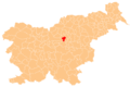
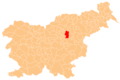
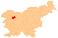
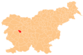
This section holds maps of the administrative divisions.
-
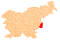
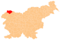
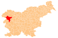
 Ajdovščina municipality
 -
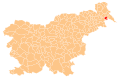
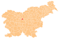
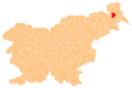
 Apače municipality
 -
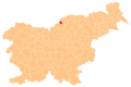
 Beltinci municipality
 -
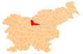
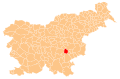
 Benedikt municipality
 -
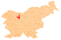
 Bistrica ob Sotli municipality
 -
 Bled municipality
 -
 Bloke municipality
 -
 Bohinj municipality
 -
 Borovnica municipality
 -
 Bovec municipality
 -
 Braslovče municipality
 -
 Brda municipality
 -
 Brezovica municipality
 -
 Brežice municipality
 -
 Cankova municipality
 -
 Celje municipality
 -
 Cerklje na Gorenjskem municipality
 -
 Cerknica municipality
 -
 Cerkno municipality
 -
 Cerkvenjak municipality
 -
 Cirkulane municipality
 -
 Črenšovci municipality
 -
 Črna na Koroškem municipality
 -
 Črnomelj municipality
 -
 Destrnik municipality
 -
 Divača municipality
 -
 Dobje municipality
 -
 Dobrepolje municipality
 -
 Dobrna municipality
 -
 Dobrova-Polhov Gradec municipality
 -
 Dobrovnik municipality
 -
 Dol pri Ljubljani municipality
 -
 Dolenjske Toplice municipality
 -
 Domžale municipality
 -
 Dornava municipality
 -
 Dravograd municipality
 -
 Duplek municipality
 -
 Gorenja vas-Poljane municipality
 -
 Gorišnica municipality
 -
 Gorje municipality
 -
 Gornja Radgona municipality
 -
 Gornji Grad municipality
 -
 Gornji Petrovci municipality
 -
 Grad municipality
 -
 Grosuplje municipality
 -
 Hajdina municipality
 -
 Hoče-Slivnica municipality
 -
 Hodoš municipality
 -
 Horjul municipality
 -
 Hrastnik municipality
 -
 Hrpelje-Kozina municipality
 -
 Idrija municipality
 -
 Ig municipality
 -
 Ilirska Bistrica municipality
 -
 Ivančna Gorica municipality
 -
 Izola municipality
 -
 Jesenice municipality
 -
 Jezersko municipality
 -
 Juršinci municipality
 -
 Kamnik municipality
 -
 Kanal ob Soči municipality
 -
 Kidričevo municipality
 -
 Kobarid municipality
 -
 Kobilje municipality
 -
 Kočevje municipality
 -
 Komen municipality
 -
 Komenda municipality
 -
 Koper municipality
 -
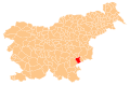
 Kostanjevica na Krki municipality
 -
 Kostel municipality
 -
 Kozje municipality
 -
 Kranj municipality
 -
 Kranjska Gora municipality
 -
 Križevci municipality
 -
 Krško municipality
 -
 Kungota municipality
 -
 Kuzma municipality
 -
 Laško municipality
 -
 Lenart municipality
 -
 Lendava municipality
 -
 Litija municipality
 -
 Ljubljana municipality
 -
 Ljubno municipality
 -
 Ljutomer municipality
 -
 Log-Dragomer municipality
 -
 Logatec municipality
 -
 Loška dolina municipality
 -
 Loški Potok municipality
 -
 Lovrenc na Pohorju municipality
 -
 Luče municipality
 -
 Lukovica municipality
 -
 Majšperk municipality
 -
 Makole municipality
 -
 Maribor municipality
 -
 Markovci municipality
 -
 Medvode municipality
 -
 Mengeš municipality
 -
 Metlika municipality
 -
 Mežica municipality
 -
 Miren-Kostanjevica municipality
 -
 Mirna Peč municipality
 -
 Mislinja municipality
 -
 Mokronog-Trebelno municipality
 -
 Moravče municipality
 -
 Moravske Toplice municipality
 -
 Mozirje municipality
 -
 Murska Sobota municipality
 -
 Muta municipality
 -
 Naklo municipality
 -
 Nazarje municipality
 -
 Nova Gorica municipality
 -
 Novo mesto municipality
 -
 Odranci municipality
 -
 Oplotnica municipality
 -
 Ormož municipality
 -
 Osilnica municipality
 -
 Pesnica municipality
 -
 Piran municipality
 -
 Pivka municipality
 -
 Podčetrtek municipality
 -
 Podlehnik municipality
 -
 Podvelka municipality
 -
 Poljčane municipality
 -
 Polzela municipality
 -
 Postojna municipality
 -
 Prebold municipality
 -
 Preddvor municipality
 -
 Prevalje municipality
 -
 Ptuj municipality
 -
 Puconci municipality
 -
 Rače-Fram municipality
 -
 Radeče municipality
 -
 Radenci municipality
 -
 Radlje ob Dravi municipality
 -
 Radovljica municipality
 -
 Ravne na Koroškem municipality
 -
 Razkrižje municipality
 -
 Rečica ob Savinji municipality
 -
 Renče-Vogrsko municipality
 -
 Ribnica municipality
 -
 Ribnica na Pohorju municipality
 -
 Rogaška Slatina municipality
 -
 Rogašovci municipality
 -
 Rogatec municipality
 -
 Ruše municipality
 -
 Selnica ob Dravi municipality
 -
 Semič municipality
 -
 Sevnica municipality
 -
 Sežana municipality
 -
 Slovenj Gradec municipality
 -
 Slovenska Bistrica municipality
 -
 Slovenske Konjice municipality
 -
 Sodražica municipality
 -
 Solčava municipality
 -
 Središče ob Dravi municipality
 -
 Starše municipality
 -
 Straža municipality
 -
 Sveta Ana municipality
 -
 Sveta Trojica v Slovenskih goricah municipality
 -
 Sveti Andraž v Slovenskih goricah municipality
 -
 Sveti Jurij ob Ščavnici municipality
 -
 Sveti Jurij v Slovenskih goricah municipality
 -
 Sveti Tomaž municipality
 -
 Šalovci municipality
 -
 Šempeter-Vrtojba municipality
 -
 Šenčur municipality
 -
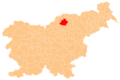
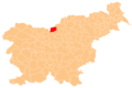
 Šentilj municipality
 -
 Šentjernej municipality
 -
 Šentjur municipality
 -
 Šentrupert municipality
 -
 Škocjan municipality
 -
 Škofja Loka municipality
 -
 Škofljica municipality
 -
 Šmarje pri Jelšah municipality
 -
 Šmarješke Toplice municipality
 -
 Šmartno ob Paki municipality
 -
 Šmartno pri Litiji municipality
 -
 Šoštanj municipality
 -
 Štore municipality
 -
 Tabor municipality
 -
 Tišina municipality
 -
 Tolmin municipality
 -
 Trbovlje municipality
 -
 Trebnje municipality
 -
 Trnovska vas municipality
 -
 Trzin municipality
 -
 Tržič municipality
 -
 Turnišče municipality
 -
 Velenje municipality
 -
 Velika Polana municipality
 -
 Velike Lašče municipality
 -
 Veržej municipality
 -
 Videm municipality
 -
 Vipava municipality
 -
 Vitanje municipality
 -
 Vodice municipality
 -
 Vojnik municipality
 -
 Vransko municipality
 -
 Vrhnika municipality
 -
 Vuzenica municipality
 -
 Zagorje ob Savi municipality
 -
 Zavrč municipality
 -
 Zreče municipality
 -
 Žalec municipality
 -
 Železniki municipality
 -
 Žetale municipality
 -
 Žiri municipality
 -
 Žirovnica municipality
 -
 Žužemberk municipality


Notes and references
|
General remarks:
|