Atlas of Brazil
Other territories: Aruba · Bonaire · Curaçao · Falkland Islands · French Guiana · South Georgia and the South Sandwich Islands
‡: partly located in South America

|
Wikimedia Commons Atlas of the World The Wikimedia Atlas of the World is an organized and commented collection of geographical, political and historical maps available at Wikimedia Commons. Discussion • Update the atlas • Index of the Atlas • Atlas in categories • Other atlases on line |
|
| ||||||||||||||||||||||||||||||||||||||||
_-_BRA_-_UNOCHA.svg)

General maps

|
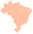
Map of Brazil |

|
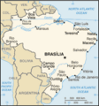
Map of Brazil |

|
Map of Brazil |

|
Map of Brazil |

|
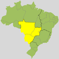
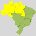
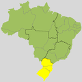
Regions of Brazil: 1 • Centro-Oeste (Center-West, Midwest) 2 • Nordeste (Northeast) 3 • Norte (North) 4 • Sudeste (Southeast) 5 • Sul (South) |

|
Regions |

|
States of Brazil |

|
Brazil municipalities |
Maps of divisions
This section holds maps of the administrative divisions.
Regiões / regions
-
 Centro-Oeste (Center-West)
 -
 Nordeste (Northeast)
 -
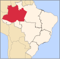
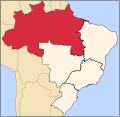 Norte (North)
 -
 Sudeste (Southeast)
 -
 Sul (South)
 -
 Centro-Oeste
 -
 Nordeste
 -
 Norte
Norte -
 Sudeste
 -
 Sul
Sul


Estados / states
-
 Acre
Acre -
 Alagoas
 -
 Amapá
Amapá -
 Amazonas
 -
 Bahia
Bahia -
 Ceará
Ceará -
 Distrito Federal
 -
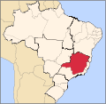
 Espírito Santo
 -
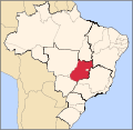
 Goiás
Goiás -
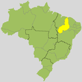
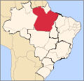
 Maranhão
 -
 Mato Grosso
 -
 Mato Grosso do Sul
 -
 Minas Gerais
 -
 Pará
Pará -
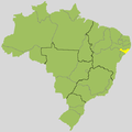
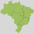
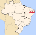
 Paraíba
 -
 Paraná
 -
 Pernambuco
 -
 Piauí
Piauí -
 Rio de Janeiro
 -
 Rio Grande do Norte
 -
 Rio Grande do Sul
 -
 Rondônia
 -
 Roraima
 -
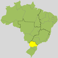
 Santa Catarina
 -
 São Paulo
 -
 Sergipe
 -
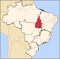
 Tocantins


-

-

-
 Acre
Acre -
 Alagoas
 -
 Amapá
Amapá -
 Amazonas
 -
 Bahia
Bahia -
 Ceará
Ceará -
 Distrito Federal
 -
 Espírito Santo
 -
 Goiás
Goiás -
 Maranhão
 -
 Mato Grosso
 -
 Mato Grosso do Sul
 -
 Minas Gerais
 -
 Pará
Pará -
 Paraíba
 -
 Paraná
 -
 Pernambuco
 -
 Piauí
Piauí -
 Rio de Janeiro
 -
 Rio Grande do Norte
 -
 Rio Grande do Sul
 -
 Rondônia
 -
 Roraima
 -
 Santa Catarina
 -
 São Paulo
 -
 Sergipe
 -
 Tocantins


Cidades / cities
-
 English: Map of ports
 -
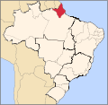
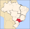
 Localização de Belém no Brasil
 -
 Localização de Florianópolis no Brasil
 -
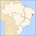
 Localização de Fortaleza no Brasil
 -
 Localização de Goiânia no Brasil
 -
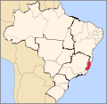
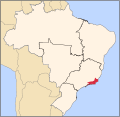
 Localização de Salvador no Brasil
 -
 Localização de São Luís no Brasil


|
Map of Brazil |
History maps
This section holds a short summary of the history of the area of present-day Brazil, illustrated with maps, including historical maps of former countries and empires that included present-day Brazil.

|
Captaincies of Colonial Brazil 1534 |

|
Portuguese colonial possessions in the 19th century |

|
States in 1572 |

|
Captaincies in 1709 |
| File:Brazil in 1789.svg | Captaincies in 1789 |

|
Provinces in 1822 |

|
States in 1889 |

|
States in 1943 |
_-_en_-_colored.svg)
|
States in 1990 |
Old maps
This section holds copies of original general maps more than 70 years old.

|
Map of Brazil, 1519 |
Hydrographic maps
-
 English: Map of rivers
 -
 English: Map of river basins
 -
 English: Eastern rivers
 -
 Rio São Francisco
 -
 Rio Tietê / Rio Paraná
 -
 English: Amazon river basin
 -
 Português: O mapa mostra a Região Hidrográfica do Amazonas

Other maps

|
Population, Administrative Divisions and Economic Regions Map (1977) |

|
Population density (2000) |

|
Population density (2020) |

|
Population distribution in Brazil (2000). |

|
Vegetation map |

|
Vegetation map |

|
Temperature and precipitation |
| Climate classification for Brazil, according to the Köppen criteria. |

|
Economic Activity (1977) |

|
Land use |

|
Agriculture in Brazil |

|
Ports of Brazil |

|
Uranium in Brazil |

|
English: Map of rivers
|

|
English: Map of river basins
|

|
English: Eastern rivers
|

|
River São Francisco |

|
Rio Tietê / Rio Paraná |

|
English: Amazon river basin
|

|
English: Hydrographic map of Amazonas
|

|
English: Map of Brazilian states by area
|

|
English: Map of Brazilian states by GDP per capita
|

|
English: Map of Brazilian States by GDP
|

|
English: Map of Brazilian States by HDI
|

|
English: Map of Brazilian States by Infant mortality
|

|
English: Map of Brazilian states by Life expectancy
|

|
English: Map of Brazilian states by Literacy rate
|

|
English: Map of Brazilian states by Population density
|

|
English: Map of Brazilian states by Population
|

|
English: Map of Brazilian states by Race
|
-
 Português: Mapa-mundiEnglish: Worldmap
 -
 Brasil
 -
 Português: Contorno fino do mapa do Brasil.
 -
 English: Numbered map
 -

-

-

-

-
 English: Map of Brasil in French.Français : Carte du Brésil en Francais.
 -
 Português: Mapa do Brasil com a bandeira nacional.English: Map of Brasil with flag.
 -
 Português: Topografia do Brasil.English: Topographical map of Brasil.


.png)


Notes and references
|
General remarks:
|