| |
|

|
Northern Ireland
|
|
|
|
|
|
|
|
Northern Ireland
Tuaisceart Éireann
Norlin Airlann
|
|
|
|
| English
|
Northern Ireland - Northern Ireland
Northern Ireland is part of the United Kingdom, and covers 5,459 square miles (14,139 km²) in the northeast of the island of Ireland, approximately a sixth of the total area of the island. It has a population of 1,685,000 (April 2001) — between a quarter and a third of the island's total population. It consists of six counties situated within the province of Ulster, and in the UK is generally known as one of its four Home Nations, forming a constituent part of the United Kingdom. The remainder of the island of Ireland is a sovereign state, the Republic of ► Ireland. To the north-east of Northern Ireland lies ► Scotland, to the east lies the ► Isle of Man.
|
| Gaeilge
|
Tuaisceart Éireann
Is ionann Tuaisceart Éireann agus limistéar na sé gcontae úd Aontroim, Ard Mhacha, Doire, An Dún, Tír Eoghain agus Fear Manach a dealaíodh ón gcuid eile d'Oileán na hÉireann nuair a tháinig an Conradh Angla-Éireannach i bhfeidhm sa bhliain 1922. B'é an tAcht um Rialtas na hÉireann ón mbliain 1920 a shainigh críocha agus teorainneacha an stáitín, áfach, cé nach bhfuil teorainneacha cruinne gearrtha dó inniu féin, agus tá áiteanna ann nach féidir a rá fúthu go neamhdhébhríoch cé acu sa Tuaisceart nó sa Phoblacht atá siad suite. Baineann dhá dtrian de Chúige Uladh le Tuaisceart Éireann, ach tá sé de nós ag na hAontachtóirí "Cúige Uladh" (Ulster) a thabhairt ar an stáitín. Stát féinrialaithe ann féin is ea Tuaisceart Éireann, nó go bunúsach, is slánaonad faoi fhéinrialtas é atá faoi fhorlámhas na Ríochta Aontaithe, murab ionann agus an chuid eile d'oileán na hÉireann. Mar sin, is féidir é a chur i gcomparáid le Sasana, leis an mBreatain Beag agus le hAlbain.
|
| Ulster Scots
|
Norlin Airlann
Norlin Airlann[1] is ane o fower pairts o the Unitit Kinrick. It is seetuate on the island o Airlann, whaur it haes a laund mairch wi the Republic o Ireland, the ae pairt o the Unitit Kinrick wi an internaitional laund mairch. It wis foondit by the Govrenment o Ireland Act, 1920. It kivers 5,459 mi² in the nor-aest o the island o Airlann, aboot a saxt o the hale area o the island, an haes 1,685,000 indwallers (Aprile 2001) — atween a quarter an a thrid o the island's hail population.
|
|
| Short name
|
Northern Ireland
|
| Official name
|
Northern Ireland
|
| Status
|
Constituent country of the ► United Kingdom
|
| Capital
|
Belfast
Béal Feirste
|
| Population
|
1,881,641 inhabitants
|
| Area
|
13,843 km²
|
| Major languages
|
English, Irish, Ulster Scots
|
| Major religions
|
Protestantism and Roman-Catholicism
|
| More information
|
Northern Ireland, Geography of Northern Ireland, History of Northern Ireland and Politics of Northern Ireland
|
| More images
|
Northern Ireland - Northern Ireland (Category).
|
|


.svg)


.svg)
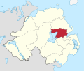 Antrim and Newtownabbey
 Armagh, Banbridge and Craigavon
 Causeway Coast and Glens
 Derry/Londonderry and Strabene
 Fermanagh and Omagh
 Lisburn and Castlereagh
 Mid and East Antrim
 Mid Ulster
 Newry, Mourne and Down


