| |
|
Atlas-country

|
Malaysia
|
|
|
|
|
|
|
|
Malaysia
|
|
|
|
| Bahasa Malaysia
|
Malaysia
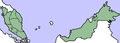
Malaysia ialah sebuah negara persekutuan yang terletak di Asia Tenggara. Malaysia mempunyai dua kawasan utama yang terpisah oleh Laut China Selatan; iaitu Semenanjung Malaysia, bersempadankan Thailand di utara dan Singapura di selatan; dan Malaysia Timur, bahagian utara Pulau Borneo yang bersempadan dengan Indonesia di selatan dan Brunei di utara.
|
| English
|
Malaysia - Malaysia
Malaysia is a federation of thirteen states in Southeast Asia. The country consists of two geographical regions divided by the South China Sea. Peninsular Malaysia (or West Malaysia) on the Malay Peninsula shares a land border on the north with ► Thailand and is connected by the Johor-Singapore Causeway and the Malaysia-Singapore Second Link to the south with ► Singapore. It consists of nine sultanates (Johor, Kedah, Kelantan, Negeri Sembilan, Pahang, Perak, Perlis, Selangor and Terengganu), two states headed by governors (Malacca and Penang), and two federal territories (Putrajaya and Kuala Lumpur). Malaysian Borneo (or East Malaysia) occupies the northern part of the island of Borneo, bordering ► Taiwan, ► the People's Republic of China, ► Vietnam, ► Indonesia, and the ► Spratly Islands, and surrounding the Sultanate of ► Brunei. It has maritime borders with ► Vietnam and with the ► Bangsamoro region in the ► Philippines and claims the ► Spratly Islands. It consists of the states of Sabah and Sarawak and the federal territory of Labuan. The name "Malaysia" was adopted in 1963 when the Federation of Malaya (Malay: Persekutuan Tanah Melayu), Singapore, Sabah and Sarawak formed a 14-state federation. Singapore was expelled from the federation in 1965 and subsequently become an independent country.
|
|
|
|
| Short name
|
Malaysia
|
| Official name
|
Malaysia
|
| Status
|
The Malaya received her independence from the British in 1957.
On September 16, 1963, the eleven states of the Federation of Malaya, the former colonies of Sarawak and Sabah on the western coast of Borneo and the State of Singapore jointed Malaya to form Malaysia. In August 1965, however, Singapore seceded from this newly-formed federation to become an independent republic.
Malaysia, as it is known today, consists of the eleven peninsular states that constituted of Malaya (this is referred to as peninsular Malaysia), Sabah and Sarawak.
|
| Location
|
South East Asia
|
| Capital
|
Kuala Lumpur
|
| Population
|
33,782,400 inhabitants
|
| Area
|
329,847 square kilometres (127,355 sq mi)
|
| Major languages
|
Malay (official), English, Arabic, Chinese dialects, Tamil, Telugu, Malayalam, Vietnamese
|
| Major religions
|
Islam (official), Buddhism, Hinduism, Christianity
|
| More information
|
Malaysia, Geography of Malaysia, History of Malaysia and Politics of Malaysia
|
| More images
|
Malaysia - Malaysia (Category).
|
|


 Perlis, Malaysia
 Kedah, Malaysia
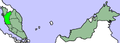 Perak, Malaysia
 Malacca, Malaysia
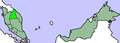 Kelantan, Malaysia
 Selangor, Malaysia


