Atlas of Latvia
Specific status: Akrotiri and Dhekelia‡ · Faroe Islands · Gibraltar · Bailiwick of Guernsey · Isle of Man · Jersey · Svalbard – Limited recognition: Abkhazia‡ · Gagauzia · Kosovo · South Ossetia‡ · Transnistria · Northern Cyprus‡
‡: partly located in Europe

|
Wikimedia Commons Atlas of the World The Wikimedia Atlas of the World is an organized and commented collection of geographical, political and historical maps available at Wikimedia Commons. Discussion • Update the atlas • Index of the Atlas • Atlas in categories • Other atlases on line |
|
| ||||||||||||||||||||||||||||||||||||||||||||||||
General maps
|
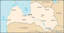
Karte Latvija Карта Латвии Map of Latvia |

|

|
Fiziskās ģeogrāfiskās kartes Физико-географическая карта Physical geography map |

|
Latvija un Baltijas jūras Латвии и Балтийского моря Latvia and the Baltic Sea |
Maps of divisions
This section holds maps of the administrative divisions.

|
Vēsturiskajiem novadiem Исторические регионы Historical regions |

|
Latvijas rajoni Districts of Latvia |
-
Ainaži
-
Aizkraukle
-
Aizpute
-
Aknīste
-
Aloja
-
Alūksne
-
Ape
-
Auce
-
Baldone
-
Baloži
-
Balvi
-
Bauska
-
Brocēni
-
Cesvaine
-
Cēsis
-
Dagda
-
Dobele
-
Durbe
-
Grobiņa
-
Ikšķile
-
Jaunjelgava
-
Jēkabpils
-
Kalnciems
-
Kandava
-
Krāslava
-
Kuldīga
-
Kārsava
-
Lielvārde
-
Limbaži
-
Lubāna
-
Ludza
-
Līgatne
-
Līvāni
-
Madona
-
Mazsalaca
-
Ogre
-
Olaine
-
Piltene
-
Preiļi
-
Priekule
-
Pāvilosta
-
Pļaviņas
-
Rūjiena
-
Sabile
-
Salacgrīva
-
Salaspils
-
Saldus
-
Saulkrasti
-
Seda
-
Sigulda
-
Skrunda
-
Smiltene
-
Staicele
-
Stende
-
Strenči
-
Subate
-
Talsi
-
Tukums
-
Valdemārpils
-
Valka
-
Valmiera
-
Vangaži
-
Varakļāni
-
Viesīte
-
Viļaka
-
Viļāni
-
Zilupe
-
Aizkraukle District
-
Alūksne District
-
Balvi District
-
Bauska District
-
Cēsis District
-
Daugavpils City
-
Daugavpils District
-
Dobele District
-
Gulbene District
-
Jēkabpils District
-
Jelgava City
-
Jelgava District
-
Jūrmala City
-
Krāslava District
-
Kuldīga District
-
Liepāja City
-
Liepāja District
-
Limbaži District
-
Ludza District
-
Madona District
-
Ogre District
-
Preiļi District
-
Rēzekne City
-
Rēzekne District
-
Riga City
-
Riga District
-
Saldus District
-
Talsi District
-
Tukums District
-
Valka District
-
Valmiera District
-
Ventspils City
-
Ventspils District

|
Lv. Latvijas administratīvais iedalījums Ru. Административное деление Латвии Ltg. Latvejis administrativais teritoriskais dalejums En. Subdivisions of Latvia De. Verwaltungsgliederung Lettlands |

|
Административное деление Латвии Subdivisions of Latvia Verwaltungsgliederung Lettlands |
History maps
This section holds a short summary of the history of the area of present-day Latvia, illustrated with maps, including historical maps of former countries and empires that included present-day Latvia.

|
Baltu cilšu ap 1200. Балтийские племена около 1200. Baltic Tribes around AD 1200. Baltischen Stämme um 1200. |

|
Livonija Терра Мариана, 1260. The Medieval Livonia in 1260. Alt-Livland |
|
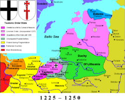
Государство Тевтонского ордена 1225-1250 The Monastic state of the Teutonic Knights 1225-1250 Staat des Deutschen Ordens 1225-1250 |
|
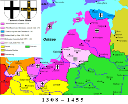
Государство Тевтонского ордена 1308–1455 The Monastic state of the Teutonic Knights 1308–1455 Staat des Deutschen Ordens 1308–1455 |
|
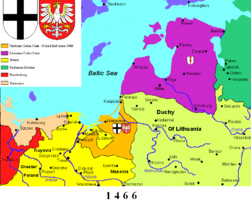
Государство Тевтонского ордена 1466 The Monastic state of the Teutonic Knights 1466 Staat des Deutschen Ordens 1466 |

|
Livonija un Kurzeme 1619 Лифляндии и Курляндии в 1619 году Livonia and Courland in 1619 Livland und Kurland im Jahre 1619 |

|
Lettland under svenskt styre Latvia under Swedish occupation in 1646 (Treaty of Brömsebro) |

|
Sweden incl. Latvia in 1658 (Treaty of Roskilde) |

|
Duchy of Courland and Semigallia in 1740, part of the Polish Lithuanian Commonwealth |
|
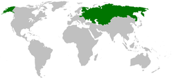
Krievijas impērija Российская Империя Russian Empire |

|
Krievijas impērija, 1866 Российская Империя, 1866 The Russian Empire in 1866 |

|
History of the Russian Empire (in German) |

|
Ethnic map of European Russia before the First World War (in French) |
|
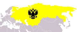
Russia in 1912 |
|
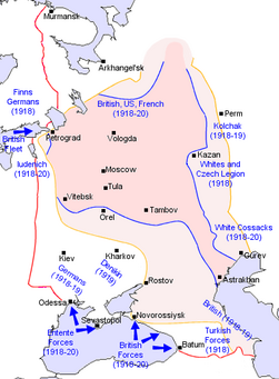
Russian Civil War |

|
Independent Latvia in 1920 |

|
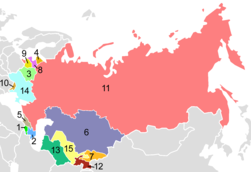
In 1940 Latvia is annexed by the Soviet Union. Location of the USSR |
|
The republics of the USSR |

|
Latvia in the USSR |

|
Evolution of the Soviet Union |
| [[|border|251x400px]] | Map of the 1974 geographic location of various ethnic groups within the Soviet Union |

|
Soviet Union administrative divisions, 1989 |
Old maps
This section holds copies of original general maps more than 70 years old.

|
Livonia, as shown in a 15th century map. |

|
Livonia, Estonia and Courland in 1662 by Joan Blaeu. |

|
Livonia and Courland in 1705 by Frederik de Wit |
Other maps

|
Map of Latvia in the colors of the Flag of Latvia. |
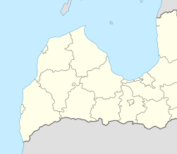
|
Map of Latvia Baltic coast. |
Satellite maps

|
Satellite map |
Notes and references
|
General remarks:
|


