Category:Aerial photographs of Yamanashi prefecture
Jump to navigation
Jump to search

Media in category "Aerial photographs of Yamanashi prefecture"
The following 51 files are in this category, out of 51 total.
-
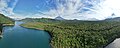 Aerial panorama of Mount Fuji from Lake Saiko. June 2023.jpg 8,192 × 3,302; 10.12 MB
-
-
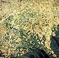
 Aerial photograph of Minobu-cho Ohatsuki Ginkgo natural monument group area.jpg 4,613 × 3,076; 4.91 MB
-

-
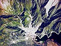
 Aerial photographs of Kyodo River Alluvial fan.jpg 3,333 × 3,267; 2.87 MB
-
 Aerial photographs of the deserted village district NENBA.jpg 2,800 × 2,097; 10.58 MB
-
 Aerial view of Bijutukan-Dori street Kofu and Kai city.jpg 8,613 × 2,738; 17.15 MB
-
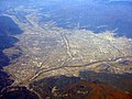
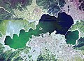
 Aerial view of the Kofu Basin.jpg 3,264 × 2,448; 3.22 MB
-
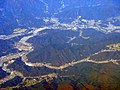
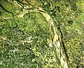 Confluence downstream portion of the river Midai and Kamanashi Aerial photograph.1975.jpg 6,252 × 5,093; 27.69 MB
-
 Enzan district Koshu city Aerial photograph.1976.jpg 4,667 × 3,478; 14.89 MB
-
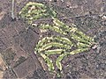 Fuji Golf Course, Yamanakako Yamanashi Aerial photograph.2012.jpg 3,784 × 2,837; 3.57 MB
-
 Fuji Lake Side Country Club, Naruawa Yamanashi Aerial photograph.2007.jpg 1,660 × 1,245; 1.09 MB
-

-
 Fujiyoshida city center area Aerial photograph.1975.jpg 5,809 × 3,459; 17.68 MB
-
 Fujizakura Country Club, Fujikawaguchiko Yamanashi Aerial photograph.2007.jpg 1,241 × 930; 606 KB
-
 Hirose Dam Lake Aerial photograph.1976.jpg 2,465 × 1,786; 4.49 MB
-
 Kamiyoshida district Aerial Photograph.jpg 733 × 1,526; 389 KB
-
 Kamui Misaka.jpg 690 × 890; 617 KB
-
 KawaguchiKo zoomed in.jpg 2,653 × 842; 726 KB
-
 KawaguchiKo.jpg 2,816 × 2,112; 1.92 MB
-
 Kiriishi Minobu district Aerial photo.1976.jpg 1,394 × 1,009; 1.36 MB
-
 Kofu city center area Aerial photograph.1975.jpg 9,465 × 8,172; 65.27 MB
-
 KofuBonchi.jpg 2,816 × 2,112; 1.87 MB
-
 Kyodo River Alluvial fan written name of a place Aerial photographs.jpg 3,487 × 3,262; 4.3 MB
-
 Lake Kawaguchi Aerial photograph.1975.jpg 5,197 × 3,762; 31.45 MB
-
 Lake Kawaguchi Aerial photograph.2015.jpg 6,929 × 3,955; 8.1 MB
-
 Lake Sai and Aokigahara Forest Aerial photograph.jpg 2,458 × 1,723; 1.56 MB
-
 Lake Shibire aerial photo.JPG 1,092 × 818; 723 KB
-
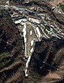
 LinearTestLane.JPG 1,280 × 960; 277 KB
-
 Manzawa Nanbu district Aerial photo.1976.jpg 2,638 × 1,912; 4.56 MB
-
 Maple Point Golf Club, Uenohara Yamanashi Aerial photograph.2008.jpg 2,223 × 1,667; 1.36 MB
-
 Nirasaki city center area Aerial photograph.1976.jpg 3,102 × 3,210; 9.13 MB
-
 Nishijima Minobu district Aerial photo.1976.jpg 2,037 × 1,481; 2.59 MB
-
 Otsuki city center area Aerial photograph.1975.jpg 3,942 × 2,461; 8.77 MB
-
 Renpo Yashiki local ruling family residences Aerial photograph.1975.jpg 1,987 × 1,442; 2.29 MB
-
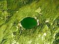
 SaiKo.jpg 2,816 × 2,112; 1.79 MB
-
 Shichiri rock plateau Nirasaki Aerial photograph.jpg 2,355 × 3,139; 2.06 MB
-
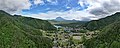
 Shimobe Hot springs aerial photograph.JPG 1,636 × 1,228; 1.36 MB
-
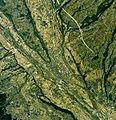
 Shingen-Bomichi of the historic military road Aerial Photograph.JPG 2,379 × 1,336; 2.58 MB
-
 ShojiKo.jpg 2,816 × 2,112; 2 MB
-
 ShojiKoS.jpg 1,600 × 1,200; 645 KB
-
 Sone Hills southern Kofu Basin Aerial photograph.1975.jpg 7,836 × 3,285; 21.47 MB
-
 Tsukimigaike water reservoir Aerial photograph.1974.jpg 642 × 466; 385 KB
-
 Tsuru city center area Aerial photograph.1975.jpg 4,351 × 5,392; 17.9 MB
-
 Uenohara city center area Aerial photograph.1976.jpg 3,131 × 2,757; 8.1 MB
-
 Umedaira Minobu district Aerial photo.1976.jpg 3,002 × 2,167; 6.14 MB
-
 Usui-numa Marsh Aerial photograph.1975.jpg 4,307 × 2,907; 9.5 MB
-
 Utsubuna Nanbu district Aerial photo.1976.jpg 2,097 × 1,517; 2.93 MB
-
 Yamanashi city center area Aerial photograph.1975.jpg 4,219 × 5,948; 18.31 MB
-
 Yamanashi pref. food industrial park,CCB20075-C12-23.jpg 1,436 × 1,548; 870 KB
-
 Yoshida Fire Festival district Aerial Photograph.jpg 827 × 1,775; 650 KB


.jpg)