Category:Aerial photographs of Wakayama prefecture
Jump to navigation
Jump to search

Media in category "Aerial photographs of Wakayama prefecture"
The following 42 files are in this category, out of 42 total.
-
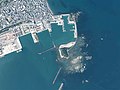 Aerial photo of Miwasaki fishing port and Ku island area in 2019.jpg 2,731 × 2,049; 2.13 MB
-
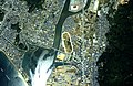
 Aerial photograph of Shimazu district Shingu City.jpg 2,311 × 1,736; 4.28 MB
-

-
 Aerial photograph of the Hongu district.jpg 2,474 × 1,781; 1.19 MB
-
 Aerial photograph of the Hongu district.The written version of the name of a place.jpg 2,457 × 1,846; 7.43 MB
-
 Arida city center area Aerial photograph.2019.jpg 7,917 × 5,938; 20.75 MB
-
 Cape Shiono Aerial photograph.1975.jpg 4,119 × 4,012; 11.35 MB
-
 Ckk-75-15 c11 3 kashima.jpg 720 × 640; 77 KB
-
 Gobo city center area Aerial photograph.2019.jpg 8,821 × 8,062; 26.78 MB
-

-

-
 Hashimoto city center area Aerial photograph.2012.jpg 6,894 × 5,170; 10.94 MB
-
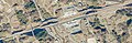
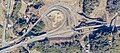
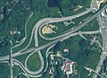 Hashimoto Interchange Aerial photograph 2012.jpg 1,007 × 732; 171 KB
-
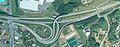 Hashimoto-Higashi Interchange Aerial photograph 2011.jpg 1,302 × 506; 189 KB
-
 Hiromura Teibo Seawall Aerial photograph.jpg 1,105 × 782; 430 KB
-
 Iwade city center area Aerial photograph.2008.jpg 3,177 × 3,217; 3.82 MB
-
 Iwade-Negoro Interchange Aerial photograph 2022.jpg 1,400 × 648; 242 KB
-
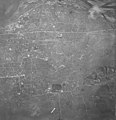 Japan, Wakayama - aerial view 1947.jpg 3,398 × 3,526; 2.47 MB
-
 Japan, Wakayama - aerial view 1975.jpg 3,492 × 3,195; 4.7 MB
-
 Kainan city center area Aerial photograph.2019.jpg 10,398 × 5,848; 22.86 MB
-
-
 Kei, Kumano & Kuju, Shingu.CKK20113X-C11-26.jpg 593 × 873; 201 KB
-
 Kihoku-Katsuragi Interchange Aerial photograph 2022.jpg 1,553 × 1,357; 470 KB
-
 Kii Oshima Island Aerial photograph.1975.jpg 10,570 × 5,609; 26.85 MB
-
 Kimiidera Racecourse Aerial photograph.1985.jpg 3,546 × 2,307; 6.74 MB
-
 Kindai Shingu, CKK20113X-C14-25.jpg 200 × 125; 12 KB
-
 Kinokawa City. An aerial photograph of the north side of the Kinokawa River 2012.jpg 11,521 × 5,994; 20.79 MB
-
 Kinokawa Interchange Aerial photograph 2022.jpg 1,079 × 828; 252 KB
-
 Kinokawa-Higashi Interchange Aerial photograph 2022.jpg 1,567 × 1,135; 449 KB
-
 Koyaguchi Interchange Aerial photograph 2022.jpg 1,093 × 480; 183 KB
-
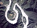
 Koza-gawa river estuary Aerial photograph.1975.jpg 2,385 × 3,541; 3.61 MB
-
 Nanki-Shirahama Airport Aerial photograph.2017.jpg 5,181 × 4,714; 7.56 MB
-
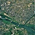
 Shingu city center area Aerial photograph.2019.jpg 10,781 × 10,936; 33.33 MB
-
 Shirahama Golf Club, Shirahama Wakayama Aerial photograph.2019.jpg 2,390 × 1,792; 1.9 MB
-
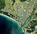
 Tanabe city center area Aerial photograph.2017.jpg 13,269 × 7,464; 29.73 MB
-
 Terraced rice-fields Aerial Photograph.jpg 1,600 × 1,161; 1.69 MB
-
 Tomoga-shima Islands Aerial photograph.1974.jpg 7,383 × 2,771; 13.66 MB
-
 Torinosu Peninsula Tanabe, Wakayama Aerial photograph.2017.jpg 4,045 × 3,033; 2.62 MB
-
 Wakayama Country Club, Wakayama Aerial photograph.2008.jpg 2,351 × 1,763; 1.4 MB
-
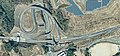
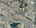
 Wakayama Junction Aerial photograph 2022.jpg 6,694 × 2,860; 3.29 MB
-
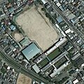 Wakayama Shingu high school, CKK20113X-C14-25.jpg 254 × 255; 37 KB
-
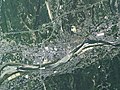
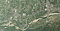
 川辺町役場付近航空写真 - Ckk-75-14 c8a 14.jpg 892 × 928; 242 KB


