Category:Aerial photographs of Nagasaki prefecture
Jump to navigation
Jump to search

Subcategories
This category has the following 2 subcategories, out of 2 total.
N
Media in category "Aerial photographs of Nagasaki prefecture"
The following 82 files are in this category, out of 82 total.
-
 2013-08-27 aerial view of Shimabara Peninsula.jpg 5,184 × 3,456; 9.29 MB
-
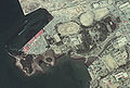
 Aerial photographs of Sakamoto International Cemetery 20100508.jpg 360 × 480; 166 KB
-
 Aerial view of US Fleet Activities Sasebo in March 2016.JPG 3,064 × 2,440; 1.27 MB
-
 Aerial view of US Fleet Activities Sasebo, Japan in 1957.jpg 917 × 501; 329 KB
-
 Ajika-island natural monument Aerial Photograph.JPG 3,399 × 2,547; 2.96 MB
-
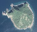
 Akashima Island, Goto Nagasaki Aerial photograph.2014.jpg 1,638 × 1,229; 692 KB
-
 Aso Bay Aerial photograph.2016.jpg 15,912 × 11,992; 42.04 MB
-
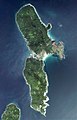
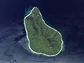
 Azuchi Oshima Island, Hirado Nagasaki Aerial photograph.2013.jpg 8,150 × 4,504; 15.65 MB
-
 Cku-74-20 c13b 6.jpg 3,591 × 3,907; 2.19 MB
-
 CKU20103-C4-22.jpg 4,354 × 2,419; 1.09 MB
-
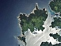
 Enoshima Island Saikai, Nagasaki Aerial photograph.2014.jpg 3,140 × 2,354; 1.68 MB
-
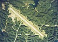
 Fukue Airport Aerial photograph.2014.jpg 2,928 × 1,952; 1.75 MB
-
 Fukue.airports.Aerial Shoot.jpg 3,641 × 2,493; 5.35 MB
-
 Futagami-jima Island Aerial photograph.2009.jpg 2,021 × 1,487; 530 KB
-
 Goto city Fukue district Aerial photograph.2014.jpg 3,995 × 2,997; 3.71 MB
-
 Haiki Strait, Sasebo Nagasaki Aerial photograph.2016.jpg 7,246 × 12,259; 32.44 MB
-
 Hario Strait, Sasebo Saikai Nagasaki Aerial photograph.2016.jpg 9,464 × 5,677; 16.93 MB
-
 Hime-shima Island Nagasaki prefecture Aerial photograph.jpg 1,426 × 1,224; 1.39 MB
-
 Hinoe Castle air info.jpg 1,081 × 1,000; 541 KB
-
 Hirado Castle air.jpg 1,104 × 1,092; 662 KB
-
 Hirado city center area Aerial photograph.2013.jpg 7,915 × 5,936; 13.22 MB
-
 Hirado Strait, Hirado Nagasaki Aerial photograph.2013.jpg 7,440 × 10,128; 20.81 MB
-
 Hirashima Island Saikai, Nagasaki Aerial photograph.2014.jpg 4,786 × 3,419; 6.85 MB
-
 Iki city Gonoura district Aerial photograph.2017.jpg 4,618 × 3,463; 6.2 MB
-
 Iki Island Aerial photograph.2017.jpg 20,000 × 21,884; 91.24 MB
-
 Iki Island Aerial photograph.May 2017.jpg 15,000 × 15,622; 127.58 MB
-
 Ikitsukishima Island, Hirado Nagasaki Aerial photograph.2013.jpg 7,251 × 18,908; 37.25 MB
-
 Iojima Island Nagasaki Aerial photograph.2014.jpg 5,203 × 5,124; 5.77 MB
-
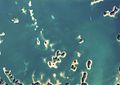 Iroha-Jima Islands Matsuura Nagasaki Aerial Photograph.jpg 3,161 × 2,231; 583 KB
-
 Isahaya city center area Aerial photograph.2010.jpg 6,909 × 5,182; 14.73 MB
-
 Isahaya wan.jpg 1,600 × 1,200; 505 KB
-
 Kamigoto oil storage 01.jpg 1,600 × 1,200; 1.19 MB
-
 Kashima Island, Nagasaki Isahaya Aerial photograph.2010.jpg 2,294 × 1,721; 985 KB
-
 Kashiragasgima Island and Kamigoto Airport Aerial photograph.2014.jpg 2,423 × 1,615; 907 KB
-
 Kazurashima Island Goto, Nagasaki Aerial photograph.2014.jpg 2,385 × 1,788; 2.23 MB
-
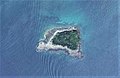 Koguro-jima Island Ojika, Nagasaki Aerial photograph.2014.jpg 822 × 537; 153 KB
-
 Konoura Oshima-mura Aerial Photograph.jpg 1,435 × 1,039; 517 KB
-
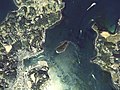
 Kurokojima Cku-77-3 c15b 8.jpg 640 × 500; 188 KB
-
 Kurokojima Islet Aerial photo.jpg 2,113 × 1,584; 810 KB
-
 Kuroshima Island Ojika, Nagasaki Aerial photograph.2014.jpg 1,911 × 1,248; 550 KB
-
 Kuroshima Island Sasebo, Nagasaki Aerial photograph.2016.jpg 8,611 × 5,740; 14.4 MB
-
 Kuroshima Island, Goto Nagasaki Aerial photograph.2014.jpg 1,978 × 1,483; 815 KB
-
 Kushijima Island, Nagasaki Aerial photograph.2014.jpg 2,883 × 2,162; 2.03 MB
-
 Looking east towards Nagasaki, August 1, 1945.jpg 1,212 × 804; 247 KB
-
 Madarashima Island Aerial photograph.2014.jpg 2,234 × 1,458; 908 KB
-
 Maejima and Todomarijima Islands, Nagasaki Sasebo Aerial photograph.2016.jpg 2,689 × 2,016; 1.48 MB
-
 Maeshima Island Goto, Nagasaki Aerial photograph.2010.jpg 2,330 × 1,748; 1.21 MB
-
 Minamishimabara city Arie district Aerial photograph.1975.jpg 3,444 × 2,582; 3.9 MB
-
 Mushima Island Ojika, Nagasaki Aerial photograph.2014.jpg 1,647 × 1,075; 623 KB
-
 Nagasaki Harbor looking east, August 1, 1945.jpg 1,204 × 806; 210 KB
-
 Nagasaki International Golf Club, Isahaya Nagasaki Aerial photograph.2010.jpg 3,415 × 2,561; 3.04 MB
-
 Nagasaki Park Athletic Studium, 1974.jpg 400 × 400; 126 KB
-
 Nkmchospital2.jpg 5,272 × 3,948; 11.45 MB
-
 Noshima Island Ojika, Nagasaki Aerial photograph.2014.jpg 1,870 × 1,222; 649 KB
-
 Nozaki Island Aerial photograph.2014.jpg 3,629 × 5,665; 6.32 MB
-
 O-shima Island Ojika, Nagasaki Aerial photograph.2014.jpg 1,691 × 1,269; 648 KB
-
 Ojika Airport Aerial photograph.2014.jpg 2,174 × 1,449; 918 KB
-
 Omura Castle air.jpg 1,526 × 1,033; 397 KB
-
 Omura city center area Aerial photograph.2014.jpg 7,753 × 8,496; 18.18 MB
-
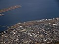 Omura.airfield.aerial shoot.jpg 3,648 × 2,736; 3.41 MB
-
 Oosetofukushima-saikai-nagasaki-cku-74-20 c6 5 t1.jpg 2,833 × 3,505; 2.11 MB
-
 Oushima Island, Goto Nagasaki Aerial photograph.2014.jpg 2,432 × 1,621; 1.26 MB
-
 Sagano-Shima Island Aerial photograph.jpg 2,520 × 4,530; 6.66 MB
-
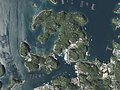
 Saikai city Oseto district Aerial photograph.2010.jpg 3,658 × 2,742; 3.41 MB
-
 Sasebo Country Club, Sasebo Nagasaki Aerial photograph.2016.jpg 3,438 × 2,578; 3.05 MB
-
 Sazaejima Island, Nagasaki, Goto Aerial photograph.2014.jpg 2,458 × 1,844; 695 KB
-
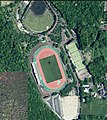 Shimabara Athletic Stadium.jpg 900 × 1,013; 499 KB
-
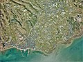
 Shimabara city center area Aerial photograph.2015.jpg 7,233 × 10,100; 20.16 MB
-
 Shinsyu, Suwa (2043022931).jpg 1,280 × 853; 325 KB
-
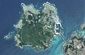
 Shugenjima Island, Nagasaki Aerial photograph.2014.jpg 2,996 × 2,246; 2.13 MB
-
 Takashima Dam that partitioned small bay Aerial photograph.2013.jpg 1,269 × 952; 535 KB
-
 Takashima Island, Hirado Nagasaki Aerial photograph.2017.jpg 2,509 × 1,882; 1.53 MB
-
 Takashima-Kouzaki underwater remains Aerial photograph.1977.jpg 3,309 × 1,863; 3.32 MB
-
 Takushima Island, Hirado Nagasaki Aerial photograph.2013.jpg 8,538 × 5,985; 12.93 MB
-
 Terashima Island Uku Sasebo, Nagasaki Aerial photograph.2016.jpg 5,165 × 3,719; 4.65 MB
-
 Tobishima Island, Matsuura Nagasaki Aerial photograph.2013.jpg 2,647 × 1,986; 1.36 MB
-
 Tsuburajima Island, Nagasaki, Goto Aerial photograph.2014.jpg 2,495 × 1,871; 1.49 MB
-
 Tsushima Airport Aerial photograph.2011.jpg 3,165 × 2,109; 1.56 MB
-
 Tsushima Airport Aerial Photograph.jpg 3,235 × 2,340; 1.83 MB
-
 Unzen city Azuma district Aerial photograph.2013.jpg 2,641 × 1,981; 1.44 MB
-
 Yaburogi Island Aerial photograph.2014.jpg 1,420 × 1,065; 423 KB
-
 校舎.jpg 640 × 480; 456 KB


.jpg)


