Category:Aerial photographs of Ehime prefecture
Jump to navigation
Jump to search

Media in category "Aerial photographs of Ehime prefecture"
The following 86 files are in this category, out of 86 total.
-
 1962年森松線全像.png 2,319 × 5,376; 6.19 MB
-
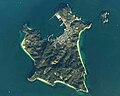
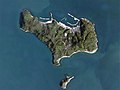
 Aerial photo of Umashima Island.jpg 3,182 × 2,697; 9.19 MB
-
 Aerial photograph of Ehime prefecture library.jpg 600 × 600; 274 KB
-

-
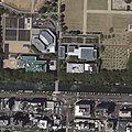
 Aerial photograph of JGSDF Camp Matuyama.jpg 1,050 × 600; 466 KB
-
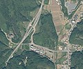
 Aerial photograph of Nakayama smart inteechange.jpg 2,500 × 2,000; 2.58 MB
-
 Aerial photograph of Ozu-Fuji interchange.jpg 1,600 × 1,000; 997 KB
-
 Aerial photograph of Ozu-Kitatada interchange.jpg 1,563 × 1,624; 1.57 MB
-
 Aerial photograph of Ozu-Konan interchange.jpg 1,500 × 1,200; 1.27 MB
-
 Aerial photograph of Ozu-minami interchange.jpg 1,000 × 500; 333 KB
-
 Aerial photograph of Tushima-Takata interchange.jpg 1,800 × 1,500; 2.2 MB
-
 Aerial photograph of Uchiko-Ikazaki interchange.jpg 2,000 × 1,500; 1.52 MB
-
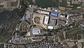
 Aerial photograph of Uwajima City Hospital.jpg 600 × 600; 375 KB
-
 Aerial photograph of Uwajima-Asahi interchange.jpg 900 × 900; 704 KB
-
 Aerial photograph of Uwajima-Betto interchange.jpg 1,200 × 1,000; 899 KB
-
 Aerial photograph of Uwajima-kita interchange.jpg 1,500 × 1,500; 1.95 MB
-
 Aerial photograph of Uwajima-minami interchange.jpg 900 × 2,100; 1.48 MB
-
 Aerial photograph of Uwajima-Sakashizu interchange.jpg 1,200 × 1,000; 899 KB
-
 Aerial photographs of Iyo interchange.jpg 1,500 × 1,800; 1.81 MB
-
 Aerial photographs of Ozu interchange.jpg 2,100 × 900; 1.01 MB
-
 Aerophotograph of Niihama port.jpg 1,024 × 799; 1.51 MB
-
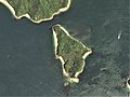
 Aijima 2019.jpg 3,199 × 2,136; 1.45 MB
-
 Ainan town Uchiumi junior high school Aerial view (2019-10).png 750 × 500; 816 KB
-
 Akinada Orange Line 26-May-2018.jpg 3,585 × 2,879; 1.59 MB
-
 Ehime Golf Club, Uchiko Ehime Aerial photograph.2012.jpg 4,312 × 3,234; 4.89 MB
-
 Elleair Golf Club Matsuyama, Matsuyama Ehime Aerial photograph.2010.jpg 3,785 × 3,028; 9.54 MB
-
 Eno-shima Island, Ehime Aerial photograph.2009.jpg 2,031 × 1,523; 358 KB
-
 Futagami jima Island Aerial photograph.2019.jpg 7,528 × 4,235; 12.08 MB
-
 Gogoshima 2019.jpg 5,594 × 3,735; 2.68 MB
-
 Hiburi-jima Island Aerial photograph.1975.jpg 8,123 × 3,660; 20.05 MB
-
 Hiburi-jima Island Aerial photograph.2007.jpg 3,605 × 2,704; 1.52 MB
-
 Hikijima Island, Ehime Aerial photograph.2016.jpg 2,824 × 2,117; 1.43 MB
-
 Hyakkanjima Island, Kamijima Ehime Aerial photograph.2009.jpg 1,530 × 1,148; 231 KB
-
 Imabari city center area Aerial photograph.2016.jpg 10,000 × 7,346; 12.13 MB
-
 Iyo city center area Aerial photograph.2010.jpg 6,415 × 4,693; 11.33 MB
-
 Iyo-Aoshima Island Aerial photograph.jpg 2,531 × 1,836; 1.09 MB
-
 Iyomishima district Shikokuchuo city center area Aerial photograph.1975.jpg 1,852 × 1,389; 1,006 KB
-
 Kashima Island, Ainan Ehime Aerial photograph.2019.jpg 4,537 × 3,403; 3.66 MB
-
 Kashima Island, Uwajima Ehime Aerial photograph.2019.jpg 3,295 × 2,471; 1.67 MB
-
 Kawanoe district Shikokuchuo city center area Aerial photograph.1975.jpg 2,245 × 1,684; 1.21 MB
-
 Kushima Island, Uwajima Ehime Aerial photograph.2019.jpg 6,248 × 4,686; 7.96 MB
-
 Kōge Island, Ehime, Japan 26-May-2018.jpg 2,130 × 1,745; 592 KB
-
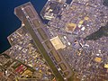 Matsuyama Airport (Is seen from the sky) Ehime,JAPAN.jpg 1,024 × 767; 413 KB
-
 Matsuyama Airport Aerial photograph.2010.jpg 4,204 × 4,192; 5.39 MB
-
 Matsuyama Castle air.jpg 1,967 × 1,807; 2.27 MB
-
 Matsuyama city center area Aerial photograph.2010.jpg 15,225 × 12,198; 60.41 MB
-
 Matsuyama Golf Club, Toon Ehime Aerial photograph.2010.jpg 2,347 × 1,760; 1.44 MB
-
 Muzuki Island, Ehime, Japan 11-Aug-2018.jpg 4,483 × 3,305; 1.56 MB
-
 Muzuki jima Island Aerial photograph.2019.jpg 5,964 × 4,772; 14.9 MB
-
 Nii-Oshima, Csi-74-9 c19b 2.jpg 2,441 × 2,513; 1.68 MB
-
 Niihama city center area Aerial photograph.2010.jpg 6,199 × 5,599; 13.73 MB
-
 Niihama Country Club, Niihama Ehime Aerial photograph.2010.jpg 2,721 × 2,041; 2.52 MB
-
 Nogutsuna jima Island Aerial photograph.2019.jpg 3,334 × 2,668; 3.06 MB
-
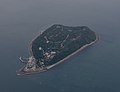
 Nogutsunajima 2019.jpg 3,901 × 2,604; 1.68 MB
-
 Nuwa jima Island Aerial photograph.2019.jpg 7,245 × 6,974; 39.99 MB
-
 Oitsukami-jima Island Aerial photograph.1975.jpg 5,642 × 3,317; 13.45 MB
-
 Okamura Island, Ehime, Japan 26-May-2018.jpg 2,960 × 2,468; 1.21 MB
-
 Okinoshima Island, Uwajima Ehime Aerial photograph.2019.jpg 2,399 × 1,800; 895 KB
-
 Ozu city center area Aerial photograph.2013.jpg 10,167 × 9,607; 33.43 MB
-
 Ozu Golf Club, Ozu Ehime Aerial photograph.2013.jpg 4,180 × 3,135; 4.11 MB
-
 Ozukumajima Island, Imabari Ehime Aerial photograph.2016.jpg 1,996 × 1,497; 891 KB
-
 Saijo city center area Aerial photograph.2010.jpg 5,850 × 3,360; 8.36 MB
-
 Saijo Hiuchi Athletic Stadium.jpg 1,872 × 1,002; 1.01 MB
-
 Saijō power station - aerial.jpg 588 × 749; 104 KB
-
 Shisakajima Islands, Imabari Ehime Aerial photograph.2009.jpg 3,202 × 2,401; 1.72 MB
-
 Taka-shima Island Uwajima city Aerial photograph.1975.jpg 2,896 × 2,104; 2.24 MB
-
 Takega-shima Uwajima city Aerial photograph.1975.jpg 3,016 × 2,184; 2.85 MB
-
 Tojima Island, Ehime Uwajima Aerial photograph.2007.jpg 3,144 × 2,358; 992 KB
-
 Toodoshima Island, Ehime Uwajima Aerial photograph.2008.jpg 1,067 × 800; 178 KB
-
 Toon city center area Aerial photograph.2010.jpg 7,599 × 4,837; 11.55 MB
-
 Toyoshima Island, Kamijima Ehime Aerial photograph.2009.jpg 2,764 × 2,072; 1,015 KB
-
 Tsurushima Island, Ehime, Japan 14-Aug-2019.jpg 3,161 × 2,433; 1.37 MB
-
 Tsushima Island, Imabari Ehime Aerial photograph.2016.jpg 4,525 × 3,394; 4.53 MB
-
 Tsuwaji jima Island Aerial photograph.2019.jpg 6,376 × 5,101; 19.83 MB
-
 Unomachi district Seiyo city Aerial photograph.2013.jpg 8,672 × 6,008; 18.89 MB
-
 Uo-Shima Island Aerial photograph.jpg 4,839 × 3,486; 6.43 MB
-
 Uo-shima Island, Ehime Aerial photograph.2009.jpg 2,514 × 1,886; 618 KB
-
 Uwajima Castle air.jpg 919 × 808; 341 KB
-
 Uwajima city center area Aerial photograph.2019.jpg 10,562 × 8,040; 29.76 MB
-
 Yawatahama city center area Aerial photograph.2013.jpg 8,045 × 6,904; 19.28 MB
-
 Yawatahama-oshima.jpg 2,000 × 2,000; 242 KB
-
 Yuduki Castle air.jpg 951 × 967; 771 KB
-
 Yura Peninsula Aerial photograph.2007.jpg 8,550 × 5,324; 8.79 MB
-
 Yuri-Jima Island Aerial photograph.jpg 2,467 × 1,783; 1.02 MB
-
 森松線石井駅(1962).jpg 243 × 276; 17 KB
-
 青島 (愛媛県).jpg 2,933 × 1,935; 632 KB


.png)


_Ehime,JAPAN.jpg)


.jpg)
.jpg)