Category:Aerial photographs of Hiroshima prefecture
Jump to navigation
Jump to search
Subcategories
This category has only the following subcategory.
A
Media in category "Aerial photographs of Hiroshima prefecture"
The following 183 files are in this category, out of 183 total.
-
 ABASHIMA Island 1948.jpg 680 × 886; 98 KB
-
 ABASHIMA Island 1962.jpg 2,568 × 3,203; 1.16 MB
-
 ABASHIMA Island 1981.jpg 2,273 × 3,130; 1.45 MB
-
 ABASHIMA Island 2010.jpg 2,387 × 3,133; 1.98 MB
-
 Aerial photograph of Bingo Sports Park.jpg 1,800 × 1,800; 2.11 MB
-
 Aerial photograph of Geihoku highland Taisa ski resort.jpg 1,500 × 1,000; 1,024 KB
-
 Aerial photograph of Geihoku-kokusai Ski resort.jpg 1,800 × 900; 1.01 MB
-
 Aerial photograph of Ikuchijima-minami interchange.jpg 1,500 × 900; 954 KB
-

-
 Aerial photograph of Nippon Kokan Fukuyama Hospital.jpg 900 × 600; 410 KB
-
 Aerial photograph of Nishi-Seto Onomichi Interchange.jpg 2,000 × 2,000; 2.82 MB
-
 Aerial photograph of Yawata highland 191 resort.jpg 900 × 600; 379 KB
-
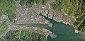
 Aerial view of Kure, Hiroshima.jpg 3,264 × 2,448; 4.18 MB
-
 Akana Pass 1948.jpg 1,313 × 1,232; 373 KB
-
 Akinada Orange Line 26-May-2018.jpg 3,585 × 2,879; 1.59 MB
-
 Amagi Katsuragi Kure 1945 attack NAN7-76.jpg 900 × 1,222; 280 KB
-
 ATATAJIMA Island 1947.jpg 1,522 × 1,039; 764 KB
-
 ATATAJIMA Island 1974.jpg 4,044 × 2,887; 7.97 MB
-
 ATATAJIMA Island 2008.jpg 4,515 × 3,262; 9.01 MB
-
 Atomic cloud over Hiroshima (from Matsuyama).jpg 2,000 × 1,395; 798 KB
-

-
 CCG20101-C13-4-20100917.jpg 692 × 1,241; 316 KB
-
 CITRUS PARK SETODA 2005.jpg 677 × 1,163; 303 KB
-
 Crescent Beach 2013.jpg 2,236 × 1,621; 1.06 MB
-
 Enoshima Island, Etajima Hiroshima Aerial photograph.2008.jpg 1,560 × 1,169; 232 KB
-
 Former Mukaishima POW camp.JPG 2,160 × 1,856; 906 KB
-
 From the sky , 向島上空から - panoramio - z tanuki.jpg 3,648 × 2,736; 752 KB
-
 From the sky , 向島上空から - panoramio.jpg 3,648 × 2,736; 1.14 MB
-
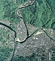
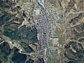
 Fuchu city Hiroshima prefecture center area Aerial photograph.2018.jpg 11,032 × 8,294; 37.81 MB
-
 Fukuama-Castle-map.jpg 1,040 × 880; 660 KB
-
 Fukuyama city center area Aerial photograph.2018.jpg 19,985 × 11,531; 92.79 MB
-
 Fukuyama city central.jpg 1,000 × 1,000; 510 KB
-
 Futyu Hiroshima Bingo 1947.jpg 2,544 × 1,776; 632 KB
-
 H30 07gouu-0713kuretoubu-C3-0143 Central Yasuura 2018-07-13.jpg 2,061 × 1,546; 789 KB
-
 HASHIRIJIMA Island 1947.jpg 1,500 × 1,048; 768 KB
-
 HASHIRIJIMA Island 1974.jpg 3,328 × 4,816; 8.77 MB
-
 HASHIRIJIMA Island 2005.jpg 1,409 × 1,094; 553 KB
-
 Hatsukaichi city center area Aerial photograph.2008.jpg 5,107 × 3,831; 7.5 MB
-
 Hiroshima Airport Aerial photograph.2005.jpg 4,561 × 1,203; 2.14 MB
-
 Hiroshima Country Club Hachihonmatu Course 1981.jpg 2,437 × 1,677; 848 KB
-
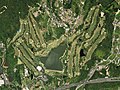
 Hiroshima Country Club Saijo Course 1981.jpg 3,491 × 2,572; 1.81 MB
-
 Hitachi Zosen Innoshima 1947.jpg 1,148 × 756; 197 KB
-
 HOSOJIMA Island , Hiroshima 1947.jpg 867 × 1,010; 253 KB
-
 HOSOJIMA Island , Hiroshima 1948.jpg 1,593 × 1,217; 231 KB
-
 HOSOJIMA Island , Hiroshima 1966.jpg 2,811 × 2,311; 1.61 MB
-
 HOSOJIMA Island , Hiroshima 1981.jpg 5,663 × 4,801; 5.25 MB
-
 HOSOJIMA Island , Hiroshima 2010.jpg 5,560 × 4,608; 5.58 MB
-
 IKUCH-Shima Island 2005.jpg 4,768 × 3,760; 10.42 MB
-
 IKUCHI - SHIMA Island 1947.jpg 3,162 × 3,380; 4.79 MB
-
 IKUNOJIMA Island 1947.jpg 1,085 × 975; 192 KB
-
 IKUNOSHIMA Island 1986.jpg 1,836 × 1,827; 611 KB
-
 IKUNOSHIMA Island 2010.jpg 3,473 × 3,623; 6.37 MB
-
 INNOSHIMA Island 1947.jpg 3,020 × 3,760; 2.4 MB
-
 INNOSHIMA Island 1964.jpg 3,152 × 4,136; 3.41 MB
-
 INNOSHIMA Island 1994.jpg 4,730 × 6,157; 7.03 MB
-
 INNOSHIMA Island 2005.jpg 4,568 × 5,240; 13.13 MB
-
 Itsukishima 2019.jpg 3,361 × 2,242; 1.17 MB
-
 ITSUKISHIMA Island 1948.jpg 783 × 572; 272 KB
-
 ITSUKISHIMA Island 1981.jpg 2,004 × 1,569; 2.34 MB
-
 ITSUKISHIMA Island 2009.jpg 2,395 × 1,659; 2.88 MB
-
 Japanese battleship Haruna under attack on 28 July 1945 (80-G-490224).jpg 5,756 × 4,492; 9.28 MB
-
 Japanese battleship Ise burning at Kure 28 July 1945.jpeg 924 × 778; 335 KB
-
 Japanese cruiser Aoba aerial photo 28 July 1945.jpg 550 × 636; 180 KB
-
-
 Japanese warships under attack at Kure March 1945.jpg 740 × 580; 127 KB
-
 Joge Town 1947.jpg 2,816 × 3,377; 1.94 MB
-
 Kaibutuen 1947.JPG 2,208 × 2,498; 1.04 MB
-
 Kaita Aerial Shoot.jpg 1,424 × 1,068; 1.93 MB
-
 Kamegakubi 1947.jpg 1,435 × 1,564; 579 KB
-
 Kamikamagari Island, Hiroshima, Japan 26-May-2018.jpg 2,710 × 1,995; 753 KB
-
 Kamine Pass 1947.jpg 2,829 × 3,017; 2.08 MB
-
 Kamo estuary (Takehara) 2010.jpg 2,778 × 2,720; 4.71 MB
-
 Karouto 1947.jpg 1,580 × 1,600; 286 KB
-
 Karouto 1990.jpg 2,005 × 2,051; 501 KB
-
 KASHIMA Onomichi 1947.jpg 558 × 668; 99 KB
-
 KASHIMA Onomichi 1981.JPG 1,300 × 1,624; 368 KB
-
 KASHIMA Onomichi 2010.JPG 1,486 × 1,777; 504 KB
-
 KOSAGIJIMA Island 1947.jpg 864 × 651; 153 KB
-
 KOSAGIJIMA Island 2010.jpg 3,643 × 2,404; 1.27 MB
-
 KOUNE - SHIMA Island 2005.jpg 1,457 × 2,041; 1.71 MB
-
 Kure city center area Aerial photograph.2009.jpg 7,960 × 6,234; 20.68 MB
-
 Matsunaga Country Club, Fukuyama Hiroshima Aerial photograph.2018.jpg 2,384 × 1,788; 1.52 MB
-
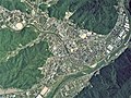
 Mihara city center area Aerial photograph.2010.jpg 10,799 × 5,256; 21.65 MB
-
 Miinohara 1947.jpg 1,694 × 1,869; 586 KB
-
 MIKADOSHIMA Island, Kure 1948.jpg 629 × 576; 108 KB
-
 MIKADOSHIMA Island, Kure 1962.jpg 2,814 × 2,229; 3.51 MB
-
 MIKADOSHIMA Island, Kure 1974.jpg 2,593 × 2,393; 3.68 MB
-
 MIKADOSHIMA Island, Kure 1990.jpg 1,224 × 1,104; 482 KB
-
 MIKADOSHIMA Island, Kure 2006.jpg 866 × 809; 472 KB
-
 MITARAI Area 1948.jpg 3,373 × 3,003; 1.5 MB
-
 Mitarai district Aerial photograph.jpg 1,757 × 1,264; 393 KB
-
 Mitsu , Higashihiroshima 1948.jpg 1,346 × 1,231; 424 KB
-
 Miyakehonten 1947.jpg 3,437 × 2,803; 2.75 MB
-
 Miyoshi Athetic Stadium.jpg 1,865 × 1,007; 777 KB
-
 Miyoshi City Baseball Studium - Aerial photograph.jpg 900 × 750; 639 KB
-
 Miyoshi city Hiroshima Prefecture center area Aerial photograph.2015.jpg 6,319 × 6,985; 19.08 MB
-
 Mukaishima - panoramio.jpg 2,340 × 1,560; 502 KB
-
 MUKAISHIMA Island 19470424.jpg 4,840 × 2,936; 2.49 MB
-
 MUKAISHIMA Island 19471001.jpg 9,553 × 3,105; 4.49 MB
-
 MUKAISHIMA Island 1964.jpg 3,992 × 2,896; 2.58 MB
-
 MUKAISHIMA Island 1986.jpg 7,200 × 5,232; 6.84 MB
-
 MUKAISHIMA Island 2005.jpg 7,746 × 5,403; 12.21 MB
-
 Mukaishima Orchid Center 2005.jpg 458 × 360; 101 KB
-
 MUTSUMI Bridge 1961.jpg 1,352 × 1,434; 684 KB
-
 MUTSUMI Bridge 1981.jpg 1,462 × 1,708; 1.83 MB
-
 NAGASHIMA Island , Hiroshima 1948.jpg 1,124 × 1,276; 809 KB
-
 NAGASHIMA Island , Hiroshima 1966.jpg 1,589 × 1,760; 948 KB
-
 NAGASHIMA Island , Hiroshima 1986.jpg 1,694 × 1,875; 1.03 MB
-
 NAGASHIMA Island , Hiroshima 2006.jpg 1,105 × 1,242; 328 KB
-
 NASAKEJIMA Island 1947.jpg 1,012 × 970; 547 KB
-
 NASAKEJIMA Island 1981.jpg 2,600 × 2,456; 2.5 MB
-
 NASAKEJIMA Island 2003.jpg 780 × 744; 203 KB
-
 Niko park 1947.jpg 3,371 × 3,377; 2.89 MB
-
 Norosan speed park.jpg 1,787 × 1,747; 747 KB
-
 Ogaki district Etajima city Aerial photograph.2008.jpg 6,949 × 4,173; 10.48 MB
-
 Ohama , Fukuyama 2005.jpg 1,393 × 1,276; 656 KB
-
 Ohama Oil Terminal 1974.jpg 1,644 × 1,616; 1.05 MB
-
 Okuno , Tadanoumi 1948.jpg 2,553 × 2,352; 798 KB
-
 Okunoshima & Kokunoshima 1947.jpg 778 × 702; 107 KB
-
 Okunoshima & Kokunoshima 1948.jpg 941 × 733; 122 KB
-
 Okunoshima & Kokunoshima 1964.jpg 832 × 669; 136 KB
-
 Okunoshima & Kokunoshima 1981.jpg 3,162 × 2,663; 1.39 MB
-
 Okunoshima & Kokunoshima 2006.jpg 1,038 × 874; 202 KB
-
 Okunoshima 1962.jpg 1,659 × 2,331; 922 KB
-
 Ondo no Seto 1947.jpg 1,690 × 2,322; 956 KB
-
 Ondo-no-Seto and Ondo Bridge, Hiroshima Aerial photograph 2018-2.jpg 831 × 486; 432 KB
-
 Ondo-no-Seto and Ondo Bridge, Hiroshima Aerial photograph 2018-3.jpg 1,235 × 595; 721 KB
-
 Ondo-no-Seto and Ondo Bridge, Hiroshima Aerial photograph 2018.jpg 1,808 × 1,808; 2.67 MB
-
 Ondono-seto Ccg-88-1 c32 2.jpg 1,800 × 1,800; 1.68 MB
-
 Onomichi Bridge 1974.jpg 1,032 × 1,532; 355 KB
-
 Onomichi Channel Aerial photograph.1981.jpg 9,872 × 4,947; 39.77 MB
-
 Onomichi city center area Aerial photograph.2010.jpg 12,880 × 7,116; 40.08 MB
-
 OOSAKIKAMIJIMA Island 2006.jpg 5,133 × 5,481; 7.24 MB
-
 Otake city center area Aerial photograph.2016.jpg 4,155 × 4,532; 6.24 MB
-
 Saijo district Higashihiroshima city Aerial photograph.2005.jpg 4,365 × 3,274; 6.54 MB
-
 Saijo district Shobara city Aerial photograph.1976.jpg 2,268 × 1,700; 1.57 MB
-
 Saijo Higashihiroshima 1947.jpg 1,833 × 1,215; 448 KB
-
 Sannose 1948.jpg 2,379 × 2,237; 1 MB
-
 Sannose 2009.jpg 2,972 × 3,286; 3.18 MB
-
 Sea of Setonaikai (2043821746).jpg 1,280 × 853; 284 KB
-
 Sea of Setonaikai (2043822024).jpg 1,280 × 853; 279 KB
-
 Setoda Sunset Beach 2005.jpg 599 × 660; 157 KB
-
 Shobara city center area Aerial photograph.1975.jpg 2,528 × 1,896; 1.82 MB
-
 SUKUNE Island 1974.jpg 1,310 × 1,223; 224 KB
-
 SUKUNEJIMA Island 1962.jpg 748 × 797; 237 KB
-
 SUKUNEJIMA Island 1994.jpg 465 × 546; 65 KB
-
 SUKUNEJIMA Island 2010.jpg 969 × 1,140; 109 KB
-
 Tadanoumi Area 1947.jpg 3,142 × 2,534; 1.38 MB
-
 Tadanoumi Area 2005.jpg 4,407 × 3,139; 3.92 MB
-
 Takehara city center area Aerial photograph.2010.jpg 4,788 × 6,114; 11.94 MB
-
 Takehara district 1947.jpg 3,185 × 3,525; 5.09 MB
-
 Tojo district Shobara city Aerial photograph.1975.jpg 2,879 × 2,159; 2.41 MB
-
 ToneUnderAttack1945.jpg 5,796 × 4,188; 10 MB
-
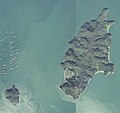
 Toyoshima Island, Hiroshima, Japan 26-May-2018.jpg 3,151 × 2,484; 1.12 MB
-

-
 Utsumi Bridge 2013.jpg 2,756 × 2,852; 3.2 MB
-
 Utsumi Fukuyama 1947.jpg 4,465 × 2,733; 2.25 MB
-
 Utsumi Fukuyama 1964.jpg 3,546 × 2,245; 1.53 MB
-
 Utsumi Fukuyama 1977.jpg 4,024 × 2,088; 1.44 MB
-
 Utsumi Fukuyama 1986.jpg 6,315 × 4,631; 3.37 MB
-
 Utsumi Fukuyama 1999.jpg 4,968 × 3,291; 3.9 MB
-
 Yoshida district Akitakata city center area Aerial photograph.2005.jpg 2,512 × 1,884; 2.03 MB
-
 とおり町ストリートガーデン 2018.jpg 488 × 849; 181 KB
-
 上下町上下 2014.jpg 9,189 × 6,079; 21.35 MB
-
 上根峠 1983.jpg 3,070 × 3,177; 2.26 MB
-
 上根峠 2016.jpg 2,519 × 2,835; 2.08 MB
-
 亀ヶ首 2003.jpg 1,408 × 1,606; 233 KB
-
 五入道川 2014.jpg 2,088 × 4,320; 3.57 MB
-
 井仁の棚田 1974.jpg 2,387 × 1,633; 1.68 MB
-
 吉田サッカー公園 2005.jpg 790 × 664; 203 KB
-
 堂々川 2013.jpg 2,178 × 5,370; 3.33 MB
-
 大貫峠 2017.png 2,695 × 2,832; 11.43 MB
-
 巴橋 (三次市) 1947.jpg 470 × 469; 101 KB
-
 巴橋 (三次市) 1974.jpg 548 × 548; 90 KB
-
 巴橋 (三次市) 2015.jpg 807 × 807; 234 KB
-
 弥山の砂防河川 1947.jpg 1,956 × 3,488; 1.86 MB
-
 弥山の砂防河川 2008.jpg 2,585 × 4,048; 4.95 MB
-
 祝橋 (三次市) 1947.jpg 563 × 564; 133 KB
-
 祝橋 (三次市) 2015.jpg 1,023 × 1,022; 378 KB
-
 福山市本通・本通船町商店街1947.jpg 327 × 573; 40 KB
-
 福山市本通・本通船町商店街1981.jpg 420 × 728; 125 KB
-
 赤名峠 1964.jpg 1,622 × 1,552; 920 KB
-
 音戸の瀬戸 2018.jpg 2,380 × 2,560; 1.24 MB


.jpg)


.jpg)


_2010.jpg)


.jpg)
.jpg)


.jpg)


_1947.jpg)
_1974.jpg)
_2015.jpg)


_1947.jpg)
_2015.jpg)


.jpg)