Category:Aerial photographs of Fukuoka prefecture
Jump to navigation
Jump to search

Subcategories
This category has only the following subcategory.
Media in category "Aerial photographs of Fukuoka prefecture"
The following 108 files are in this category, out of 108 total.
-
 20080813UmiNoNakamichiM.jpg 1,280 × 960; 114 KB
-
 17-DEC-2022 - TW293 ICN-FUK (B737-800 - HL8294) (04).jpg 2,048 × 1,536; 379 KB
-
 Adventure pool, Kitakyushu-Kokuraminami.jpg 444 × 639; 241 KB
-
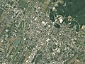
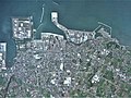
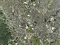
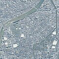
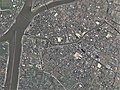
 Aerial photograph around the main district of Munakata city, Fukuoka Prefecture.2010.jpg 12,132 × 6,264; 25.5 MB
-
 Aerial photographs of Moji interchange.jpg 2,720 × 1,400; 2.18 MB
-
 Aino-shima Island Kokura-kita Ward Aerial photograph.1974.jpg 5,409 × 3,047; 12.44 MB
-
 Aino-shima Island, Kokura-kita Ward Aerial photograph.2009.jpg 3,269 × 4,708; 3.28 MB
-
 Ainoshima Island, Shingu Fukuoka Aerial photograph.2010.jpg 4,252 × 3,189; 1.47 MB
-
 Ariake sea nori nets.jpg 880 × 800; 149 KB
-
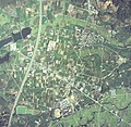
 Asakura city Amagi district Aerial photograph.2017.jpg 6,632 × 4,974; 11.37 MB
-
 Ashiya.airfield.aerial shoot.jpg 3,648 × 2,736; 6.75 MB
-
 Buzen city center area Aerial photograph.2013.jpg 3,062 × 2,285; 2.3 MB
-
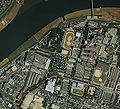
 Chikugo city center area Aerial photograph.2010.jpg 5,468 × 4,101; 7.59 MB
-
 Chikugo Ozeki Weir Aerial photograph.1987.jpg 3,585 × 2,591; 6.6 MB
-
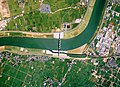
 Chikugo River Lift bridge aerial.jpg 1,000 × 1,000; 203 KB
-
 Chikushino city center area Aerial photograph.2017.jpg 6,241 × 4,681; 11.97 MB
-
 CKU20081-C27-43.jpg 1,900 × 1,468; 1.48 MB
-
 CKU20101-C12-8.jpg 1,004 × 792; 598 KB
-
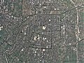
 Dazaifu city center area Aerial photograph.2017.jpg 8,424 × 6,318; 22.75 MB
-
 Dazaifu Golf Club, Dazaifu Fukuoka Aerial photograph.2007.jpg 4,232 × 3,174; 5.39 MB
-
 Dokai Bay Aerial photograph.2005.jpg 8,038 × 4,674; 13.34 MB
-
 Fukuoka Airport Aerial photograph.2007.jpg 1,360 × 3,080; 4.03 MB
-
 Fukuoka Castle Aerial photograph 2020.jpg 3,600 × 2,600; 4.99 MB
-
 Fukuoka Castle air.jpg 2,702 × 2,286; 3.22 MB
-
 Fukuoka Country Club, Higashi-ku Fukuoka Aerial photograph.2007.jpg 3,971 × 2,979; 4.64 MB
-
 Fukuoka Najima sports park air 1987.jpg 530 × 397; 139 KB
-
 Fukuoka Nishi park air 1987.jpg 1,110 × 833; 461 KB
-
 Fukuoka Seaside Momochi Aerial Shoot.jpg 3,988 × 2,648; 2.24 MB
-
 Fukuoka Shingu Ainoshima aerial shoot.jpg 3,648 × 2,736; 5.86 MB
-
 Fukutsu city center area Aerial photograph.2010.jpg 4,484 × 3,363; 4.6 MB
-
 Gannos Airport 1974.jpg 2,192 × 2,192; 1.39 MB
-
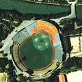
 Heiwadai Stadium 1987.jpg 374 × 374; 59 KB
-
 Heiwadai Stadium 1987.png 500 × 500; 626 KB
-
 Heiwadai stadium air 1987.jpg 361 × 361; 71 KB
-
 Himeshima, cku-81-1 c37 3.jpg 2,032 × 2,304; 817 KB
-
 Iizuka city center area Aerial photograph.2007.jpg 6,512 × 8,535; 19.24 MB
-
 Iki Airport Aerial Photograph.jpg 3,240 × 2,337; 2.25 MB
-
 Inatsuki district Kama city Aerial photograph.2007.jpg 4,467 × 5,198; 7.55 MB
-
 Itoshima city Maebaru district Aerial photograph.2001.jpg 1,554 × 1,169; 750 KB
-
 JGSDF Camp Iiduka.jpg 2,267 × 2,181; 3.99 MB
-
 Jinoshima aerial shot.jpg 3,648 × 2,736; 6.6 MB
-
 Jinoshima Island, Munakata Fukuoka Aerial photograph.2010.jpg 5,496 × 4,122; 2.76 MB
-
 Kaho district Kama city Aerial photograph.2009.jpg 3,998 × 2,998; 4.17 MB
-
 Kasuga city center area Aerial photograph.2007.jpg 3,617 × 2,713; 4.33 MB
-
 Katsushima in Munakata City.jpg 3,648 × 2,736; 7.01 MB
-
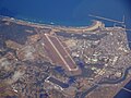
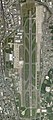
 Kitakyushu Airport Aerial photograph.2009.jpg 4,989 × 9,027; 12.48 MB
-
 Kitakyushu Airport air 1974.jpg 2,465 × 1,386; 1.78 MB
-
 Koga Golf Club, Koga Fukuoka Aerial photograph.2007.jpg 3,666 × 2,750; 3.56 MB
-
 Kokudo-chiriin kōkūshashin CKU20201-C21-45 part Gofukumachi 20230906.jpg 1,776 × 1,776; 516 KB
-
 Kokudo-chiriin kōkūshashin CKU20201-C21-46 part 20230729.jpg 1,152 × 1,152; 245 KB
-
 Kokudo-chiriin kōkūshashin CKU20201-C21-49 part 20230819.jpg 1,680 × 1,680; 471 KB
-
 Kokudo-chiriin kōkūshashin CKU20201-C22-50 part Yakuin 20230913.jpg 2,160 × 2,160; 793 KB
-
 Kokudo-chiriin kōkūshashin CKU20201-C24-41 part 20230830.jpg 1,616 × 2,880; 649 KB
-
 Kokudo-chiriin kōkūshashin CKU20201-C24-43 part 20230730.jpg 1,440 × 1,440; 346 KB
-
 Kokudo-chiriin kōkūshashin CKU20201-C26-39 part 20230820.jpg 1,296 × 2,304; 496 KB
-
 Kokudo-chiriin kōkūshashin CKU20201-C28-27 part 20230903.jpg 2,880 × 2,880; 1.21 MB
-
 Kokudo-chiriin kōkūshashin CKU20201-C28-29 part 20230903.jpg 1,152 × 2,048; 331 KB
-
 Kokudo-chiriin kōkūshashin CKU20201-C29-28 part 20230816.jpg 1,344 × 1,344; 266 KB
-
 Kokura Comprehensive Vehicle Center.2009.04.jpg 900 × 1,600; 1.31 MB
-
 Kokura Country Club, Kokuraminami-ku Kitakyushu Aerial photograph.2009.jpg 3,496 × 2,622; 3.47 MB
-
 Kokura Racecourse Aerial photograph 2009.jpg 2,952 × 2,573; 2.62 MB
-
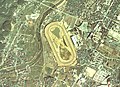 Kokura Racecourse Aerial photograph.1974.jpg 2,690 × 1,941; 4.94 MB
-
 Kurume Castle air.jpg 1,601 × 1,452; 1.02 MB
-
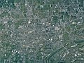
 Kurume city center area Aerial photograph.2010.jpg 13,091 × 9,818; 41.09 MB
-
-
 Miike-Jima Island, Omuta Fukuoka Aerial photograph.2008.jpg 1,085 × 814; 320 KB
-
 Miyama city Setaka district Aerial photograph.2008.jpg 5,179 × 3,884; 5.68 MB
-
 Miyawaka city Miyata district Aerial photograph.2007.jpg 4,374 × 3,281; 4.34 MB
-
 Miyawaka city Wakamiya district Aerial photograph.2007.jpg 3,410 × 2,557; 2.41 MB
-
 Mizuki a 1975.jpg 1,952 × 1,528; 2.2 MB
-
 MKU611-C2-17.jpg 1,425 × 2,002; 1,014 KB
-
 Mutsure-jima Island and Uma-shima Island Aerial photograph.1974.jpg 3,885 × 2,813; 8.3 MB
-
 Mutsure.island.jpg 3,648 × 2,736; 7.58 MB
-
 Nakagawa city center area Aerial photograph.2018.jpg 4,290 × 5,721; 9.11 MB
-
 Nakama city center area Aerial photograph.2010.jpg 6,674 × 4,068; 10.03 MB
-
 Nogata city center area Aerial photograph.2007.jpg 6,353 × 4,764; 10.74 MB
-
 Nokonoshima Island Aerial photograph.2007.jpg 4,801 × 7,266; 18.81 MB
-
 Ogori Athletic Stadium.jpg 892 × 1,003; 383 KB
-
 Ogori city center area Aerial photograph.2010.jpg 4,591 × 3,443; 4.73 MB
-
 Okawa city center area Aerial photograph.2008.jpg 5,733 × 4,299; 7.4 MB
-
 Okayama(Chikugo)-Airfield-CKU20101-C35-7.jpg 3,285 × 3,258; 9.62 MB
-
 Okayama(Chikugo)-Airfield-CKU813-C17-64.jpg 3,268 × 3,186; 9.07 MB
-
 Okayama(Chikugo)-Airfield-USA-M665-125.jpg 2,144 × 2,144; 1.79 MB
-
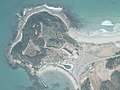
 Okinoshima aerial01.jpg 1,500 × 1,400; 341 KB
-
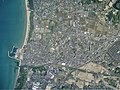
 Omuta city center area Aerial photograph.2016.jpg 12,698 × 9,523; 37.35 MB
-
 Onojo city center area Aerial photograph.2007.jpg 3,603 × 4,804; 7.85 MB
-
 Orono Island, Fukuoka.jpg 2,697 × 2,657; 608 KB
-
 Oronoshima Island, Nishi-ku fukuoka Aerial photograph.2014.jpg 3,805 × 2,853; 3.53 MB
-
 Oshima Island, Munakata Fukuoka Aerial photograph.2010.jpg 8,214 × 6,162; 9.35 MB
-
 Oshima island.jpg 3,648 × 2,736; 5.65 MB
-
 Otake Short Course, Higashi-ku Fukuoka Aerial photograph.2007.jpg 1,890 × 1,416; 1.41 MB
-
 Saitozaki Sea Side Country Club, Higashi-ku Fukuoka Aerial photograph.2007.jpg 3,114 × 2,335; 2.89 MB
-
 Sasaguru Kasuya Research Forest, Kyushu University Aerial Photograph.2007.jpg 1,802 × 1,201; 875 KB
-
 Shikanoshima aerial shoot.jpg 3,648 × 2,736; 5.86 MB
-
 Shirashima Island, Wakamatsu Kitakyushu Aerial photograph.2009.jpg 3,000 × 2,250; 1.5 MB
-
 Sumitomo Metal Industries Kokura Aerial Photograph 2009.jpg 5,217 × 3,913; 5.9 MB
-
 Tagawa city center area Aerial photograph.2009.jpg 4,328 × 3,246; 4.82 MB
-
 The Classic Golf Club, Miyawaka Fukuoka Aerial photograph.2010.jpg 2,702 × 3,602; 3.11 MB
-
 The Queen’s Hill Golf Club, Itoshima Fukuoka Aerial photograph.2001.jpg 1,282 × 954; 444 KB
-
 Ukiha city main areas Aerial photograph.2018.jpg 14,438 × 5,661; 26.42 MB
-
 Usui district Kama city Aerial photograph.2007.jpg 4,346 × 3,259; 4.36 MB
-
 Wajiro mudflat Aerial photograph.1987.jpg 4,015 × 2,903; 7.24 MB
-
 Wakamatsu Golf Club, Wakamatsu-ku Kitakyushu Aerial photograph.2016.jpg 4,396 × 3,297; 4.22 MB
-
 Yamada district Kama city Aerial photograph.2009.jpg 2,706 × 2,008; 2.5 MB
-
 Yame city center area Aerial photograph.2010.jpg 5,962 × 4,471; 8.19 MB
-
 Yanagawa city center area Aerial photograph.2008.jpg 6,708 × 5,030; 10.57 MB
-
 Yukuhashi city center area Aerial photograph.2009.jpg 6,397 × 4,798; 11.39 MB
-
 宮若市犬鳴 航空写真 CKU951X-C5-9.jpg 1,189 × 1,701; 781 KB

_(04).jpg)


-Airfield-CKU20101-C35-7.jpg)
-Airfield-CKU813-C17-64.jpg)
-Airfield-USA-M665-125.jpg)


