Category:Aerial photographs of Oita prefecture
Jump to navigation
Jump to search

Subcategories
This category has only the following subcategory.
O
- Aerial photographs of Oita, Oita (32 F)
Media in category "Aerial photographs of Oita prefecture"
The following 48 files are in this category, out of 48 total.
-
 2023-04-03 Myoban Onsen、明礬温泉空撮 DJI 0757.jpg 4,000 × 2,250; 4.01 MB
-
 Aerial photograph of Asaji interchange.jpg 2,100 × 1,500; 2.22 MB
-
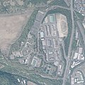 Aerial photograph of JGSDF Camp Beppu.jpg 1,500 × 1,500; 1.52 MB
-
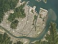
 Beppu city center area Aerial photograph.2013.jpg 14,702 × 28,642; 101.43 MB
-
 Bungo-ono city Miemachi district Aerial photograph.2008.jpg 5,485 × 4,114; 8.05 MB
-
 Bungotakada city center area Aerial photograph.1975.jpg 3,935 × 2,951; 4.38 MB
-
 Fuka-shima Island Aerial photograph.2008.jpg 1,952 × 1,464; 495 KB
-
 Harajiri Falls in Bungoono City Oita Prefecture.01.jpg 2,880 × 2,160; 7.22 MB
-
 Harajiri Falls in Bungoono City Oita Prefecture.jpg 3,440 × 1,440; 5.32 MB
-
 Hiji town center.jpg 1,920 × 1,080; 1.69 MB
-
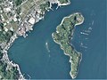 Hikoshima Island, Saiki Oita Aerial photograph.2018.jpg 2,548 × 1,911; 1.01 MB
-
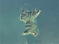
 Hime-shima Island Oita prefecture Aerial photograph.1974.jpg 9,304 × 3,820; 23.79 MB
-
 Hime-shima Island Oita prefecture Aerial photograph.2015.jpg 6,532 × 3,455; 2.85 MB
-
 Hita city center area Aerial photograph.2018.jpg 9,046 × 8,262; 28.25 MB
-
 Hodo-Jima Island Aerial photograph.2009.jpg 1,961 × 1,471; 587 KB
-
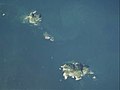 Jiguro-shima and Okiguro-shima Islands Aerial photograph.2008.jpg 1,668 × 1,251; 236 KB
-
 Katajiro-Jima Island Aerial photograph.2008.jpg 1,141 × 856; 173 KB
-
 Kitsuki city center area Aerial photograph.2013.jpg 6,610 × 4,957; 9.14 MB
-
 Kuju Gliding Field Aerial photograph.2016.jpg 2,586 × 2,069; 3.91 MB
-
 Kunisaki city center area Aerial photograph.2015.jpg 3,364 × 2,523; 2.19 MB
-
 Kunisakihantou.jpg 1,280 × 960; 30 KB
-
 Kuro-shima Island in Tsukumi City, Oita Prefecture. Aerial photograph.2009.jpg 1,823 × 1,367; 341 KB
-
 Mitsugo-Jima Island in Usuki City, Oita Prefecture. Aerial photograph.2009.jpg 2,346 × 1,760; 1.04 MB
-
 Muku-shima Islands Aerial photograph.2009.jpg 5,593 × 3,349; 5.75 MB
-
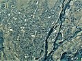
 Nakatsu city center area Aerial photograph.2013.jpg 3,624 × 2,729; 4.51 MB
-
 Nakatsu Racecourse Aerial photograph.1974.jpg 3,172 × 2,298; 6.34 MB
-
 Nanase River.jpg 1,920 × 1,440; 2.28 MB
-
 O-shima Island in Saiki City, Oita Prefecture. Aerial photograph.2008.jpg 2,280 × 3,041; 1.66 MB
-
 Oita Airport Aerial photograph.2015.jpg 1,577 × 3,583; 1,019 KB
-
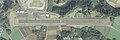
 Oita kenoh.runway approach.jpg 3,840 × 2,160; 3.73 MB
-
 Oita Kenou Airfields, Bungo-ono Oita Aerial photograph.2008.jpg 1,907 × 1,430; 1.08 MB
-
 Oita Prefectural Airfield Aerial photograph 2008.jpg 400 × 1,200; 447 KB
-
 Oita Prefectural Airfield Aerial photograph.2008.jpg 1,200 × 400; 368 KB
-
 Pacific Blue Country Club, Kunisaki Oita Aerial photograph.2015.jpg 3,305 × 2,478; 2.28 MB
-
 Saiki Chuo Hospital Stadium.jpg 1,421 × 1,011; 719 KB
-
 Saiki city center area Aerial photograph.2018.jpg 9,977 × 7,482; 21.49 MB
-
 Sumiyoshi-Hama beaches Aerial Photograph.jpg 2,563 × 1,922; 955 KB
-
 Taketa city center area Aerial photograph.2016.jpg 6,299 × 4,724; 9.41 MB
-
 Tsukumi city center area Aerial photograph.2018.jpg 7,917 × 5,938; 17.58 MB
-
 Tsuta-shima Island in Oita City, Oita Prefecture. Aerial photograph.2007.jpg 2,246 × 1,685; 518 KB
-
 Usa city center area Aerial photograph.2013.jpg 3,148 × 2,361; 2.84 MB
-
 Usuki city center area Aerial photograph.2018.jpg 6,256 × 4,693; 10.83 MB
-
 Ya-shima Island in Saiki City, Oita Prefecture. Aerial photograph.2008.jpg 1,311 × 983; 274 KB
-
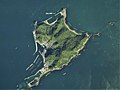
 Yakata-jima Island Aerial photograph.2008.jpg 2,318 × 1,739; 989 KB
-
 Yoko-shima Island in Saiki City, Oita Prefecture. Aerial photograph.2008.jpg 1,762 × 1,322; 623 KB
-
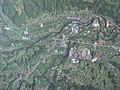
 Yufu city Hasama district Aerial photograph.2014.jpg 7,197 × 5,398; 13.59 MB
-
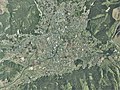
 Yufu city Shonai district Aerial photograph.2013.jpg 2,900 × 2,175; 2.22 MB
-
 Yufu city Yufuin district Aerial photograph.2014.jpg 6,995 × 5,246; 14.45 MB


