Category:Aerial photographs of Miyazaki prefecture
Jump to navigation
Jump to search

Media in category "Aerial photographs of Miyazaki prefecture"
The following 45 files are in this category, out of 45 total.
-
 2021-01-07 Aoshima Island (Miyazaki)Aerial photography青島 (宮崎県)DJI 0246 (2)空撮.jpg 3,739 × 2,078; 2.92 MB
-
 2021-01-07 Aoshima Island (Miyazaki)Aerial photography青島 (宮崎県)DJI 0249 (2)空撮.jpg 4,000 × 2,226; 4.11 MB
-
 2021-01-07 Aoshima Island (Miyazaki)青島 (宮崎県)DJI 0255 (2)空撮.jpg 4,000 × 2,250; 4.06 MB
-
 2021-01-08 Aburatsu Port(油津港空撮)Aerial photography DJI 0308.jpg 4,000 × 2,250; 4.17 MB
-
 2021-01-09 Inyouseki Kobayashi,Miyazaki Aerial photography(陰陽石、宮崎県小林市) DJI 0382 (2)空撮.jpg 4,000 × 2,250; 3.31 MB
-
 Aerial photo of Nobeoka City 16-Mar-2019.jpg 6,016 × 4,016; 3.75 MB
-
 Aerial photograph of Obi District 2020-2.jpg 2,553 × 2,553; 6.87 MB
-
 Aerial photograph of Obi District 2020.jpg 2,017 × 1,867; 1.33 MB
-
 Aerial photographs of Miyazaki-nishi interchange.jpg 2,188 × 2,368; 3.96 MB
-
 Aerial View of Seagaia Resort in Miyazaki, Japan.jpg 3,008 × 2,008; 1.96 MB
-
 Aoshima Island Aerial photograp 2017.jpg 2,500 × 1,900; 4.83 MB
-
 Ebino city center area Aerial photograph.2009.jpg 3,852 × 2,890; 3.52 MB
-
 Hitotsuse Dam survey.jpg 504 × 378; 30 KB
-
 Hitotsuse power station survey 1976.jpg 690 × 516; 96 KB
-
 Hyuga city center area Aerial photograph.2018.jpg 14,696 × 12,698; 66.54 MB
-
 Kobayashi city center area Aerial photograph.976.jpg 4,552 × 3,414; 6.2 MB
-
 Kushima city center area Aerial photograph.2008.jpg 3,375 × 4,500; 5.07 MB
-
 Mesahodzuka air.jpg 397 × 357; 47 KB
-
 Miazaki Prefecture 2015-08-08 (21303814720).jpg 2,560 × 1,920; 582 KB
-
 Miyakonojo city center area Aerial photograph.1975.jpg 6,376 × 4,782; 12.49 MB
-
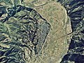
 Miyakonojou Basin.jpg 4,608 × 2,373; 1,009 KB
-
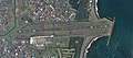 Miyazaki Airport Aerial photograph.2017.jpg 6,290 × 2,756; 4.49 MB
-
 Miyazaki city center area Aerial photograph.2010.jpg 12,000 × 13,114; 55.08 MB
-
 Miyazaki Country Club, Miyazaki Miyazaki Aerial photograph.2017.jpg 2,363 × 3,150; 2.36 MB
-
 Miyazaki.airports.aerial.shoot.jpg 3,648 × 2,736; 3.95 MB
-
 Nichinan city Aburatsu district Aerial photograph.1975.jpg 4,193 × 3,144; 5.1 MB
-
 Nichinan city Agata district Aerial photograph.1975.jpg 3,084 × 2,314; 3.09 MB
-
 Nichinan city Kitago district Aerial photograph.1975.jpg 3,349 × 2,512; 3.44 MB
-
 Nichinan city Nango district Aerial photograph.1975.jpg 3,380 × 2,536; 3.35 MB
-
 Nichinan city Obi district Aerial photograph.1975.jpg 2,682 × 2,012; 2.31 MB
-
 Nichinan city Odotsu district Aerial photograph.1975.jpg 4,265 × 3,199; 3.73 MB
-
 Nobeoka city center area Aerial photograph.2018.jpg 16,032 × 13,044; 73.17 MB
-
 Obi Castle air.jpg 1,295 × 1,096; 3.02 MB
-
 Obi Groups of Traditional Buildings District Aerial photograph.1974.jpg 2,317 × 1,677; 3.36 MB
-
 Osahodzuka air.jpg 415 × 360; 55 KB
-
 Oto-jima Island, Kadogawa Miyazaki Aerial photograph.2018.jpg 2,982 × 2,236; 2.24 MB
-
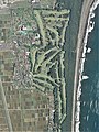
 Phoenix Country Club, Miyazaki Miyazaki Aerial photograph.2017.jpg 4,761 × 3,963; 6.08 MB
-
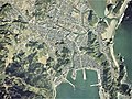
 Saito city center area Aerial photograph.2008.jpg 3,876 × 2,907; 4.26 MB
-
 Saitobaru Kofungun air.jpg 2,158 × 2,784; 849 KB
-
 SeaGaia - Miyazaki Ocean Dome - outside.jpg 2,000 × 1,430; 1.34 MB
-
 Shimanoura Island 16-Mar-2019.jpg 3,855 × 3,003; 1.31 MB
-
 Shimanoura Island, Nobeoka Miyazaki Aerial photograph.2018.jpg 6,078 × 4,862; 26.65 MB
-
 Sugiyasu Dam Aerial Photograph.jpg 400 × 300; 15 KB
-
 UMK Country Club, Miyazaki Miyazaki Aerial photograph. 2017.jpg 2,991 × 2,393; 3.02 MB
-
 五ヶ瀬ハイランドスキー場.JPG 1,280 × 856; 485 KB

%E7%A9%BA%E6%92%AE.jpg)


.jpg)


Aerial_photography%E9%9D%92%E5%B3%B6_(%E5%AE%AE%E5%B4%8E%E7%9C%8C)DJI_0246_(2)%E7%A9%BA%E6%92%AE.jpg)
Aerial_photography%E9%9D%92%E5%B3%B6_(%E5%AE%AE%E5%B4%8E%E7%9C%8C)DJI_0249_(2)%E7%A9%BA%E6%92%AE.jpg)
%E9%9D%92%E5%B3%B6_(%E5%AE%AE%E5%B4%8E%E7%9C%8C)DJI_0255_(2)%E7%A9%BA%E6%92%AE.jpg)