Category:Aerial photographs of Nara prefecture
Jump to navigation
Jump to search

Media in category "Aerial photographs of Nara prefecture"
The following 86 files are in this category, out of 86 total.
-
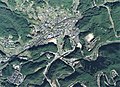
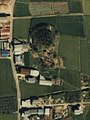
 790911 Nikiyama Kofun aerial.jpg 748 × 478; 566 KB
-
 Aerial panorama of Nara Park.jpg 8,192 × 3,304; 10.2 MB
-
 Aerial panorama of Nora Park facing the old town.jpg 8,192 × 3,302; 9.75 MB
-
 Aerial perspective of Nara Park.jpg 8,192 × 3,310; 10.41 MB
-
 Aerial perspective of Tōdai-ji Buddhist Temple.jpg 4,032 × 2,268; 5.67 MB
-
 Aerial photo of Nara 10-Aug-2019.jpg 4,666 × 3,105; 3.13 MB
-
 Aerial view of Tenri, Nara 2019-04-12.jpg 4,000 × 6,000; 17.37 MB
-
 Akasaka tennnouyama kohun aerial.jpg 510 × 600; 65 KB
-
 Asuka Country Club, Nara Aerial photograph.2008.jpg 4,367 × 3,276; 5.62 MB
-
 Goido Rail Yard, CKK20083-C34-38.jpg 1,277 × 1,037; 609 KB
-
 Gojo city center area Aerial photograph.2011.jpg 4,391 × 3,294; 5.86 MB
-
 Gojo Interchange Aerial photograph 2011.jpg 721 × 773; 218 KB
-
 Gojo-Nishi Interchange Aerial photograph 2011.jpg 744 × 517; 135 KB
-
 Gosaji kohun 01.jpg 800 × 600; 646 KB
-
 Gosashi kohun aerial.jpg 500 × 540; 34 KB
-
 Gose city center area Aerial photograph.2011.jpg 4,181 × 3,136; 5.18 MB
-
 Grandage Golf Club, Yoshino Nara Aerial photograph.2011.jpg 3,765 × 2,823; 4.07 MB
-
 Haibara district Uda city Aerial photograph.2011.jpg 4,210 × 3,157; 4.5 MB
-
 Hashihaka kohun aerial.jpg 640 × 480; 44 KB
-
 Heijo and Soraku District aerial photo 2021.jpg 2,000 × 1,800; 2.17 MB
-
 Heijo Palace Site aerial photo 2021.jpg 1,680 × 1,680; 1.38 MB
-
 Higaida ohtsuka kohun aerial.jpg 240 × 180; 5 KB
-
 Hishiage kohun aerial.jpg 530 × 550; 36 KB
-
 Hokenoyama kohun aerial.jpg 320 × 240; 16 KB
-
 Ichiniwa kohun aerial.jpg 600 × 600; 55 KB
-
 Ikoma city center area Aerial photograph.2008.jpg 8,163 × 6,226; 21.97 MB
-
 Kashiba city center area Aerial photograph.2008.jpg 6,153 × 4,872; 12.09 MB
-
 Kashihara city center area Aerial photograph.2008.jpg 7,839 × 5,226; 15.55 MB
-
 Katsuragi city center area Aerial photograph.2011.jpg 6,649 × 4,987; 12.16 MB
-
 Kawai power station 1976.jpg 395 × 297; 52 KB
-
 KOMA Country Club, Nara Nara Aerial photograph.2011.jpg 3,286 × 2,464; 2.8 MB
-
 Konabe kohun aerial.jpg 460 × 500; 31 KB
-

-
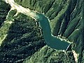 Kose Dam lake 1976.jpg 720 × 540; 137 KB
-
 KT-Camp Car Station AP1948.jpg 510 × 314; 128 KB
-
 Kurotsuka kohun aerial.jpg 540 × 340; 37 KB
-
 Mesuriyama kohun aerial.jpg 640 × 420; 56 KB
-
 Mise Maruyama kofun aerial.jpg 440 × 480; 32 KB
-
 Misemaruyamakofun.jpg 2,263 × 2,060; 449 KB
-
 Mount Amanokagu Aerial photograph.1985.jpg 2,966 × 2,145; 4.61 MB
-
 Mount Miminashi Aerial photograph.1985.jpg 2,611 × 1,884; 3.91 MB
-
 Mount Unebi Aerial photograph.1985.jpg 4,038 × 2,925; 8.97 MB
-
 Muro district Uda city Aerial photograph.2011.jpg 3,188 × 2,322; 2.83 MB
-
 Nakayama ohtsuka kohun aerial.jpg 280 × 340; 17 KB
-
 Nakayamatsuka aerial.jpg 420 × 330; 17 KB
-
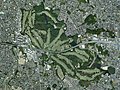
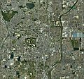
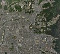 Nara city center area Aerial photograph.2008.jpg 9,815 × 8,855; 33.56 MB
-
 Nara Kokusai Golf Club, Nara Aerial photograph.2008.jpg 4,501 × 3,376; 5.46 MB
-
 Nara-kotsu driving school.jpg 504 × 404; 170 KB
-
 Noguchinoounohaka aerial.jpg 300 × 320; 14 KB
-
 Oouda district Uda city Aerial photograph.2011.jpg 4,239 × 3,179; 4.65 MB
-
 Ossaka dannnoduka kohun aerial.jpg 250 × 250; 12 KB
-
 Sakitatenami kohungun aerial 1.jpg 1,302 × 1,078; 1.52 MB
-
 Sakitatenami kohungun aerial 2.jpg 952 × 1,532; 1.93 MB
-
 Sakitatenami kohungun aerial 3.jpg 740 × 580; 64 KB
-
 Sakurai city center area Aerial photograph.2008.jpg 8,137 × 6,103; 19.17 MB
-
 Sakurai tyausuyama kohun 1974a.jpg 480 × 360; 52 KB
-
 Sakurai tyausuyama kohun aerial 1985.jpg 300 × 360; 22 KB
-
 Shimoikeyama kohun aerial.jpg 280 × 320; 127 KB
-
 Suyama kofun stereo.jpg 1,268 × 620; 877 KB
-
 Syoubuike kohun aerial.jpg 210 × 220; 8 KB
-
 Takatori Castle air.jpg 1,752 × 1,529; 1.67 MB
-
 Takayama District aerial photo 2021.jpg 1,600 × 1,600; 1.44 MB
-
 Taketo, Totsukawa.CKK766-C17B-11.jpg 2,785 × 2,953; 2.91 MB
-
 Tenri city center area Aerial photograph.2008.jpg 8,073 × 5,188; 15.95 MB
-
 Tenri Uenoyama kohun aerial.jpg 280 × 320; 14 KB
-
 The aerial photo of the Mt. Tamaki summit sanctuary.jpg 3,363 × 2,426; 3.97 MB
-
 The Former Nara Prison Aerial photograph.2008.jpg 1,121 × 747; 352 KB
-
 The lower reaches of Nishikawa (from Shiidaira to Yagimoto, Warabio).jpg 3,590 × 3,560; 2.3 MB
-
 The upper reaches of Kawarabigawa (near Omata, Totsukawa vil.).jpg 3,590 × 3,543; 2.42 MB
-
 Three Makimuku kofun aerial view.jpg 520 × 400; 29 KB
-
 Tsuzurao Dam 1976.jpg 380 × 285; 39 KB
-
 Ueyama kohun aerial.jpg 450 × 400; 27 KB
-
 Umeyama kohun aerial.jpg 366 × 284; 187 KB
-
 Utano district Uda city Aerial photograph.2011.jpg 3,999 × 2,999; 4.07 MB
-
 Uwanabe kohun aerial.jpg 580 × 600; 42 KB
-
 Wada power station (Nara) 1976.jpg 361 × 269; 43 KB
-
 Yamato Sanzan the three mountains of Yamato Province Aerial photograph.1985.jpg 8,767 × 6,339; 40.62 MB
-
 Yamato Tenjinyama kohun aerial.jpg 320 × 260; 15 KB
-
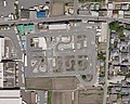
 Yamatokoriyama city baseball stadium.jpg 614 × 644; 254 KB
-
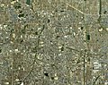
 Yamatokoriyama city center area Aerial photograph.2008.jpg 8,031 × 7,528; 19.92 MB
-
 Yamatotakada city center area Aerial photograph.2008.jpg 8,186 × 6,512; 20.27 MB
-
 Yanagimoto Ohtsuka kohun aerial.jpg 240 × 320; 12 KB
-
 市庭古墳-1.jpg 739 × 740; 103 KB
-
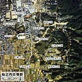 杣之内古墳群-L.jpg 1,600 × 1,601; 455 KB
-
 紀伊山地 (484461062).jpg 1,138 × 853; 301 KB
-
 纒向石塚古墳.jpg 182 × 160; 5 KB


.jpg)
.jpg)


_1976.jpg)


.jpg)
