Category:Maps of Tennessee
Jump to navigation
Jump to search
States of the United States: Alabama · Alaska · Arizona · Arkansas · California · Colorado · Connecticut · Delaware · Florida · Georgia · Hawaii · Idaho · Illinois · Indiana · Iowa · Kansas · Kentucky · Louisiana · Maine · Maryland · Massachusetts · Michigan · Minnesota · Mississippi · Missouri · Montana · Nebraska · Nevada · New Hampshire · New Jersey · New Mexico · New York · North Carolina · North Dakota · Ohio · Oklahoma · Oregon · Pennsylvania · Rhode Island · South Carolina · South Dakota · Tennessee · Texas · Utah · Vermont · Virginia · Washington · West Virginia · Wisconsin · Wyoming – Washington, D.C.
insular area of the United States: American Samoa · Guam · Northern Mariana Islands · Puerto Rico · United States Virgin Islands – United States Minor Outlying Islands: Baker Island · Howland Island · Jarvis Island · Johnston Atoll · Kingman Reef · Midway Atoll · Navassa Island · Palmyra Atoll · Wake Island
insular area of the United States: American Samoa · Guam · Northern Mariana Islands · Puerto Rico · United States Virgin Islands – United States Minor Outlying Islands: Baker Island · Howland Island · Jarvis Island · Johnston Atoll · Kingman Reef · Midway Atoll · Navassa Island · Palmyra Atoll · Wake Island
Wikimedia category | |||||
| Upload media | |||||
| Instance of | |||||
|---|---|---|---|---|---|
| Category combines topics | |||||
| Tennessee | |||||
state of the United States of America .jpg)   .jpg)  | |||||
| Pronunciation audio | |||||
| Instance of | |||||
| Part of | |||||
| Named after |
| ||||
| Location |
| ||||
| Capital | |||||
| Legislative body | |||||
| Executive body | |||||
| Highest judicial authority | |||||
| Official language | |||||
| Head of government |
| ||||
| Inception |
| ||||
| Highest point | |||||
| Population |
| ||||
| Area |
| ||||
| Elevation above sea level |
| ||||
| Replaces | |||||
| Different from | |||||
| Maximum temperature record |
| ||||
| Minimum temperature record |
| ||||
| official website | |||||
 | |||||

Subcategories
This category has the following 27 subcategories, out of 27 total.
A
- Area code maps of Tennessee (2 F)
B
C
E
F
G
H
L
- Location maps of Tennessee (4 F)
M
N
- National Atlas maps of Tennessee (14 F)
O
P
R
S
T
Media in category "Maps of Tennessee"
The following 57 files are in this category, out of 57 total.
-
 1796 House of Representatives tennessee.svg 540 × 180; 73 KB
-
 203433W sm.png 895 × 716; 33 KB
-
 8FranklinCounties.png 1,340 × 1,029; 210 KB
-
 Alcohol Laws of Tennessee Counties as of 2022.png 1,986 × 486; 182 KB
-
 Alcohol Laws of Tennessee Counties-2022.png 1,986 × 486; 182 KB
-
 American malacological bulletin (1988) (18157297401).jpg 1,787 × 1,042; 238 KB
-
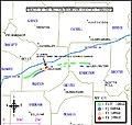
 Appalachian-tennessee-arc-2003-status.jpg 344 × 160; 19 KB
-
 Battle of Wauhatchie map.jpg 2,082 × 2,214; 2.77 MB
-
 Chickamauga Towns.jpg 3,000 × 2,400; 1.46 MB
-
 Condorcet Tennessee.png 413 × 117; 1 KB
-
 Cumberlandplateaumap.png 600 × 600; 539 KB
-
 EDTenn map.png 550 × 132; 19 KB
-
 Fred Thompson office locations Tnmap.gif 450 × 126; 11 KB
-
 Full Trail Map (890f5356-c252-4c2a-98d9-cb38f46ff625).jpg 774 × 1,024; 159 KB
-
 Guide to the summer resorts and watering places of East Tennessee (1880) (14574523048).jpg 3,678 × 2,025; 1.48 MB
-
 Guide to the summer resorts and watering places of East Tennessee (1880) (14761168885).jpg 3,328 × 1,971; 1.43 MB
-
 Jacksontrack.JPG 524 × 499; 45 KB
-
 Jacob Brown Grant Map.png 800 × 475; 173 KB
-
 Kentucky Bend.png 902 × 768; 470 KB
-
 KIH20-Map.gif 579 × 285; 13 KB
-

-

-

-
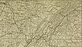
 Map of Kentucky and Tennessee.jpg 3,501 × 2,935; 3.94 MB
-
 Map of the Tennessee Valley Authority - NARA - 195895.tif 2,000 × 1,226; 2.36 MB
-
 MDTenn map.PNG 508 × 133; 10 KB
-

-
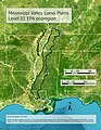 Mississippi Valley Loess Plains Map.jpg 2,550 × 3,300; 8.66 MB
-
 New Madrid and Wabash seizmic zones-USGS.png 748 × 819; 467 KB
-
 New Madrid quakes.png 300 × 351; 82 KB
-
 NMSZ Vergleich.jpg 437 × 281; 37 KB
-
 Nolichucky Watauga Grants Map Greenville.jpg 416 × 268; 27 KB
-
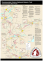 Overmountain victory NHT.png 2,278 × 3,174; 1.38 MB
-
 Personal Memoirs of Ulysses S. Grant Volume II (page 27 crop).jpg 2,272 × 1,304; 863 KB
-
 Personal Memoirs of Ulysses S. Grant Volume II (page 385 crop).jpg 1,375 × 2,281; 768 KB
-
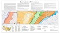
 Physiographic provinces of Kentucky and Tennessee (26846316391).jpg 2,177 × 1,678; 2.17 MB
-
 Population density of Tennessee counties (2020).png 5,839 × 2,128; 1.39 MB
-
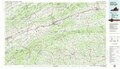
 Primary Highways in Tennessee.jpg 3,318 × 840; 1.19 MB
-
 Tennesse Highway Map.jpg 3,183 × 6,362; 6.39 MB
-
 Tennessee 2004.png 1,595 × 313; 367 KB
-
 Tennessee 90.jpg 1,606 × 456; 166 KB
-
 Tennessee County Flips 2004.svg 810 × 206; 58 KB
-
 Tennessee judicial districts map.png 918 × 288; 209 KB
-
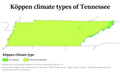 Tennessee Köppen.png 6,300 × 3,781; 210 KB
-
 Tennessee Level IV ecoregions.pdf 5,400 × 3,000; 1.65 MB
-
 Tennessee Map of Interstate Routes 1927.png 2,568 × 1,522; 2.4 MB
-
 Tennessee map simple sketch.png 1,200 × 712; 27 KB
-
 Tennessee population map.png 700 × 400; 152 KB
-
 Tennessee ref 2001.jpg 710 × 207; 113 KB
-
 Tennessee wind resource map 50m 800.jpg 1,100 × 850; 421 KB
-
 Tennessee, Hardin County, Swift.jpg 831 × 715; 67 KB
-
 TN-NC border counties.PNG 4,303 × 2,203; 1.43 MB
-
 TVA map.png 792 × 612; 255 KB
-
 US Southeastern Plains Map.jpg 3,300 × 2,550; 6.8 MB
-
 VA Wytheville 188819 1982 100000 geo.pdf 6,283 × 3,629; 24.97 MB
-
 Vanden Bulck Bridge map.jpg 756 × 488; 160 KB
-
 WDTenn map.PNG 508 × 133; 10 KB


_(18157297401).jpg)


.jpg)
_(14574523048).jpg)
_(14761168885).jpg)


.jpg)
.jpg)
.jpg)


.png)