Category:Maps of Rhode Island
Jump to navigation
Jump to search
States of the United States: Alabama · Alaska · Arizona · Arkansas · California · Colorado · Connecticut · Delaware · Florida · Georgia · Hawaii · Idaho · Illinois · Indiana · Iowa · Kansas · Kentucky · Louisiana · Maine · Maryland · Massachusetts · Michigan · Minnesota · Mississippi · Missouri · Montana · Nebraska · Nevada · New Hampshire · New Jersey · New Mexico · New York · North Carolina · North Dakota · Ohio · Oklahoma · Oregon · Pennsylvania · Rhode Island · South Carolina · South Dakota · Tennessee · Texas · Utah · Vermont · Virginia · Washington · West Virginia · Wisconsin · Wyoming – Washington, D.C.
insular area of the United States: American Samoa · Guam · Northern Mariana Islands · Puerto Rico · United States Virgin Islands – United States Minor Outlying Islands: Baker Island · Howland Island · Jarvis Island · Johnston Atoll · Kingman Reef · Midway Atoll · Navassa Island · Palmyra Atoll · Wake Island
insular area of the United States: American Samoa · Guam · Northern Mariana Islands · Puerto Rico · United States Virgin Islands – United States Minor Outlying Islands: Baker Island · Howland Island · Jarvis Island · Johnston Atoll · Kingman Reef · Midway Atoll · Navassa Island · Palmyra Atoll · Wake Island
Wikimedia category | |||||
| Upload media | |||||
| Instance of | |||||
|---|---|---|---|---|---|
| Category combines topics | |||||
| Rhode Island | |||||
state of the United States of America    .svg)  .svg)   | |||||
| Pronunciation audio | |||||
| Instance of | |||||
| Part of | |||||
| Named after | |||||
| Location |
| ||||
| Located in or next to body of water | |||||
| Capital | |||||
| Legislative body | |||||
| Executive body | |||||
| Highest judicial authority |
| ||||
| Anthem |
| ||||
| Head of government |
| ||||
| Inception |
| ||||
| Highest point | |||||
| Population |
| ||||
| Area |
| ||||
| Elevation above sea level |
| ||||
| Replaces |
| ||||
| Maximum temperature record |
| ||||
| Minimum temperature record |
| ||||
| official website | |||||
 | |||||

Subcategories
This category has the following 26 subcategories, out of 26 total.
*
- Travel maps of Rhode Island (1 F)
A
B
- Blank maps of Rhode Island (3 F)
C
G
H
L
M
- Maps of Narragansett Bay (26 F)
N
O
P
R
S
T
Media in category "Maps of Rhode Island"
The following 58 files are in this category, out of 58 total.
-
 1924 Rand McNally Standard Map of Rhode Island.jpg 7,978 × 12,249; 13.49 MB
-

-
 Admirakty Chart No 2480 Approaches to New York, Published 1896, New Edition 1919.jpg 17,665 × 11,284; 64.78 MB
-
 Admiralty Chart No 2890 Nantucket Shoal to Block Island, Published1862.jpg 13,086 × 8,678; 14.67 MB
-
 Admiralty Chart No 2892a Rhode Island State Narraganset Bay, Published 1862.jpg 12,505 × 8,835; 13.38 MB
-
 Admiralty Chart No 2892b Rhode Island State Narraganset Bay, Published 1862.jpg 12,505 × 8,734; 13.03 MB
-

-

-
 Area code 401.png 140 × 130; 3 KB
-
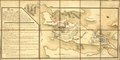
 Attacks upon Rhode Island, Augt. 1778. LOC gm71000685.jpg 6,299 × 4,304; 3.25 MB
-
 Blockisland.png 720 × 540; 64 KB
-

-
 Charlestown RI lg.PNG 527 × 811; 24 KB
-
 Connecticut and Rhode Island - NARA - 26335495.jpg 8,448 × 6,171; 9.27 MB
-
 History of the state of Rhode Island and Providence plantations (1859) (14594857270).jpg 1,884 × 2,832; 673 KB
-
 History of the state of Rhode Island and Providence plantations (1859) (14781219832).jpg 2,056 × 2,988; 863 KB
-
 LarkAndCerberusWreckMap.jpg 600 × 450; 72 KB
-
 List of municipalities in Rhode Island zh-hk.jpg 1,080 × 1,580; 324 KB
-
 List of municipalities in Rhode Island.gif 493 × 553; 15 KB
-
 Map of Pawtucket, Mass July 1848.jpg 3,228 × 3,910; 5.45 MB
-
 Map of Rhode Island Regions.png 1,426 × 2,180; 214 KB
-
 Map of Rhode Island.jpg 1,959 × 2,904; 1.79 MB
-
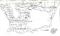
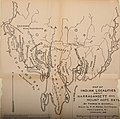
 Map of the Colony of Rhode Island giving the Indian names of locations.jpg 8,418 × 11,284; 37.12 MB
-
 Middletown RI lg.PNG 527 × 811; 25 KB
-
 NarragansettBay1777.jpg 1,959 × 2,817; 1.95 MB
-

-
 New England Minor Civil Divisions.png 718 × 945; 325 KB
-
 New England Town Lines and Borders in the Six New England States.png 1,180 × 1,500; 134 KB
-
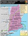
 New England's Southern Gateway.jpg 4,222 × 5,633; 6.32 MB
-
 Pettequamscutt Purchase map 1724.jpg 426 × 256; 46 KB
-
-

-

-
-
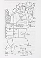 Plat of Quidnesett.jpg 2,445 × 3,471; 2.37 MB
-
 Population density of Rhode Island counties (2020).png 4,525 × 2,780; 600 KB
-
 Rhode Island Colleges.png 397 × 584; 38 KB
-
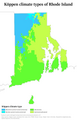 Rhode Island Köppen.png 6,300 × 9,838; 419 KB
-
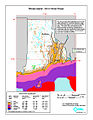 Rhode Island wind resource map 50m 800.jpg 850 × 1,100; 432 KB
-
 Rhode-Island-counties-map-hant.png 831 × 1,132; 59 KB
-
 Rhode-island-counties.gif 389 × 546; 12 KB
-
 Rhode-island-map.jpg 6,230 × 4,705; 3.28 MB
-
 RhodeIslandLocations.png 389 × 546; 26 KB
-
 RI - State Police Troop Map.png 864 × 1,314; 411 KB
-
 Ri towns by population.png 800 × 1,216; 134 KB
-
 Scituate watershed.gif 654 × 701; 33 KB
-

-

-
-
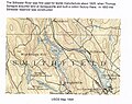 Stillwater mill usgs 1894.jpg 2,080 × 1,644; 1.69 MB
-
 Stillwater mill usgs 1943.jpg 1,846 × 1,148; 1.33 MB
-
 The American journal of science (1918) (18153001845).jpg 3,376 × 2,040; 1.54 MB
-
 Trolley trips through New England (1900) (14593147199).jpg 1,608 × 1,636; 371 KB
-
 Wood river watershed.png 998 × 793; 1.3 MB
-
 Wpdms ev26188 blockislandsound.jpg 326 × 222; 19 KB
-
 Wpdms ev26188 pointjudith.jpg 326 × 222; 19 KB
-
 Wpdms ev26188 rhodeislandsound.jpg 326 × 222; 19 KB
-
 Vie de George Washington 1807 (125491537).jpg 4,835 × 7,664; 7.96 MB

.jpg)


.jpg)
.jpg)


_(14594857270).jpg)
_(14781219832).jpg)


.jpg)


.png)


.jpg)
_(14781312581).jpg)
_(14784099762).jpg)


_(18153001845).jpg)
_(14593147199).jpg)


.jpg)