Category:Maps of New York (state)
Jump to navigation
Jump to search
States of the United States: Alabama · Alaska · Arizona · Arkansas · California · Colorado · Connecticut · Delaware · Florida · Georgia · Hawaii · Idaho · Illinois · Indiana · Iowa · Kansas · Kentucky · Louisiana · Maine · Maryland · Massachusetts · Michigan · Minnesota · Mississippi · Missouri · Montana · Nebraska · Nevada · New Hampshire · New Jersey · New Mexico · New York · North Carolina · North Dakota · Ohio · Oklahoma · Oregon · Pennsylvania · Rhode Island · South Carolina · South Dakota · Tennessee · Texas · Utah · Vermont · Virginia · Washington · West Virginia · Wisconsin · Wyoming – Washington, D.C.
insular area of the United States: American Samoa · Guam · Northern Mariana Islands · Puerto Rico · United States Virgin Islands – United States Minor Outlying Islands: Baker Island · Howland Island · Jarvis Island · Johnston Atoll · Kingman Reef · Midway Atoll · Navassa Island · Palmyra Atoll · Wake Island
insular area of the United States: American Samoa · Guam · Northern Mariana Islands · Puerto Rico · United States Virgin Islands – United States Minor Outlying Islands: Baker Island · Howland Island · Jarvis Island · Johnston Atoll · Kingman Reef · Midway Atoll · Navassa Island · Palmyra Atoll · Wake Island
Wikimedia category | |||||
| Upload media | |||||
| Instance of | |||||
|---|---|---|---|---|---|
| Category combines topics | |||||
| New York | |||||
state of the United States of America  The New York State Capitol in Albany   .svg)   | |||||
| Pronunciation audio | |||||
| Instance of |
| ||||
| Part of | |||||
| Named after | |||||
| Location |
| ||||
| Located in or next to body of water | |||||
| Capital | |||||
| Legislative body | |||||
| Executive body | |||||
| Highest judicial authority | |||||
| Head of government |
| ||||
| Inception |
| ||||
| Highest point | |||||
| Population |
| ||||
| Area |
| ||||
| Elevation above sea level |
| ||||
| Replaces |
| ||||
| Different from | |||||
| Maximum temperature record |
| ||||
| Minimum temperature record |
| ||||
| official website | |||||
 | |||||

Subcategories
This category has the following 41 subcategories, out of 41 total.
A
- Area code maps of New York (26 F)
B
C
F
- Flag maps of New York (state) (10 F)
G
H
L
M
N
O
P
R
S
T
U
Pages in category "Maps of New York (state)"
The following 2 pages are in this category, out of 2 total.
Media in category "Maps of New York (state)"
The following 200 files are in this category, out of 226 total.
(previous page) (next page)-

-

-

-
 1898 bird's eye view of Depew, New York.jpg 13,664 × 9,408; 48.42 MB
-
 2018NYDEMLTGOVprimary.svg 744 × 577; 297 KB
-
 216 of 'The Youth's History of the United States, etc' (11192387035).jpg 2,960 × 2,046; 908 KB
-

-
 29 of 'Rhymes of the States. With drawings, etc' (11237838183).jpg 1,873 × 2,617; 1.04 MB
-
 300px-Map of New York highlighting Central New York.png 300 × 232; 9 KB
-
 5 boros of NYC in 1814.jpg 2,689 × 2,305; 3.49 MB
-
 5 boroughs final thumbnail.jpg 500 × 375; 623 KB
-
 5 Boroughs of New York.jpg 600 × 418; 106 KB
-
 5 boroughs of New York.jpg 864 × 648; 731 KB
-
 821 quad in Mohegan Lake NY.PNG 500 × 582; 37 KB
-
 A draught of New York from the Hook to New York Town (9495451898).jpg 800 × 638; 121 KB
-
 A new and correct map... (2674618029).jpg 1,582 × 2,000; 2.79 MB
-

-
 Actual government of New York.. (1918) (14778584051).jpg 2,324 × 3,544; 1,018 KB
-
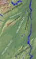
 Adirondack Region.jpg 1,056 × 1,267; 611 KB
-

-
 Albany ny physical map.png 1,038 × 1,000; 1,015 KB
-
 ALTERNATIVE 2 - USACE.png 1,354 × 957; 674 KB
-

-

-
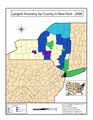
 Ancestry-new-york-by county-2000.PNG 609 × 470; 14 KB
-
 Annals of the New York Academy of Sciences (1918) (18414021725).jpg 2,148 × 1,276; 424 KB
-
 Annual report (1910) (14757251246).jpg 1,872 × 4,564; 2.52 MB
-
 Annual report (1910) (17809258843).jpg 3,060 × 1,700; 1.14 MB
-
 Annual report (1910) (17809419283).jpg 1,900 × 3,436; 1,012 KB
-
 Annual report of the Commissioner of Agriculture .. (1894-1911) (18403168376).jpg 2,560 × 1,682; 635 KB
-
 Annual report of the Commissioner of Agriculture .. (1894-1911) (18425405552).jpg 2,576 × 1,716; 657 KB
-

-

-

-
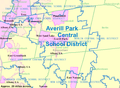 AverillParkCSDMap.png 898 × 661; 416 KB
-
 Battle of Stony Point - British Assuslt.Dean.USMA.edu.history.gif 912 × 742; 68 KB
-
 Battle of Stony Point.USMA.edu.history.gif 993 × 761; 137 KB
-
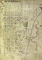 Belcher Hyde Dutch Kills map.jpg 510 × 740; 578 KB
-
 Belgii Novi, Angliae Novae, et partis Virginiae (2675731556).jpg 2,000 × 1,684; 2.99 MB
-
 BerlinCentralSchoolDistrictMap.png 294 × 459; 148 KB
-
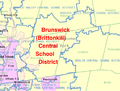 BrunswickCSDMap.png 746 × 568; 237 KB
-
 Buffalo-Niagara Falls metropolitan area.png 425 × 330; 17 KB
-
 Burned over district.png 1,056 × 832; 208 KB
-

-
 Catskills.jpg 309 × 248; 67 KB
-
 Central New York.jpg 688 × 765; 221 KB
-
 Central-New-York Region.jpg 636 × 457; 65 KB
-
 Clarendon-Linden Fault.jpg 512 × 394; 35 KB
-
 Cortland NY.png 422 × 359; 5 KB
-
 County Atlas of Cayuga New York. NYPL1583054.tiff 5,659 × 3,168; 51.32 MB
-
 CrossHarborRailTunnelMap.png 415 × 349; 20 KB
-
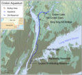 Croton-aqueduct-en.png 1,245 × 1,131; 1.5 MB
-
 Croton-aqueduct.png 1,245 × 1,131; 1.51 MB
-
 Cumberlandplateaumap.png 600 × 600; 539 KB
-
 Delaware01.png 1,182 × 1,387; 473 KB
-
 Delta Oneida NY Gillette 1858.png 1,024 × 1,239; 1.79 MB
-
 Delta to WesternVille Oneida NY Gillette 1858.png 1,024 × 468; 1,019 KB
-
 Downstate New York map.png 640 × 512; 18 KB
-
 DownState.png 674 × 585; 14 KB
-
 Ecclesiastical Province of New York map.png 596 × 377; 24 KB
-
 Elizabeth Ann Goldin, American - Map of the State of New York - Google Art Project.jpg 4,001 × 3,385; 7.19 MB
-
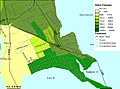
 EllisIslandMapOSM.png 1,631 × 1,757; 279 KB
-
 Elmiranymap.jpg 800 × 600; 54 KB
-
 Fair Haven (Village) NYPL1583062.tiff 5,414 × 6,542; 101.34 MB
-
 Family Life Network stations.png 1,848 × 1,236; 274 KB
-
 Field notes - New York, 1886-1891, includes hand-drawn map of Troy, N. Y. area (IA fieldnotesnewyo00walcb).pdf 2,362 × 3,718, 118 pages; 16.89 MB
-
 Finger Lakes.jpg 1,000 × 862; 344 KB
-
 FLT M03 7.5 mi - Sign with trail map put up by WNYMBA - panoramio.jpg 1,536 × 2,048; 547 KB
-

-
-
 French Portage Road.jpg 527 × 649; 170 KB
-
 Frontier of NY in Revolution2.png 1,000 × 796; 780 KB
-
 GBNewYorkState.png 1,300 × 975; 236 KB
-
 Great Gull Island, NY (5912667305).jpg 3,648 × 2,736; 2.1 MB
-
 Guy Johnson, Map of the Country of the VI Nations, 1771.jpg 8,773 × 5,968; 42.68 MB
-
 Halcott Mountain map.png 867 × 597; 1.25 MB
-
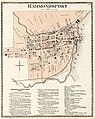 Hammondsport map, 1873.jpg 1,604 × 2,014; 689 KB
-
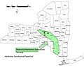 Herkimer Sandstone Drilling Fairway.jpg 1,362 × 1,096; 114 KB
-
 Herkimer Sandstone Outcrop Belt.jpg 1,350 × 1,043; 315 KB
-
 Hicksville-map.gif 575 × 425; 73 KB
-
 Highlands of the Hudson Forest Reservation 1909.jpg 2,142 × 3,091; 1.19 MB
-
 HighlandsConnecticutNewJerseyNewYorkPennsylvaniaMap.jpg 2,550 × 3,300; 529 KB
-
 Hudson Valley.jpg 582 × 903; 305 KB
-
 HudsonValley.png 609 × 470; 11 KB
-
 Indians of Manhattan Island and vicinity - (1921) (14761757936).jpg 2,554 × 1,728; 295 KB
-
 Irokesen (5 Nationen um1650).png 1,134 × 730; 1.07 MB
-
 Irondequoit Bay, NY State.gif 764 × 695; 47 KB
-
 Jurisdiction of the United States Attorney for the Southern District of New York.jpg 2,200 × 1,700; 290 KB
-
 Kings Highway Albany Crop.png 1,039 × 894; 980 KB
-
 Kingston Port Ewen Bridge map3.gif 422 × 359; 12 KB
-
 Kiryas Joel NY.png 422 × 359; 5 KB
-
 Largest New York Ancestry.pdf 1,275 × 1,650; 2.3 MB
-
 Little Nine Partners Patent Lots Division 1744.jpg 1,843 × 2,767; 932 KB
-
 Location of Shawangunk Ridge, NY.png 701 × 701; 287 KB
-
 Location Selkirk Yard (Albany-Troy).png 661 × 496; 469 KB
-
 Long island1.jpg 1,005 × 437; 169 KB
-
 LSP location.jpg 1,120 × 1,197; 578 KB
-
 Map of Hudson River Line Steamers Wellcome L0046613.jpg 2,468 × 3,908; 3.48 MB
-
 Map of New York highlighting Bronx County.png 300 × 232; 8 KB
-
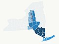
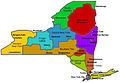
 Map of New York highlighting ESG Regions.svg 6,649 × 5,080; 311 KB
-
 Map of New York highlighting LoonLake.png 250 × 193; 6 KB
-
 Map of New York highlighting Southern Tier.png 300 × 232; 12 KB
-
 Map of New York highlighting Upstate.png 300 × 232; 10 KB
-
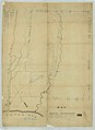
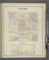
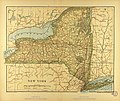 Map of New York.jpg 3,480 × 2,936; 3.54 MB
-

-
 Map of Oneida Reservation - NARA - 76028691.jpg 8,224 × 11,719; 8.12 MB
-
 Map of Oneida Reservation - NARA - 76028693.jpg 8,384 × 11,493; 6.14 MB
-
 Map of Potsdam, New York from OSM.jpg 1,081 × 963; 119 KB
-

-
 Map of the Republic of Oneida.png 864 × 1,024; 197 KB
-
 Map of Western New York.png 5,374 × 4,096; 894 KB
-
 Map thumbnail of Potsdam, New York from OSM.jpg 224 × 200; 11 KB
-
 Map-upstate-ny.png 300 × 232; 10 KB
-
 MapShowingAProposedRoadToBearMountain1923NYT.png 1,469 × 1,348; 85 KB
-
 Metropolitan New York Library Council Service Area.png 1,400 × 1,000; 153 KB
-
 Monsey NY.png 422 × 359; 5 KB
-
 Mount Tremper map.png 934 × 872; 2 MB
-
 Nanfan.jpg 994 × 768; 543 KB
-
 NENY.jpg 2,048 × 1,536; 114 KB
-
 New Haven Business Directory.; New Haven (Village); New Haven (Township) NYPL1602828.tiff 5,428 × 7,230; 112.28 MB
-
 New York - Southern Tier region map.png 3,996 × 781; 561 KB
-
 New york 90.jpg 1,653 × 1,248; 547 KB
-
 New York Community Bank footprint 2010-05.png 1,131 × 918; 125 KB
-
 New York judicial districts.png 1,000 × 752; 78 KB
-
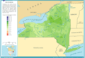
 New York Köppen.png 6,000 × 6,481; 328 KB
-
 New York Level III and Level IV ecoregions.pdf 7,200 × 5,550; 21.51 MB
-
 New York Locator Map with Adirondack Park.png 425 × 330; 20 KB
-
 New York Map.png 1,181 × 729; 275 KB
-
 New York Population Map.png 600 × 600; 181 KB
-
 New York quarter, reverse side, 2001.jpg 1,106 × 1,105; 230 KB
-
 New york ref 2001.jpg 835 × 639; 370 KB
-
 New York reigons.jpg 685 × 514; 36 KB
-
 New York State area code map.png 2,000 × 2,474; 485 KB
-
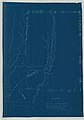
 New York State Blue Map.jpg 612 × 490; 15 KB
-
 New York State Department Economic Development Regions.png 629 × 504; 213 KB
-
 New York State municipalities population density.png 5,000 × 3,814; 2.59 MB
-
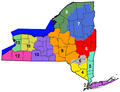
 New York State Regions.png 583 × 489; 121 KB
-
 New York Supreme Court, Appellate Division department map.png 2,000 × 1,504; 65 KB
-
 NewYork41st.district.gif 359 × 490; 13 KB
-
 NJ-GoldCoast.png 998 × 1,375; 212 KB
-
 NOAA Weather Radio WXL31 Coverage Map.gif 816 × 1,056; 45 KB
-
 North Country NY.jpg 901 × 655; 254 KB
-
 North Country.png 300 × 232; 15 KB
-
 NortheastAppalachiansMap.gif 810 × 626; 76 KB
-
 NortheastAppalachiansMap.jpg 405 × 313; 185 KB
-
 NorthernWallkillValley.png 1,011 × 1,654; 2.82 MB
-
 Northport South of Main St. NYPL1633991.tiff 7,230 × 4,960; 102.6 MB
-
 NY - Park Police Regions.png 900 × 690; 171 KB
-
 Ny 08.JPG 640 × 480; 42 KB
-
 NY 308 Sepasco Lake topo.gif 469 × 450; 29 KB
-
 NY 52 profile.png 1,233 × 508; 23 KB
-
 NY House of Reps 2022.svg 125 × 100; 48 KB
-
 NY Regions.jpg 768 × 530; 138 KB
-
 NY-NJ Highlands.jpg 825 × 638; 175 KB
-
 NYDEM34.png 1,280 × 976; 193 KB
-
 NYDEM40.png 1,280 × 976; 193 KB
-
 NYGOP34.png 1,280 × 976; 192 KB
-
 NYGOP40.png 1,280 × 976; 193 KB
-
 NYlakeeffectsnow.png 421 × 300; 29 KB
-

-
 Newengland and New York (NYPL b15102843-433720).jpg 2,068 × 2,320; 1.35 MB
-
 NYrainfall.png 588 × 400; 150 KB
-
 NYSEN34.png 1,280 × 976; 191 KB
-
 NYSEN40.png 1,280 × 976; 189 KB
-
 NYSP - Troop Map.jpg 988 × 744; 287 KB
-
 NYSPP Districts and Zones.jpg 1,320 × 1,000; 466 KB
-
 NYSseccession.png 609 × 470; 17 KB
-
 Ontario County NY.jpg 628 × 582; 228 KB
-
 Orange County (New York).jpg 627 × 469; 222 KB
-
 Orleans County NY.jpg 577 × 383; 149 KB
-
 Otsego County 1791.png 1,138 × 1,563; 727 KB
-
 Pan-American Exposition map.jpg 2,185 × 3,141; 1.58 MB
-
 Panther rosette stream pattern.gif 399 × 408; 82 KB
-
 PatriotBankBranches.png 250 × 250; 35 KB
-
 Philipsburg manor map.png 1,000 × 1,392; 525 KB
-
 Physiographic provinces of New York (26880328976).jpg 2,187 × 1,686; 2.42 MB
-
 Population density of New York counties (2020).png 4,949 × 3,940; 1.41 MB
-
 Proposed autonomous regions of New York state.png 6,900 × 4,275; 1.2 MB
-
 Railway map around New York City.png 512 × 384; 16 KB
-
 Rome, N.Y. LOC 75694841.tif 10,624 × 5,456; 165.84 MB
-
 Schuyler County NY.jpg 704 × 592; 249 KB
-
 Scotchtown-ny.gif 575 × 425; 52 KB
-
 Scriba. (Township) NYPL1602844.tiff 5,428 × 7,230; 112.28 MB
-
 Seneca County NY.jpg 440 × 607; 201 KB
-
 Seneca Nation territory 1794.tif 2,525 × 1,849; 77 KB
-
 Shawangunk Ridge map.jpg 537 × 577; 138 KB
-
 Southeast Corner of North Massapequa located in Massapequa School District.png 1,495 × 1,032; 435 KB
-
 Southern Tier NY.jpg 900 × 321; 176 KB
-
 Southern Tier.jpg 1,000 × 356; 182 KB
-
 Speculator New York Map.gif 575 × 425; 32 KB
-
 St. Lawrence Valley-Champlain Province of Appalachian Highlands.jpg 1,198 × 790; 183 KB
-
 Steve Richey 2015-01-28 (Unsplash).jpg 2,011 × 2,495; 3.26 MB
-
 Stewartafb-map.jpg 248 × 189; 7 KB
-
 Summer Hill (Township); Summer Hill (Village) NYPL1583111.tiff 5,414 × 6,630; 102.7 MB
-
 SyracuseMuni NY 49chart.JPG 510 × 408; 50 KB
-
 T Neck Bronx.jpg 575 × 425; 260 KB
-

-
 The archeological history of New York (Page 47) BHL21855789.jpg 4,208 × 2,436; 988 KB
-
 The Indians of Manhattan island and vicinity (Page 14) BHL17730176.jpg 2,274 × 3,594; 642 KB
-
 The magazine of American history with notes and queries (1877) (14766036251).jpg 1,720 × 2,820; 302 KB
)%27_(11018218456).jpg)
.jpg)
%27_(11227569746).jpg)


.jpg)
%27_(11006464475).jpg)
.jpg)


.jpg)
.jpg)
.jpg)
_(14778584051).jpg)

.jpg)


_(18414021725).jpg)
_(17809258843).jpg)
_(17809419283).jpg)
_(18403168376).jpg)
_(18425405552).jpg)
_(14568732670).jpg)
_(14758906746).jpg)
_(14781498112).jpg)


.jpg)


_-_NARA_-_137929694.jpg)


.jpg)


_(14761757936).jpg)
.png)


.png)


_(cropped).jpg)
.jpg)


.jpg)


.jpg)
.png)


.jpg)


_(14784698232).jpg)
_BHL21855789.jpg)
_BHL17730176.jpg)
_(14766036251).jpg)
&filefrom=The+magazine+of+American+history+with+notes+and+queries+%281877%29+%2814768832642%29.jpg#mw-category-media)
_(14757251246).jpg)