Category:Maps of North Rhine-Westphalia
Jump to navigation
Jump to search
Federal states of Germany:
Use the appropriate category for maps showing all or a large part of North Rhine-Westphalia. See subcategories for smaller areas:
| If the map shows | Category to use |
|---|---|
| North Rhine-Westphalia on a recently created map | Category:Maps of North Rhine-Westphalia or its subcategories |
| North Rhine-Westphalia on a map created more than 70 years ago | Category:Old maps of North Rhine-Westphalia or its subcategories |
| the history of North Rhine-Westphalia on a recently created map | Category:Maps of the history of North Rhine-Westphalia or its subcategories |
| the history of North Rhine-Westphalia on a map created more than 70 years ago | Category:Old maps of the history of North Rhine-Westphalia or its subcategories |
Wikimedia category | |||||
| Upload media | |||||
| Instance of | |||||
|---|---|---|---|---|---|
| Category combines topics | |||||
| North Rhine-Westphalia | |||||
state in Germany  someja satełitar in marso    | |||||
| Instance of | |||||
| Named after |
| ||||
| Location |
| ||||
| Capital | |||||
| Legislative body | |||||
| Highest judicial authority |
| ||||
| Head of government |
| ||||
| Has part(s) | |||||
| Inception |
| ||||
| Highest point | |||||
| Population |
| ||||
| Area |
| ||||
| Elevation above sea level |
| ||||
| Follows |
| ||||
| Replaces |
| ||||
| official website | |||||
 | |||||
Subcategories
This category has the following 79 subcategories, out of 79 total.
!
- Maps of Ruhr (17 F)
- Maps of Rur (13 F)
- Maps of the Sauerland (18 F)
- Maps of Wupper (9 F)
*
A
B
C
D
E
G
H
K
L
M
O
P
R
S
U
V
W
Media in category "Maps of North Rhine-Westphalia"
The following 23 files are in this category, out of 23 total.
-
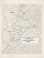
 AAV Projektkarte 2022-23.jpg 1,722 × 1,217; 205 KB
-
 AAV Projektkarte-web2020.jpg 2,300 × 1,630; 780 KB
-
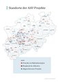
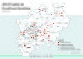 AAV-Projekte in Nordrhein-Westfalen.jpg 9,410 × 6,670; 2.94 MB
-
 After Action Report - Köln - NARA - 100384913.jpg 12,934 × 8,228; 27.93 MB
-
 Ahr (Rhein).png 632 × 303; 407 KB
-
 Anti-Tank Gun Defenses between Roer and Erft Rivers - NARA - 100385029.jpg 8,680 × 6,562; 4.33 MB
-
 BLB NRW Karte Niederlassungen.jpg 980 × 972; 158 KB
-
 BLB-Niederlassungskarte.jpg 1,200 × 1,241; 325 KB
-
 Backsteingotik NRW.png 717 × 946; 660 KB
-
 Flag map of North Rhine-Westphalia.svg 520 × 517; 161 KB
-
 Große Burg.png 1,236 × 1,074; 1.58 MB
-
 Ica-region-nrw.png 300 × 257; 19 KB
-
 Karte von Lembeck.jpg 3,264 × 2,448; 2.78 MB
-
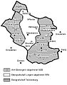
 Karte-nrw-II-struktur.png 821 × 787; 867 KB
-
 Kreis Tecklenburg geschichtliche Darstellung.JPG 556 × 709; 63 KB
-
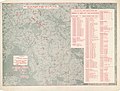
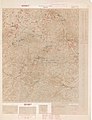 Map of Bonn (East) - NARA - 100384395 (page 1).jpg 6,624 × 8,662; 3.86 MB
-
 North Rhine-Westphalia location map 05 G.jpg 1,000 × 994; 51 KB
-
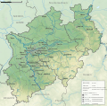 North Rhine-Westphalia topographic map 01Vb.svg 560 × 550; 10.19 MB
-
 Polizei nrw kriminalhauptstellen.jpg 500 × 491; 71 KB
-
 Projektkarte 2018.pdf 1,239 × 1,752; 1.52 MB
-
 Projektkarte 2018.svg 794 × 1,123; 1.16 MB
-
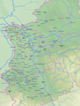
 Routes of Advance to Rhine River from Prum-Bitung Area - NARA - 100384467 (page 2).jpg 6,600 × 8,650; 5.12 MB
-
 Tecklenburger Land.svg 335 × 309; 1.48 MB


.png)


_-_NARA_-_100384395_(page_1).jpg)


.jpg)
