Category:Maps of Brandenburg
Jump to navigation
Jump to search
Federal states of Germany:
Use the appropriate category for maps showing all or a large part of Brandenburg. See subcategories for smaller areas:
| If the map shows | Category to use |
|---|---|
| Brandenburg on a recently created map | Category:Maps of Brandenburg or its subcategories |
| Brandenburg on a map created more than 70 years ago | Category:Old maps of Brandenburg or its subcategories |
| the history of Brandenburg on a recently created map | Category:Maps of the history of Brandenburg or its subcategories |
| the history of Brandenburg on a map created more than 70 years ago | Category:Old maps of the history of Brandenburg or its subcategories |
Wikimedia category | |||||
| Upload media | |||||
| Instance of | |||||
|---|---|---|---|---|---|
| Category combines topics | |||||
| Brandenburg | |||||
state in North-East of Germany     | |||||
| Instance of | |||||
| Part of | |||||
| Location | Germany | ||||
| Capital | |||||
| Legislative body | |||||
| Highest judicial authority |
| ||||
| Head of government | |||||
| Legal form | |||||
| Inception |
| ||||
| Highest point | |||||
| Population |
| ||||
| Area |
| ||||
| Elevation above sea level |
| ||||
| Follows | |||||
| Replaces |
| ||||
| Budget |
| ||||
| Different from | |||||
| official website | |||||
 | |||||
Subcategories
This category has the following 29 subcategories, out of 29 total.
*
D
- Maps of Drebkau (15 F)
G
K
L
- Location maps of Brandenburg (4 F)
- Maps of Löwenberger Land (2 F)
- Maps of Lübben (Spreewald) (8 F)
M
- Maps of Schraden (9 F)
- Maps of Spreewald (5 F)
- Maps of Mühlberg/Elbe (7 F)
O
- Maps of Oranienburg (5 F)
S
T
Z
- Maps of Zossen (10 F)
Pages in category "Maps of Brandenburg"
The following 3 pages are in this category, out of 3 total.
Media in category "Maps of Brandenburg"
The following 161 files are in this category, out of 161 total.
-
 2016 08 07 Zehdenick Trockendock IMG 8985 S P. beschriftet.JPG 1,822 × 1,141; 340 KB
-
 2018 07 30 Fürstenberg KZ-Ravensbrück final 2.PNG 881 × 527; 429 KB
-
 220923-BHA-Karte Standorte.jpg 4,450 × 4,575; 1.94 MB
-

-
 Barnimteltow um 1250.png 1,807 × 1,414; 135 KB
-
 Barnimteltow um 1250p.jpg 1,807 × 1,414; 576 KB
-
 Beetzerheide.png 562 × 433; 27 KB
-
 BeetzseenaturschutzX.svg 552 × 647; 125 KB
-
 Behnitzer seen vergleich.svg 298 × 422; 14 KB
-
 Berliner-siedlungsstern.png 2,016 × 1,583; 777 KB
-
 Bieselheide.jpg 638 × 434; 94 KB
-
 Brandenburg Testkarte.png 1,000 × 962; 37 KB
-
 Backsteingotik Brandenburg.png 1,076 × 1,131; 1.82 MB
-

-
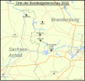 Karte buga 2015.svg 1,770 × 1,690; 275 KB
-
 BWahlkreis 57.svg 530 × 530; 45 KB
-
 BWahlkreis 58.svg 530 × 530; 45 KB
-
 BWahlkreis 59.svg 530 × 530; 45 KB
-
 BWahlkreis 60.svg 530 × 530; 45 KB
-
 BWahlkreis 61.svg 530 × 530; 45 KB
-
 BWahlkreis 62.svg 530 × 530; 45 KB
-
 BWahlkreis 63.svg 530 × 530; 45 KB
-
 BWahlkreis 64.svg 530 × 530; 45 KB
-
 BWahlkreis 65.svg 530 × 530; 45 KB
-
 BWahlkreis 66.svg 530 × 530; 45 KB
-
 Burgwall Reckahn.svg 805 × 605; 12 KB
-
 Butter laake karte.svg 313 × 213; 44 KB
-
 Dekanat Torgau.jpg 3,030 × 1,203; 1.49 MB
-
 Doeberitzerheideplan.jpg 1,222 × 991; 273 KB
-
 DosseSpeicher Kyritz-Lageplan.png 922 × 420; 405 KB
-
 Dreieck nuthetal map.svg 414 × 300; 182 KB
-
 East brandenburg in rt.GIF 497 × 465; 8 KB
-
 Ehemalige Besitzungen des Klosters Zinna.png 2,200 × 2,200; 350 KB
-
 Erpe & Wuhle.png 942 × 1,242; 469 KB
-
 Europas größtes Einfamilienhausgebiet.png 1,396 × 908; 48 KB
-
 Feldberger Seen + Abflusswege.png 2,609 × 2,574; 2.25 MB
-
 Feldberger Seen zur Havel & zur Ucker.png 5,083 × 3,080; 5.66 MB
-
 Ffh-gebiete havelsee4.svg 886 × 1,251; 180 KB
-
 Ffh-gebiete.svg 886 × 1,251; 192 KB
-
 Ffh-gebiete3.svg 886 × 1,251; 200 KB
-
 Ffh-giebieteinhavelsee.svg 886 × 1,251; 180 KB
-
 Flaeming Skate1 Map.JPG 819 × 609; 84 KB
-
 Flag map of Brandenburg.svg 943 × 955; 88 KB
-
 Flaeming.png 1,169 × 865; 220 KB
-
 Fluss Havel in Deutschland.PNG 1,414 × 1,929; 1.95 MB
-
 Friesack, Umgebungkarte.jpg 1,437 × 1,155; 535 KB
-
 Fußballkreise Brandenburg.png 1,580 × 1,550; 2.71 MB
-
 Gamengrund Reliefkarte.png 3,147 × 8,344; 756 KB
-
 Gamengrund Süd.png 3,147 × 4,096; 435 KB
-
 GDR location map Oct1949 - Jul1952 BB.svg 1,075 × 1,273; 743 KB
-
 Gewässerkarte stadtgebiet rathenow.svg 1,437 × 907; 94 KB
-
 Gliederung der Gemeinde Schönefeld.png 1,222 × 1,197; 155 KB
-
 Glien, Muhrgraben, Ruppiner Kan.png 1,324 × 1,656; 689 KB
-
 Godendorfer Mühlenbach-Hegensteinfließ.png 2,376 × 2,577; 1.84 MB
-
 Golmberg.png 1,169 × 865; 227 KB
-
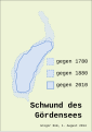 Gördenseeverlust.svg 197 × 278; 10 KB
-
 Hakekarte1.JPG 640 × 480; 186 KB
-
 Havelkanal Karte der Berliner Wasserstrassen.png 1,498 × 1,672; 360 KB
-
 Havelland FH.gif 1,035 × 781; 144 KB
-
 Havelland FHSW.gif 1,035 × 781; 129 KB
-
 Havelland.svg 1,460 × 1,114; 736 KB
-
 HavelRhin.gif 1,394 × 1,394; 126 KB
-
 Havelsee naturschutzgebiete.svg 886 × 1,251; 270 KB
-
 Hochschulestandorte brandenburg.svg 565 × 595; 33 KB
-
 Hochstift Brandenburg.svg 190 × 170; 135 KB
-
 Horno friebe.jpg 1,500 × 1,296; 250 KB
-
 Internationalpark.png 410 × 423; 21 KB
-
 Karte Agglomeration Berlin.png 1,770 × 1,862; 331 KB
-
 Karte beetzsee gemeinde.svg 533 × 637; 92 KB
-
 Karte beetzseeheide landschaftsbestand.svg 699 × 921; 137 KB
-
 Karte beetzseeheide marginalbildungenx.svg 848 × 843; 37 KB
-
 Karte beetzseeheide naturschutz, ffh, spa.svg 695 × 917; 122 KB
-
 Karte beetzseeheidexx.svg 747 × 825; 127 KB
-
 Karte beetzseerinne.svg 371 × 534; 16 KB
-
 Karte beetzseerinne2.svg 1,855 × 2,229; 47 KB
-
 Karte bensdorf.svg 735 × 765; 84 KB
-
 Karte bohnenalandrinne.svg 664 × 823; 23 KB
-
 Karte Bäke1.JPG 1,380 × 862; 275 KB
-
 Karte der Eisenbahnen Deutschlands um 1857.jpg 400 × 383; 86 KB
-
 Karte der Wasserstraßen in Potsdam.png 1,311 × 1,216; 530 KB
-
 Karte der Ämter in Brandenburg.png 3,242 × 3,388; 935 KB
-
 Karte des ehemaligen Truppenübungsplatz Wittstock (Bombodrom).png 5,064 × 3,495; 4.11 MB
-
 Karte des Flusses Havel.gif 501 × 531; 12 KB
-
 Karte fiener vogelschutz.svg 1,690 × 790; 71 KB
-
 Karte gemarkung butzow.svg 675 × 841; 103 KB
-
 Karte gemarkung gortz.svg 675 × 841; 103 KB
-
 Karte gemarkung ketzür.svg 675 × 841; 103 KB
-
 Karte gemarkung mötzow.svg 675 × 841; 103 KB
-
 Karte Gemeinde Schoenwalde-Glien Ostteil 2003.gif 2,653 × 2,000; 2.15 MB
-
 Karte Gemeinde Schoenwalde-Glien Westteil 2003.gif 1,634 × 2,000; 1.05 MB
-
 Karte gortz und umgebung.svg 527 × 404; 41 KB
-
 Karte Jakobswege in Brandenburg, Westpommern und Lebus.jpg 2,181 × 3,208; 2.75 MB
-
 Karte karower platte fiener bruch.svg 2,190 × 1,310; 127 KB
-
 Karte Landschaftswiesen.JPG 556 × 571; 48 KB
-
 Karte marzahner fenn, weißes fennx.svg 355 × 387; 36 KB
-
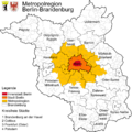
 Karte Metropolregion Berlin-Brandenburg.svg 829 × 833; 327 KB
-
 Karte Neuendorfer See im Spreewald.png 2,065 × 1,614; 1.46 MB
-
 Karte pritzerber see.svg 717 × 491; 41 KB
-
 Karte päwesin.svg 600 × 606; 88 KB
-
 Karte rabensein.svg 945 × 945; 133 KB
-
 Karte Region Berlin (Bearbeitungsvorlage).svg 1,353 × 996; 4.59 MB
-
 Karte rosenau schutzgebiete.svg 945 × 685; 67 KB
-
 Karte rosenau.svg 945 × 685; 81 KB
-
 Karte roskow.svg 906 × 609; 106 KB
-
 Karte schutzgebiete bensdorf.svg 735 × 765; 75 KB
-
 Karte stadt havelsee.svg 886 × 1,251; 168 KB
-
 Karte stadt havelseex.svg 880 × 1,184; 159 KB
-
 Karte Stangenhagen.JPG 372 × 496; 34 KB
-
 Karte Tatorte des Serienmörders Wolfgang Schmidt.png 1,030 × 703; 949 KB
-
 Karte Vom Regierungs-Bezirke Potsdam.jpg 11,651 × 11,629; 34.19 MB
-
 Karte wenzlow.svg 695 × 506; 43 KB
-
 Karte wollin.svg 625 × 715; 58 KB
-
 Karte ziesar.svg 1,005 × 805; 136 KB
-
 Karte(PS) Brandenburg 1150.jpg 666 × 476; 85 KB
-
 Kreis Beeskow-Storkow.png 1,092 × 1,013; 153 KB
-
 Lage Berliner Ring Metropolregion Berlin.png 651 × 582; 26 KB
-
 Lageplan Lychener Seenkreuz.png 701 × 665; 124 KB
-
 LaufderPanke.png 1,706 × 1,831; 521 KB
-
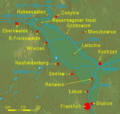
 LausitzLage.png 259 × 219; 5 KB
-
 Luche FHSW.gif 811 × 459; 61 KB
-
 Luchseekarte.jpg 330 × 247; 27 KB
-
 Lv brandenburg.gif 223 × 221; 3 KB
-
 Lychener Gewässer.png 3,153 × 2,628; 2.76 MB
-
 Map Nuthe Urstromtal.JPG 698 × 585; 71 KB
-
 Marzahner Fenn, Weißes Fenn Marzahne.svg 355 × 387; 39 KB
-
 Medizinische hochschule brandenburg standorte.svg 570 × 600; 27 KB
-
 Metropolregion-BerlinBrandenburg-Infrastruktur.svg 825 × 826; 892 KB
-
 Lage Metropolregion Berling.png 535 × 500; 19 KB
-
 Metropolregion-BerlinBrandenburg-Infrastruktur.png 1,674 × 1,682; 978 KB
-
 Metropolregion-BerlinBrandenburg-Staedte.png 1,670 × 1,679; 858 KB
-
 Metropolregion-BerlinBrandenburg.png 1,666 × 1,663; 878 KB
-
 Naturpark3.svg 886 × 1,251; 149 KB
-
 Naturschutzgebiete4.svg 886 × 1,251; 276 KB
-
 Nuthe Nieplitz Seen Kern.jpg 1,175 × 1,056; 488 KB
-
 Nuthe-Nieplitz.jpg 611 × 702; 138 KB
-
 Oderbruch.gif 860 × 819; 319 KB
-
 Pankelauf.png 1,706 × 1,831; 519 KB
-
 Parkübersicht-2014-nur-Seilgarten.png 1,062 × 720; 282 KB
-
 Parsteiner See tiefen.png 622 × 936; 59 KB
-
 Parsteiner See.png 622 × 936; 70 KB
-
 Post- und Verwaltungs-Karte der Provinz Brandenburg 1850.jpg 400 × 413; 26 KB
-
 Quillow & Strom.png 3,315 × 2,573; 2.95 MB
-
 Region-Berlin-Brandenburg.png 1,865 × 1,920; 1,014 KB
-
 Regionalverkehr brandenburg ebunternehmen.svg 741 × 861; 80 KB
-
 River Havel.png 800 × 600; 895 KB
-
 Rotes Luch.gif 1,062 × 743; 135 KB
-
 Rotes Luch.png 1,062 × 743; 133 KB
-
 Ruppinersee.gif 744 × 800; 52 KB
-
 Schwielowsee.png 716 × 605; 460 KB
-
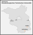 Standorte btu.svg 565 × 595; 22 KB
-
 Steinhöfel-Behlendorf 2012 (FoP-Germany).jpg 2,644 × 2,786; 1.3 MB
-
 Tactical Study of Terrain - Berlin Plain - DPLA - 6df7d8fa5fce688678900ca8228e1c4e.jpg 6,600 × 8,687; 7.08 MB
-
 Tegeler fliess karte.png 1,200 × 1,600; 116 KB
-
 Teltow Detail.png 1,893 × 1,429; 528 KB
-
 Templiner Gewässer.png 2,910 × 2,274; 2.44 MB
-
 Topographische Karte N-33-12-B - DDR Rathenow.jpg 551 × 311; 70 KB
-
 Ucker.png 4,621 × 4,227; 7.18 MB
-
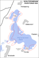
 Uckerseen.png 460 × 346; 273 KB
-
 WIG Mapa Operacyjna Polski - 52 Zbąszyń-Frankfurt 1935.jpg 5,799 × 5,718; 15.52 MB
-
 Wojna glog.svg 1,600 × 1,200; 101 KB
-
 Zauche01.png 765 × 599; 350 KB


.jpg)


.png)


.svg)


_Brandenburg_1150.jpg)


.jpg)


