Category:Maps of Dortmund
Jump to navigation
Jump to search
Wikimedia category | |||||
| Upload media | |||||
| Instance of | |||||
|---|---|---|---|---|---|
| Category combines topics | |||||
| Dortmund | |||||
city in North Rhine-Westphalia, Germany      | |||||
| Pronunciation audio | |||||
| Instance of |
| ||||
| Part of | |||||
| Location | |||||
| Located in or next to body of water | |||||
| Visitor center | |||||
| Head of government |
| ||||
| Inception |
| ||||
| Highest point | |||||
| Population |
| ||||
| Area |
| ||||
| Elevation above sea level |
| ||||
| official website | |||||
 | |||||
Subcategories
This category has the following 6 subcategories, out of 6 total.
E
- Election maps of Dortmund (4 F)
L
M
- Maps of Phoenix-See (5 F)
O
- OpenStreetMap maps of Dortmund (29 F)
P
Media in category "Maps of Dortmund"
The following 35 files are in this category, out of 35 total.
-
 Dortmund - Mergelkopfweg - Grünanlage 01 ies.jpg 5,616 × 3,744; 8.47 MB
-
 Dortmund - Rombergpark 03 ies.jpg 3,744 × 5,616; 7.73 MB
-
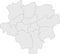
 Dortmund Bezirke und Nachbargemeinden.png 1,200 × 1,021; 326 KB
-
 Dortmund districts grey simple.svg 916 × 868; 1.53 MB
-
 Dortmund districts yellow simple.svg 916 × 868; 1.53 MB
-
 Dortmund in Nordrhein-Westfalen.png 720 × 675; 455 KB
-
 Dortmund Ostenfriedhof Lageplan.png 788 × 643; 33 KB
-
 Dortmund Stahl und Eisenbahn.svg 928 × 845; 125 KB
-
 Dortmund subdivisions grey.svg 916 × 868; 1.89 MB
-
 Dortmund Wahlkreise.gif 1,000 × 893; 76 KB
-
 Dortmund Wahlkreise.png 1,000 × 893; 173 KB
-
 Dortmund-Verkehr.png 1,200 × 900; 215 KB
-
 Dortmunder Stadtviertel.png 2,859 × 2,103; 455 KB
-
 Eisenbahn Dortmund Soest01.png 1,233 × 723; 354 KB
-
 EwaldiparkPlan.jpg 1,111 × 1,501; 781 KB
-
 Feuerwachen Dortmund.png 668 × 594; 79 KB
-
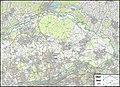
 Grubenfeld gneisenau.png 690 × 687; 259 KB
-
 Lage der kreisfreien Stadt Dortmund in Deutschland.png 176 × 234; 3 KB
-
 Lage der kreisfreien Stadt Dortmund in Deutschland.PNG 176 × 234; 6 KB
-
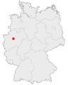 Lage der Stadt Dortmund in Deutschland.png 188 × 235; 5 KB
-
 Locator map DO in Germany.svg 1,075 × 1,273; 637 KB
-
 Locator map DO in North Rhine-Westphalia.svg 657 × 656; 479 KB
-
 Messtischblaetter 4309-4410 Altbuergermeisterei Castrop um 1910.jpg 10,793 × 8,016; 20.85 MB
-
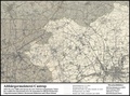 Messtischblaetter 4309-4410 Altbuergermeisterei Castrop um 1910.pdf 1,754 × 1,302; 15.49 MB
-
 Messtischblatt 4510 Witten 1906.jpg 7,775 × 8,707; 13.65 MB
-
 Messtischblatt 4510 Witten 193x.jpg 9,528 × 7,743; 15.34 MB
-
 North rhine w DO.png 593 × 585; 70 KB
-
 North rhine w DO.svg 660 × 660; 221 KB
-
 NRW-RE57.png 1,500 × 1,250; 308 KB
-
 Obervest Gliederung.jpg 11,549 × 8,401; 14.68 MB
-
 Rettungsdienst Dortmund.png 691 × 615; 86 KB
-
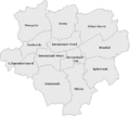 Stadtbezirke Dortmund benannt.png 714 × 635; 1.73 MB
-
 Stadtbezirke Dortmund unbenannt.png 714 × 635; 1.73 MB
-
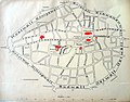 Stadtplan-DO-1894-IMG 2727.jpg 2,570 × 2,003; 4.78 MB
-
 Städtepartnerschaften der Stadt Dortmund.png 1,500 × 747; 220 KB


