Category:1840s maps of Finland
Jump to navigation
Jump to search
Countries of Europe: Albania · Armenia‡ · Austria · Azerbaijan‡ · Belarus · Belgium · Bosnia and Herzegovina · Bulgaria · Croatia · Cyprus‡ · Czech Republic · Denmark · Finland · France‡ · Georgia‡ · Germany · Greece · Hungary · Republic of Ireland · Italy · Lithuania · Netherlands‡ · Norway · Poland · Portugal‡ · Romania · Russia‡ · Serbia · Slovakia · Slovenia · Spain‡ · Sweden · Switzerland · Turkey‡ · Ukraine · United Kingdom
Limited recognition: Abkhazia‡
‡: partly located in Europe
Limited recognition: Abkhazia‡
‡: partly located in Europe
Subcategories
This category has only the following subcategory.
Media in category "1840s maps of Finland"
The following 4 files are in this category, out of 4 total.
-
 General Karte Vom Europäischen Russland und den kaukasischen Ländern 01.jpg 4,704 × 5,534; 7.15 MB
-
 Geografisk karta öfver Piikkie härad af Åbo län.jpg 11,043 × 8,308; 64.73 MB
-
 Map of Hirvlax 1845.png 537 × 575; 611 KB
-
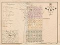 Porvoo 1843.jpg 1,200 × 901; 136 KB


