Category:1840s maps of Europe
Jump to navigation
Jump to search
Temperate regions: North America · South America · Africa · Europe · Asia · Oceania – Polar regions: – Other regions:
Subcategories
This category has the following 49 subcategories, out of 49 total.
.
A
B
- 1840s maps of Belarus (16 F)
C
- 1840s maps of Cyprus (1 F)
- 1840s maps of Czechia (1 F)
D
E
- 1840s maps of Eastern Europe (9 F)
F
G
- 1840s maps of Greece (12 F)
H
- 1840s maps of Hungary (8 F)
I
L
- 1840s maps of Lithuania (9 F)
N
P
- 1840s maps of Portugal (47 F)
R
S
- 1840s maps of Slovakia (1 F)
- 1840s maps of Slovenia (8 F)
- 1840s maps of Sweden (1 F)
T
U
- 1840s maps of Ukraine (12 F)
Media in category "1840s maps of Europe"
The following 8 files are in this category, out of 8 total.
-

-
 Barclay's Dictionary Europe.jpg 5,991 × 4,829; 20.19 MB
-
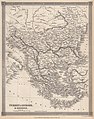 Barclay's Dictionary Turkey in Europe & Greece.jpg 4,775 × 6,063; 21.15 MB
-
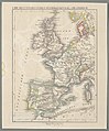 Die Britischen Inseln, Spanien, Portugal, u. Frankreich 01.jpg 2,251 × 2,714; 1.81 MB
-
 Die Britischen Inseln, Spanien, Portugal, u. Frankreich 02.jpg 2,224 × 2,694; 1.81 MB
-
 Europa - Atlas der neuen Erdkunde.jpg 2,696 × 2,226; 1.89 MB
-
 Italien, Europaeische Türkey, Griechenland, und die Jonischen Inseln.jpg 2,667 × 2,256; 2.06 MB
-

.jpg)


_(14788979243).jpg)