Category:1840s maps of Turkey
Jump to navigation
Jump to search
Countries of Europe: Albania · Armenia‡ · Austria · Azerbaijan‡ · Belarus · Belgium · Bosnia and Herzegovina · Bulgaria · Croatia · Cyprus‡ · Czech Republic · Denmark · Finland · France‡ · Georgia‡ · Germany · Greece · Hungary · Republic of Ireland · Italy · Lithuania · Netherlands‡ · Norway · Poland · Portugal‡ · Romania · Russia‡ · Serbia · Slovakia · Slovenia · Spain‡ · Sweden · Switzerland · Turkey‡ · Ukraine · United Kingdom
Limited recognition: Abkhazia‡
‡: partly located in Europe
Limited recognition: Abkhazia‡
‡: partly located in Europe
Countries of Asia: Afghanistan · Armenia‡ · Azerbaijan‡ · People's Republic of China · Cyprus‡ · Egypt‡ · Georgia‡ · India · Indonesia‡ · Iran · Iraq · Japan · Lebanon · Pakistan · Philippines · Russia‡ · Syria · Turkey‡ · Turkmenistan · Uzbekistan
Limited recognition: Abkhazia‡ · Taiwan · State of Palestine
‡: partly located in Asia
Limited recognition: Abkhazia‡ · Taiwan · State of Palestine
‡: partly located in Asia
Subcategories
This category has the following 5 subcategories, out of 5 total.
- 1840 maps of Turkey (1 F)
- 1842 maps of Turkey (2 F)
- 1843 maps of Turkey (empty)
- 1844 maps of Turkey (3 F)
*
- 1840s maps of Istanbul (7 F)
Media in category "1840s maps of Turkey"
The following 6 files are in this category, out of 6 total.
-
 1843 map of İstanbul.jpg 3,071 × 2,561; 2.03 MB
-
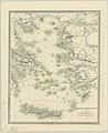 Grecian Archipelago (ancient) by William Smith.jpg 4,431 × 5,420; 2.56 MB
-

-

-
 Barclay's Dictionary Turkey in Asia.jpg 5,931 × 4,800; 19.45 MB
-
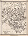 Barclay's Dictionary Turkey in Europe & Greece.jpg 4,775 × 6,063; 21.15 MB

_by_William_Smith.jpg)

.jpg)

