Commons:Wiki Loves Monuments in Switzerland/Solothurn/F-J
Jump to navigation
Jump to search
Feldbrunnen-St. Niklaus
| Location | Upload | Photo | Object | Cat. | Coordinates | KGS-Nr | |
|---|---|---|---|---|---|---|---|
| Feldbrunnen-St. Niklaus | 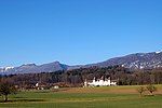
|
Schloss Waldegg | A+ISOS | 47°13′24″N 7°32′54″E / 47.22338°N 7.54842°E | 4539 | ||
| Feldbrunnen-St. Niklaus | 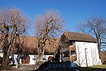
|
Dorfmuseum beim Waldegghof | B | 47°13′13″N 7°33′12″E / 47.22028°N 7.55336°E | 4545 | ||
| Feldbrunnen-St. Niklaus | 
|
katholische Kirche St. Niklaus (1683) mit umliegenden Grabdenkmälern | B | 47°13′14″N 7°32′37″E / 47.22052°N 7.54357°E | 4541 | ||
| Feldbrunnen-St. Niklaus | 
|
Schürmatthof, ehemaliger Schlosshof (1750) | B | 47°13′13″N 7°33′11″E / 47.22025°N 7.55307°E | 4542 | ||
| Feldbrunnen-St. Niklaus | 
|
Villa Koch (1921, Salvisberg) | B | 47°12′59″N 7°33′06″E / 47.21646°N 7.55163°E | 4543 | ||
| Feldbrunnen-St. Niklaus | 
|
Villa Serdang (17. Jh., 1900) mit Park | B | 47°13′07″N 7°33′08″E / 47.21856°N 7.55219°E | 4544 | ||
| Feldbrunnen-St. Niklaus | 
|
Wohnhaus | B | 47°13′23″N 7°32′39″E / 47.22305°N 7.5443°E | 13474 | ||
Flumenthal
| Location | Upload | Photo | Object | Cat. | Coordinates | KGS-Nr | |
|---|---|---|---|---|---|---|---|
| Flumenthal | 
|
Bauernhaus 1838 | B | 47°14′24″N 7°35′53″E / 47.2399°N 7.59812°E | 13475 | ||
| Flumenthal | 
|
Egghof (18. Jahrhundert, ehemaliges Gasthaus zum Einhorn) | B | 47°14′22″N 7°35′35″E / 47.23937°N 7.59309°E | 4546 | ||
| Flumenthal | 
|
Pfarrhaus | B | 47°14′08″N 7°35′51″E / 47.23566°N 7.59752°E | 13477 | ||
| Flumenthal | 
|
Restaurant Nüssli 1727 | B | 47°14′20″N 7°35′43″E / 47.23883°N 7.59528°E | 13476 | ||
Fulenbach
| Location | Upload | Photo | Object | Cat. | Coordinates | KGS-Nr | |
|---|---|---|---|---|---|---|---|
| Fulenbach | 
|
Bauernhaus | B | 47°16′37″N 7°50′09″E / 47.2769°N 7.83571°E | 11146 | ||
| Fulenbach | 
|
Gasthaus zum alten Bad | B | 47°16′22″N 7°49′24″E / 47.27268°N 7.82347°E | 11145 | ||
| Fulenbach | gedeckte Holzbrücke über die Aare (1863) | gedeckte Holzbrücke über die Aare (1863) | B | 47°16′03″N 7°49′54″E / 47.26744°N 7.8318°E | 4547 | ||
| Fulenbach | 
|
Pfarrhaus | B | 47°16′35″N 7°50′13″E / 47.2763°N 7.83695°E | 11144 | ||
Gänsbrunnen
| Location | Upload | Photo | Object | Cat. | Coordinates | KGS-Nr | |
|---|---|---|---|---|---|---|---|
| Gänsbrunnen | 
|
Gasthof St. Joseph | B | 47°15′46″N 7°28′04″E / 47.26289°N 7.4678°E | 11147 | ||
| Gänsbrunnen | 
|
Pfarrhaus 1720 | B | 47°15′51″N 7°28′13″E / 47.26406°N 7.47035°E | 13478 | ||
| Gänsbrunnen | 
|
Pfarrkirche St. Joseph 1627 | B | 47°15′50″N 7°28′15″E / 47.26388°N 7.47079°E | 4549 | ||
Gäu District
| Location | Upload | Photo | Object | Cat. | Coordinates | KGS-Nr | |
|---|---|---|---|---|---|---|---|
| Gäu District | 
|
Niederbuchsiten | ISOS | 47°17′49″N 7°46′15″E / 47.296944444°N 7.770833333°E | |||
| Gäu District | 
|
Neuendorf | ISOS | 47°18′09″N 7°47′40″E / 47.3025°N 7.794444444°E | |||
Gempen
| Location | Upload | Photo | Object | Cat. | Coordinates | KGS-Nr | |
|---|---|---|---|---|---|---|---|
| Gempen | 
|
Wohnhaus 15. Jahrhundert | B | 47°28′33″N 7°39′33″E / 47.47597°N 7.65919°E | 13479 | ||
Gerlafingen
| Location | Upload | Photo | Object | Cat. | Coordinates | KGS-Nr | |
|---|---|---|---|---|---|---|---|
| Gerlafingen | 
|
Altbauten der Von Rollschen Eisenwerke | B | 47°10′07″N 7°34′00″E / 47.16869°N 7.56657°E | 4550 | ||
Gösgen District
| Location | Upload | Photo | Object | Cat. | Coordinates | KGS-Nr | |
|---|---|---|---|---|---|---|---|
| Gösgen District | 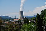
|
Niedergösgen | ISOS | 47°22′25″N 7°59′35″E / 47.373611111°N 7.993055555°E | |||
Grenchen
| Location | Upload | Photo | Object | Cat. | Coordinates | KGS-Nr | |
|---|---|---|---|---|---|---|---|
| Grenchen | 
|
Kultur-Historisches Museum Grenchen | B | 47°11′34″N 7°23′42″E / 47.192655748°N 7.394863215°E | 10997 | ||
| Grenchen | 
|
Kunsthaus Grenchen | B | 47°11′21″N 7°23′53″E / 47.18912°N 7.39812°E | 10171 | ||
| Grenchen | 
|
Stadtarchiv Grenchen | B | 47°11′32″N 7°23′40″E / 47.19218°N 7.39436°E | 10589 | ||
| Grenchen | 
|
Alte Mühle 1611/1834 | B | 47°11′52″N 7°23′39″E / 47.19771°N 7.39405°E | 11079 | ||
| Grenchen | 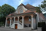
|
Alte Turnhalle (1905) | B | 47°11′32″N 7°23′34″E / 47.19218°N 7.3928°E | 13957 | ||
| Grenchen | 
|
Arbeiterhaus Frohheim | B | 47°11′48″N 7°23′24″E / 47.1967°N 7.39013°E | 11077 | ||
| Grenchen | 
|
Bachtelenbad (1818) | B | 47°11′19″N 7°22′59″E / 47.18867°N 7.38302°E | 4552 | ||
| Grenchen | 
|
Bauernhaus | B | 47°09′48″N 7°24′20″E / 47.16342°N 7.40547°E | 11149 | ||
| Grenchen | 
|
BLS-Viadukt und Bahnanlagen Grenchen-Nord (1915) | B | 47°11′35″N 7°23′24″E / 47.19295°N 7.39007°E | 4553 | ||
| Grenchen | 
|
Ehemaliges Kaplanenhaus | B | 47°11′44″N 7°22′15″E / 47.1955°N 7.37074°E | 13534 | ||
| Grenchen | 
|
Ehemaliges Pfarrhaus/Lindenschulhaus um 1870 | B | 47°11′33″N 7°23′40″E / 47.192430765°N 7.394559906°E | 13535 | ||
| Grenchen | 
|
Hôtel de Ville Gemeindehaus 1907 | B | 47°11′27″N 7°23′47″E / 47.19094°N 7.3965°E | 4554 | ||
| Grenchen | 
|
Hotel Löwen | B | 47°11′33″N 7°23′46″E / 47.19247°N 7.39607°E | 11078 | ||
| Grenchen | 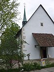
|
Kapelle Allerheiligen (1682) | B | 47°11′43″N 7°22′13″E / 47.19537°N 7.37026°E | 4556 | ||
| Grenchen | 
|
Kapelle im Staad (18. und 20. Jh.) | B | 47°09′47″N 7°24′25″E / 47.16318°N 7.40706°E | 4557 | ||
| Grenchen | 
|
Parktheater | B | 47°11′28″N 7°23′27″E / 47.191°N 7.39075°E | 13536 | ||
| Grenchen | 
|
Pfarrkirche St. Eusebius 1805-1812 | B | 47°11′34″N 7°23′40″E / 47.19285°N 7.39449°E | 13531 | ||
| Grenchen | 
|
Rainschulhaus 1821-1823 / Kulturhistorisches Museum | B | 47°11′33″N 7°23′42″E / 47.19259°N 7.39488°E | 13532 | ||
| Grenchen | 
|
Römerbrücke | B | 47°10′53″N 7°25′27″E / 47.18144°N 7.42405°E | 13537 | ||
| Grenchen | 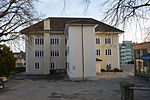
|
Schulhaus I (1844/46) | B | 47°11′31″N 7°23′39″E / 47.19203°N 7.3943°E | 4555 | ||
| Grenchen | 
|
Schulhaus II (1883) | B | 47°11′30″N 7°23′36″E / 47.19162°N 7.39344°E | 13955 | ||
| Grenchen | 
|
Schulhaus III (1910/1912) | B | 47°11′33″N 7°23′32″E / 47.19254°N 7.39211°E | 13533 | ||
| Grenchen | 
|
Villa Girard | B | 47°11′21″N 7°23′53″E / 47.18912°N 7.39806°E | 11076 | ||
Gretzenbach
| Location | Upload | Photo | Object | Cat. | Coordinates | KGS-Nr | |
|---|---|---|---|---|---|---|---|
| Gretzenbach | 
|
Gutshof Zirzelhof 17. Jh. | B | 47°21′36″N 8°00′16″E / 47.36003°N 8.0044°E | 11150 | ||
| Gretzenbach | 
|
Pfahlbauten im Bally-Park | B | 47°21′52″N 7°59′43″E / 47.36439°N 7.99519°E | 14000 | ||
| Gretzenbach | 
|
Pfarrkirche St. Peter und Paul 1664/1884 | B | 47°21′42″N 7°59′45″E / 47.36173°N 7.99579°E | 11151 | ||
Grindel
| Location | Upload | Photo | Object | Cat. | Coordinates | KGS-Nr | |
|---|---|---|---|---|---|---|---|
| Grindel | 
|
Pfarrkirche St. Stephan | B | 47°22′53″N 7°30′05″E / 47.38134°N 7.50136°E | 13559 | ||
Günsberg
| Location | Upload | Photo | Object | Cat. | Coordinates | KGS-Nr | |
|---|---|---|---|---|---|---|---|
| Günsberg | 
|
Pfarrhof 1697 | B | 47°15′26″N 7°34′35″E / 47.25722°N 7.57634°E | 13958 | ||
| Günsberg | 
|
Restaurant Glutzenberg | B | 47°15′47″N 7°34′18″E / 47.263°N 7.57172°E | 13959 | ||
Gunzgen
| Location | Upload | Photo | Object | Cat. | Coordinates | KGS-Nr | |
|---|---|---|---|---|---|---|---|
| Gunzgen | 
|
Pfarrkirche St. Katharina 1643/1860 | B | 47°18′54″N 7°49′39″E / 47.31504°N 7.82737°E | 13560 | ||
Hägendorf
| Location | Upload | Photo | Object | Cat. | Coordinates | KGS-Nr | |
|---|---|---|---|---|---|---|---|
| Hägendorf | 
|
Berghof 17. Jh. | B | 47°21′44″N 7°49′40″E / 47.36233°N 7.82765°E | 13960 | ||
| Hägendorf | 
|
Fasiswaldhof 1781 | B | 47°21′30″N 7°49′17″E / 47.35824°N 7.82126°E | 13961 | ||
| Hägendorf | 
|
Wohnhaus 1586 | B | 47°20′00″N 7°50′39″E / 47.33335°N 7.84411°E | 4559 | ||
Halten
| Location | Upload | Photo | Object | Cat. | Coordinates | KGS-Nr | |
|---|---|---|---|---|---|---|---|
| Halten | 
|
Wohnturm | B | 47°10′05″N 7°36′14″E / 47.16819°N 7.60389°E | 4560 | ||
| Halten | 
|
Museum Wasseramt | B | 47°10′06″N 7°36′14″E / 47.16821°N 7.60384°E | 13962 | ||
Härkingen
| Location | Upload | Photo | Object | Cat. | Coordinates | KGS-Nr | |
|---|---|---|---|---|---|---|---|
| Härkingen | 
|
Bauernhaus | B | 47°18′28″N 7°48′53″E / 47.30784°N 7.81472°E | 11153 | ||
| Härkingen | 
|
Bauernhaus 1728 | B | 47°18′29″N 7°48′54″E / 47.30795°N 7.81513°E | 13964 | ||
| Härkingen | 
|
Ehemalige Pfarrkirche St. Johann der Täufer | B | 47°18′31″N 7°48′57″E / 47.30871°N 7.81573°E | 13966 | ||
| Härkingen | 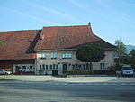
|
Gasthaus zum Lamm | B | 47°18′29″N 7°48′50″E / 47.30809°N 7.8139°E | 11152 | ||
| Härkingen | 
|
Pfarrhaus | B | 47°18′31″N 7°48′56″E / 47.30858°N 7.81552°E | 13965 | ||
| Härkingen | 
|
Wohnhaus 1832 | B | 47°18′30″N 7°48′57″E / 47.30842°N 7.81588°E | 13963 | ||
Hauenstein-Ifenthal
| Location | Upload | Photo | Object | Cat. | Coordinates | KGS-Nr | |
|---|---|---|---|---|---|---|---|
| Hauenstein-Ifenthal | 
|
Pfarrhaus 1824 | B | 47°22′24″N 7°51′19″E / 47.3734°N 7.85517°E | 13967 | ||
| Hauenstein-Ifenthal | 
|
Pfarrkirche St. Katharina | B | 47°22′25″N 7°51′20″E / 47.37362°N 7.85569°E | 11154 | ||
| Hauenstein-Ifenthal | 
|
Restaurant zur Sonne mit Scheune | B | 47°22′37″N 7°52′23″E / 47.3769°N 7.87301°E | 13968 | ||
Herbetswil
| Location | Upload | Photo | Object | Cat. | Coordinates | KGS-Nr | |
|---|---|---|---|---|---|---|---|
| Herbetswil | 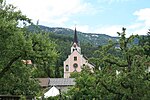
|
Pfarrkirche St. Johann Baptist | B | 47°17′49″N 7°35′35″E / 47.29691°N 7.59311°E | 11156 | ||
Himmelried
| Location | Upload | Photo | Object | Cat. | Coordinates | KGS-Nr | |
|---|---|---|---|---|---|---|---|
| Himmelried | 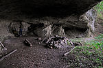
|
Kastelhöhle, paläolithische Wohnhöhle | A | 47°25′40″N 7°34′09″E / 47.42773°N 7.56919°E | 4563 | ||
| Himmelried | 
|
Gemeindehaus 1811 | B | 47°25′20″N 7°35′53″E / 47.42236°N 7.59816°E | 13973 | ||
| Himmelried | 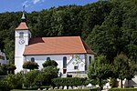
|
Pfarrkirche St. Franz Xaver 1807-09 | B | 47°25′20″N 7°35′54″E / 47.42222°N 7.59844°E | 13972 | ||
Hochwald
| Location | Upload | Photo | Object | Cat. | Coordinates | KGS-Nr | |
|---|---|---|---|---|---|---|---|
| Hochwald | 
|
Kirche St. Gallus | B | 47°27′22″N 7°38′28″E / 47.4561°N 7.64102°E | 13538 | ||
Hofstetten-Flüh
| Location | Upload | Photo | Object | Cat. | Coordinates | KGS-Nr | |
|---|---|---|---|---|---|---|---|
| Hofstetten-Flüh | 
|
Ruine Sternenberg | B | 47°28′43″N 7°30′18″E / 47.47858°N 7.50495°E | 4565 | ||
| Hofstetten-Flüh | 
|
Ehemaliges Meierhaus | B | 47°28′33″N 7°30′55″E / 47.4758°N 7.51537°E | 11158 | ||
| Hofstetten-Flüh | 
|
Flühmühle | B | 47°28′54″N 7°30′04″E / 47.48159°N 7.50119°E | 11159 | ||
| Hofstetten-Flüh | 
|
Hofstetter Köpfli, Fluchtburg mit Wall | B | 47°28′58″N 7°30′23″E / 47.48282°N 7.50629°E | 4568 | ||
| Hofstetten-Flüh | 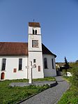
|
Pfarrkirche St. Nikolaus 1609 | B | 47°28′38″N 7°30′44″E / 47.47728°N 7.51221°E | 13578 | ||
| Hofstetten-Flüh | 
|
Restaurant zur Rose 1688 | B | 47°29′19″N 7°29′53″E / 47.48854°N 7.49792°E | 13539 | ||
| Hofstetten-Flüh | 
|
Roter Ochsen 1692 | B | 47°29′13″N 7°29′52″E / 47.48705°N 7.49772°E | 13540 | ||
| Hofstetten-Flüh | 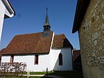
|
St. Johanneskapelle (Wandmalereien um 1430) | B | 47°28′30″N 7°30′52″E / 47.47491°N 7.51437°E | 4567 | ||
Holderbank
| Location | Upload | Photo | Object | Cat. | Coordinates | KGS-Nr | |
|---|---|---|---|---|---|---|---|
| Holderbank | 
|
Ruine Alt-Bechburg | A | 47°19′57″N 7°46′19″E / 47.33245°N 7.77199°E | 4569 | ||
| Holderbank | 
|
Ehemaliges Pfarrhaus frühes 19. Jh. | B | 47°20′03″N 7°45′24″E / 47.33407°N 7.75678°E | 13542 | ||
| Holderbank | 
|
Ehemaliges Untervogthaus spätgotisch | B | 47°19′59″N 7°45′12″E / 47.33312°N 7.75328°E | 13541 | ||
| Holderbank | 
|
Ehemaliges Zollhaus 18. Jh. | B | 47°20′30″N 7°46′05″E / 47.34177°N 7.76797°E | 13974 | ||
| Holderbank | 
|
katholische Kirche St. Fridolin (1734, 1912) | B | 47°20′01″N 7°45′12″E / 47.33351°N 7.75329°E | 4570 | ||
| Holderbank | 
|
Sennhof Alt Bechburg | B | 47°19′56″N 7°46′21″E / 47.3323°N 7.77261°E | 11160 | ||
Hüniken
| Location | Upload | Photo | Object | Cat. | Coordinates | KGS-Nr | |
|---|---|---|---|---|---|---|---|
| Hüniken | 
|
Kapelle St. Michael | B | 47°11′04″N 7°38′14″E / 47.18456°N 7.63735°E | 11161 | ||