Category:Wohnhaus (15. Jh.) (Gempen)
Jump to navigation
Jump to search
| Object location | | View all coordinates using: OpenStreetMap |
|---|
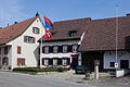
residential building in Gempen in the canton of Solothurn, Switzerland  | |||||
| Upload media | |||||
| Instance of | |||||
|---|---|---|---|---|---|
| Part of | |||||
| Location | Gempen, Dorneck District, Dorneck-Thierstein, Solothurn, Switzerland | ||||
| Street address |
| ||||
| Heritage designation |
| ||||
| Inception |
| ||||
 | |||||
Media in category "Wohnhaus (15. Jh.) (Gempen)"
This category contains only the following file.
-
 B-Gempen-Wohnhaus.jpg 1,800 × 1,200; 2.15 MB