Category:Maps of the history of Indiana
Jump to navigation
Jump to search
States of the United States: Alabama · Alaska · Arizona · Arkansas · California · Colorado · Connecticut · Delaware · Florida · Georgia · Hawaii · Idaho · Illinois · Indiana · Iowa · Kansas · Kentucky · Louisiana · Maine · Maryland · Massachusetts · Michigan · Minnesota · Mississippi · Missouri · Montana · Nebraska · Nevada · New Hampshire · New Jersey · New Mexico · New York · North Carolina · North Dakota · Ohio · Oklahoma · Oregon · Pennsylvania · Rhode Island · South Carolina · South Dakota · Tennessee · Texas · Utah · Vermont · Virginia · Washington · West Virginia · Wisconsin · Wyoming – Washington, D.C.
Puerto Rico
Puerto Rico
Subcategories
This category has the following 3 subcategories, out of 3 total.
Media in category "Maps of the history of Indiana"
The following 14 files are in this category, out of 14 total.
-

-
 Buffalo Trace Indiana map.jpg 472 × 311; 23 KB
-
 Caborn Welborn Map HRoe 2010 01.jpg 800 × 548; 318 KB
-
 EB9 United States - historical maps (top).jpg 2,488 × 1,803; 997 KB
-
 Fort Ancient Monongahela cultures HRoe 2010.jpg 700 × 496; 312 KB
-
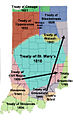 Indiana Indian treaties.jpg 334 × 550; 161 KB
-
 Indiana Indian treaties.svg 2,887 × 4,423; 313 KB
-
 Lochry defeat map.PNG 1,138 × 1,038; 952 KB
-
 Map from Indian land cessions in the United States by Charles C. Royce 32.jpg 3,297 × 4,256; 4.76 MB
-
 National road map.png 600 × 353; 73 KB
-
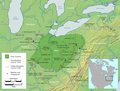 Ohio Country en.png 1,217 × 920; 1.41 MB
-
 Tecumseh's War.png 822 × 840; 322 KB
-

-
 Wpdms illinois country settlements 1763.png 325 × 255; 37 KB
%27_(11225109536).jpg)


.jpg)


.jpg)
