Category:Maps of the history of New Mexico
Jump to navigation
Jump to search
States of the United States: Alabama · Alaska · Arizona · Arkansas · California · Colorado · Connecticut · Delaware · Florida · Georgia · Hawaii · Idaho · Illinois · Indiana · Iowa · Kansas · Kentucky · Louisiana · Maine · Maryland · Massachusetts · Michigan · Minnesota · Mississippi · Missouri · Montana · Nebraska · Nevada · New Hampshire · New Jersey · New Mexico · New York · North Carolina · North Dakota · Ohio · Oklahoma · Oregon · Pennsylvania · Rhode Island · South Carolina · South Dakota · Tennessee · Texas · Utah · Vermont · Virginia · Washington · West Virginia · Wisconsin · Wyoming – Washington, D.C.
Puerto Rico
Puerto Rico
English: Maps of the History of New Mexico.
Subcategories
This category has the following 2 subcategories, out of 2 total.
Media in category "Maps of the history of New Mexico"
The following 21 files are in this category, out of 21 total.
-
 Ancient-Regions.svg 929 × 1,008; 1.82 MB
-
 Arizona and New Mexico Territories 1863.svg 405 × 278; 36 KB
-
 Arizona Civil War New Mexico.png 422 × 359; 24 KB
-
 Arizona Territory in Confederate States.png 2,000 × 1,007; 280 KB
-
 CalColumnMap.jpg 931 × 503; 142 KB
-
 EB9 United States - historical maps (bottom).jpg 2,501 × 2,000; 942 KB
-
 Evolution of borders at Four Corners, USA - June 2013.gif 1,000 × 758; 617 KB
-
 Fremont and Anasazi regions.svg 624 × 769; 73 KB
-
 HohokamArea.ca1350.png 340 × 419; 100 KB
-
 Mexico 1824 (equirectangular projection).png 1,400 × 1,047; 405 KB
-
 Mexico 1835-1846 administrative map-de.svg 1,241 × 1,138; 162 KB
-
 Mexico 1835-1846 administrative map-en.svg 1,241 × 1,138; 426 KB
-
 Mexico 1835-1846 administrative map-es.svg 1,518 × 1,138; 1.18 MB
-
 Mexico 1835-1846 administrative map-fr.svg 1,241 × 1,138; 416 KB
-
 México División Política-República Central.png 1,098 × 1,181; 319 KB
-
 Oasisamerica Esp.jpg 1,280 × 1,569; 375 KB
-
 Oasisamerican cultures circa 1350 CE.png 720 × 887; 362 KB
-
 Oasisamérica-Mogollón.png 766 × 965; 1.21 MB
-
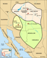
 The Chacoan System.png 1,054 × 914; 304 KB
-
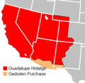 Treaty of Guadalupe Hidalgo.png 320 × 315; 9 KB
-
 Wpdms arizona new mexico territories 1863 idx.png 264 × 281; 14 KB


.jpg)


.png)


