Category:Maps of Indiana
Jump to navigation
Jump to search
States of the United States: Alabama · Alaska · Arizona · Arkansas · California · Colorado · Connecticut · Delaware · Florida · Georgia · Hawaii · Idaho · Illinois · Indiana · Iowa · Kansas · Kentucky · Louisiana · Maine · Maryland · Massachusetts · Michigan · Minnesota · Mississippi · Missouri · Montana · Nebraska · Nevada · New Hampshire · New Jersey · New Mexico · New York · North Carolina · North Dakota · Ohio · Oklahoma · Oregon · Pennsylvania · Rhode Island · South Carolina · South Dakota · Tennessee · Texas · Utah · Vermont · Virginia · Washington · West Virginia · Wisconsin · Wyoming – Washington, D.C.
insular area of the United States: American Samoa · Guam · Northern Mariana Islands · Puerto Rico · United States Virgin Islands – United States Minor Outlying Islands: Baker Island · Howland Island · Jarvis Island · Johnston Atoll · Kingman Reef · Midway Atoll · Navassa Island · Palmyra Atoll · Wake Island
insular area of the United States: American Samoa · Guam · Northern Mariana Islands · Puerto Rico · United States Virgin Islands – United States Minor Outlying Islands: Baker Island · Howland Island · Jarvis Island · Johnston Atoll · Kingman Reef · Midway Atoll · Navassa Island · Palmyra Atoll · Wake Island
Wikimedia category | |||||
| Upload media | |||||
| Instance of | |||||
|---|---|---|---|---|---|
| Category combines topics | |||||
| Indiana | |||||
state of the United States of America    | |||||
| Pronunciation audio | |||||
| Instance of | |||||
| Part of | |||||
| Named after | |||||
| Location |
| ||||
| Located in or next to body of water | |||||
| Capital |
| ||||
| Legislative body | |||||
| Executive body | |||||
| Highest judicial authority | |||||
| Official language | |||||
| Anthem | |||||
| Head of government |
| ||||
| Inception |
| ||||
| Highest point | |||||
| Population |
| ||||
| Area |
| ||||
| Elevation above sea level |
| ||||
| Different from | |||||
| Maximum temperature record |
| ||||
| Minimum temperature record |
| ||||
| official website | |||||
 | |||||

Subcategories
This category has the following 34 subcategories, out of 34 total.
*
5
- 50 State quarter (Indiana) (4 F)
A
- Area code maps of Indiana (4 F)
B
- Bird's eye view maps of Indiana (10 F)
C
E
F
- Flag maps of Indiana (4 F)
G
H
L
- Maps of lakes of Indiana (8 F)
- Linguistic maps of Indiana (3 F)
- Location maps of Indiana (27 F)
N
P
R
S
T
- Time zone maps of Indiana (13 F)
Media in category "Maps of Indiana"
The following 167 files are in this category, out of 167 total.
-
 1817 Indiana Map.jpg 2,010 × 2,525; 1.12 MB
-
 2020aug-derecho-storm-crop-overlay-usda-map.png 705 × 545; 406 KB
-
 280x-US-IN-Westport.png 280 × 438; 23 KB
-
 A Diagram of the State of Indiana - NARA - 25464309.jpg 3,712 × 6,005; 2.13 MB
-
 AmDiscoveryMap.jpg 300 × 211; 32 KB
-
 Anishinaabewaki.jpg 1,056 × 816; 565 KB
-

-
 Annual report of the Indiana State Board of Agriculture" (1852-1910) (19176904398).jpg 1,688 × 2,628; 684 KB
-
 Annual report of the Indiana State Board of Agriculture" (1852-1910) (19364498555).jpg 1,860 × 2,796; 854 KB
-
 Battle of Corydon with Morgan's Raid in southern Indiana copy.jpg 600 × 691; 212 KB
-
 Beaver Dam Lake - DPLA - 24cc254c667b8cc7b11ff67c13ab7cb9.jpg 3,392 × 2,700; 513 KB
-
 Black Swamp.jpg 881 × 627; 52 KB
-
 Bluein.jpg 280 × 412; 60 KB
-
 Central Indiana.PNG 690 × 1,020; 38 KB
-
 East Central Indiana.png 405 × 599; 50 KB
-
 EIAC.png 806 × 1,242; 16 KB
-
 Electric railway journal (1909) (14758075471).jpg 2,878 × 2,220; 1,013 KB
-

-
 GPWSEC.png 565 × 503; 21 KB
-
 GreatBlackSwampMap.png 500 × 500; 129 KB
-
 HHC 2023.png 806 × 1,242; 58 KB
-
 Icc2015.png 610 × 931; 60 KB
-
-
 Illinois-Indiana-Kentucky Tri-State Area.png 594 × 502; 21 KB
-
 IN - State Police Map.png 446 × 692; 301 KB
-
 IN-1 2012.svg 800 × 718; 17 KB
-
 IN-1 2014.svg 800 × 718; 17 KB
-
 IN-1 2016.svg 800 × 718; 17 KB
-
 IN-1 2020.svg 800 × 718; 17 KB
-
 IN-2 2012.svg 800 × 979; 34 KB
-
 IN-2 2014.svg 800 × 979; 34 KB
-
 IN-2 2016.svg 800 × 979; 34 KB
-
 IN-2 2020.svg 800 × 979; 34 KB
-
 IN-3 2012.svg 800 × 1,377; 35 KB
-
 IN-3 2014.svg 800 × 1,377; 35 KB
-
 IN-3 2016.svg 800 × 1,377; 35 KB
-
 IN-3 2020.svg 800 × 1,377; 35 KB
-
 IN-4 2012.svg 800 × 1,270; 57 KB
-
 IN-4 2014.svg 800 × 1,270; 57 KB
-
 IN-4 2016.svg 800 × 1,270; 57 KB
-
 IN-4 2020.svg 800 × 1,270; 57 KB
-
 IN-5 2012.svg 800 × 752; 28 KB
-
 IN-5 2014.svg 800 × 752; 28 KB
-
 IN-5 2016.svg 800 × 752; 28 KB
-
 IN-5 2020.svg 800 × 752; 28 KB
-
 IN-6 2012.svg 800 × 1,413; 70 KB
-
 IN-6 2014.svg 800 × 1,413; 70 KB
-
 IN-6 2016.svg 800 × 1,413; 70 KB
-
 IN-6 2020.svg 800 × 1,413; 70 KB
-
 IN-7 2014.svg 800 × 699; 9 KB
-
 IN-7 2020.svg 800 × 699; 9 KB
-
 IN-8 2012.svg 800 × 1,350; 148 KB
-
 IN-8 2014.svg 800 × 1,350; 148 KB
-
 IN-8 2016.svg 800 × 1,350; 148 KB
-
 IN-8 2020.svg 800 × 1,350; 148 KB
-
 IN-9 2012.svg 800 × 1,348; 66 KB
-
 IN-9 2014.svg 800 × 1,348; 66 KB
-
 IN-9 2016.svg 800 × 1,348; 66 KB
-
 IN-9 2020.svg 800 × 1,348; 66 KB
-
 IN2004.jpg 600 × 844; 78 KB
-
 Indiana (CAC).png 806 × 1,242; 13 KB
-
 Indiana (MIFC).png 806 × 1,242; 14 KB
-
 Indiana (NCAC).png 806 × 1,242; 20 KB
-
 Indiana (NECC).png 806 × 1,242; 47 KB
-
 Indiana (NEHC).png 806 × 1,242; 47 KB
-
 Indiana (NSC2).png 806 × 1,242; 47 KB
-
 Indiana (PAC) (2021).png 806 × 1,242; 22 KB
-
 Indiana (TEC).png 806 × 1,242; 47 KB
-
 Indiana (TRC).png 806 × 1,242; 47 KB
-
 Indiana (WabRivConf).PNG 806 × 1,242; 46 KB
-
 Indiana - NARA - 109186526.jpg 5,804 × 8,406; 4.29 MB
-
 Indiana - NARA - 26335509.jpg 6,176 × 8,342; 8.03 MB
-
 Indiana - NARA - 66799143.jpg 7,104 × 10,523; 5.21 MB
-
 Indiana 90.jpg 764 × 1,118; 476 KB
-
 Indiana BSA Councils.png 600 × 900; 73 KB
-
 Indiana civil war map.jpg 500 × 597; 214 KB
-
 Indiana Collegiate Conference map.PNG 800 × 520; 87 KB
-
 Indiana County Flips 2008.svg 810 × 810; 34 KB
-
 Indiana Klan percentage.jpg 502 × 366; 27 KB
-
 Indiana Köppen.png 6,300 × 10,200; 381 KB
-
 Indiana Map Southern Roads 2021.png 250 × 368; 49 KB
-
 Indiana ref 2001.jpg 500 × 710; 227 KB
-
 Indiana Referendum Counties 2.JPG 922 × 1,256; 121 KB
-
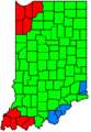
 Indiana Referendum Counties.JPG 494 × 754; 45 KB
-
 Indiana State House 2022 Results vote share.svg 1,417 × 1,052; 755 KB
-
 Indiana Territory 1812.gif 600 × 600; 58 KB
-
 Indiana Territory 1812.jpg 495 × 632; 182 KB
-
 Indiana time counties, 1918-1961.png 285 × 413; 41 KB
-
 Indiana time counties, 1967-2006.png 285 × 413; 49 KB
-
 Indiana time counties, 1977-1991.png 285 × 413; 43 KB
-
 Indiana time counties, 1991-2006.png 285 × 413; 43 KB
-
 Indiana time counties, 3-07 to 11-07.png 285 × 413; 46 KB
-
 Indiana time counties, 4-06 to 3-07.png 285 × 413; 44 KB
-
 Indiana Trenton Gas Field.jpg 391 × 599; 117 KB
-
 Indiana Whitewater Canal map.jpg 334 × 550; 156 KB
-
 Indiana Whitewater Canal map2.jpg 334 × 550; 44 KB
-
 Indiana wind resource map 50m 800.jpg 850 × 1,100; 588 KB
-
 Indiana, 1817.jpg 7,177 × 9,506; 15.68 MB
-
 Indiana, 1868.jpg 4,256 × 6,019; 12.75 MB
-
 Indiana- Index to Field Notes - NARA - 84785988.jpg 7,136 × 10,530; 5.49 MB
-
 Indiana-(MIC).png 806 × 1,242; 21 KB
-
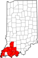
 Indiana-Southwestern Indiana Highlighted.PNG 850 × 550; 90 KB
-

-
 Indianarailroadmap.GIF 712 × 1,065; 29 KB
-
 IndianaRegions.png 931 × 1,020; 47 KB
-
 Indianaterr.PNG 484 × 529; 98 KB
-
 Lake Tippecanoe.png 1,059 × 600; 143 KB
-
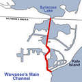 Lake Wawasees Main Channel.png 500 × 500; 130 KB
-
 Little Calumet River watershed map.png 2,269 × 1,193; 4.28 MB
-
 Mammoth Improvenment Act Projects.jpg 636 × 993; 322 KB
-
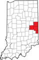
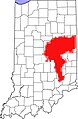
 Map of Indiana highlighting Nine-County Region.PNG 195 × 300; 28 KB
-
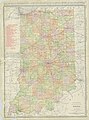
 Map of Indiana.jpg 2,920 × 3,501; 2.65 MB
-
 Map of Indianapolis Metropolitan Police Department Jurisdiction.png 650 × 550; 66 KB
-
 Map of Kentuckiana.png 849 × 781; 24 KB
-
 Map of Michigan, Indiana, and Ohio.jpg 1,710 × 2,090; 308 KB
-
 Map of native terms for places in Indiana, 1882.jpg 1,680 × 2,664; 597 KB
-

-
 Map of the counties in Northern Indiana.png 307 × 434; 11 KB
-
 Map of the State of Indiana - NARA - 25464306.jpg 6,528 × 8,308; 5.07 MB
-
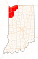
 Map of USA highlighting Indiana.png 280 × 183; 35 KB
-
 MapofIN.png 1,460 × 2,400; 2.35 MB
-
 Marion IL Tornado Map.PNG 413 × 234; 14 KB
-
 Michiana.jpg 197 × 347; 40 KB
-
 Nanfan.jpg 994 × 768; 543 KB
-
 Nattie Crow Beach Lake Wawasee.png 760 × 700; 478 KB
-
 Northen Indiana.JPG 307 × 434; 22 KB
-
 Northern Indiana.png 405 × 599; 48 KB
-
 Northwest Indiana Seven County Map.png 512 × 800; 24 KB
-
 Nov10map2.JPG 398 × 453; 24 KB
-
 Ohio Indiana Level IV ecoregions.pdf 3,750 × 3,450; 1.05 MB
-
 Palmsundayalltornadoes.jpg 1,024 × 768; 181 KB
-
 Piste des bisons.gif 474 × 306; 8 KB
-

-
 Population density of Indiana counties (2020).png 3,170 × 4,098; 1.43 MB
-

-
 SIAC (2020).png 806 × 1,242; 21 KB
-
 Southern Indiana.PNG 690 × 1,020; 39 KB
-
 Southwestern Indiana.png 832 × 758; 36 KB
-
 SouthwesternIndiana.png 690 × 1,020; 10 KB
-

-

-
 US-IN-Angola trunc.PNG 393 × 411; 14 KB
-
 US-IN-Country Club Heights.png 512 × 800; 33 KB
-
 US-IN-Fremont.png 512 × 800; 34 KB
-
 US-IN-Hamilton trunc.png 372 × 411; 13 KB
-
 US-IN-Indian Village Noble.png 512 × 800; 109 KB
-
 US-IN-NewPalestine.PNG 512 × 800; 33 KB
-
 US-IN-Northwest.PNG 512 × 800; 33 KB
-
 US-IN-Speedway-doton.PNG 512 × 800; 33 KB
-
 Valparaiso Public School District.gif 575 × 425; 54 KB
-
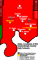
 Vanderburgh County High Schools.png 465 × 802; 27 KB
-
 Vanderburgh High School & Charter School Locations - Revised.png 465 × 730; 28 KB
-
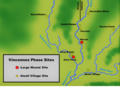
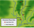 Vincennes Phase Sites.png 1,242 × 1,015; 1.13 MB
-
 Wabash and Erie Canal map.jpg 334 × 550; 66 KB
-
 Webster Lake, Indiana.png 670 × 500; 117 KB
-
 White lick creek map.jpg 563 × 465; 125 KB
-
 WhiteCounty.IN.(NW detail map).png 776 × 518; 663 KB
-
 WhiteCounty.IN.map.1908.png 1,152 × 992; 2.62 MB
-
 WIC Overview 2019.jpg 435 × 538; 46 KB
-
 Wikinews Indiana Bloomington Map.png 194 × 324; 19 KB
-
 Wikinews Indiana Evansville Map.png 249 × 253; 25 KB
-
 Wikinews Indiana Gary Map.png 216 × 364; 19 KB
-
 Wikinews Indiana Indianapolis Map.png 238 × 234; 12 KB
-
 Wikinews Indiana Muncie Map.png 186 × 254; 12 KB
-
 Wikinews Indiana New Albany Map.png 249 × 306; 18 KB
-
 Wikinews Indiana Terre Haute Map.png 276 × 340; 20 KB
-
 With Names (3).png 1,235 × 904; 713 KB


_(18739595164).jpg)
_(19176904398).jpg)
_(19364498555).jpg)


_(14758075471).jpg)


.png)
.png)
.png)
.png)
.png)
.png)
_(2021).png)
.png)
.png)
.PNG)


.png)

_(14757618584).jpg)


.jpg)


.jpg)
.png)
_(14755445801).jpg)
.png)


_-_The_Matthews-Northrup_Co._-_DPLA_-_605863f6faf40d4ecdef8d72edf7a6a5_(page_1).jpg)
_-_The_Matthews-Northrup_Co._-_DPLA_-_605863f6faf40d4ecdef8d72edf7a6a5_(page_2).jpg)


.png)


.png)