Category:Maps of the history of Nebraska
Jump to navigation
Jump to search
States of the United States: Alabama · Alaska · Arizona · Arkansas · California · Colorado · Connecticut · Delaware · Florida · Georgia · Hawaii · Idaho · Illinois · Indiana · Iowa · Kansas · Kentucky · Louisiana · Maine · Maryland · Massachusetts · Michigan · Minnesota · Mississippi · Missouri · Montana · Nebraska · Nevada · New Hampshire · New Jersey · New Mexico · New York · North Carolina · North Dakota · Ohio · Oklahoma · Oregon · Pennsylvania · Rhode Island · South Carolina · South Dakota · Tennessee · Texas · Utah · Vermont · Virginia · Washington · West Virginia · Wisconsin · Wyoming – Washington, D.C.
Puerto Rico
Puerto Rico
Subcategories
This category has only the following subcategory.
Media in category "Maps of the history of Nebraska"
The following 11 files are in this category, out of 11 total.
-
 Arikara movements, 1795 to 1862.png 1,776 × 2,502; 7.43 MB
-

-
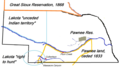
 Battlefields (approx.) - U.S. Army and Lakotas, 1854-1890.png 500 × 371; 298 KB
-
 Cooperative economic insect report (1957) (20698078925).jpg 3,442 × 2,206; 2.07 MB
-
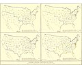 EB9 United States - historical maps (bottom).jpg 2,501 × 2,000; 942 KB
-
-
 Pawnee Indian cessions (2). (Pawnee country after 1833).png 2,256 × 1,462; 5.83 MB
-
 Pawnee Indian cessions (3). Pawnee country after 1848).png 2,256 × 1,462; 5.83 MB
-
 Pawnee Indian cessions (4). (Pawnee country after 1857).png 2,256 × 1,462; 5.84 MB
-
 Pawnee Indian cessions (5). (Pawnee country in Nebraska after 1876).png 2,256 × 1,462; 7.09 MB
-
 Trajet-ponca.png 800 × 1,051; 109 KB

_-_U.S._Army_and_Lakotas,_1854-1868_(blue_x)_and_1869-1890_(red_x).png)
_-_U.S._Army_and_Lakotas,_1854-1890.png)
_(20698078925).jpg)
.jpg)
,_Nebraska._Pawnee_reservation_and_relevant_Indian_territories.png)
._(Pawnee_country_after_1833).png)
._Pawnee_country_after_1848).png)
._(Pawnee_country_after_1857).png)
._(Pawnee_country_in_Nebraska_after_1876).png)
