Category:Maps of Yellowstone National Park
Jump to navigation
Jump to search
United States national parks: Acadia · American Samoa · Arches · Badlands · Big Bend · Biscayne · Black Canyon of the Gunnison · Bryce Canyon · Canyonlands · Capitol Reef · Carlsbad Caverns · Channel Islands · Congaree · Crater Lake · Cuyahoga Valley · Death Valley · Denali · Dry Tortugas · Everglades · Gateway Arch · Gates of the Arctic · Glacier · Glacier Bay · Grand Canyon · Grand Teton · Great Basin · Great Smoky Mountains · Guadalupe Mountains · Haleakalā · Hawaii Volcanoes · Hot Springs · Indiana Dunes · Isle Royale · Joshua Tree · Kenai Fjords · Kings Canyon · Kobuk Valley · Lake Clark · Lassen Volcanic · Mammoth Cave · Mesa Verde · Mount Rainier · North Cascades · Olympic · Petrified Forest · Pinnacles · Redwood · Rocky Mountain · Saguaro · Sequoia · Shenandoah · Theodore Roosevelt · Virgin Islands · Voyageurs · White Sands · Wind Cave · Wrangell-St. Elias · Yellowstone · Yosemite · Zion
Wikimedia category | |||||
| Upload media | |||||
| Instance of | |||||
|---|---|---|---|---|---|
| Category combines topics | |||||
| Yellowstone National Park | |||||
first national park in the world, located in Wyoming, Montana, and Idaho in the United States    | |||||
| Instance of | |||||
| Part of |
| ||||
| Named after | |||||
| Location | |||||
| Visitor center | |||||
| Operator | |||||
| Has part(s) | |||||
| Heritage designation |
| ||||
| IUCN protected areas category | |||||
| Inception |
| ||||
| Significant event |
| ||||
| Part of the series | |||||
| Highest point | |||||
| Area |
| ||||
| Visitors per year |
| ||||
| official website | |||||
 | |||||
Subcategories
This category has the following 15 subcategories, out of 15 total.
A
B
- Maps of Biscuit Basin (1 F)
G
M
- Maps of Mammoth Hot Springs (7 F)
- Maps of Norris Geyser Basin (5 F)
Media in category "Maps of Yellowstone National Park"
The following 129 files are in this category, out of 129 total.
-
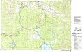
 Map Yellowstone National Park.jpg 1,371 × 1,666; 307 KB
-
 1909MapofLowerGeyserBasinYNP.JPG 885 × 1,226; 391 KB
-

-
 2020 Yellowstone Road Construction Map (48980485441).jpg 11,787 × 12,098; 13.26 MB
-
 41467 2019 8499 Fig1.webp 1,314 × 1,451; 121 KB
-
 41598 2018 32593 Fig1 map.jpg 776 × 811; 153 KB
-
 41598 2018 32593 Fig1.webp 1,650 × 1,300; 276 KB
-
 43705 2022 175 Fig2 HTML.webp 2,096 × 1,459; 459 KB
-
 43705 2022 175 Fig2l HTML.jpg 1,572 × 1,458; 611 KB
-
 43705 2022 175 Fig2ll HTML.jpg 1,230 × 1,458; 500 KB
-

-
 AmCyc Wyoming - Yellowstone map.jpg 1,975 × 2,167; 900 KB
-

-
 Collier's 1921 Montana.jpg 2,278 × 1,878; 1.19 MB
-
 EB9 Wyoming, Idaho, Montana, & Dakota.jpg 5,597 × 3,860; 4.7 MB
-
 Fire Control Map - NARA - 84786394.jpg 12,519 × 10,784; 10.64 MB
-
 Forest and stream (1886) (14801809313).jpg 4,352 × 2,416; 935 KB
-

-
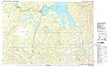
 Greater Yellowstone ecosystem map.jpg 640 × 952; 135 KB
-
 Grizzly bear range expansion in Greater Yellowstone Ecosystem 1990–2018 – animated map.gif 1,440 × 1,080; 1.35 MB
-
 Heinrich Berann NPS Panorama of Yellowstone with labels.jpg 12,132 × 9,021; 89.26 MB
-
 Heinrich Berann NPS Panorama of Yellowstone without labels.jpg 12,358 × 8,445; 97.47 MB
-
 Heinrich Berann NPS Yellowstone.jpg 5,284 × 3,587; 8.19 MB
-
 Lewis Lake, Wyoming - OSM.png 1,169 × 826; 378 KB
-
 Yellowstone National Park location map.svg 576 × 576; 773 KB
-
 Yellowstone National Park relief location map.png 1,920 × 1,920; 2.56 MB
-
 LocMap of WH Yellowstone.png 280 × 210; 29 KB
-
 LowerGeyserBasinBelcher1872.jpg 10,528 × 6,736; 10.83 MB
-
 Map of early plant collecting Yellowstone.jpg 1,209 × 1,280; 2.33 MB
-
 Map Wyoming NPS sites USA.gif 500 × 429; 15 KB
-
 Map-of-YNP-showing-hydrothermal-areas.jpg 980 × 1,070; 227 KB
-
 Midway Geyser Basin map.jpg 1,600 × 1,677; 647 KB
-
 NPS craters-of-the-moon-regional-map.jpg 865 × 918; 154 KB
-
 NPS yellowstone-backcountry-map.jpg 4,370 × 3,195; 2.35 MB
-
 NPS yellowstone-canyon-backcountry-map.jpg 2,066 × 732; 151 KB
-
 NPS yellowstone-canyon-map.jpg 595 × 736; 91 KB
-
 NPS yellowstone-canyon-village-printable-map.gif 626 × 829; 63 KB
-
 NPS yellowstone-canyon-winter-map.gif 1,038 × 1,645; 198 KB
-
 NPS yellowstone-fishing-bridge-lake-bridge-bay-map.jpg 814 × 730; 95 KB
-
 NPS yellowstone-fountain-paint-pot-trail-map.gif 516 × 769; 50 KB
-
 NPS yellowstone-grand-canyon-trail-map.gif 580 × 737; 48 KB
-
 NPS yellowstone-heart-lake-backcountry-map.jpg 1,552 × 1,528; 220 KB
-
 NPS yellowstone-lake-backcountry-map.jpg 2,090 × 2,536; 819 KB
-
 NPS yellowstone-lake-depth-map.jpg 1,552 × 2,190; 777 KB
-
 NPS yellowstone-lake-geologic-map.jpg 4,508 × 4,460; 2.93 MB
-
 NPS yellowstone-lake-printable-map.gif 899 × 827; 72 KB
-
 NPS yellowstone-lodging-map.gif 630 × 616; 28 KB
-
 NPS yellowstone-map-2020.jpg 3,000 × 3,558; 2.5 MB
-
 NPS yellowstone-map.jpg 3,025 × 3,487; 1.85 MB
-
 NPS yellowstone-map.pdf 2,520 × 3,360; 11.18 MB
-
 NPS yellowstone-northeast-winter-map.gif 1,038 × 1,645; 290 KB
-
 NPS yellowstone-old-faithful-area-trail-map.gif 593 × 751; 36 KB
-
 NPS yellowstone-old-faithful-map.jpg 589 × 734; 85 KB
-
 NPS yellowstone-old-faithful-printable-map.gif 623 × 826; 66 KB
-
 NPS yellowstone-old-faithful-trail-map.gif 582 × 646; 39 KB
-
 NPS yellowstone-old-faithful-winter-map.gif 1,038 × 1,645; 350 KB
-
 NPS yellowstone-printable-map.gif 2,580 × 3,100; 564 KB
-
 NPS yellowstone-regional-map.jpg 1,430 × 982; 199 KB
-
 NPS yellowstone-regional-road-map.gif 1,163 × 980; 113 KB
-
 NPS yellowstone-river-backcountry-map.jpg 2,070 × 1,366; 460 KB
-
 NPS yellowstone-shoshone-lake-backcountry-map.jpg 1,058 × 2,030; 263 KB
-
 NPS yellowstone-simple-map.gif 630 × 616; 27 KB
-
 NPS yellowstone-topo-map-north.jpg 5,685 × 3,597; 5.96 MB
-
 NPS yellowstone-topo-map-south.jpg 5,818 × 3,659; 5.96 MB
-
 NPS yellowstone-tower-winter-map.gif 1,645 × 1,048; 395 KB
-
 NPS yellowstone-west-thumb-geyser-basin-trail-map.gif 725 × 724; 41 KB
-
 NPS yellowstone-west-thumb-grant-printable-map.gif 625 × 826; 53 KB
-
 NPS yellowstone-west-thumb-grant-village-map.jpg 596 × 736; 72 KB
-
 NPS yellowstone-west-yellowstone-winter-trails.gif 963 × 1,645; 261 KB
-
 NPS yellowstone-winter-map.gif 1,656 × 2,096; 294 KB
-
 OldFaithfulHistoricDistrictApplication Map.jpg 4,380 × 3,385; 1.14 MB
-

-

-
 Panoramic view of the Yellowstone National Park, Wyoming-Montana-Idaho. LOC 97683603.jpg 5,888 × 6,864; 6.45 MB
-
 Panoramic view of the Yellowstone National Park, Wyoming-Montana-Idaho. LOC 97683603.tif 5,888 × 6,864; 115.63 MB
-
 PanoramicMapofYellowstone1915.jpg 3,073 × 3,458; 2.68 MB
-
 Park map exhibit at Canyon Visitor Education Center (48637380658).jpg 8,374 × 5,583; 31.53 MB
-

-
 The calumet of the Coteau, and other poetical legends of the border (1883) (14761456606).jpg 2,928 × 2,826; 2.57 MB
-
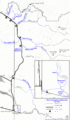
 The Cody road into Yellowstone Park (1907) (14574191189).jpg 3,322 × 2,898; 2.16 MB
-
 The Cody Road into Yellowstone Park (1914) (14757326334).jpg 4,486 × 2,628; 2.47 MB
-
 The Quarterly journal of the Geological Society of London (12825504405).jpg 1,883 × 3,200; 810 KB
-

-

-

-
 TopoReliefMapYellowstoneNationalPark.jpg 1,056 × 1,344; 184 KB
-
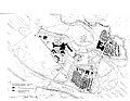
 Tower Falls Parking Area Plan - DPLA - a88b0be2760e139aad3de6a784a20a2e.JPG 12,444 × 10,720; 14.92 MB
-
 Upper Falls Viewpoints (b82a8cc7-04c3-41d3-8856-f0ed30b10266).png 1,400 × 1,600; 469 KB
-
 Upper Geyser Basin (8345827949).jpg 800 × 490; 96 KB
-
 Upper Geyser Basin (9136154285).jpg 799 × 490; 97 KB
-
 UpperGeyserBasin1871.jpg 7,568 × 5,952; 9.85 MB
-
 Wonderland junior (1896) (14735326806).jpg 2,756 × 3,576; 2.55 MB
-
 Wonderland; or, Alaska and the inland passage (1886) (14738141036).jpg 3,024 × 2,460; 1.09 MB
-

-
 YELL145676.00001 (19302965281).jpg 8,339 × 7,342; 68.22 MB
-
 YELL145676.00002 (19292943972).jpg 2,936 × 4,012; 15.59 MB
-
 YELL145676.00003 (19272843916).jpg 5,372 × 7,168; 39.88 MB
-
 Yellowstone - DPLA - 25eb9fcd82c29fccd524aae59a4ffc83.jpg 3,321 × 4,006; 1.39 MB
-
 Yellowstone 1871.jpg 3,696 × 4,312; 18.46 MB
-
 Yellowstone 1871b.jpg 3,486 × 3,700; 16.03 MB
-
 Yellowstone Hamilton Stores Map.png 3,000 × 3,558; 12.19 MB
-
 Yellowstone Major Calderas Map Simplified.jpg 1,275 × 1,020; 288 KB
-
 Yellowstone Major Calderas Map.jpg 1,275 × 1,020; 310 KB
-
 Yellowstone Map.jpg 800 × 1,031; 746 KB
-
 Yellowstone mapdirectory.JPG 4,320 × 3,240; 3.69 MB
-
 Yellowstone National Park (1909) (14758660944).jpg 1,724 × 3,288; 1.17 MB
-
 Yellowstone National Park 1898.jpg 6,136 × 8,078; 12.57 MB
-
 Yellowstone National Park by Wellge, 1904.jpg 18,916 × 12,450; 50.21 MB
-
 Yellowstone National Park historical map.jpg 1,365 × 1,919; 979 KB
-
 Yellowstone National Park Map.png 2,857 × 3,797; 2.46 MB
-

-
 Yellowstone National Park. LOC 97683575.jpg 8,160 × 11,280; 14.69 MB
-
 Yellowstone National Park. LOC 97683575.tif 8,160 × 11,280; 263.34 MB
-
 Yellowstone Park - how to get there and cost of tours (1904) (14574380189).jpg 2,708 × 2,712; 1.67 MB
-
 Yellowstone relief map.jpg 800 × 500; 171 KB
-
 Yellowstone route Nez Perce.png 748 × 486; 674 KB
-
 Yellowstone Zone of Death.png 2,751 × 3,013; 1.78 MB
-
 Yellowstone-area-map.png 2,261 × 2,416; 805 KB
-
 Yellowstone-area-map.svg 2,386 × 2,609; 4.87 MB
-
 Yellowstone-map.png 845 × 926; 258 KB
-
 Yellowstone-TF.jpg 7,680 × 4,320; 8.3 MB
-
 Yellowstone.png 750 × 750; 242 KB
-
 YellowstoneMap.jpg 394 × 410; 25 KB
-
 YellowstoneNationalPark1880.jpg 2,867 × 2,035; 1.1 MB
-
 YellowstoneNationalParkMap.png 551 × 577; 38 KB
-
 YellowstonePanorama1910.jpg 2,528 × 2,680; 1.41 MB
-
 YellowstonePlateaus.jpg 3,300 × 3,655; 7.44 MB
-
 YellowstoneProposedHotelsRail-c1900.jpg 7,024 × 5,904; 9.13 MB
-
 YellowstoneTopoWithRanges.jpg 1,056 × 1,344; 281 KB


.jpg)
.jpg)


_(14760606582).jpg)

_(18430880152).jpg)


_(14801809313).jpg)
.jpg)


.jpg)
.jpg)


.jpg)

_(14761456606).jpg)
_(14574191189).jpg)
_(14757326334).jpg)
.jpg)
_(14577917050).jpg)
.jpg)


.png)
.jpg)
.jpg)

_(14735326806).jpg)
_(14738141036).jpg)
_(14764577262).jpg)
.jpg)
.jpg)
.jpg)


_(14758660944).jpg)


.jpg)

_(14574380189).jpg)


.jpg)