Category:Maps of Big Bend National Park
Jump to navigation
Jump to search
United States national parks: Acadia · American Samoa · Arches · Badlands · Big Bend · Biscayne · Black Canyon of the Gunnison · Bryce Canyon · Canyonlands · Capitol Reef · Carlsbad Caverns · Channel Islands · Congaree · Crater Lake · Cuyahoga Valley · Death Valley · Denali · Dry Tortugas · Everglades · Gateway Arch · Gates of the Arctic · Glacier · Glacier Bay · Grand Canyon · Grand Teton · Great Basin · Great Smoky Mountains · Guadalupe Mountains · Haleakalā · Hawaii Volcanoes · Hot Springs · Indiana Dunes · Isle Royale · Joshua Tree · Kenai Fjords · Kings Canyon · Kobuk Valley · Lake Clark · Lassen Volcanic · Mammoth Cave · Mesa Verde · Mount Rainier · North Cascades · Olympic · Petrified Forest · Pinnacles · Redwood · Rocky Mountain · Saguaro · Sequoia · Shenandoah · Theodore Roosevelt · Virgin Islands · Voyageurs · White Sands · Wind Cave · Wrangell-St. Elias · Yellowstone · Yosemite · Zion
Wikimedia category | |||||
| Upload media | |||||
| Instance of | |||||
|---|---|---|---|---|---|
| Category combines topics | |||||
| Big Bend National Park | |||||
U.S. national park located in Southern Texas, bordering Mexico   | |||||
| Instance of | |||||
| Location | Brewster County, Texas | ||||
| Visitor center | |||||
| Operator | |||||
| Has part(s) | |||||
| Heritage designation |
| ||||
| IUCN protected areas category | |||||
| Inception |
| ||||
| Significant event |
| ||||
| Highest point | |||||
| Area |
| ||||
| Visitors per year |
| ||||
| official website | |||||
 | |||||
Subcategories
This category has only the following subcategory.
Media in category "Maps of Big Bend National Park"
The following 33 files are in this category, out of 33 total.
-
 Big Bend area map.png 1,200 × 859; 241 KB
-
 Big Bend area map.svg 744 × 1,052; 233 KB
-
 Big Bend map (NPS base).png 2,500 × 2,250; 1.12 MB
-
 Big Bend map (NPS base).svg 744 × 1,052; 6.71 MB
-
 Big Bend map green (NPS base).png 2,500 × 2,250; 1.03 MB
-
 Big Bend map lighter green (NPS base).png 2,500 × 2,250; 1.05 MB
-
 Big bend map reformatted.png 2,960 × 2,250; 1.25 MB
-
 Big bend map.png 2,500 × 2,250; 1.05 MB
-
 Big Bend map1 2007.png 1,682 × 1,520; 1.92 MB
-
 Big Bend NASA.jpg 720 × 720; 273 KB
-
 Big Bend National Park.svg 1,000 × 1,000; 34 KB
-
 LocMap Big Bend National Park.png 280 × 183; 31 KB
-
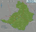
 Map of Big Bend National Park.png 3,252 × 2,899; 1.47 MB
-
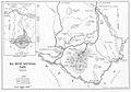 NPS big-bend-1944-map.jpg 1,392 × 969; 234 KB
-
 NPS big-bend-chisos-basin-campground-map.gif 1,574 × 1,079; 109 KB
-
 NPS big-bend-chisos-basin-detail-map.gif 1,160 × 741; 75 KB
-
 NPS big-bend-chisos-mountains-trail-map.jpg 1,486 × 1,982; 794 KB
-
 NPS big-bend-chisos-mountains-vegetation-map.jpg 1,088 × 1,260; 373 KB
-
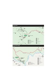 NPS big-bend-detail-maps.pdf 1,200 × 1,556; 622 KB
-
 NPS big-bend-fire-history-map.jpg 1,092 × 1,268; 264 KB
-
 NPS big-bend-map.jpg 3,289 × 2,956; 1.39 MB
-
 NPS big-bend-map.pdf 2,479 × 2,227; 7.46 MB
-
 NPS big-bend-national-park-map.jpg 2,985 × 2,662; 1.06 MB
-
 NPS big-bend-national-park-map.pdf 2,487 × 2,218; 6.83 MB
-
 NPS big-bend-night-sky-map.jpg 887 × 885; 144 KB
-
 NPS big-bend-regional-map.jpg 735 × 533; 92 KB
-
 NPS big-bend-regional-map.pdf 366 × 266; 201 KB
-
 NPS big-bend-rio-grande-village-campground-map.gif 2,014 × 1,046; 223 KB
-
 NPS big-bend-rio-grande-village-detail-map.gif 1,158 × 774; 104 KB
-
 NPS big-bend-simple-map.gif 1,795 × 1,289; 272 KB
-
 NPS big-bend-simple-map.pdf 1,795 × 1,289; 458 KB
-
 NPS big-bend-vegetation-map.jpg 1,088 × 1,264; 280 KB
-
 Official Big Bend National Park map2007.png 2,524 × 2,280; 3.63 MB


.png)
.svg)
.png)
.png)


