Category:Maps of Grand Canyon National Park
Jump to navigation
Jump to search
United States national parks: Acadia · American Samoa · Arches · Badlands · Big Bend · Biscayne · Black Canyon of the Gunnison · Bryce Canyon · Canyonlands · Capitol Reef · Carlsbad Caverns · Channel Islands · Congaree · Crater Lake · Cuyahoga Valley · Death Valley · Denali · Dry Tortugas · Everglades · Gateway Arch · Gates of the Arctic · Glacier · Glacier Bay · Grand Canyon · Grand Teton · Great Basin · Great Smoky Mountains · Guadalupe Mountains · Haleakalā · Hawaii Volcanoes · Hot Springs · Indiana Dunes · Isle Royale · Joshua Tree · Kenai Fjords · Kings Canyon · Kobuk Valley · Lake Clark · Lassen Volcanic · Mammoth Cave · Mesa Verde · Mount Rainier · North Cascades · Olympic · Petrified Forest · Pinnacles · Redwood · Rocky Mountain · Saguaro · Sequoia · Shenandoah · Theodore Roosevelt · Virgin Islands · Voyageurs · White Sands · Wind Cave · Wrangell-St. Elias · Yellowstone · Yosemite · Zion
English: Maps of Grand Canyon National Park
Wikimedia category | |||||
| Upload media | |||||
| Instance of | |||||
|---|---|---|---|---|---|
| Category combines topics | |||||
| Grand Canyon National Park | |||||
national park in Coconino and Mohave counties in Arizona, United States   | |||||
| Instance of | |||||
| Location |
| ||||
| Visitor center | |||||
| Operator | |||||
| Has part(s) | |||||
| Heritage designation |
| ||||
| IUCN protected areas category | |||||
| Inception |
| ||||
| Area |
| ||||
| Visitors per year |
| ||||
| Different from | |||||
| official website | |||||
 | |||||
Subcategories
This category has the following 4 subcategories, out of 4 total.
.
Media in category "Maps of Grand Canyon National Park"
The following 47 files are in this category, out of 47 total.
-
 Arizona State Route 389 map.svg 1,001 × 586; 89 KB
-
 Arizona State Route 67 map.svg 1,001 × 586; 76 KB
-
 Environmental and Cardiac Fatalities, Nankoweap to Royal Arch - Flickr - brewbooks.jpg 2,982 × 2,314; 3.28 MB
-
 Grand Canyon Hermit Road Detour Winter 2015 (December 1 through 18) (23447143556).jpg 3,500 × 2,373; 3.2 MB
-
 Grand Canyon National Park 2014 Annual Pass - Flickr - Grand Canyon NPS.jpg 3,044 × 1,904; 3.05 MB
-
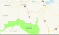
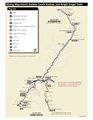
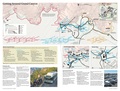
 Grand Canyon National Park, Regional Map (2012 revision) - Flickr - Grand Canyon NPS.jpg 2,963 × 2,550; 1.48 MB
-
 Grand Canyon, Arizona, USA - panoramio (14).jpg 5,184 × 3,456; 5.73 MB
-
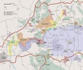
 NPS grand-canyon-bigger-regional-map.jpg 2,469 × 2,083; 675 KB
-
 NPS grand-canyon-bigger-regional-map.pdf 1,481 × 1,250; 1.52 MB
-
 NPS grand-canyon-bright-angel-trail-map.jpg 868 × 797; 154 KB
-
 NPS grand-canyon-classic-map.gif 3,638 × 2,375; 522 KB
-
 NPS grand-canyon-classic-map.pdf 2,183 × 1,425; 181 KB
-
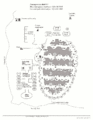
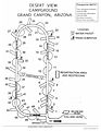 NPS grand-canyon-desert-view-campground-map.jpg 2,125 × 2,750; 504 KB
-
 NPS grand-canyon-hiking-map.jpg 1,871 × 2,626; 430 KB
-
 NPS grand-canyon-hiking-map.pdf 1,275 × 1,650, 2 pages; 247 KB
-
 NPS grand-canyon-mather-campground-map.gif 1,760 × 1,360; 236 KB
-
 NPS grand-canyon-national-park-map.jpg 3,536 × 2,676; 1.38 MB
-
 NPS grand-canyon-national-park-map.pdf 3,314 × 2,508; 15.2 MB
-
 NPS grand-canyon-north-rim-campground-map.gif 2,125 × 2,750; 204 KB
-
 NPS grand-canyon-north-rim-cape-royal-map.jpg 745 × 937; 138 KB
-
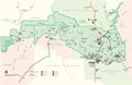
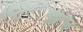 NPS grand-canyon-north-rim-map.jpg 2,692 × 1,064; 701 KB
-
 NPS grand-canyon-north-rim-map.pdf 1,614 × 637; 2.89 MB
-
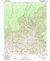 NPS grand-canyon-north-rim-topo-map.jpg 3,074 × 3,740; 3.61 MB
-
 NPS grand-canyon-north-rim-topo-map.pdf 3,293 × 4,006; 18.47 MB
-
 NPS grand-canyon-north-rim-trail-map.jpg 5,625 × 4,250; 3 MB
-
 NPS grand-canyon-north-rim-trail-map.pdf 3,375 × 2,550; 660 KB
-
 NPS grand-canyon-north-rim-visitor-center-map.jpg 1,432 × 1,826; 512 KB
-
 NPS grand-canyon-phantom-ranch-map.gif 1,398 × 1,699; 182 KB
-
 NPS grand-canyon-regional-map.jpg 1,196 × 1,105; 207 KB
-
 NPS grand-canyon-regional-map.pdf 716 × 662; 219 KB
-
 NPS grand-canyon-south-kaibab-trail-map.jpg 869 × 797; 153 KB
-
 NPS grand-canyon-south-rim-detail-map.jpg 2,205 × 988; 503 KB
-
 NPS grand-canyon-south-rim-detail-map.pdf 1,322 × 591; 3.69 MB
-
 NPS grand-canyon-south-rim-east-topo-map.jpg 3,078 × 3,754; 3.58 MB
-
 NPS grand-canyon-south-rim-east-topo-map.pdf 3,297 × 4,020; 17.08 MB
-
 NPS grand-canyon-south-rim-map.jpg 5,433 × 2,458; 2.6 MB
-
 NPS grand-canyon-south-rim-map.pdf 3,258 × 1,472; 13.71 MB
-
 NPS grand-canyon-south-rim-pocket-map.jpg 2,310 × 2,170; 655 KB
-
 NPS grand-canyon-south-rim-west-topo-map.jpg 3,079 × 3,762; 2.78 MB
-
 NPS grand-canyon-south-rim-west-topo-map.pdf 3,297 × 4,029; 12.96 MB
-
 NPS grand-canyon-topo-map.jpg 8,420 × 4,819; 8.89 MB
-
 NPS grand-canyon-transit-map-2013.jpg 5,625 × 4,250; 3.26 MB
-
 NPS grand-canyon-transit-map-2013.pdf 3,375 × 2,550; 1.5 MB
-
 NPS grand-canyon-visitor-center-map.jpg 668 × 448; 55 KB
-
 NPS grand-canyono-desert-view-map.jpg 803 × 991; 84 KB
-
 PacSo Grand Canyon Dams-01.png 1,979 × 1,313; 588 KB
-
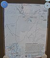 Toroweap Area map - Flickr - brewbooks.jpg 2,073 × 2,393; 1.62 MB


_(23447143556).jpg)

_-_Flickr_-_Grand_Canyon_NPS.jpg)
.jpg)


