Category:Geography of Butte County, California
Jump to navigation
Jump to search
Counties of California: Alameda · Alpine · Amador · Butte · Calaveras · Colusa · Contra Costa · Del Norte · El Dorado · Fresno · Glenn · Humboldt · Imperial · Inyo · Kern · Kings · Lake · Lassen · Los Angeles · Madera · Marin · Mariposa · Mendocino · Merced · Modoc · Mono · Monterey · Napa · Nevada · Orange · Placer · Plumas · Riverside · Sacramento · San Benito · San Bernardino · San Diego · San Joaquin · San Luis Obispo · San Mateo · Santa Barbara · Santa Clara · Santa Cruz · Shasta · Sierra · Siskiyou · Solano · Sonoma · Stanislaus ·Sutter · Tehama · Trinity · Tulare · Tuolumne · Ventura · Yolo · Yuba – Consolidated city-county: San Francisco
Wikimedia category | |||||
| Upload media | |||||
| Instance of | |||||
|---|---|---|---|---|---|
| Category combines topics | |||||
| Butte County | |||||
county in California, United States    | |||||
| Instance of | |||||
| Named after | |||||
| Location | California, Pacific States Region | ||||
| Capital | |||||
| Inception |
| ||||
| Population |
| ||||
| Area |
| ||||
| Different from | |||||
| official website | |||||
 | |||||
Subcategories
This category has the following 8 subcategories, out of 8 total.
Media in category "Geography of Butte County, California"
The following 13 files are in this category, out of 13 total.
-
 Bald Rock Dome (1).jpg 2,816 × 2,112; 1.07 MB
-
 Bald Rock Dome.jpg 2,816 × 2,112; 1.41 MB
-
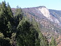
 Bald Rock In Northern California.jpg 3,264 × 2,448; 2.03 MB
-
 BigChicoCreek BidwellPark.jpg 800 × 604; 96 KB
-
 Butte County, CA.jpg 2,304 × 1,728; 1.7 MB
-
-
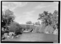
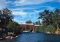 Honey Run Covered Bridge.jpg 4,733 × 3,357; 2.16 MB
-
 Oroville.jpg 1,935 × 2,008; 2.21 MB
-
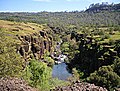
 South Table Mountain Butte County.jpg 3,264 × 2,448; 2 MB
-
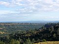
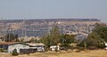 Table mountain from lp.jpg 2,640 × 1,412; 1.27 MB
-
 Thermalito afterbay trail.jpeg 2,592 × 1,936; 1.83 MB
-
 Thermalito afterbay water ski.jpeg 2,592 × 1,936; 1.93 MB
-
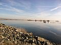
 Thermalito afterbay.jpeg 2,592 × 1,936; 1.89 MB
.jpg)


