Category:Geography of Alpine County, California
Jump to navigation
Jump to search
Counties of California: Alameda · Alpine · Amador · Butte · Calaveras · Colusa · Contra Costa · Del Norte · El Dorado · Fresno · Glenn · Humboldt · Imperial · Inyo · Kern · Kings · Lake · Lassen · Los Angeles · Madera · Marin · Mariposa · Mendocino · Merced · Modoc · Mono · Monterey · Napa · Nevada · Orange · Placer · Plumas · Riverside · Sacramento · San Benito · San Bernardino · San Diego · San Joaquin · San Luis Obispo · San Mateo · Santa Barbara · Santa Clara · Santa Cruz · Shasta · Sierra · Siskiyou · Solano · Sonoma · Stanislaus ·Sutter · Tehama · Trinity · Tulare · Tuolumne · Ventura · Yolo · Yuba – Consolidated city-county: San Francisco
- Geography of Alpine County — in the Eastern Sierra and Great Basin regions, eastern California.
Wikimedia category | |||||
| Upload media | |||||
| Instance of | |||||
|---|---|---|---|---|---|
| Category combines topics | |||||
| Alpine County | |||||
county in California, United States  Граница округа    | |||||
| Instance of | |||||
| Named after | |||||
| Location | California, Pacific States Region | ||||
| Capital | |||||
| Inception |
| ||||
| Population |
| ||||
| Area |
| ||||
| Different from | |||||
| official website | |||||
 | |||||
Subcategories
This category has the following 13 subcategories, out of 13 total.
*
C
E
- East Fork Carson River (1 F)
- Ebbetts Pass (12 F)
H
- Hope Valley, California (11 F)
L
S
- Silver Mountain, California (23 F)
Media in category "Geography of Alpine County, California"
The following 23 files are in this category, out of 23 total.
-
 Back of Round Top from end of Summit City Canyon - panoramio.jpg 2,560 × 1,920; 1.53 MB
-
 California fish and game (20520178441).jpg 1,626 × 2,308; 365 KB
-
 East of Upper Blue Lake - panoramio.jpg 1,824 × 1,368; 750 KB
-
 Fourth of July Lake, Alpine County.jpg 3,938 × 2,952; 4.24 MB
-
 Highland Peak, Sierra Nevada Range, Alpine County, California (21384522330).jpg 4,000 × 3,000; 4.43 MB
-
 Jobs Peak (155877704).jpg 600 × 450; 49 KB
-
 JobsPeak.jpg 1,024 × 768; 53 KB
-
 Lake Alpine, CA.jpg 1,600 × 1,200; 380 KB
-
 Lower Sunset Lake - panoramio.jpg 1,152 × 864; 414 KB
-
 Panorama of Lower Mosquito Lake.jpg 3,324 × 1,000; 824 KB
-
 A skier heading towards RoundTop Peak.JPG 1,534 × 1,090; 703 KB
-
 Cressent Couloir shot from the summit of Round Top Peak.JPG 1,224 × 1,632; 612 KB
-
 Silver Mountain 04.jpg 4,928 × 2,772; 11.21 MB
-
 Silver Mountain Peak; altitude 11,000 feet; Alpine County LCCN2002723004.jpg 1,536 × 1,454; 317 KB
-
 Silver Mountain Peak; altitude 11,000 feet; Alpine County LCCN2002723004.tif 1,536 × 1,454; 2.13 MB
-
 Silver Mountain Valley, from the Pass, Alpine County LCCN2002723005.jpg 1,536 × 1,448; 320 KB
-
 Silver Mountain Valley, from the Pass, Alpine County LCCN2002723005.tif 1,536 × 1,448; 2.12 MB
-
 Utica Reservoir Campsite.jpg 8,064 × 2,518; 8.51 MB
-
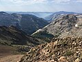
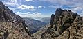
 View from Round Top Trail, Alpine County.jpg 5,520 × 2,528; 7.09 MB
-
 View from Round Top, Alpine County 2.jpg 5,440 × 2,530; 6.89 MB
-

-

-
 Winnemucca Lake, Alpine County.jpg 3,264 × 2,448; 4.08 MB

.jpg)


.jpg)
.jpg)


