Category:1685 maps
Jump to navigation
Jump to search
| ← 1680 1681 1682 1683 1684 1685 1686 1687 1688 1689 → |
Deutsch: Karten mit Bezug zum Jahr 1685
English: Maps related to the year 1685
Español: Mapas relativos al año 1685
Français : Cartes concernant l’an 1685
Русский: Карты 1685 года
Subcategories
This category has the following 8 subcategories, out of 8 total.
Media in category "1685 maps"
The following 51 files are in this category, out of 51 total.
-
 Jacob Peeters, Insula Di Candia Del Mare Mediteranea (FL35071107 2530471).jpg 6,724 × 4,013; 39.49 MB
-

-
 527 of 'History of New England. vol. 1-4' (11054930193).jpg 1,815 × 1,440; 727 KB
-
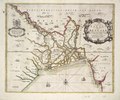
 A map of Rariton River, Milstone River, South River ... (1685) LOC 97683564.jpg 8,368 × 7,152; 6.7 MB
-
 A map of Rariton River, Milstone River, South River ... (1685) LOC 97683564.tif 8,368 × 7,152; 171.23 MB
-
-
 A new map of Carolina (8643472096).jpg 660 × 800; 122 KB
-
 Novissima totius tarrarum orbis tabula, Auctore Hugonis Allardi.jpg 6,000 × 4,826; 9.56 MB
-
 AMH-8632-NA Map of Nieuw Nederland featuring an inset showing Nieuw Amsterdam.jpg 2,400 × 2,028; 839 KB
-
 Amsterdam1685..jpg 3,150 × 2,719; 4.5 MB
-
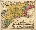
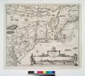
 Atlas Maior - Novi Belgii - four colors.jpg 6,912 × 5,824; 11.21 MB
-
 Belgii Novi, Angliae Novae, et partis Virginiae (NYPL Hades-118550-54677).tif 4,747 × 4,141; 56.25 MB
-
 Belgii novi, angliae novae, et partis Virginiae - novissima delineatio. NYPL433965.tiff 4,975 × 4,262; 60.67 MB
-
 Cremona nel 17esimo secolo.jpg 863 × 600; 263 KB
-
 Dirk Jansz van Santen - map finish comparison.jpg 640 × 815; 115 KB
-
 Fort frontenac.jpg 1,312 × 1,569; 1.15 MB
-
 Gerard Valck, Sinus Gangeticus Vulgo Golfo de Bengala Nova descriptio (FL25570030 2467393).jpg 15,008 × 12,765; 264.77 MB
-
 Guangdong yu tu LOC 2002626734.jpg 3,766 × 3,318; 1.81 MB
-
 Guangdong yu tu LOC 2002626734.tif 3,766 × 3,318; 35.75 MB
-
 Harteneck.1685.jpg 193 × 258; 48 KB
-
 Jacob Peeters, Bergh Sinai alias oreb (FL13720535 2368145).jpg 4,475 × 2,773; 15.3 MB
-
 Jacob Peeters, Constantinopelen (FL51871439 2369943).jpg 6,989 × 4,261; 38.68 MB
-
 Jacob Peeters, den Bergh uan oliueten (FL6880711 2368144).jpg 3,100 × 1,904; 2.39 MB
-
 Jacob Peeters, Ierusalem (FL6880459 2368143).jpg 3,500 × 1,649; 3.41 MB
-
 Jansson-Visscher map.jpg 1,728 × 1,456; 2.67 MB
-
 Karta över Kullaberg 1685.png 2,692 × 1,403; 5.08 MB
-

-

-

-
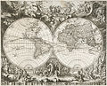
 Map of the southern polar regions, 1685.jpg 647 × 900; 421 KB
-

-
 Masatlan (and) Sallinas RMG F1810.tiff 6,632 × 5,280; 100.18 MB
-

-

-

-

-

-
-
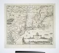
 NoviBelgii.jpg 1,607 × 1,375; 915 KB
-
 Novi Belgii Novaeque Angliae nec non partis Virginiae tabula (NYPL b14946244-434503).jpg 5,259 × 4,736; 5.38 MB
-
 Novi Belgii Novaeque Angliae nec non partis Virginiae tabula (NYPL b14946244-434503).tiff 5,259 × 4,744; 71.39 MB
-
 Route of Coronation 1685 Hall to Abbey.jpg 712 × 555; 183 KB
-
 Scarella - Yedikule.png 628 × 489; 191 KB
-

-
 UBBasel Map 1685 Kartenslg Schw A 111.tif 10,028 × 5,944, 2 pages; 170.56 MB
-
 UBBasel Map 1685 Kartenslg Schw A 112.tif 8,174 × 5,715, 2 pages; 133.68 MB
-
 UBBasel Map 1685 Kartenslg Schw A 112a.tif 7,403 × 4,831, 2 pages; 102.35 MB
-
 UBBasel Map 1685 VB A2-1-24.tif 11,847 × 8,770, 2 pages; 590.7 MB
-
 UBBasel Map Griechenland 1685 Kartenslg Mappe 250-33.tif 11,309 × 8,594, 2 pages; 278.09 MB
-
 Visscher - Novi Belgii Novaeque Angliae (Detail Nieuw Amsterdam).png 936 × 188; 360 KB
-
 臺灣府志鳳山縣治圖.jpg 320 × 218; 19 KB
.jpg)
.jpg)
.jpg)
_LOC_97683564.jpg)
.jpg)


.jpg)


.jpg)
.jpg)
.jpg)
.jpg)


.jpg)

.jpg)


.jpg)


.jpg)

.png)