Category:1683 maps
Jump to navigation
Jump to search
| ← · 1680 · 1681 · 1682 · 1683 · 1684 · 1685 · 1686 · 1687 · 1688 · 1689 · → |
Deutsch: Karten mit Bezug zum Jahr 1683
English: Maps related to the year 1683
Español: Mapas relativos al año 1683
Français : Cartes concernant l’an 1683
Русский: Карты 1683 года
Subcategories
This category has the following 5 subcategories, out of 5 total.
Media in category "1683 maps"
The following 37 files are in this category, out of 37 total.
-
 1683 Charles Ashcom, surveyor map (Chester Co.) (1b) DelCo Inst of Science.jpg 2,848 × 4,272; 2.29 MB
-
 1683 spy plan of Belgrade.jpg 2,365 × 1,726; 694 KB
-
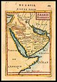
 Alain Manesson Mallet, Ancienne Arabie (FL33249822 2368747).jpg 3,252 × 5,026; 19.92 MB
-
 Alain Manesson Mallet, Arabie Moderne (FL33249819 2368748).jpg 2,997 × 4,296; 13.85 MB
-
-
 Alain Manesson Mallet, Turquie en Asie (FL36010533 2716042).jpg 3,267 × 5,039; 24.13 MB
-
 Ariañy en el Insula Maioricae Vicentius Mut (1683).jpg 857 × 552; 333 KB
-

-
 Den Bergh van oliveten (FL37124270 3901564).jpg 3,213 × 1,933; 2.69 MB
-

-
 Giacomo Cantelli, Isole dell India (FL25569952 2467642).jpg 15,342 × 11,735; 219.04 MB
-

-
 Giacomo Cantelli, Penisola dell India (FL25569998 2467653).jpg 12,081 × 15,331; 225.23 MB
-
 Giacomo Cantelli, Penisola dell India di qua dal Gange (FL35470376 2513726).jpg 12,011 × 14,999; 243.9 MB
-

-
 Insula Maioricae Vicentius Mut 1683.jpg 7,388 × 5,481; 16.82 MB
-
 Jamaica 1683 (Allain Mallet).png 1,958 × 636; 1.61 MB
-
 Jamaica 1683 (Allain Mallet).svg 1,836 × 596; 705 KB
-
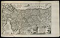
 Map of Anatolia, Description de L'Universe (Alain Manesson Mallet, 1683).jpg 725 × 1,078; 172 KB
-
 Map of ancient Europe, 1683.jpg 600 × 907; 219 KB
-
 Map of Asia Minor, Description de L'Universe (Alain Manesson Mallet, 1683).jpg 725 × 1,077; 165 KB
-
 Map of Cyprus, Description de L'Universe (Alain Manesson Mallet, 1683).jpg 725 × 1,078; 163 KB
-

-
 Map of the Philippines, 1683.jpg 725 × 1,078; 167 KB
-

-
 Mappemonde 1683.JPG 5,500 × 4,421; 16.13 MB
-
 Pas-kaart vande zee kusten inde boght van Niew Engeland (2675724522).jpg 2,000 × 1,793; 3.34 MB
-
 Plan der Stadt Wien und Umgebung im Jahre 1683 und 1883 Brigittenau.jpg 2,167 × 2,889; 2.1 MB
-

-
 Royaume de Chili 1683.png 625 × 863; 1.01 MB
-
 Taiwan di li tu LOC gm71005037.jpg 23,500 × 13,650; 31.3 MB
-
 UBBasel Map 1683 Kartenslg Schw A 104.tif 11,584 × 7,507, 2 pages; 248.82 MB
-
 UBBasel Map 1683 Kartenslg Schw A 105.tif 16,010 × 10,865, 2 pages; 497.7 MB
-
 UBBasel Map 1683 Kartenslg Schw A 106.tif 14,993 × 9,428, 2 pages; 404.44 MB
-
 UBBasel Map 1683 VB A2-1-21b.tif 11,109 × 6,939, 2 pages; 220.57 MB
-
 Vassal states of the Ottoman Empire in 1683 hu.svg 877 × 688; 397 KB
-
_(1b)_DelCo_Inst_of_Science.jpg)

.jpg)
.jpg)
.jpg)
.jpg)
.jpg)
.jpg)
.jpg)
.jpg)
.jpg)
.jpg)
.jpg)
.jpg)
.jpg)

.jpg)

.jpg)
.jpg)
.jpg)

.jpg)

.jpg)

.jpg)


.jpg)
.png)
.svg)