Category:1679 maps
Jump to navigation
Jump to search
| ← · 1670 · 1671 · 1672 · 1673 · 1674 · 1675 · 1676 · 1677 · 1678 · 1679 · → |
Deutsch: Karten mit Bezug zum Jahr 1679
English: Maps related to the year 1679
Español: Mapas relativos al año 1679
Français : Cartes concernant l’an 1679
Русский: Карты 1679 года
Subcategories
This category has the following 4 subcategories, out of 4 total.
Media in category "1679 maps"
The following 25 files are in this category, out of 25 total.
-
 America. NYPL465061.tiff 809 × 1,385; 3.23 MB
-
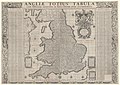 Angliae Totius Tabula 1679.jpg 12,043 × 8,542; 20.95 MB
-
 Atlantica, 1600-tal - Skoklosters slott - 102296.tif 3,087 × 4,587, 2 pages; 40.54 MB
-
 Canada, or, New France. NYPL465062.tiff 2,862 × 1,698; 13.91 MB
-
 Cette carte montre le chemin que Louis Jolliet a fait depuis Tadoussac.jpg 1,412 × 952; 277 KB
-
 Egypt-1679.jpg 800 × 538; 172 KB
-
 Jasper Danckaerts - Map based on - New York from Brooklyn Heights - 1679.jpg 3,000 × 999; 406 KB
-
 Jean-Baptiste Tavernier, Carte des isles du Iapon (FL37099043 2469228).jpg 18,890 × 13,639; 319.08 MB
-
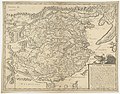
 Karta över Ungern, från 1679 - Skoklosters slott - 97996.tif 4,845 × 3,664; 50.81 MB
-

-

-
-
 Map of Diocese of Agen 1679.jpg 9,487 × 7,088; 18.84 MB
-

-

-
 Petrocorii Evesché de Sarlat partie meridionale de leslection de Perigord (5121160344).jpg 2,000 × 1,488; 2.89 MB
-
 Plansch i Atlantica, 1679 - Skoklosters slott - 102658.tif 3,070 × 5,102, 2 pages; 44.85 MB
-

-

-
 The English Empire in America. NYPL465063.tiff 2,862 × 1,746; 14.3 MB
-

-

-
 UBBasel Map 1679 Kartenslg Schw A 110 Helvetia.tiff 12,789 × 8,940, 2 pages; 327.13 MB
-
 UBBasel Map Philippinen Marianen 1679 Kartenslg Mappe 251-112.tif 6,250 × 3,692, 2 pages; 66.04 MB
-


.jpg)

.jpg)

.jpg)
.jpg)
.jpg)

.jpg)

.jpg)