Commons:Wiki Loves Monuments in Switzerland/Thurgau/L-S
Jump to navigation
Jump to search
Langrickenbach
| Location | Upload | Photo | Object | Cat. | Coordinates | KGS-Nr | |
|---|---|---|---|---|---|---|---|
| Langrickenbach | 
|
Ehemalige Gastwirtschaft Rössli | B | 47°34′43″N 9°14′57″E / 47.578621°N 9.249063°E | 11019 | ||
| Langrickenbach | 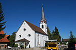
|
Reformierte Kirche | B | 47°35′38″N 9°14′52″E / 47.593862°N 9.247814°E | 11020 | ||
Lengwil
| Location | Upload | Photo | Object | Cat. | Coordinates | KGS-Nr | |
|---|---|---|---|---|---|---|---|
| Lengwil | 
|
Paritätische Kirche Oberhofen | B | 47°37′07″N 9°11′41″E / 47.618615°N 9.194773°E | 5130 | ||
| Lengwil | 
|
Schloss Liebburg | B | 47°37′32″N 9°12′09″E / 47.625435°N 9.202424°E | 5131 | ||
Lommis
| Location | Upload | Photo | Object | Cat. | Coordinates | KGS-Nr | |
|---|---|---|---|---|---|---|---|
| Lommis | 
|
Bauernhaus | B | 47°31′03″N 8°59′38″E / 47.517421°N 8.993943°E | 13765 | ||
| Lommis | 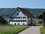
|
Ehemalige Mühle mit Säge | B | 47°31′08″N 8°59′44″E / 47.51884°N 8.995419°E | 13764 | ||
| Lommis | 
|
Katholische Kirche St. Jakob | B | 47°31′01″N 8°59′53″E / 47.516944°N 8.997966°E | 5097 | ||
| Lommis | 
|
Ökonomiebauten des Schlosses Lommis | B | 47°30′56″N 9°00′05″E / 47.515514°N 9.00127°E | 13763 | ||
Mammern
| Location | Upload | Photo | Object | Cat. | Coordinates | KGS-Nr | |
|---|---|---|---|---|---|---|---|
| Mammern | 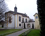
|
Schlosskapelle Mammern | A | 47°38′48″N 8°55′03″E / 47.646666666°N 8.9175°E | 5099 | ||
| Mammern | 
|
Wallfahrtskirche Mariahilf, Klingenzell | A | 47°38′15″N 8°53′58″E / 47.637559°N 8.89946°E | 5100 | ||
| Mammern | 
|
Burgruine Neuburg | B | 47°38′54″N 8°56′23″E / 47.648342°N 8.939824°E | 5101 | ||
| Mammern | 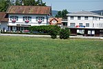
|
Ehemaliger Bahnhof | B | 47°38′39″N 8°54′50″E / 47.644167°N 8.913897°E | 11022 | ||
| Mammern | 
|
Gasthof Zum Schiff | B | 47°38′47″N 8°54′57″E / 47.646435°N 8.915917°E | 5103 | ||
| Mammern | 
|
Katholische Kirche St. Blasius | B | 47°38′45″N 8°55′00″E / 47.645867°N 8.916739°E | 11021 | ||
| Mammern | 
|
Eschenzer Becken | ISOS | 47°39′15″N 8°52′22″E / 47.6541°N 8.8728°E | |||
| Mammern | 
|
Mammern | ISOS | 47°38′43″N 8°54′56″E / 47.645277777°N 8.915555555°E | |||
Märstetten
Müllheim
| Location | Upload | Photo | Object | Cat. | Coordinates | KGS-Nr | |
|---|---|---|---|---|---|---|---|
| Müllheim | 
|
Ehemalige Mühle Maltbach | B | 47°36′08″N 8°59′11″E / 47.602222°N 8.986452°E | 11028 | ||
| Müllheim | 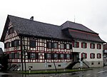
|
Gasthof Löwen | B | 47°36′16″N 9°00′35″E / 47.604463°N 9.009794°E | 13770 | ||
| Müllheim | Reformierte Kirche St. Verena | Reformierte Kirche St. Verena | B | 47°36′17″N 9°00′33″E / 47.604634°N 9.00912°E | 5115 | ||
Münchwilen
| Location | Upload | Photo | Object | Cat. | Coordinates | KGS-Nr | |
|---|---|---|---|---|---|---|---|
| Münchwilen | 
|
Kapelle St. Margarethen | A | 47°29′11″N 9°00′05″E / 47.4865°N 9.0013°E | 5116 | ||
| Münchwilen | 
|
Bezirksgebäude / Gerichtshaus | B | 47°28′40″N 8°59′50″E / 47.477724°N 8.997215°E | 5117 | ||
| Münchwilen | 
|
Bildkapelle Pilgerhüsli | B | 47°29′21″N 9°00′16″E / 47.489077°N 9.004502°E | 13775 | ||
| Münchwilen | 
|
Ehemalige Weberei / Ehemaliges Mädchenheim | B | 47°28′46″N 8°59′46″E / 47.479545°N 8.996247°E | 13771 | ||
| Münchwilen | 
|
Ehemalige Weberei und Strumpffabrik | B | 47°28′44″N 8°59′41″E / 47.478943°N 8.994809°E | 13774 | ||
| Münchwilen | 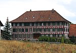
|
Ehemaliges Gasthaus Freudenberg | B | 47°28′26″N 8°58′56″E / 47.473957°N 8.982271°E | 5118 | ||
| Münchwilen | 
|
Ehemaliges Schulhaus | B | 47°28′35″N 8°59′24″E / 47.476442°N 8.990119°E | 13772 | ||
| Münchwilen | 
|
Primarschulhaus | B | 47°28′40″N 8°59′40″E / 47.477705°N 8.994561°E | 13773 | ||
Münsterlingen
| Location | Upload | Photo | Object | Cat. | Coordinates | KGS-Nr | |
|---|---|---|---|---|---|---|---|
| Münsterlingen | 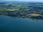
|
Münsterlingen TG | ISOS | 47°37′53″N 9°14′01″E / 47.6313°N 9.2337°E | |||
| Münsterlingen | 
|
Kloster Münsterlingen | A | 47°38′06″N 9°13′54″E / 47.635083333°N 9.231577777°E | 5120 | ||
| Münsterlingen | 
|
Kapelle St. Leonhard, Landschlacht | A | 47°37′32″N 9°14′41″E / 47.625595°N 9.244704°E | 5119 | ||
| Münsterlingen | 
|
Bauernhaus | B | 47°37′49″N 9°13′26″E / 47.630207°N 9.223955°E | 5122 | ||
| Münsterlingen | 
|
Ehemaliges Zehnthaus | B | 47°37′32″N 9°15′00″E / 47.62551°N 9.250051°E | 5121 | ||
Neunforn
| Location | Upload | Photo | Object | Cat. | Coordinates | KGS-Nr | |
|---|---|---|---|---|---|---|---|
| Neunforn | 
|
Reformierte Kirche | A | 47°36′22″N 8°46′01″E / 47.60605°N 8.766839°E | 5132 | ||
| Neunforn | 
|
Ehemaliges Trottengebäude | B | 47°36′23″N 8°46′10″E / 47.606462°N 8.76939°E | 11030 | ||
| Neunforn | 
|
Reformierte Kapelle mit Feuerwehrdepot | B | 47°35′46″N 8°46′48″E / 47.596139°N 8.780022°E | 5124 | ||
| Neunforn | 
|
Reformiertes Pfarrhaus | B | 47°36′22″N 8°45′59″E / 47.606074°N 8.766348°E | 13776 | ||
| Neunforn | 
|
Wohnhaus Fahrhof | B | 47°35′46″N 8°45′19″E / 47.596235°N 8.755158°E | 13777 | ||
Pfyn
| Location | Upload | Photo | Object | Cat. | Coordinates | KGS-Nr | |
|---|---|---|---|---|---|---|---|
| Pfyn | 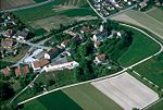
|
Kastell Pfyn | A | 47°35′40″N 8°57′41″E / 47.5944°N 8.96144°E | 5137 | ||
| Pfyn | 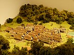
|
Breitenloo, prähistorische Seeufersiedlung | A | 47°35′40″N 8°55′54″E / 47.594474°N 8.931785°E | 9678 | ||
| Pfyn | 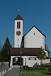
|
Pariätische Kirche St. Batholomäus | A | 47°35′40″N 8°57′40″E / 47.594317°N 8.961209°E | 10224 | ||
| Pfyn | 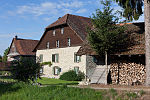
|
Bauernhaus | B | 47°35′53″N 8°57′11″E / 47.598183°N 8.953061°E | 13778 | ||
| Pfyn | 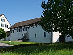
|
Ehemalige Schlosstrotte | B | 47°35′39″N 8°57′33″E / 47.594119°N 8.959168°E | 13779 | ||
| Pfyn | 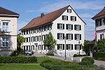
|
Schloss | B | 47°35′39″N 8°57′35″E / 47.594284°N 8.959585°E | 13780 | ||
Raperswilen
| Location | Upload | Photo | Object | Cat. | Coordinates | KGS-Nr | |
|---|---|---|---|---|---|---|---|
| Raperswilen | 
|
Schanz, Erdwerk | B | 47°37′21″N 9°01′28″E / 47.622481°N 9.024377°E | 13884 | ||
Rickenbach
| Location | Upload | Photo | Object | Cat. | Coordinates | KGS-Nr | |
|---|---|---|---|---|---|---|---|
| Rickenbach | 
|
Katholische Pfarrkirche St. Verena | B | 47°26′55″N 9°03′07″E / 47.448627°N 9.051996°E | 11031 | ||
Roggwil
| Location | Upload | Photo | Object | Cat. | Coordinates | KGS-Nr | |
|---|---|---|---|---|---|---|---|
| Roggwil | Schloss Mammertshofen | Schloss Mammertshofen | A | 47°29′41″N 9°23′53″E / 47.494722222°N 9.398055555°E | 5142 | ||
| Roggwil | 
|
Gasthof Traube | A | 47°30′01″N 9°23′45″E / 47.500289°N 9.395736°E | 10225 | ||
| Roggwil | 
|
Bauernhaus | B | 47°30′43″N 9°23′46″E / 47.511806°N 9.39624°E | 13782 | ||
| Roggwil | 
|
Ehemaliger Kehlhof | B | 47°31′12″N 9°23′50″E / 47.520137°N 9.397277°E | 13783 | ||
| Roggwil | 
|
Reformierte Kirche | B | 47°30′00″N 9°23′47″E / 47.500126°N 9.396341°E | 5144 | ||
| Roggwil | 
|
Schloss Freihof | B | 47°29′10″N 9°23′51″E / 47.486141°N 9.397618°E | 13781 | ||
| Roggwil | 
|
Schloss Roggwil | B | 47°30′02″N 9°23′42″E / 47.500633°N 9.395085°E | 5143 | ||
Romanshorn
| Location | Upload | Photo | Object | Cat. | Coordinates | KGS-Nr | |
|---|---|---|---|---|---|---|---|
| Romanshorn | 
|
Alte paritätische Kirche | A | 47°34′08″N 9°22′56″E / 47.568756°N 9.382241°E | 5145 | ||
| Romanshorn | Katholische Kirche St. Johannes der Täufer | Katholische Kirche St. Johannes der Täufer | A | 47°34′08″N 9°22′51″E / 47.568754°N 9.380712°E | 10226 | ||
| Romanshorn | 
|
Alte Turnhalle | B | 47°33′55″N 9°22′28″E / 47.565233°N 9.374496°E | 13790 | ||
| Romanshorn | 
|
Bauernhaus | B | 47°33′24″N 9°20′06″E / 47.556555°N 9.335093°E | 13786 | ||
| Romanshorn | 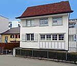
|
Bauernhaus | B | 47°34′01″N 9°22′43″E / 47.566999°N 9.378628°E | 13794 | ||
| Romanshorn | 
|
Bauernhaus | B | 47°33′13″N 9°20′07″E / 47.553491°N 9.335383°E | 13787 | ||
| Romanshorn | 
|
Bauten der ehemaligen Alkoholverwaltung | B | 47°33′28″N 9°22′31″E / 47.557788°N 9.375314°E | 13907 | ||
| Romanshorn | 
|
Ehemalige Wäschefabrik | B | 47°33′56″N 9°22′18″E / 47.565458°N 9.371792°E | 13789 | ||
| Romanshorn | 
|
Gasthof zum Schiff | B | 47°34′04″N 9°22′48″E / 47.567694°N 9.380075°E | 11034 | ||
| Romanshorn | 
|
Geschäftshaus Thurgauer Kantonalbank | B | 47°33′57″N 9°22′33″E / 47.565824°N 9.375753°E | 13795 | ||
| Romanshorn | Hotel Restaurant Zum Schloss | Hotel Restaurant Zum Schloss | B | 47°34′07″N 9°22′55″E / 47.568624°N 9.382077°E | 10227 | ||
| Romanshorn | 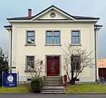
|
Kaplanei / Kindergarten | B | 47°34′09″N 9°22′46″E / 47.569044°N 9.37954°E | 13793 | ||
| Romanshorn | 
|
Primar-/Oberschulhaus | B | 47°33′56″N 9°22′27″E / 47.56558°N 9.374203°E | 13792 | ||
| Romanshorn | 
|
Primarschule Rebsamen | B | 47°33′56″N 9°22′30″E / 47.565612°N 9.374948°E | 13791 | ||
| Romanshorn | 
|
Reformierte Kirche | B | 47°33′53″N 9°22′10″E / 47.564778°N 9.369375°E | 13785 | ||
| Romanshorn | 
|
Villa | B | 47°33′41″N 9°22′34″E / 47.561364°N 9.376109°E | 13788 | ||
| Romanshorn | 
|
Wohnhaus | B | 47°33′59″N 9°22′44″E / 47.566482°N 9.378861°E | 11033 | ||
| Romanshorn | 
|
Wohnhaus | B | 47°34′04″N 9°22′42″E / 47.567869°N 9.378261°E | 11035 | ||
| Romanshorn | 
|
Wohnhaus | B | 47°33′58″N 9°21′54″E / 47.56621°N 9.364974°E | 13784 | ||
| Romanshorn | 
|
Wohnhäuser Fischerhäuser | B | 47°33′53″N 9°22′43″E / 47.564598°N 9.37854°E | 13796 | ||
| Romanshorn | [[File:RomanshornBahnhofHafen.jpg, Bahnhofplatz Romanshorn.jpg, SBB Historic - F 122 00869 006 - Romanshorn Bahnhofgebaeude Strassenseite.jpg, SBB Historic - F 122 00869 007 - Romanshorn Bahnhofgebaeude Strassenseite.jpg and SBB Historic - F 122 00869 005 - Romanshorn Bahnhofgebaeude Bahnseite.jpg|150x150px|Bahnhof Romanshorn]] | Bahnhof Romanshorn | A | 47°34′00″N 9°23′00″E / 47.5667°N 9.38333°E | 5146 | ||
Salenstein
| Location | Upload | Photo | Object | Cat. | Coordinates | KGS-Nr | |
|---|---|---|---|---|---|---|---|
| Salenstein | Schloss Eugensberg | Schloss Eugensberg | A | 47°40′00″N 9°02′36″E / 47.666666666°N 9.043333333°E | 5150 | ||
| Salenstein | 
|
Schloss Hubberg | B | 47°39′28″N 9°04′02″E / 47.6577°N 9.06724°E | 11036 | ||
| Salenstein | 
|
Schloss Louisenberg | A | 47°40′19″N 9°02′55″E / 47.671830555°N 9.048555555°E | 5148 | ||
| Salenstein | 
|
Napoleonmuseum Thurgau | A | 47°40′22″N 9°03′33″E / 47.67269°N 9.05925°E | 8465 | ||
| Salenstein | 
|
Wallfahrtskapelle St. Aloysius | A | 47°40′18″N 9°02′55″E / 47.671657°N 9.048621°E | 10228 | ||
| Salenstein | 
|
Bahnhof Mannenbach | B | 47°40′25″N 9°03′10″E / 47.673607°N 9.052689°E | 13812 | ||
| Salenstein | 
|
Musikaliensammlung Schloss Arenenberg | B | 47°40′21″N 9°03′33″E / 47.672635°N 9.059172°E | 9545 | ||
| Salenstein | 
|
Schloss Salenstein | B | 47°40′11″N 9°03′20″E / 47.669797°N 9.055596°E | 5151 | ||
| Salenstein | 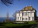
|
Arenenberg | A | 47°40′22″N 9°03′33″E / 47.672777777°N 9.059166666°E | 5149 | ||
Schlatt
| Location | Upload | Photo | Object | Cat. | Coordinates | KGS-Nr | |
|---|---|---|---|---|---|---|---|
| Schlatt | Eisenbibliothek | Eisenbibliothek | B | 47°41′04″N 8°40′33″E / 47.684418°N 8.675844°E | 13893 | ||
| Schlatt | 
|
Doppelbauernhaus, Alt Paradies | A | 47°40′59″N 8°40′40″E / 47.683067°N 8.677731°E | 10252 | ||
| Schlatt | 
|
Bauernhaus | B | 47°39′20″N 8°41′54″E / 47.65569°N 8.698418°E | 13814 | ||
| Schlatt | 
|
Ehemaliger Speicher | B | 47°38′53″N 8°43′26″E / 47.648018°N 8.723872°E | 13818 | ||
| Schlatt | 
|
Glockenturm | B | 47°39′22″N 8°41′59″E / 47.656126°N 8.699666°E | 13813 | ||
| Schlatt | 
|
Reformierte Kirche | B | 47°39′36″N 8°42′14″E / 47.660029°N 8.703873°E | 11040 | ||
| Schlatt | 
|
Steckhof | B | 47°38′53″N 8°43′27″E / 47.647941°N 8.724282°E | 13817 | ||
| Schlatt | 
|
Torhaus des Klosters Paradies | B | 47°41′00″N 8°40′38″E / 47.683387°N 8.6771335°E | 13890 | ||
| Schlatt | 
|
Wohnhaus | B | 47°38′52″N 8°43′24″E / 47.647745°N 8.723372°E | 13819 | ||
| Schlatt | 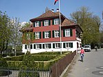
|
Wohnhaus Paradies / Ehemalige Wirtschaft Zum Kreuz | B | 47°30′55″N 9°25′47″E / 47.515229°N 9.429739°E | 13816 | ||
Schönholzerswilen
| Location | Upload | Photo | Object | Cat. | Coordinates | KGS-Nr | |
|---|---|---|---|---|---|---|---|
| Schönholzerswilen | 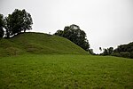
|
Toos-Waldi, bronzezeitliche Höhensiedlung | A | 47°31′28″N 9°06′51″E / 47.524425°N 9.114153°E | 5153 | ||
| Schönholzerswilen | 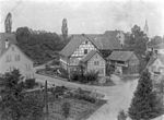
|
Altes Schweizerhaus | B | 47°30′58″N 9°08′24″E / 47.516247°N 9.140108°E | 13823 | ||
| Schönholzerswilen | 
|
Bauernhaus | B | 47°31′04″N 9°08′22″E / 47.517723°N 9.139465°E | 13821 | ||
| Schönholzerswilen | 
|
Burg Wunnenberg | B | 47°31′03″N 9°09′21″E / 47.517429°N 9.155762°E | 13885 | ||
| Schönholzerswilen | 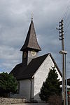
|
Katholische Kirche St. Markus | B | 47°31′01″N 9°08′27″E / 47.517001°N 9.140862°E | 5154 | ||
| Schönholzerswilen | 
|
Reformierte Kirche | B | 47°31′05″N 9°08′19″E / 47.518042°N 9.138572°E | 5155 | ||
| Schönholzerswilen | 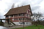
|
Reformiertes Pfarrhaus | B | 47°31′06″N 9°08′21″E / 47.518197°N 9.139028°E | 13820 | ||
| Schönholzerswilen | 
|
Wohnhaus | B | 47°31′10″N 9°06′18″E / 47.519394°N 9.104964°E | 13824 | ||
| Schönholzerswilen | 
|
Wohnhaus | B | 47°31′00″N 9°08′23″E / 47.516741°N 9.139593°E | 13822 | ||
Schweiz
| Location | Upload | Photo | Object | Cat. | Coordinates | KGS-Nr | |
|---|---|---|---|---|---|---|---|
| Schweiz | 
|
Schaaren (Gebiet) | A | 47°41′13″N 8°41′48″E / 47.6869°N 8.69654°E | 9620 | ||
Sirnach
| Location | Upload | Photo | Object | Cat. | Coordinates | KGS-Nr | |
|---|---|---|---|---|---|---|---|
| Sirnach | 
|
Bauernhaus | B | 47°27′31″N 9°00′51″E / 47.458703°N 9.014074°E | 13830 | ||
| Sirnach | 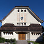
|
Ehemalige Turnhalle / Gemeindezentrum | B | 47°27′47″N 8°59′52″E / 47.463027°N 8.99766°E | 13827 | ||
| Sirnach | 
|
Ehemaliges reformiertes Pfarr- und Schulhaus | B | 47°27′46″N 8°59′49″E / 47.462657°N 8.997079°E | 11038 | ||
| Sirnach | 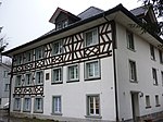
|
Fischinger Mühle | B | 47°27′25″N 8°59′20″E / 47.457081°N 8.988984°E | 13829 | ||
| Sirnach | 
|
Gasthof Engel | B | 47°27′42″N 8°59′48″E / 47.461576°N 8.99653°E | 11037 | ||
| Sirnach | 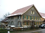
|
Hof Rütibach | B | 47°27′16″N 8°59′12″E / 47.454404°N 8.986651°E | 13825 | ||
| Sirnach | 
|
Reformierte Kirche | B | 47°27′35″N 8°59′48″E / 47.459675°N 8.996753°E | 13826 | ||
| Sirnach | 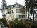
|
Villa | B | 47°27′29″N 8°59′21″E / 47.458085°N 8.989199°E | 13828 | ||
Sommeri
| Location | Upload | Photo | Object | Cat. | Coordinates | KGS-Nr | |
|---|---|---|---|---|---|---|---|
| Sommeri | 
|
Paritätische Kirche St. Mauritius | B | 47°34′02″N 9°17′24″E / 47.567115°N 9.29009°E | 5160 | ||
| Sommeri | 
|
Wohnhaus | B | 47°33′51″N 9°17′25″E / 47.564252°N 9.290229°E | 13831 | ||
Steckborn
Stettfurt
| Location | Upload | Photo | Object | Cat. | Coordinates | KGS-Nr | |
|---|---|---|---|---|---|---|---|
| Stettfurt | 
|
Schloss Sonnenberg | A | 47°31′42″N 8°57′43″E / 47.5282°N 8.96187°E | 5174 | ||
| Stettfurt | 
|
Bauernhaus | B | 47°32′06″N 8°57′09″E / 47.535024°N 8.952603°E | 11048 | ||
| Stettfurt | 
|
Bauernhaus | B | 47°31′28″N 8°57′20″E / 47.524541°N 8.955559°E | 11055 | ||
| Stettfurt | 
|
Ehemaliges Gasthaus Zur Kreuzstrasse | B | 47°31′27″N 8°57′17″E / 47.52413°N 8.954684°E | 13807 | ||
| Stettfurt | 
|
Gartenhaus | B | 47°31′25″N 8°57′17″E / 47.523662°N 8.954737°E | 13806 | ||
| Stettfurt | 
|
Gemeindehaus / Ehemaliges Restaurant Kreuzstrasse | B | 47°31′27″N 8°57′18″E / 47.524305°N 8.955074°E | 11050 | ||
| Stettfurt | 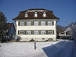
|
Primarschulhaus | B | 47°31′30″N 8°57′17″E / 47.524941°N 8.954614°E | 11056 | ||
| Stettfurt | 
|
Reformierte Kirche | B | 47°31′28″N 8°57′15″E / 47.524534°N 8.954071°E | 11052 | ||
| Stettfurt | 
|
Sonnenberg, prähistorische Siedlungsstelle | B | 47°31′42″N 8°57′42″E / 47.528238°N 8.9618°E | 13886 | ||
| Stettfurt | 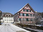
|
Wohnhaus / Ehemaliges Messmerhaus | B | 47°31′29″N 8°57′17″E / 47.524626°N 8.954592°E | 11051 | ||
| Stettfurt | 
|
Wohnhaus Lydiaheim | B | 47°31′26″N 8°57′19″E / 47.523997°N 8.955198°E | 11053 | ||
| Stettfurt | 
|
Wohnhaus Wüthrich | B | 47°31′28″N 8°57′17″E / 47.524363°N 8.954757°E | 11049 | ||
Sulgen
| Location | Upload | Photo | Object | Cat. | Coordinates | KGS-Nr | |
|---|---|---|---|---|---|---|---|
| Sulgen | 
|
Ehemalige Wirtschaft Traube | B | 47°32′08″N 9°12′59″E / 47.535693°N 9.216476°E | 13808 | ||
| Sulgen | 
|
Reformierte Kirche | B | 47°32′35″N 9°11′01″E / 47.542983°N 9.183678°E | 5176 | ||
| Sulgen | 
|
Wohnhaus Lindenhof | B | 47°32′51″N 9°12′07″E / 47.547483°N 9.202016°E | 11039 | ||


