Category:Rebsamenschulhaus
Jump to navigation
Jump to search
| Object location | | View all coordinates using: OpenStreetMap |
|---|
 | |||||
| Upload media | |||||
| Instance of | |||||
|---|---|---|---|---|---|
| Part of | |||||
| Location |
| ||||
| Street address |
| ||||
| Heritage designation | |||||
 | |||||
|
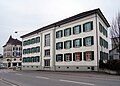
This is a category about a cultural property of national significance in Switzerland with KGS number 13791
|
Media in category "Rebsamenschulhaus"
The following 12 files are in this category, out of 12 total.
-
 ETH-BIB-Romanshorn v. S. W. aus 300 m-Inlandflüge-LBS MH01-004109.tif 5,875 × 3,964; 66.79 MB
-
 Kantonalbank Thurgau - panoramio.jpg 2,630 × 1,931; 1.28 MB
-
 RomanshornBahnhofstr24.jpg 3,548 × 3,195; 6.73 MB
-
 RomanshornHafenstrasseTKB.jpg 4,362 × 2,883; 5.94 MB
-
 RomanshornRebsamen&Co.jpg 4,284 × 2,907; 7.13 MB
-
 RomanshornRebsamen.jpg 4,873 × 3,475; 8.42 MB
-
 RomanshornRebsamenOberschulhaus.jpg 4,821 × 3,355; 10.13 MB
-
 RomanshornRebsamenschulhaus.jpg 4,919 × 3,381; 8 MB
-
 RomanshornRebsamenschulhaus1.jpg 4,090 × 3,072; 7.75 MB
-
 RomanshornRebsamenTKBetc.jpg 4,872 × 3,888; 9.82 MB
-
 RomanshornSchulhaeuser.jpg 4,736 × 2,947; 7.5 MB
-
 RomanshornSpritzenhaus1.jpg 4,572 × 3,088; 6.96 MB


