Commons:Graphic Lab/Map workshop/Archive/2016
 | This is an archive of past discussions. Do not edit the contents of this page. If you wish to start a new discussion or revive an old one, please do so on the current talk page. |
W3C compliant SVG file rendered as text, not image
-
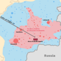
 Location of Hendaye in Labourd

- Article(s)
- eu:Hendaia
- Request
- I uploaded a new version of the map that passed the W3C validator test (I uploaded it to W3C before doing so in Commons). However, now, each time I click on the image to see the original size, I expect to see it rendered in the browser. But, in this case I only get to see the source code of the SVG, not the rendered image itself as with other SVGs. Both with Firefox and Chromiun. How can I fix this and make the SVG map both W3C compliant and rendered on the browser? Thank you. --Janfri (talk) 12:01, 19 January 2016 (UTC)
- Graphist opinion(s)
You need <?xml version="1.0" encoding="utf-8"?> before <svg> tag. It's weird that the "all raw code" bug only happens when you directly load the SVG from Wikimedia server. When I download the file to my harddisk and open in Firefox the image renders normally. -- Sameboat - 同舟 (talk · contri.) 14:40, 19 January 2016 (UTC)
- Thank you very much Sameboat!! --Janfri (talk) 14:54, 21 January 2016 (UTC)
- This section was archived on a request by: Janfri (talk) 14:54, 21 January 2016 (UTC)
Map of countries served directly by London Gatwick

- Article(s)
- voy:Gatwick Airport
- Request
Could someone shade in India, Costa Rica, Nigeria and the Czech Republic please, as they are all served directly by Gatwick. The links here can prove that: to Lagos, Nigeria (let it load, then click Direct on the left), to Goa, India, to Prague, Czech Republic, to San José, Costa Rica. I am asking here because I do not know how to update these files and it is used on the Wikivoyage guide for Gatwick Airport. Thank you! (I've already asked for help at the Help Desk and the map creator's talk page with no response) --Seagull123 (talk) 18:37, 15 February 2016 (UTC)- Don't worry, MarrickLip has updated this map. Seagull123 (talk) 12:05, 16 February 2016 (UTC)
- Graphist opinion(s)
- This section was archived on a request by: Seagull123 (talk) 12:05, 16 February 2016 (UTC)
Help reducing the size of Asia Minor ca 842 AD-V3DisDeImpSHPSimpl.svg
- This section was archived on a request by: Rowanwindwhistler (talk) 16:31, 11 April 2016 (UTC)
-
 Asia MInor in 842

- Article(s)
- es:Batalla de Lalakaon and others
- Request
- Just in case this is right and I should have asked here instead of here. Is any one able to reduce the size of the above SVG map without loosing too much detail so that it gets rendered in both Commons & Wikipedia? No matter what I try I cannot make it smaller without breaking it... I would also welcome any advide on making these SVGs lighter (with as little loss of detail as possible) and would like to know whether there is any rendering limit for SVG in Commons/Wikipedia (as it seems a file smaller than 10M has no problem getting rendered). Thank you!--Rowanwindwhistler (talk) 06:00, 31 March 2016 (UTC)
- Graphist opinion(s)
North Hesse
-
 Regierungsbezirk Kassel

Request:
- I need a map from North Hesse, this map overhead isn't from North Hessen, but Regierungsbezirk Kassel. The districts Landkreis Hersfeld-Rotenburg und Landkreis Fulda aren't in North Hesse, but Eastern Hesse. Yours faithfully -- Feuermond16 (talk) 10:41, 24 June 2014 (UTC)
Graphist opinion(s):
- Die richtige Stelle für deine Anfrage wäre die Kartenwerkstatt in der deutschen WP -- Maxxl² - talk 10:12, 25 June 2014 (UTC)
- Da habe ich auch schon angefragt, leider bis jetzt ohne Erfolg. Gruß -- Feuermond16 (talk) 11:36, 25 June 2014 (UTC)
- Dann sprich doch bitte den Autor der Datei NNW direkt an. Nach meiner sehr positive Erfahrung hat er noch nie eines seiner "Kinder" im Stich gelassen. Er hilft bestimmt. Da bin ich ganz sicher. -- Maxxl² - talk 11:50, 25 June 2014 (UTC)
- Danke, werde ich machen! In der Grafikwerkstatt hatte ich ja auch eine Anfrage gestellt, mal gucken was daraus wird. -- Feuermond16 (talk) 12:34, 25 June 2014 (UTC)
Ponte Rotto
Article(s): fr:Nécropole de Ponte Rotto, it:Siti archeologici dell'Italia antica
Request:
- Could someone create a map like this please? This one is a JPEG, and should be deleted as derivative work. --Yann (talk) 20:15, 24 October 2014 (UTC)
Graphist opinion(s):
- Have you forgotten to add a link because I can't see which map you want a svg version of? --Goran tek-en (talk) 15:51, 10 November 2014 (UTC)
Diocese map fixing
-
 Archdiocese of Boston map
 -
 Diocese of Fall River map


Article(s): Archdiocese of Boston, Diocese of Fall River
Request:
- Essentially, both maps include a few towns within the respective counties that are in the other diocese. If possible, would it be possible to remove the towns to show that certain towns are linked to the correct dioceses? Thanks! --Kevin Rutherford (talk) 04:24, 17 November 2014 (UTC)
Graphist opinion(s):
- @Ktr101: You will have t be more specific. Most of us graphic workers has ZERO knowledge of your favorite topic, thanks. --Goran tek-en (talk) 18:13, 3 October 2015 (UTC)
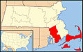
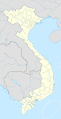
Location maps of South East Asia.svg
-
 Indonesia
 -
 Malaysia
 -
 Singapore
 -
 Thailand
 -
 Brunei
 -
 Vietnam
 -
 Cambodia
 -
 Laos
Laos -
 Myanmar
 -
 Philippines
 -
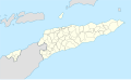 East Timor


- Article(s)
- en:2014 AFF Championship, en:2012 AFF Championship, en:2010 AFF Championship, en:SEA Games etc
- Request
- Please make the location map of South East Asia (one map that consist of all countries in South East Asia Region). This location maps is very important because in that articles the contributors only can use asian location maps. Asian location maps couldn't interpret the location of headquarter, the city of that region, etc. Thank you. --User:Riskykurniawan 07.30, 27 November 2014 (UTC)
- Graphist opinion(s)
Subnational entities on world map?
-
 this is how treaty maps are easily coloured using codes like ".nl, .ca" somewhere at the top to colour those 2 countries
 -
 The base map containg the ISO3166 alpha 2 codes for colouring
 -
 maps where a second level subdivision is needed for some colouring;


- Article(s)
-
- Many possibilities. I want to use them now on Cape Town Treaty, where the Aircraft protocol does not apply to new brunswick... But it would also enable easier updating of maps in Category:SVG maps of the world with subnational borders, which is now often a specialist work or "breaking the nice svg-code" colouring
- Request
- There are several world maps that combine information on laws of both national and subnational jurisdictions. For example w:speed limits by country are controlled mostly by federal law, but in certain systems (notably the US) by state law. The need for a second level subdivision is mainly seen for Canada, the US, the UK and Australia. There are several maps that include second level subdivisions of those states (see above), but none of them are easily editable with a text editor as the world maps are. I therefore think that a
- worldmap based on File:BlankMap-World6.svg
- with second level subdivisions of Canada, the US, the UK and Australia
- for which the colouring can be indicated through w:ISO 3166-2 (e.g. w:ISO 3166-2:CA with British Columbia as ca-bc)
- where the subnational borders can be "switched on" and "switched off"
Would that be possible? Maybe good to start with Canada and from there see how it is working? Thanks in advance! --L.tak (talk) 15:58, 28 December 2014 (UTC)
- Graphist opinion(s)
Map to SVG
-
 Map of the water way from Rotterdam to Constanţa

- Article(s)
Used in few atricles, can see in the file page.
- Request
- Hi, i want to ask to transfer this map to SVG, it will make the translation much easier and it's better also to use the SVG photo in the original English, thanks --Eitan96 (talk) 20:17, 23 April 2016 (UTC)
- Graphist opinion(s)
- I created it myself. :This section was archived on a request by: Eitan96 (talk) 15:16, 15 June 2016 (UTC)
Numidia-moved from illustration lab
- This section was archived on a request by: Offnfopt(talk) 01:15, 4 July 2016 (UTC)

Request: English version please... Kintetsubuffalo (talk) 05:12, 2 March 2012 (UTC)
- Have you tried SVGtranslate? -- πϵρήλιο ℗ 13:56, 7 March 2012 (UTC)
- Not a tech guy, so I wouldn't dare.--Kintetsubuffalo (talk) 12:00, 8 March 2012 (UTC)
- Doesn't look like it requires much in the way of technical knowledge. Just provide the appropriate translations for each text tag -- which is something you'll probably need to do anyway to get this request done, as otherwise you'll have to wait for someone proficient in Spanish willing to take the time to research proper translations. Powers (talk) 18:13, 15 March 2012 (UTC)
- Not a tech guy, so I wouldn't dare.--Kintetsubuffalo (talk) 12:00, 8 March 2012 (UTC)
Graphist opinion(s): The translation tool has moved to http://tools.wmflabs.org/svgtranslate/ but someone will need to provide the translations. I believe I can do one of them. Delphi234 (talk) 02:45, 13 January 2015 (UTC)
- Spanish English translation
- Auzia en:Auzia
- Cirta en:Cirta
- Sitifis en:Sitifis
- Lambaesis en:Lambaesis
- Thamugadi en:Thamugadi
- Theveste en:Theveste
- Thelepte en:Thelepte
- Capsa en:Capsa
- Siga en:Siga
- (Masesilos) en:Masaesyli
- REINO
- DE
- GAIA en:Gala (King of the Massylii)
- (Masilios) en:Massylii
- REINO KINGDOM
- DE OF
- SIFAX en:Syphax
I edited the text in Inkscape and uploaded a translation: File:Numidia 220 BC-en.svg. --Amble (talk) 00:11, 12 September 2015 (UTC)
- Filled in the list above and made a couple of spelling corrections in the -en svg.
Looks like "Gaia" is a typo in the Spanish original.--Amble (talk) 18:51, 12 September 2015 (UTC) Correction: looks like it really is "Gaia" in some languages es:Gaia (rey) and "Gala" in English. I'm not sure what linguistic processed brought that about, but now it's reflected in the map versions. --Amble (talk) 18:54, 12 September 2015 (UTC)- Fantastic, thank you so much! This was really a nice surprise!--Kintetsubuffalo (talk) 19:30, 17 September 2015 (UTC)
 Done --Amble (talk) 18:50, 28 September 2015 (UTC)
Map of Warlord China
- This section was archived on a request by: Offnfopt(talk) 01:15, 4 July 2016 (UTC)
- Article(s)
- es:Zhang Zuolin. es:Era de los señores de la guerra, possibly others as well
- Request
- I wonder if someone could make a map putting together the 2 pieces in pages 18 & 19 of this book (public domain as far as I can see) possibly removing the yellowish background too. It shows pretty clearly the main centers of republican China and the main railways at the beginning of the 20th century and I would like to use it in some articles.--Rowanwindwhistler (talk) 14:32, 29 December 2014 (UTC)
- Graphist opinion(s)
There is a gap of roughly 10 to 15 pixels missing between the two images. Note the letters No missing at the left side bottom from the right half. Delphi234 (talk) 02:10, 13 January 2015 (UTC)
- Hmmm, indeed, I had not noticed the missing part. I have found a version that seems to be complete, though. Could this be cropped and "cleaned" to be used in Wikipedia? Thank you.--Rowanwindwhistler (talk) 09:14, 13 January 2015 (UTC)
- I have uploaded this version cleaning up as much as I could...--Rowanwindwhistler (talk) 10:43, 21 January 2015 (UTC)
- Even though the source was jpeg, a png would be much better - especially in a cleaned up version - there is nothing that needs to be in a compressed format - and a jpeg introduces artifacts. Delphi234 (talk) 03:10, 29 January 2015 (UTC)
- I basically cropped the original final removing the frame and tried to remove some "noise" as well, I did not go beyond that, I am sure it can be improved...--Rowanwindwhistler (talk) 20:11, 29 January 2015 (UTC)
- Jpeg is a lossy format, and a lot of "noise" is introduced as an artifact just from the compression process. PNG is lossless, so whatever you clean up, stays cleaned up. See {{BadJPEG}} for a link to the article on compression artifacts. Delphi234 (talk) 21:41, 29 January 2015 (UTC)
- I basically cropped the original final removing the frame and tried to remove some "noise" as well, I did not go beyond that, I am sure it can be improved...--Rowanwindwhistler (talk) 20:11, 29 January 2015 (UTC)
- Even though the source was jpeg, a png would be much better - especially in a cleaned up version - there is nothing that needs to be in a compressed format - and a jpeg introduces artifacts. Delphi234 (talk) 03:10, 29 January 2015 (UTC)
50m and 80m average wind speed maps
- This section was archived on a request by:
 This section is marked as stale due to inactivity in the section, for this reason the section is marked to be archived by Offnfopt(talk) 01:14, 4 July 2016 (UTC).
-
World map
-
Continent maps (Europe, Africa, South America, Asia, etc.)
-
Country maps (Italy, Russia, Mexico, Colombia, etc.)
- Article(s)
- Wind power, Wind power in XXX
- Request
- Create maps of average wind speed at 50 m, from Wind Speed At 50 m Above The Surface Of The Earth, for both every country, continent, and for the entire world. Also create a world map of average wind speeds at 80 m. An 80 m map is here. --Delphi234 (talk) 00:37, 12 January 2015 (UTC)
- Graphist opinion(s)
Extract images from pdf files
- This section was archived on a request by: Offnfopt(talk) 01:14, 4 July 2016 (UTC)
- Article(s)
- Wind power in XXX
- Request
- Can someone with access to Acrobat or similar program convert the pdf's to png or jpg from http://www.nrel.gov/wind/international_wind_resources.html that were created by NREL and are not available in a graphics format (Afghanistan, Angola, Armenia, etc.)? These can be uploaded to the Category:Mean wind speed maps, and to the categories Wind speed in XXX where it exists. These were created by an agency of the US Government so can be licensed PD USGOV. I think these are typically around 2,550 × 3,300 pixels. --Delphi234 (talk) 01:15, 13 January 2015 (UTC)
- Graphist opinion(s)
@Delphi234: I guess you can do that your self. Download the pdf you want. Right click on it and click on open with Gimp. If you don't have Gimp you can download it, it's open source. You will then get a window that will ask you with what resolution you want to open the pdf. I guess you can set it to 200 pixels/in. Then you export the image as x.png and upload it to commons. --Goran tek-en (talk) 19:46, 17 January 2015 (UTC)
- I am a bit overloaded with programs that I have already added, so if someone else has Gimp or Acrobat that would be a big help. Not all of them are needed but the ones that have fairly high average winds would be nice. Or for all of the countries that have wind power categories. Delphi234 (talk) 19:24, 18 January 2015 (UTC)
![]() Request taken by Cerevisae (talk) 21:27, 11 August 2015 (UTC)
Request taken by Cerevisae (talk) 21:27, 11 August 2015 (UTC)
@Delphi234: ![]() Done with Category:Wind power in Afghanistan, Category:Wind power in Angola, Category:Wind power in Armenia, Category:Wind power in Bhutan, Category:Wind power in Central America, Category:Wind power in Chile, and Category:Wind power in China. Cerevisae (talk) 23:19, 13 August 2015 (UTC)
Done with Category:Wind power in Afghanistan, Category:Wind power in Angola, Category:Wind power in Armenia, Category:Wind power in Bhutan, Category:Wind power in Central America, Category:Wind power in Chile, and Category:Wind power in China. Cerevisae (talk) 23:19, 13 August 2015 (UTC)
Source?
- This section was archived on a request by: Offnfopt(talk) 01:52, 4 July 2016 (UTC)


There are not very many pd svg maps of the US, but I found one to use for these but unfortunately failed to indicate where I found it and have since purged my history. Can anyone identify the source, and confirm if it is indeed PD? It is the same size as the locator maps, and shares id labels (RI_Atlantic_1_ for example), so I am guessing that someone else erred in marking their derivative work PD. If it was possible to do a search for "RI_Atlantic_1_" (and/or "NJ_Atlantic_1_") in all svg files it should be trivial to identify. The locator maps are traced back to File:Map of USA with state names.svg as a source, which does not use that id labeling scheme. Should I just relicense this as CCA and use a different PD map? Delphi234 (talk) 04:27, 29 January 2015 (UTC)
- Graphist opinion(s)
- @Delphi234: It appears you used this image as your source. It was incorrectly set to PD and contains labels such as "RI_Atlantic" and "NJ_Atlantic". I've corrected the license on that file, but now the license on your images also need the license corrected. I'll make the changes after making this post. Offnfopt(talk) 01:40, 4 July 2016 (UTC)
- Good catch. I do not recall ever seeing that map so I probably used something else, which was also incorrectly licensed. I think the source of the locator maps is File:Map of USA with state names.svg as evidenced by this map. In fact the _1 was added in the 27 May 2006 upload. Delphi234 (talk) 03:03, 4 July 2016 (UTC)
Maps for Los Santos
- This section was archived on a request by: This section is marked as stale due to inactivity in the section, for this reason the section is marked to be archived by Offnfopt(talk) 01:12, 4 July 2016 (UTC).
-
 Relief map of Los Santos Province in Panama.
 -
 Political map of macaracas district in Los Santos


- Article(s)
- [[]]
- Request
- Hi, Map 1: We have this accurate map of Los Santos relief but It is not beautiful. I would like to have a new one shaded relief map to illustrate the relief of this province. Map 2 is a political map of Macaracas in Los Santos province. It is inaccurate but the official map is this. I'd like to replace it with the official one. And lastly, I would like to have this map to illustrate the political division of Tonosí district as well. I'll be grateful if someone with the skills to draw svg maps can help me.
PD: here are some maps from ANAM. Ant here are the political maps of the province. --62.254.75.81 12:00, 28 February 2015 (UTC)
- Graphist opinion(s)
We don't now who made this request therefore it's hard to get feedback and help. Please log in and sign this request and I think you will get help. --Goran tek-en (talk) 18:06, 16 July 2015 (UTC)
Freedom of Panorama through out the world
- This section was archived on a request by: Offnfopt(talk) 02:01, 4 July 2016 (UTC)
-
 Freedom of Panorama through out the world

- Article(s)
- 7 uses on 7 projects
- Request
- Seeing the actuality, it is quite time to create a SVG version. That would help for translations. --Yann (talk) 09:35, 26 June 2015 (UTC)
- Graphist opinion(s)
- I made an attempt:
 . I'm sure this can be improved upon though, opinions are welcome. — Julian H.✈ 15:13, 27 June 2015 (UTC)
- A pale blue for the ocean? Delphi234 (talk) 06:57, 10 July 2015 (UTC)

zoom on the boraders!
- This section was archived on a request by: This section is marked as stale due to inactivity in the section, for this reason the section is marked to be archived by Offnfopt(talk) 02:05, 4 July 2016 (UTC).
-
 Tulunid Emirate (Arabic)
 -
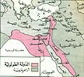 Zoomed Image
-ar.PNG)

- Article(s)
- الدولة الطولونيَّة
- Request
- can you please zoom in so that the foucus would be just on the red boraders and some of it surroundings, so it would appear similar to the second zoomed image. Keep the key map (information box on the left) present if possible --باسم (talk) 10:40, 28 July 2015 (UTC)
- Graphist opinion(s)
Korean historical map with inset
- This section was archived on a request by: Offnfopt(talk) 23:57, 3 July 2016 (UTC)
-
 Original historical map of Seoul
 -
 My attempt at map with inset showing Sanamgi location


- Article(s)
- en:Saenamteo
- Request
- I would like a map with inset showing a particular location on a historical map of Seoul, Korea. I have made an attempt at it, but the aesthetics and readability aren't great. A better version would be welcome. Feel free to use a different presentation and arrangement (and even without an inset) if it improves the result. Ideally, though, the map should show the location of Sanamgi relative to the city on the full map scale, and also show a legible version of the three Chinese characters 沙南基. Thanks! --Amble (talk) 21:38, 24 August 2015 (UTC)
- @Goran tek-en: Yes, the correct area is the second rectangle surrounding the characters in the inset map. --Amble (talk) 06:36, 28 September 2015 (UTC)
- @Goran tek-en: Right, the small feature on a large, busy map makes it difficult. Thanks for your draft. I find it difficult to distinguish the insets and overlay text, though, when viewed at a resolution likely to be used in an article. --Amble (talk) 22:19, 4 October 2015 (UTC)
- Graphist opinion(s)
![]() Request taken by Goran tek-en (talk) 18:11, 27 September 2015 (UTC)
Request taken by Goran tek-en (talk) 18:11, 27 September 2015 (UTC)
@Amble: I will try to help you but first I need you to show me exactly which is the area of Sanamgi. In your file I can see you made a rectangle and in that (which you have enlarged to the left) you have also made a rectangle surrounding some letters. I don't think the area of Sanamgi is that second rectangle so I need you to show me which area it is, thanks. --Goran tek-en (talk) 18:11, 27 September 2015 (UTC)
- @Amble: This is not so easy as the part which is important is so small compared to the whole map. The draft I show you here is made with the assumption that the whole base map doesn't need to be visible. So have a look at this draft and give me feedback on it, thanks. --Goran tek-en (talk) 18:06, 3 October 2015 (UTC)
- @Amble: I think it's better if you write your answers here so one can get an overview.
- At what resolution will it be shown? Give me the size of the image in the article in pixels. But is it not also so that you can click on it to get the full picture, thanks. --Goran tek-en (talk) 08:34, 5 October 2015 (UTC)
- It's to be used in en:Saenamteo. The size in pixels could change, but the image should be useful at a smaller size suitable for inclusion inline. --Amble (talk) 15:52, 5 October 2015 (UTC)
- @Amble: New draft. If you want something that works in the size you are having in the article I think it will be very hard to both view where it comes from and to see it by itself. --Goran tek-en (talk) 18:16, 5 October 2015 (UTC)
- Yes, that's the difficulty I found in making a sensible image for the article. I'm looking for creative ideas, suggestions, or advice rather than just technical implementation, so the question is not so much what I want, but what will be most useful in the article. That could mean an image with one or more insets, multiple images, a single image with colors to highlight the region of interest -- it doesn't have to look like the version I came up with. I like your idea of changing the color range in the base map. --Amble (talk) 22:39, 5 October 2015 (UTC)
- @Amble: Sorry for the delay but I had to do other things. If you don't want to use the last draft I made I don't think I can help you any more right now. So you have to tell me if you want to use that or I will have to let someone else have a try on this. Please also ping me as the watch doesn't work for me, thanks. --Goran tek-en (talk) 18:21, 3 November 2015 (UTC)
- @Goran tek-en: Thanks. I probably won't have time to think about this either. Anyone is free to replace my image with a better one. --Amble (talk) 06:58, 7 November 2015 (UTC)
- @Amble: Sorry for the delay but I had to do other things. If you don't want to use the last draft I made I don't think I can help you any more right now. So you have to tell me if you want to use that or I will have to let someone else have a try on this. Please also ping me as the watch doesn't work for me, thanks. --Goran tek-en (talk) 18:21, 3 November 2015 (UTC)
- Yes, that's the difficulty I found in making a sensible image for the article. I'm looking for creative ideas, suggestions, or advice rather than just technical implementation, so the question is not so much what I want, but what will be most useful in the article. That could mean an image with one or more insets, multiple images, a single image with colors to highlight the region of interest -- it doesn't have to look like the version I came up with. I like your idea of changing the color range in the base map. --Amble (talk) 22:39, 5 October 2015 (UTC)
- @Amble: New draft. If you want something that works in the size you are having in the article I think it will be very hard to both view where it comes from and to see it by itself. --Goran tek-en (talk) 18:16, 5 October 2015 (UTC)
- It's to be used in en:Saenamteo. The size in pixels could change, but the image should be useful at a smaller size suitable for inclusion inline. --Amble (talk) 15:52, 5 October 2015 (UTC)
- @Amble: I think it's better if you write your answers here so one can get an overview.
@Amble: I edited my taken but I really think this should be closed as done/resolved even if it's not. Otherwise it will just stay here but that's up to you. --Goran tek-en (talk) 18:26, 7 November 2015 (UTC)
Great Schism
- This section was archived on a request by: Offnfopt(talk) 23:51, 3 July 2016 (UTC)

- Article(s)
- it:Coluccio Salutati
- Request
- I'd like to have this map converted to SVG format, and with the contents translated in Italian:
- Holy Roman Empire → Sacro Romano Impero
- Kingdom of France → Regno di Francia
- Kingdom of Naples → Regno di Napoli
- Kingdom of Sicily → Regno di Sicilia
- Kingdom of Poland → Regno di Polonia
- Kingdom of Hungary → Regno d'Ungheria
- Kingdom of Grenada → Regno di Granada
- Kingdom of Denmark → Regno di Danimarca
- Kingdom of Sweden → Regno di Svezia
- Kingdom of England → Regno d'Inghilterra
- Kingdom of Scotland → Regno di Scozia
- Kingdom of Portugal → Regno del Portogallo
- Crown of Castile → Regno di Castiglia e León
- Crown of Aragon → Regno d'Aragona
- Allegiance to Avignon → Obbedienza ad Avignone
- Allegiance to Rome → Obbedienza a Roma
- Variable allegiance → Obbedienza variabile
- Not applicable → Non applicabile
Thank you :) --Ghibellin Fuggiasco (talk) 13:53, 13 February 2016 (UTC)
- Graphist opinion(s)
Done --Ghibellin Fuggiasco (talk) 15:33, 17 February 2016 (UTC)
![]() Done
Done
Map-of-southeast-asia 900 CE.png to SVG
- This section was archived on a request by: Offnfopt(talk) 23:51, 3 July 2016 (UTC)
-
 Southeast Asia in 900 AD.
 -
 SVG version


- Article(s)
- es:Imperio jemer & others
- Request
- I would like to request a SVG version of the above file. My goal in to translate into Spanish such a version along with the other files in this category that share the same base map. Once the base map is ready in SVG, I can generate the other maps in SVG and create the Spanish versions myself. Thank you in advance.--Rowanwindwhistler (talk) 09:17, 19 February 2016 (UTC)
- Graphist opinion(s)
![]() Request taken by Jembezmamy (talk) 18:32, 22 March 2016 (UTC)
Request taken by Jembezmamy (talk) 18:32, 22 March 2016 (UTC)
- Incidentally, just in case it helps: while trying my hand at creating maps with Qgis, I drew this version but gave up as I never managed to make the original raster map fit the one generated in Qgis (using Natural Earth data for coastline, rivers, etc and mainly Wikipedia for placing the cities in map). I am not sure it it may be a problem with Qgis (maybe I was not using the same projection as the original map) or if there is something wrong with the original map itself. I mention it just in case you may find the draft useful... Thank you!--Rowanwindwhistler (talk) 19:08, 22 March 2016 (UTC)
- Ok, thanks. I auto-traced it, because it felt easier and still produced satisfying level of detail. I tried to match maps template, but when uploading I realized that there are so many articles referencing original map colors, so I can't just change them to something completely different. At the same time I feel that my colors are easier to name and distinguish (i.e. there is light green and dark green instead of green and lime green). But if you'd like, I can of course use the original colors and then I could just globally swap the PNG version with my SVG. What do you think? Jembezmamy (talk) 21:18, 31 March 2016 (UTC)
- It looks really nice! I will start creating the Spanish versions as soon as I have the time. I may change a couple of colours in the Spanish versions if no one is really relaying on the them but that should be no problem. Thanks a lot!!!--Rowanwindwhistler (talk) 07:11, 1 April 2016 (UTC)
Font fix
- This section was archived on a request by: Offnfopt(talk) 23:49, 3 July 2016 (UTC)

- Request
- May you please fix the SVG text?--Kopiersperre (talk) 11:01, 14 June 2016 (UTC)
- Graphist opinion(s)
![]() Request taken by Sameboat - 同舟 (talk · contri.) 22:26, 14 June 2016 (UTC)
Request taken by Sameboat - 同舟 (talk · contri.) 22:26, 14 June 2016 (UTC)
- Done -- Sameboat - 同舟 (talk · contri.) 16:01, 16 June 2016 (UTC)
Oregon Senate districts (Updated!)
-
Blank map of State Senate districts of Oregon
-
Description of second image (if needed)
-
Description of third image (if needed; don't request too many at once, though)
- Article(s)
- Request
- I have created a .png base map (File:Oregon State Senate districts.png), which I would like to have converted to .svg. --MB298 (talk) 17:14, 21 June 2016 (UTC)
- Graphist opinion(s)
- Done - @MB298: File:Oregon State Senate districts-2016-MB298.svg - I did a quick and dirty autotrace to convert it to SVG (meaning it was computer generated, so there could be errors with it). If you need to make any adjustments to it, this can be done with Inkscape. Offnfopt(talk) 18:41, 3 July 2016 (UTC)
Greatǃ ̴̴
- This section was archived on a request by: Offnfopt(talk) 21:08, 3 July 2016 (UTC)
Oregon legislative districts
- This section was archived on a request by: Offnfopt(talk) 19:24, 16 July 2016 (UTC)
-
Blank SVG map of districts in the w:Oregon State Senate, which can be seen here. This can be filled in to show party affiliation of senators, etc. I don't need individual maps for the Portland metro area.
-
Blank SVG map of districts in the w:Oregon House of Representatives, which can be seen here, for same reasons as above.
-
Description of third image (if needed; don't request too many at once, though)
- Article(s)
- w:Oregon legislative elections, 2014 (derivative work of both maps can be created)
- w:Oregon legislative elections, 2012 (derivative work of both maps can be created)
- Request
- To create 2 blank maps of districts in the Oregon Legislature, for use in creating election maps. --MB298 (talk) 00:53, 8 June 2016 (UTC)
- Links to bluebook.state.or.us not accessible. Can't you use File:Oregon Senate Election Results by County, 2014.svg as the base map? -- Sameboat - 同舟 (talk · contri.) 07:00, 8 June 2016 (UTC)
- @Sameboat: those show counties in Oregon, which are different than legislative districts. MB298 (talk) 23:43, 8 June 2016 (UTC)
- @MB298: Has someone already completed this request over here: File:Oregon_State_Senate_districts-2016-MB298.svg? If so, please resolve this request. --Shandris (talk) 21:53, 13 July 2016 (UTC)
- @Shandris: Yes, see below. MB298 (talk) 23:56, 14 July 2016 (UTC)
- @MB298: Has someone already completed this request over here: File:Oregon_State_Senate_districts-2016-MB298.svg? If so, please resolve this request. --Shandris (talk) 21:53, 13 July 2016 (UTC)
- @Sameboat: those show counties in Oregon, which are different than legislative districts. MB298 (talk) 23:43, 8 June 2016 (UTC)
- Links to bluebook.state.or.us not accessible. Can't you use File:Oregon Senate Election Results by County, 2014.svg as the base map? -- Sameboat - 同舟 (talk · contri.) 07:00, 8 June 2016 (UTC)
- Graphist opinion(s)
Pakistan Sindh
-
 map of Sindh province
 -
 A location map


- Request
- hey, can someone:
- vectorise the first map
- make the first map a real location map, (like the second map)--Mikey641 (talk) 19:52, 15 August 2016 (UTC)
- Graphist opinion(s)
![]() Request taken by Goran tek-en (talk) 17:44, 31 August 2016 (UTC)
Request taken by Goran tek-en (talk) 17:44, 31 August 2016 (UTC)
@Mikey641: Do you want rivers, roads etc in it also, thanks? --Goran tek-en (talk) 17:44, 31 August 2016 (UTC)
- @Goran tek-en: That would be great. Thank you!--Mikey641 (talk) 17:45, 31 August 2016 (UTC)
- @Mikey641: Now there is a draft for you to look at and give me feedback on.
- It's really hard to know how many roads to put in so give me feedback, thanks. --Goran tek-en (talk) 19:03, 8 September 2016 (UTC)
- @Goran tek-en: . Hey, this map is great. if it's not too much trouble, I was hoping for a map with the districts borders (because that's what I saw in other maps. U can easly copy the borders from file:Sindh Districts.svg. (BTW I just found out about this map)--Mikey641 (talk) 09:54, 10 September 2016 (UTC)
- @Mikey641: It's no problem to add districts also. One thing about maps is that there is not one which is the true one, it depends on so many things. Look at this category and compare the first two rows with the next three ones. It's the same area but two different types of maps.
- In the OSM map I'm working from doesn't include more districts than the ones I have added. It seems like there are different levels of districts so I'm not really sure what to do more.
- Have a look at the two drafts here with all and here more blank. Give me feedback on them, thanks. --Goran tek-en (talk) 17:46, 10 September 2016 (UTC)
- @Goran tek-en: , Wait a minute. The map you worked on is Pakistan's. Not Sindh province.... Any chance you can creat a map for Sindh? Cause your Pakistan map is great--Mikey641 (talk) 21:08, 10 September 2016 (UTC)
- @Mikey641: Thanks for finding my mistake.
- Now there are two drafts for you to look at and give me feedback on. You really should check them to see so I got everything right, and tell me if you want something added, removed or changed.
- Give me feedback, thanks. --Goran tek-en (talk) 19:43, 16 September 2016 (UTC)
- @Goran tek-en: , That's wonderful. Just two requests:
- Can you add a coastline?
- Can you also create a blank verison?
- Thanks a lot--Mikey641 (talk) 18:21, 17 September 2016 (UTC)
- @Mikey641: I was going to do blank versions also and will add a coastline. I will need the following for the different files;
- Name of the file
- Description
- Category/ies at commons
- to be able to upload it at commons, thanks. --Goran tek-en (talk) 16:21, 18 September 2016 (UTC)
- @Mikey641: I was going to do blank versions also and will add a coastline. I will need the following for the different files;
- @Mikey641: Thanks for finding my mistake.
- In the OSM map I'm working from doesn't include more districts than the ones I have added. It seems like there are different levels of districts so I'm not really sure what to do more.
- @Mikey641: It's no problem to add districts also. One thing about maps is that there is not one which is the true one, it depends on so many things. Look at this category and compare the first two rows with the next three ones. It's the same area but two different types of maps.
- @Goran tek-en: . Hey, this map is great. if it's not too much trouble, I was hoping for a map with the districts borders (because that's what I saw in other maps. U can easly copy the borders from file:Sindh Districts.svg. (BTW I just found out about this map)--Mikey641 (talk) 09:54, 10 September 2016 (UTC)
- @Mikey641: Now there is a draft for you to look at and give me feedback on.
- Name= Pakistan Sindh location map
{{Information
|Description=
{{de|1=Positionskarte von [[:de:Sindh|Sindh]], [[:de:Pakistan|Pakistan]]}}
{{en|1=Location map of [[:en:Sindh|Sindh]], [[:en:Pakistan|Pakistan]]}}
{{he|מפת מיקום של [[:he:סינד|סינד]], [[:he:פקיסטן|פקיסטן]]}}
{{Location map series N |stretching=– |top=|bottom=|left=|right=}}
|Source={{Own using}}
* [http://www.openstreetmap.org OpenStreetMap]
|Date=2016-09-18
|Author={{U|Goran tek-en}} and OpenStreetMap contributors
|Permission=
|other_versions=
}}


[[Category:Location maps of Asia (series N)]]
[[Category:Location maps of Pakistan]]
[[Category:Maps of Sindh]]
--Mikey641 (talk) 19:57, 18 September 2016 (UTC)
Thanks for that. You should check the Description of all four because I couldn't get the HE text to appear, and everything else on them also.
Here they are;
- Location map of Pakistan
- Blank location map of Pakistan
- Location map of Sindh
- Blank location map of Sindh
![]() Done --Goran tek-en (talk) 18:42, 19 September 2016 (UTC)
Done --Goran tek-en (talk) 18:42, 19 September 2016 (UTC)
- This section was archived on a request by: Goran tek-en (talk) 18:42, 19 September 2016 (UTC)
Al Jawf location map
-
 Al Jawf in Saudi Arabia
 -
 Required Map
 -
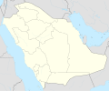 uncolored version also


Article(s): location map in several articles on ar.wiki
- Request
- Can you please create a location map of Al Jawf region (red area) but on a background from the other photo. Thank you--باسم (talk) 19:53, 27 July 2016 (UTC)
- Graphist opinion(s)
@باسم: I can do that but there is something which is not clear about the Al Jawf region. Both in OSM and in google maps the area shown is different from Al Jawf in Saudi Arabia.
So before I start which is correct and please ping me also, thanks. --Goran tek-en (talk) 19:11, 9 September 2016 (UTC)
- @Goran tek-en: a saudi friend on ar. wiki said these are the correct boarders. Thank you--باسم (talk) 19:22, 9 September 2016 (UTC)
- @باسم: I'm sorry to be a bit persistent but when I look around most maps are like the one on OSM and google. Could you please check one more time so I don't have to redo the work, thanks. --Goran tek-en (talk) 16:29, 10 September 2016 (UTC)
- @Goran tek-en: , Hello. The Saudi Government reshaped all the regions borders. According to "Kingdom of Saudi Arabia: Facts and Numbers" published by the Saudi Geological Survey in 2012, and "Kingdom's Service Guide for Cities and Villages" published by the General Authority of Statistics in 2015, this map reflects the last changes.--Sayom (talk) 21:30, 10 September 2016 (UTC)
- @باسم: I'm sorry to be a bit persistent but when I look around most maps are like the one on OSM and google. Could you please check one more time so I don't have to redo the work, thanks. --Goran tek-en (talk) 16:29, 10 September 2016 (UTC)
![]() Request taken by Goran tek-en (talk) 16:29, 10 September 2016 (UTC)
Request taken by Goran tek-en (talk) 16:29, 10 September 2016 (UTC)
- @باسم: So now there are some drafts for you to look at. I have done some different versions when I had the base maps anyway. You have to give me feedback on them and I can do mixtures of them also it's up to what you need.
- Give me feedback, thanks. --Goran tek-en (talk) 18:14, 21 September 2016 (UTC)
- @Goran tek-en: \ I was asked by @باسم: to comment, and after looking to the drafts, I think they are good. If you are willing, please do a mixtures of them and proceed with the final copy of the maps. Thank you for helping.--Sayom (talk) 15:03, 22 September 2016 (UTC)
- @باسم: So now there are some drafts for you to look at. I have done some different versions when I had the base maps anyway. You have to give me feedback on them and I can do mixtures of them also it's up to what you need.
@Sayom: Hi, I will upload those four but if you want other maps then those with a mix of parts from those four you will have to tell me which parts to join in a new map.
I will need the following for the four different maps;
- Name of the file
- Description
- Category/ies at commons
to be able to upload them at commons, thanks. --Goran tek-en (talk) 16:42, 22 September 2016 (UTC)
- @Goran tek-en: location maps:
{{Information
|Description=
{{de|1=Positionskarte von [[:de:Provinz al-Dschauf|Al-Dschauf]], [[:de:Saudi-Arabien|Saudi-Arabien]]}}
{{en|1=Location map of [[:en:Al Jawf Region|Al Jawf]], [[:en:Saudi Arabia|Saudi Arabia]]}}
{{he|מפת מיקום של [[:he:אל-ג'וף (מחוז)|אל-ג'וף]], [[:he:ערב הסעודית|ערב הסעודית]]}}
{{Location map series N |stretching=– |top=|bottom=|left=|right=}}
|Source={{Own using}}
* [http://www.openstreetmap.org OpenStreetMap]
|Date=2016-09-18
|Author={{U|Goran tek-en}} and OpenStreetMap contributors
|Permission=
|other_versions=
}}
[[Category:Location maps of Saudi Arabia]]
[[Category:Maps of Al Jawf]]
- relief
{{Information
|Description=
{{de|1=Physische Positionskarte von [[:de:Provinz al-Dschauf|Al-Dschauf]], [[:de:Saudi-Arabien|Saudi-Arabien]]}}
{{en|1=Physical location map of [[:en:Al Jawf Region|Al Jawf]], [[:en:Saudi Arabia|Saudi Arabia]]}}
{{he|מפת תבליט של [[:he:אל-ג'וף (מחוז)|אל-ג'וף]], [[:he:ערב הסעודית|ערב הסעודית]]}}
{{Location map series N |stretching=– |top=|bottom=|left=|right=}}
|Source={{Own using}}
* [http://www.openstreetmap.org OpenStreetMap]
|Date=2016-09-18
|Author={{U|Goran tek-en}} and OpenStreetMap contributors
|Permission=
|other_versions=
}}
[[Category:Location maps of Saudi Arabia]]
[[Category:Maps of Al Jawf]]
--Mikey641 (talk) 18:42, 22 September 2016 (UTC)
- Now the maps are uploaded but @Mikey641: the Category:Maps of Al Jawf does not exist. You will have to create it if you want it in the maps.
![]() Done:This section was archived on a request by: Goran tek-en (talk) 19:06, 25 September 2016 (UTC)
Done:This section was archived on a request by: Goran tek-en (talk) 19:06, 25 September 2016 (UTC)
Ahmedabad Metro map
- This section was archived on a request by: OP created a new map on their own, closing requestOffnfopt(talk) 05:47, 6 October 2016 (UTC)
-
 Ahmedabad Metro Phase 1 map (old)

- Article(s)
- Request
- Ahmedabad Metro (MEGA) Phase 1 corridors are tweaked with new alignment and more stations. The current image needs update. The new map can be found here on official website: [1] It is PNG image. Please create new SVG image with Commons colour scheme. Regards --Nizil Shah (talk) 20:03, 12 April 2015 (UTC)
- Graphist opinion(s)
Channels of the Hawaiian Islands
- This section was archived on a request by: Image created by Houdinipeter, closing request Offnfopt(talk) 10:23, 6 October 2016 (UTC)

- Article(s)
- w:Channels of the Hawaiian Islands
- Request
- Please create a map indicating all the channels of the Hawaiian Islands using maps of the island chain found on Category:Maps of Hawaii. The result should look something like this. -- KAVEBEAR (talk) 16:26, 3 June 2015 (UTC)
- Graphist opinion(s)
Request for ethnicity maps of Detroit
- This section was archived on a request by: This section is marked as stale due to inactivity in the section, for this reason the section is marked to be archived by Offnfopt(talk) 10:24, 6 October 2016 (UTC).
-
????
- Article(s)
- en:Ethnic groups in Metro Detroit
- Request
- Please take this map from the Detroit Public Library (Archive) (covering 1900-1950) and make a new color version of it. See info page (Archive)
- Please also make a new version of this 1971 ethnicity map (Archive) which, according to the Detroit Historical Society, originated from Wayne State University (Archive)
Thanks, --WhisperToMe (talk) 02:35, 3 July 2015 (UTC)
- Graphist opinion(s)
Map of Rome
- This section was archived on a request by: This section is marked as stale due to inactivity in the section, for this reason the section is marked to be archived by Offnfopt(talk) 10:35, 6 October 2016 (UTC).
-
 1
1 -
 2
2 -
 3
3


- Article(s)
- Administrative subdivision of Rome and other (elections)
- Request
- Hi, I'd like a new map that includes, at the same time, all the administrative subdivision of Rome, in particularː
- Rioni di Roma (1)
- Quartieri di Roma (2)
- Zone di Roma (3).
- Suburbi di Roma (no image)
If this is not possibile, enlarge this image File:Zone Agro Romano.jpg (but i don't think red areas can be enlarged very well). Image resolutionː available also 4000 px. Colorː only white and grey (the blue of the river is not important). No written indication. Thanks... --151 cp (talk) 23:35, 31 August 2015 (UTC)
- Graphist opinion(s)
Maps of the Houston Independent School District
- This section was archived on a request by: This section is marked as stale due to inactivity in the section, for this reason the section is marked to be archived by Offnfopt(talk) 10:35, 6 October 2016 (UTC).
-
Description of first image
-
Description of second image (if needed)
-
Description of third image (if needed; don't request too many at once, though)
- Article(s)
- en:Houston Independent School District
- Request
- This image shows a map of the Houston ISD along with ethnic groups and the city of Houston boundaries (pre-North Forest)
Would someone mind making these versions of these maps?
- HISD boundaries (alone), HISD boundaries (alone) pre-North Forest
- HISD boundaries with city limits, HISD boundaries with city limits pre-North Forest
- HISD boundaries with ethnicity, HISD boundaries with ethnicity pre-North Forest
- HISD boundaries with ethnicity and city limits, HISD boundaries with ethnicity and city limits pre-North Forest
--WhisperToMe (talk) 07:07, 27 September 2015 (UTC)
- Graphist opinion(s)
Updating Holy Roman Empire maps
- This section was archived on a request by: This section is marked as stale due to inactivity in the section, for this reason the section is marked to be archived by Offnfopt(talk) 10:37, 6 October 2016 (UTC).

Article: https://en.wikipedia.org/wiki/Holy_Roman_Empire
Requests: As fantastic as the https://commons.wikimedia.org/wiki/File:HRR_1400.png map is, is there any way to add some additional details to it? Within the Luxemburg, Wettin, and Habsburg lands, there are no internal borders between the different adjacent territories. As an example, I refer you to the https://upload.wikimedia.org/wikipedia/commons/4/4c/HRR_1789_EN.png where there are light gray borders between the Habsburg lands of Bohemia, Moravia, Syria, etc. I think this would help give a little additional detail. Additionally, this could help add some extra detail in a couple of other regions - I don't see the Bishopric of Verden within the Bishopric of Bremen; internal borders within Brunswik-Luneberg to clearly define the border with Brunswick-Wolfenbuttel as well as including the Principality of Luneberg (capital at Celle), and Principality of Grubenhagen; and also adding borders between the Bavarian divisions and Mecklenberg lands. You could even show some of the internal border regions in Savoy and Milan as those regions are large enough to show the detail. I would also like to see this detail inside Bohemia and Moravia and Selisia - beside just showing the borders between these two lands as I mentioned above, I would love to see some of the duchies and counties that existed in these lands as I can't ever find any maps that show this detail (maybe a good idea for a separate map as well). Additionally, in the countries that border the Holy Roman Empire, I like that they are just one color to differentiate the Holy Roman Empire but I would still like to see some gray borders in those countries of the duchies and counties around the Holy Roman Empire. I just love to see all that detail when I am reading articles to see what regions are next to what. Also, it would be nice if the menus could be updated to English but there is something I like about the entities being in German as it is their actual names. Maybe there is room to add a translation menu which at least explains the titles, ex. Gft. = County, Hzm. = Duchy, etc.). I also had one question about the Duchy of Teck (under the Margrave of Burgau). I have only ever been able to find this Duchy located on one map (http://www.lib.utexas.edu/maps/historical/shepherd/german2_shepherd.jpg) and they show it next to Ulm. I know there were two creations of the Duchy of Teck so not sure if this is where it was in 1400 and then there was a later Duchy of Teck by Ulm - just wanted to check for clarity.
As for the https://upload.wikimedia.org/wikipedia/commons/4/4c/HRR_1789_EN.png map, I would love to see it have the same resolution as the https://commons.wikimedia.org/wiki/File:HRR_1400.png map. There is a lot of detail on this map but at a greater resolution, you could add just a bit more. I would also like to see some of the internal borders in the Habsburg lands shown in the Electorate of Brandenburg and Electorate of Saxony, Electorate of Hanover, Austrian Netherlands, etc. And, any borders within France, Poland and Hungary would be great.
This has to be one of the best maps on Wiki of the early Holy Roman Empire from the year 1000: https://upload.wikimedia.org/wikipedia/commons/0/01/Droysens-22-23.jpg. What are the chances this would be updated to a modern map like the above at the same resolution as the https://commons.wikimedia.org/wiki/File:HRR_1400.png map and put in English? This map has so much detail that it would be a fantastic reference.
This is a great map of the Holy Roman Empire in 1689 (https://commons.wikimedia.org/wiki/File:Holy_Roman_Empire_1648.svg) but it needs to be updated to https://commons.wikimedia.org/wiki/File:HRR_1400.png level of resolution and detail.
Additionally, between this map from 1000 and the map from 1400, there are no other highly detailed maps of the Holy Roman Empire. I would love to see one from the 1200s to start off with at https://commons.wikimedia.org/wiki/File:HRR_1400.png resolution and level of detail which would give wiki a detailed map of the HRE every 200 years and then could eventually work on filling in the gaps to have one of the HRE every 100 years, e.g. 1296 when Duchy of Saxony is dissolved.
As for territories, I have found a couple of other maps I love to reference that I think would be great to update (obviously this is a long-running project): Duchy of Wurtemberg (http://www.lib.utexas.edu/maps/historical/shepherd/german2_shepherd.jpg). I think this map would be great to update as is but I would also like to see another map of just the growth of the Duchy of Wurtemberg up til 1789 as this map really shows the acquisition at the time of the dissolution of the Holy Roman Empire in the early 1800s but does not show how they acquired their main territories; Duchy of Baden (http://www.lib.utexas.edu/maps/historical/shepherd/german1_shepherd.jpg). I know there are some later ones that show the 1800s (https://en.wikipedia.org/wiki/Grand_Duchy_of_Baden#/media/File:Map_of_Baden_%281819-1945%29.png) but they do not have this detail. And again, it would be great to see an additional map with just the acquisitions up to 1771; Duchy of Bavaria (http://www.uni-regensburg.de/Fakultaeten/phil_Fak_III/Geschichte/1350g.jpg) this is a great map and I can't find anything like it on wiki. Bavaria is a great dynamic territory that should have some additional detailed maps from additional years; Electorate of Saxony: https://en.wikipedia.org/wiki/Electorate_of_Saxony#/media/File:Saxony_%28Division_of_Leipzig%29_-_NL.png and https://en.wikipedia.org/wiki/Electorate_of_Saxony#/media/File:Saxony_after_the_Capitulation_of_Wittenberg_%281547%29_-_NL.png need to be in English and the Ernestine branch of the Wettin dynasty maps (example as https://en.wikipedia.org/wiki/Saxe-Weimar#/media/File:SajoniaWeimar.jpg) should be updated and need one that includes all of the territories over several periods to show all of the divisions.
Improve Iceland outline
- This section was archived on a request by:
The image you've requested to be updated is a raster image. There are many many vector images now available so the raster image shouldn't be used anymore so there is not much reason to spend time updating it. Closing request.This section is marked as stale due to inactivity in the section, for this reason the section is marked to be archived by Offnfopt(talk) 10:49, 6 October 2016 (UTC).
-
 Blank Europe map

- Article(s)
- Allready in use.
- Request
- I would like to get the outline of Iceland fixed. The main issue I am having with this picture is the triangle in the western part of the country - it should be an peninsula, not an triangle. If you can, then please try to bring the outline of the country closer to the one present in File:Blank map of Europe cropped.svg. --Snaevar (talk) 16:12, 11 January 2016 (UTC)
- Graphist opinion(s)
Convert PNG map to SVG
- This section was archived on a request by: Offnfopt(talk) 07:14, 6 October 2016 (UTC)
-
 Png simple image
 -
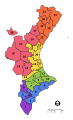


Article(s): Comarques del País Valencià and equivalent
- Request
- We need to convert this image into SVG --TaronjaSatsuma (talk) 11:37, 15 July 2016 (UTC)
- Graphist opinion(s)
@TaronjaSatsuma: ![]() Done File:Regions i comarques del pais Valencià - Proposta de Joan Soler i Riber - 1964.svg - Offnfopt(talk) 05:41, 6 October 2016 (UTC)
Done File:Regions i comarques del pais Valencià - Proposta de Joan Soler i Riber - 1964.svg - Offnfopt(talk) 05:41, 6 October 2016 (UTC)
Texan age of consent
- This section was archived on a request by: This section is marked as stale due to inactivity in the section, for this reason the section is marked to be archived by Offnfopt(talk) 07:16, 6 October 2016 (UTC).
-
 Age of consent map of the United States

Article(s): The file is used on a few articles on the English Wikipedia.
- Request
- The state of Texas needs to be filled in in some way. I believe it should be brown (=17) but a double check of the law is probably needed. --Jo-Jo Eumerus (talk) 12:58, 26 August 2016 (UTC)
- Graphist opinion(s)
Jo-Jo Eumerus We do graphic work here not reseach, if you think it should be checked please perform the check or take help from another place. Hope you understand, because we do not have knowledge about most of the subjects we make graphic work about, thanks. --Goran tek-en (talk) 17:10, 26 August 2016 (UTC)
- I'll ask for a clear input on this. Jo-Jo Eumerus (talk) 17:47, 26 August 2016 (UTC)
Better Color
- This section was archived on a request by: Offnfopt(talk) 07:15, 6 October 2016 (UTC)


Article(s): [[]]
- Request
- Hello.Please make the maps light-colored while maintaining the text.Thank you --ديفيد عادل وهبة خليل 2 (talk) 07:59, 27 September 2016 (UTC)
- Graphist opinion(s)
![]() Done - I inverted the images colors which was the simplest solution. Offnfopt(talk) 03:02, 6 October 2016 (UTC)
Done - I inverted the images colors which was the simplest solution. Offnfopt(talk) 03:02, 6 October 2016 (UTC)
Change Mexico colour in a map
- This section was archived on a request by: Offnfopt(talk) 07:15, 6 October 2016 (UTC)

Article(s): w:es:Cadena perpetua, w:en:Life_imprisonment#World_view
- Request
- Someone has asked me to correct the map, but I don't have the software needed. Mexico unabolished the life imprisonment, so Mexico has to be in reddish colour instead of blue (ref 1, ref 2). I'd like to request the modification. Thanks a lot! :) --Aleator (talk) 12:57, 1 October 2016 (UTC)
- Graphist opinion(s)
![]() Done Offnfopt(talk) 02:55, 6 October 2016 (UTC)
Done Offnfopt(talk) 02:55, 6 October 2016 (UTC)
Change country color in SVG map of ESA member states
- This section was archived on a request by: Offnfopt(talk) 07:14, 6 October 2016 (UTC)
-
 ESA and ECS member countries

Article(s): de:Europäische Weltraumorganisation and others
- Request
- Cyprus has become a European Cooperating State (ECS) on July 6, 2016 [2]. Could someone change the colour of Cyprus on the map from green to turquoise please? --Rosenzweig τ 20:29, 5 October 2016 (UTC)
- Graphist opinion(s)
![]() Done Offnfopt(talk) 21:44, 5 October 2016 (UTC)
Done Offnfopt(talk) 21:44, 5 October 2016 (UTC)
Niger-Congo
- This section was archived on a request by: Offnfopt(talk) 20:41, 6 October 2016 (UTC)

- Article(s)
- w:Niger-Congo
- Request
- Please put in South Sudan border and fix spelling of Swahili… --Kintetsubuffalo (talk) 13:11, 3 October 2016 (UTC)
- Graphist opinion(s)
![]() Done - Offnfopt(talk) 20:40, 6 October 2016 (UTC)
Done - Offnfopt(talk) 20:40, 6 October 2016 (UTC)
- Thank you!--Kintetsubuffalo (talk) 12:14, 9 October 2016 (UTC)
Scale is messed up
- This section was archived on a request by: Offnfopt(talk) 06:48, 7 November 2016 (UTC)
-
 Map of Antarctica
 -
 Derivative map 1
 -
 Derivative map 2
 -
 Derivative map 3
 -
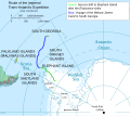 Derivative map 4


- Article(s)
- Lots of articles in multiple Wikipedias
- Request
- "Map of Antarctica" originally had an accurate scale. However, in an edit of 19:58, 26 March 2008, someone switched the captions, making it depict 1000 miles as a distance much shorter than 1000 kilometres. Could you restore the original caption? It's not a matter of simple reversion, as someone's uploaded a revised version with various fixes (but still the broken scale) since then. The other four maps are derived from it, and all of them include the broken caption. --Nyttend (talk) 16:06, 10 November 2015 (UTC)
- Graphist opinion(s)
The derivatives have been corrected by Odysseus1479. The original generates a warning:
Upload warning Found href to unsafe data: URI target <image http://www.w3.org/1999/xlink:href="data:;base64,/9j/4aaqskzjrgabagaazabkaad/7aarrhvja3kaaqaeaaaahgaa/+4adkfkb2jlagtaaaaaaf/b aiqaeaslcwwleawmebcpdq8xgxqqebqbhxcxfxcxhx4xghoaghcehimljyujhi8vmzmvl0baqeba qebaqebaqebaqaerdw8rexevehivfbeuerqafbywfbomghocghommcmehh4eizarlicnjy4rntuw mdu1qea/qebaqebaqebaqeba/8aaeqgalwf5aweiaairaqmraf/eat8aaaefaqebaqebaaaaaaaa aamaaqiebqyhcakkcweaaqubaqebaqeaaaaaaaaaaqacawqfbgcicqoleaabbaedagqcbqcgcaud ddmbaairawqhejefqvfheyjxgtigfjghsuijjbvswwiznhkc0umhjzjt8ohxy3m1fqkygyzek1rk rckjddyx0lxizfkzhmptdepzrieupiw0lctu5psltcxv5fvwznaglqa2xtbm9jdhv2d3h5ent8fx 5/craaicaqiebamebqyhbwyfnqeaaheditesbefryxeiewuygzeuobfci8fs0fazjglhcoksq1mv y3m08sugfqkygwcmnclsrjnuoxdkrvu2dgxi8roew9n14/nglksftjxe1ot0pbxf1ex1vmz2hpam tsbw5vynn0dxz3ehl6e3x//aaawdaqaceqmrad8a9assssupjjjjskkkklkssssupjjjjskkkklk ssssupjjjjskkkklkssssupjjjjskkkklkssssupjjjjskkkklkssssupjjjjskkkklkssssupjj jjskkkklkssssupjjjjskkkklkssssupjjjjskkkklkssssupjjjjskkkklkssssupjjjjskkkkl kssssupjjjjskkkklkssssupjjjjskkkklkssssupjjjjskkkklkssssupjjjjskkkklkssssupj jjjskkkklkssssupjjjjskkkklkssssupjjjjskkkklkssssupjjjjskkkklkssssupjjjjskkkk lkssssupjjjjskkkklkssssupjjjjskkkklkssssupjjjjskkkklkssssupjjjjskkkklp8a/9k="> in the uploaded SVG file.
--Delphi234 (talk) 20:01, 29 February 2016 (UTC)
File:Antarctic fr.svg still needs to be fixed. Delphi234 (talk) 05:42, 4 July 2016 (UTC)
- Best guess is the error is generated because the base64 data is not properly defined i.e. for JPEG should be "data:image/jpeg;base64" and PNG should be "data:image/png;base64". There are 12 embedded images in the file, all 12 appear to be the same file, a JPEG. So if you correct these 12 with the correct JPEG identifier I listed above I believe it'll get you fixed up. Offnfopt(talk) 15:19, 4 July 2016 (UTC)
- Way beyond something I would be able to do but if someone else could that would be helpful. Delphi234 (talk) 08:53, 5 July 2016 (UTC)
- Best guess is the error is generated because the base64 data is not properly defined i.e. for JPEG should be "data:image/jpeg;base64" and PNG should be "data:image/png;base64". There are 12 embedded images in the file, all 12 appear to be the same file, a JPEG. So if you correct these 12 with the correct JPEG identifier I listed above I believe it'll get you fixed up. Offnfopt(talk) 15:19, 4 July 2016 (UTC)
City of Larnaca
- This section was archived on a request by: Offnfopt(talk) 06:26, 7 November 2016 (UTC)
-
 City of Larnaca

Article(s): el:Α΄ κατηγορία ποδοσφαίρου ανδρών Κύπρου 2016-17
- Request
- I am using File:Cyprus adm location map.svg in the article. But in Larnaca there are 4 different stadiums for 5 teams (en:Antonis Papadopoulos Stadium, en:AEK Arena - Georgios Karapatakis, en:GSZ Stadium, en:Ammochostos Stadium). They are to close. So I can't show them exactly in the map. I think is better to make a list at Larnaca with all the 5 teams and to have a second map, with the city of Larnaka, to show where each stadium is. Xaris333 (talk) 13:15, 13 October 2016 (UTC)
- --Xaris333 (talk) 13:15, 13 October 2016 (UTC)
- Graphist opinion(s)
- Done., Xaris333. I've added File:Larnaca - OpenStreetMap.png and en:Module:Location map/data/Larnaca ... presumably the EL wikipedia will need such a module for the map to work there. Let me know if you want any changes / assistance. thanks --Tagishsimon (talk) 15:17, 16 October 2016 (UTC)
Malay and Chinese versions of MH17 maps
- This section was archived on a request by: Offnfopt(talk) 03:11, 16 November 2016 (UTC)
-
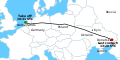 English map "MH17 map"
 -
 English map "Malaysia Airlines Flight 17 crash site"
 -
 English map "MH17 Flight Route"


.png)
- Article(s)
- ms:Penerbangan 17 Penerbangan Malaysia
Request #1
Please make a Malay version at File:MH17 map-ms.svg with this key from User:Cerevisae:
- Take off: 10:31 UTC - Waktu berlepas: 10:31 UTC (Waktu Semesta Berkoordinat)
- Netherlands - Belanda
- Germany - Jerman
- Poland - Poland
- Ukraine - Ukraine
- Russia - Rusia
- Donetsk - Donetsk
- Last contact: 13:20 UTC - Hubungan terakhir: 13:20 UTC (Waktu Semesta Berkoordinat)
- Crimea - Crimea
- Kiev - Kiev
- Graphist opinion(s)

![]() Done - Offnfopt(talk) 07:36, 7 November 2016 (UTC)
Done - Offnfopt(talk) 07:36, 7 November 2016 (UTC)
Request #2
Also please make Malay and Chinese versions of File:Malaysia Airlines Flight 17 crash site.png (Format is English - Malay/Chinese)
- route of Flight 17 - Laluan Penerbangan 17/17号航班飞行路线
- Donetsk - Donetsk/頓涅茨克
- Horlivka - Horlivka/戈尔洛夫卡
- Luhansk - Luhansk/卢甘斯克
- Area of missle launch - Kawasan pelancaran peluru berpandu/导弹发射区
- Russia - Rusia/俄罗斯
- Territory held by pro-Russian insurgents - Kawasan yang dipegang oleh pemberontak pro-Rusia/亲俄罗斯武装分子的领土
- Graphist opinion(s)


![]() Done - Offnfopt(talk) 08:53, 7 November 2016 (UTC)
Done - Offnfopt(talk) 08:53, 7 November 2016 (UTC)
Request #3
-
 Chinese SVG
 -
 Malay SVG
.svg)
.svg)
And File:MH17 Flight Route (en).png (Format is English - Malay/Chinese)
- Dnipropetrovsk - Dnipropetrovsk/第聂伯罗彼得罗夫斯克
- Donetsk - Donetsk/頓涅茨克
- Torez - Torez/多列士
- Hrabove - Hrabove/Hrabove村
- Russia - Rusia/俄罗斯
- 50km - 50km/50公里
- closed up to 26,000 ft - ruang udara ditutup sehingga ketinggian 26,000 kaki/空域关闭直到26,000英尺的高度
- closed up to 32,000 ft - ruang udara ditutup sehingga ketinggian 32,000 kaki/空域关闭直到32,000英尺的高度
--WhisperToMe (talk) 03:29, 3 December 2015 (UTC)
- Graphist opinion(s)
![]() Done - Offnfopt(talk) 15:31, 14 November 2016 (UTC)
Done - Offnfopt(talk) 15:31, 14 November 2016 (UTC)
Dividing huge Ottoman map into smaller maps
-
 Nouvelle carte generale des provinces asiatiques de L'empire Ottoman (Kiepert, 1883).jpg
.jpg)
Article(s): lots, basically every place that it mentions is a possible article to put it in.
- Request
- It is a collage of 6 different maps, (and those single maps are not uploaded to commons). My question is: Is there anyone here who could divide it into the 6 different maps (keeping the max 20,834 × 12,620 pixels size), and then upload those 6 maps to commons? --Huldra (talk) 22:42, 27 December 2016 (UTC)
- Graphist opinion(s)
@Huldra: I probably could, but you write that you want the new six different maps also should keep the same size as to original one. If I cut out 1/6 it will become smaller. What did you mean by it? --Goran tek-en (talk) 18:12, 10 May 2017 (UTC)
- @Goran tek-en: What I meant was that I would want the pixels size, 20,834 × 12,620 retained. I think that pixels size is needed for us to see the names on the map. Huldra (talk) 20:34, 10 May 2017 (UTC)
![]() Request taken by Goran tek-en (talk) 16:42, 11 May 2017 (UTC)
Request taken by Goran tek-en (talk) 16:42, 11 May 2017 (UTC)
- @Huldra: Either I don't understand what you mean or you don't have an understanding of how a bitmap image works. If I take out 1/6 of an image the pixel size of that 1/6 will be smaller (1/6) than what the original image was, but it will not reduce the resolution of that new image.
- Also I will need you to give me six names for the new six images. Start from top left and go to the right and then the bottom part, thanks. --Goran tek-en (talk) 16:42, 11 May 2017 (UTC)
- There are stamps and stuff outside the maps in some places, do want that to be a part of each image or is it just the map area you want? --Goran tek-en (talk) 17:13, 11 May 2017 (UTC)
- @Huldra: Either I don't understand what you mean or you don't have an understanding of how a bitmap image works. If I take out 1/6 of an image the pixel size of that 1/6 will be smaller (1/6) than what the original image was, but it will not reduce the resolution of that new image.
- @Goran tek-en: You are probably right...I dont know much about pixels etc...if the resolution is kept the same, then that is what I want... And the stamps etc outside the maps are not needed. What about the following names: Western Turkey, Eastern Turkey, Northern Iran, Egypt and Western Palestine, Eastern Palestine, Jordan and Southern Syria, Iraq and Iran. Huldra (talk) 20:10, 11 May 2017 (UTC)
- @Huldra: I get that to seven names, it should be six? --Goran tek-en (talk) 16:55, 12 May 2017 (UTC)
- @Goran tek-en: It is six, "Eastern Palestine, Jordan and Southern Syria," is one name. If it is too long, then try "Palestine, Jordan and Syria," Huldra (talk) 20:10, 12 May 2017 (UTC)
- @Huldra: I get that to seven names, it should be six? --Goran tek-en (talk) 16:55, 12 May 2017 (UTC)
- @Goran tek-en: You are probably right...I dont know much about pixels etc...if the resolution is kept the same, then that is what I want... And the stamps etc outside the maps are not needed. What about the following names: Western Turkey, Eastern Turkey, Northern Iran, Egypt and Western Palestine, Eastern Palestine, Jordan and Southern Syria, Iraq and Iran. Huldra (talk) 20:10, 11 May 2017 (UTC)
@Huldra: Now you can find the different files here:
File:Parts_of_Ottoman_Empire_Western_Turkey.png
File:Parts_of_Ottoman_Empire_Eastern_Turkey.png
File:Parts_of_Ottoman_Empire_Northern_Iran.png
File:Parts_of_Ottoman_Empire_Egypt_Western_Palestine.png
File:Parts_of_Ottoman_Empire_Eastern_Palestine_Jordan_Southern_Syria.png
File:Parts_of_Ottoman_Empire_Iraq_Iran.png
As you can see the files are big in Mb and that is because I have saved them in a png format, the bigger map was saved in a jpg format. Png is a non destructive format compared to jpg which is a destructive format.
You should also check the information on the different files so I got it right. I did change the file names a bit, I do hope that is OK with you. --Goran tek-en ([[User talk:Goran tek-en|
- @Goran tek-en: Thanks a lot! Great! The titles are correct, AFAIK. And yeah, they are still big, but at least now they are ..slightly...managable!! Thanks again! Huldra (talk) 20:15, 13 May 2017 (UTC)
talk]]) 18:43, 13 May 2017 (UTC)
![]() Done
Done
- This section was archived on a request by: Goran tek-en (talk) 18:43, 13 May 2017 (UTC)
Melbourne Metro Rail Project
-
 Newly created map licensed under CC4.0

Article(s): w:en:Melbourne Metro Rail Project
- Request
- Someone uploaded a possibly non-free image of a map of the stations and route of the project onto Wikipedia last year. Could someone design a substitute for it? --Pizza1016 (talk) 08:12, 30 October 2016 (UTC)
- Here's the official map webpage, in case it is needed. Pizza1016 (talk) 08:15, 30 October 2016 (UTC)
- Graphist opinion(s)
- @Sameboat: maybe you can help with this request?--Mikey641 (talk) 14:41, 16 November 2016 (UTC)
- @Pizza1016 and Mikey641: I am more of a topological artist than topographical, but I can attempt one if it's not too complicated. I want know how the deleted PNG looks like. Is it just similar to the official overview map? -- Sameboat - 同舟 (talk · contri.) 15:31, 16 November 2016 (UTC)
- @Sameboat: As I recall, yes. - Pizza1016 (talk) 04:52, 18 November 2016 (UTC)
- @Pizza1016 and Mikey641: I am more of a topological artist than topographical, but I can attempt one if it's not too complicated. I want know how the deleted PNG looks like. Is it just similar to the official overview map? -- Sameboat - 同舟 (talk · contri.) 15:31, 16 November 2016 (UTC)
- @Sameboat: maybe you can help with this request?--Mikey641 (talk) 14:41, 16 November 2016 (UTC)
![]() Request taken by Sameboat - 同舟 (talk · contri.) 10:16, 19 November 2016 (UTC)
Request taken by Sameboat - 同舟 (talk · contri.) 10:16, 19 November 2016 (UTC)
- @Pizza1016: Done, you may want to proofread it or open the SVG file in text editor to modify some text if needed. -- Sameboat - 同舟 (talk · contri.) 16:07, 19 November 2016 (UTC)
- This section was archived on a request by: Goran tek-en (talk) 18:08, 17 May 2017 (UTC)
Maps of paleolake Tauca
-
Map bbased on the Horizon source.
-
Map based on the Researchgate image.
Article(s): en:Lake Tauca (currently at en:User:Jo-Jo Eumerus/Lake Tauca)
- Request
- Is it possible to draw a map on File:Altiplano basin1.JPG (this is the only high resolution topographic map I know of the area, are there others?) of the Lake Tauca, starting from http://horizon.documentation.ird.fr/exl-doc/pleins_textes/divers08-10/36608.pdf? https://www.researchgate.net/figure/234544628_fig1_Fig-1-A-Major-features-of-the-present-day-atmospheric-circulation-over-South-America could be used as well, or both maybe. --Jo-Jo Eumerus (talk) 19:26, 20 September 2016 (UTC)
- Graphist opinion(s)
@Jo-Jo Eumerus: Are you still interested in this map. If so get back to me because I need some more information from you to be able to make the map, thanks. --Goran tek-en (talk) 17:56, 10 May 2017 (UTC)
- Yes, still interested. And should have time to answer questions. Jo-Jo Eumerus (talk) 18:46, 10 May 2017 (UTC)
- And thanks. Jo-Jo Eumerus (talk) 18:47, 10 May 2017 (UTC)
- As I understand you want a map of that Lake Tauca which doesn't exist any more?
- I don't understand that you are writing about "...starting from...".
- I also would need you to show me (very simple drawing on a map or something) which area you need as I don't think you mean the whole Altipano map?
- ou have to think of that know zero of this subject so explain as much as you think I need to know, thanks. --Goran tek-en (talk) 19:07, 10 May 2017 (UTC)
- @Goran tek-en: "Starting from" means that these links contain (non-free, hence this request) maps to give an idea of what would be desired. In practice, such a map would show all the area that would be covered by a 3770m high lake covering the present-day region. Jo-Jo Eumerus (talk) 18:07, 11 May 2017 (UTC)
- As I understand you want a map of that Lake Tauca which doesn't exist any more?
- And thanks. Jo-Jo Eumerus (talk) 18:47, 10 May 2017 (UTC)
![]() Request taken by Goran tek-en (talk) 17:09, 12 May 2017 (UTC)
Request taken by Goran tek-en (talk) 17:09, 12 May 2017 (UTC)
- @Jo-Jo Eumerus: Is it this area, in red that you want? If not please tell which, thanks. --Goran tek-en (talk) 18:07, 12 May 2017 (UTC)
- @Goran tek-en: Pretty much, yeah. The box obviously isn't the shoreline, of course. And a high resolution is always good - probably no point in trying to estimate the isostatic shift of the shorelines. Jo-Jo Eumerus (talk) 18:41, 12 May 2017 (UTC)
- @Jo-Jo Eumerus: ´Pretty much´, I have to know if that area is OK. Ones I have started to do the map it's very difficult to add area. I will do a vector image (svg) which can be enlarged without any resolution lost. So please tell me , yes that area is OK or draw on an image which area you want, thanks. --Goran tek-en (talk) 19:04, 12 May 2017 (UTC)
- That area is OK. Remember to not simply re-trace that map though - copyright issues aside it's a rough low resolution map. Using topographic maps as starting points is better. Jo-Jo Eumerus (talk) 19:09, 12 May 2017 (UTC)
- @Jo-Jo Eumerus: I will use something else for base map. Please also ping or replay to me because the watch function doesn't work all the time, thanks. --Goran tek-en (talk) 14:30, 15 May 2017 (UTC)
- That area is OK. Remember to not simply re-trace that map though - copyright issues aside it's a rough low resolution map. Using topographic maps as starting points is better. Jo-Jo Eumerus (talk) 19:09, 12 May 2017 (UTC)
- @Jo-Jo Eumerus: ´Pretty much´, I have to know if that area is OK. Ones I have started to do the map it's very difficult to add area. I will do a vector image (svg) which can be enlarged without any resolution lost. So please tell me , yes that area is OK or draw on an image which area you want, thanks. --Goran tek-en (talk) 19:04, 12 May 2017 (UTC)
- @Goran tek-en: Pretty much, yeah. The box obviously isn't the shoreline, of course. And a high resolution is always good - probably no point in trying to estimate the isostatic shift of the shorelines. Jo-Jo Eumerus (talk) 18:41, 12 May 2017 (UTC)
- @Jo-Jo Eumerus: Is it this area, in red that you want? If not please tell which, thanks. --Goran tek-en (talk) 18:07, 12 May 2017 (UTC)
@Goran tek-en: Got it. Jo-Jo Eumerus (talk) 15:01, 15 May 2017 (UTC)
- @Jo-Jo Eumerus: Now there is a draft for you to look at. This is a png image from the svg file that I work in.
- I need your feedback now. The read line is the lake, do you want me to make it as a lake or what?
- Is the topographic map what you want? --Goran tek-en (talk
) 17:39, 17 May 2017 (UTC)
- @Goran tek-en: Seems like a blue line would be better for a lake. Question, did you retrace the image in the paper? The red line obviously isn't following any contour lines. Jo-Jo Eumerus (talk) 19:14, 17 May 2017 (UTC)
- @Jo-Jo Eumerus: I don't think I really understand you.
- Do you want the lake just to be a line (blue) or do you want a line and a blue surface also?
- The line which is red (just so it's easy to see) on my draft represents the lake as in your provided image. If that is not correct then please tell me from which source, or what you want in the map?
- Please also to remember that the source has to be a one that we have the permission to use or that it's license is such.
- You write "The red line obviously isn't following any contour lines." what do you mean by that?
- The map I have used as a base is from another place that has free maps for this.
- Please remember that I have no knowledge of this subject so you have to explain to me what you want and I will draw that. --Goran tek-en (talk) 09:44, 18 May 2017 (UTC)
- @Goran tek-en: Alright. The issue with your draft image is that it is essentially retracing the coastline on the non-free image on a low resolution topographic map. That's rendering it highly inaccurate. You'd need a free map with a much higher resolution. Jo-Jo Eumerus (talk) 15:48, 18 May 2017 (UTC)
- @Jo-Jo Eumerus: I have not used "the non-free image on a low resolution topographic map" as base. I have told you that several times.
- I have used this page as the source for the base map. I have zoomed in taken several different print screens of the interested area and then add them together to get this image. If that coast line is wrong then I don't have any better free source.
- Then you will have to provide me with a better topographic free map to use.
- I have no other idea on how I should now which oast line that is the right one for you, get back to me, thanks. --Goran tek-en (talk) 17:46, 18 May 2017 (UTC)
- Redacted my previous commentSorry! That topographic map is good enough. The coastline needs to follow the 3770m and 3830m elevation contours - it doesn't seem like that topographic map has elevation contours, does it Goran tek-en? Jo-Jo Eumerus (talk) 18:36, 18 May 2017 (UTC)
- @Jo-Jo Eumerus: Okay now I start to understand. When you talked about coastline I thought you meant between land and ocean but I guess you meant the lake.
- So now I will check that the lake follow those elevation contours, do you also want the elevation contours in the map?
- As I told you before, you have to tell me in detail what you want. I have zero knowledge and I don't know what you want in the map if you don't tell me, thanks. --Goran tek-en (talk) 19:52, 18 May 2017 (UTC)
- @Jo-Jo Eumerus: Okay now I start to understand. When you talked about coastline I thought you meant between land and ocean but I guess you meant the lake.
- Then you will have to provide me with a better topographic free map to use.
- @Jo-Jo Eumerus: I have not used "the non-free image on a low resolution topographic map" as base. I have told you that several times.
- Do you want the lake just to be a line (blue) or do you want a line and a blue surface also?
- @Jo-Jo Eumerus: I don't think I really understand you.
- @Goran tek-en: Seems like a blue line would be better for a lake. Question, did you retrace the image in the paper? The red line obviously isn't following any contour lines. Jo-Jo Eumerus (talk) 19:14, 17 May 2017 (UTC)
@Goran tek-en: You've basically got the basemap. The elevation contours that coincide with the shoreline are the 3770m contour, so the shoreline should follow that contour and be labelled as "Tauca highstand"; if possible you could draw two additional shorelines for 3660m labelled "Ticaña lowstand" and 3700m labelled "Coipasa highstand". You don't need to label the elevations themselves. Jo-Jo Eumerus (talk) 20:29, 18 May 2017 (UTC)
- @Jo-Jo Eumerus: If we only have a map with those elevation contours that's not a problem. But I can't find the elevation contours on the maps we have acces to and I have searched but not been able to find any others. The free-map where I got the base map just have colors and that is not something I can use here.
- On your link to researchgate the text says "Limit of the endorheic Tauca watershed is the orange dashed line. Contour lines for present-day yearly precipitation are in white (New et al., 2002)." Do you mean I should use any of those?
- You can find contours on google maps and some others but you have to zoom in so close that you really are lost on our bigger map, it's to detailed and not visible when you zoom out. --Goran tek-en (talk) 17:55, 21 May 2017 (UTC)
- @Goran tek-en: Regarding the first question, I don't think these are needed. Regarding the second question, map services usually will display contour lines only at high resolution as the map gets too crowded otherwise. I wonder if retracing them on OpenStreetMap tiles might work, but it'd be a pretty large image. Jo-Jo Eumerus (talk) 18:10, 21 May 2017 (UTC)
- @Jo-Jo Eumerus: To my knowledge OSM does not have contour lines at all. So if you don't know of any other free source I don't know how to obtain them at this time. I don't have the knowledge to use the shape files one can download either.
- So what shall we do, continue without contours or what? --Goran tek-en (talk) 18:52, 21 May 2017 (UTC)
- @Goran tek-en: Cyclemap mode has contour lines, but again only at high resolution. Jo-Jo Eumerus (talk) 19:12, 21 May 2017 (UTC)
- @Jo-Jo Eumerus: Thanks, yes I just found out. But still as you say the high magnification makes it impossible for me to use. We have to decide how to continue. I Can't use that so what do you want me to do with my draft? --Goran tek-en (talk) 19:19, 21 May 2017 (UTC)
- @Goran tek-en: Maybe we'll need to roughly retrace the non-free map. Roughly, because while the exact trace is copyrighted, the rough copy is not as it's based off topographical criteria which aren't copyrightable. You'll need to be careful that the shorelines do not cross a mountaintop or something, that was an issue with your previous draft. Jo-Jo Eumerus (talk) 19:26, 21 May 2017 (UTC)
- @Jo-Jo Eumerus: That is what I already has done, we don't have any other map with the shape of the lake. Now there is a new draft. This has the lake with a blue line, maybe you have to update your browser to get this new one. --Goran tek-en (talk) 21:13, 21 May 2017 (UTC)
- @Goran tek-en: Barring the sudden availability of a contour map, that will have to serve. Maybe you want to insert the islands (in the first source) too. Jo-Jo Eumerus (talk) 22:39, 21 May 2017 (UTC)
- @Jo-Jo Eumerus: I have made two drafts, check the island and then tell me if you want the lake
- filled
- or not filled
- I will need the following;
- Name of the file
- Description
- Category/ies at commons
- filled
- to be able to upload it at commons. --Goran tek-en (talk) 14:19, 22 May 2017 (UTC)
- @Jo-Jo Eumerus: I have made two drafts, check the island and then tell me if you want the lake
- @Goran tek-en: Barring the sudden availability of a contour map, that will have to serve. Maybe you want to insert the islands (in the first source) too. Jo-Jo Eumerus (talk) 22:39, 21 May 2017 (UTC)
- @Jo-Jo Eumerus: Thanks, yes I just found out. But still as you say the high magnification makes it impossible for me to use. We have to decide how to continue. I Can't use that so what do you want me to do with my draft? --Goran tek-en (talk) 19:19, 21 May 2017 (UTC)
- @Jo-Jo Eumerus: To my knowledge OSM does not have contour lines at all. So if you don't know of any other free source I don't know how to obtain them at this time. I don't have the knowledge to use the shape files one can download either.
- On your link to researchgate the text says "Limit of the endorheic Tauca watershed is the orange dashed line. Contour lines for present-day yearly precipitation are in white (New et al., 2002)." Do you mean I should use any of those?
@Goran tek-en: How about File:Lake Tauca shorelines and File:Lake Tauca surface, with the descriptions "Shorelines of en:Lake Tauca, assuming present-day topography" and "Surface covered by en:Lake Tauca, assuming present-day topography"? Category:Lake Tauca as a category. Jo-Jo Eumerus (talk) 14:57, 22 May 2017 (UTC)
Now you can find them here:
Shorelines file.
Surface file.
--Goran tek-en (talk) 17:47, 22 May 2017 (UTC)
![]() Done
Done
- This section was archived on a request by: Goran tek-en (talk) 17:47, 22 May 2017 (UTC)
Plainpalais cemetery
-
 Map of the Kings Cemetery, Geneva.
 -
 Map of the Kings Cemetery, Geneva.
 -
 SVG version


Article(s): en:Cimetière des Rois (officially Plainpalais cemetery) and 6 other languages, fr:Liste des tombes du cimetière des Rois, Genève
- Request
- Creating a SVG map of the cemetery, based on the 2 files above, and on Openstreetmap. Thanks in advance, --Yann (talk) 22:48, 19 November 2016 (UTC)
- Graphist opinion(s)
- @Yann: , please tell me what you think. Did I miss anything important? Or do you want all the small grave numbers transferred as well? I guessed nobody knows the names of these anyway, so they are not necessary. Anything else? --Lommes (talk) 18:30, 2 May 2017 (UTC)
- Lommes: Yes, we know the name of these people. Most of the people buried there are famous. So if you can add the grave numbers, it would be great. See fr:Liste des tombes du cimetière des Rois, Genève. Thanks for your help, Yann (talk) 18:46, 2 May 2017 (UTC)
- @Yann: , I'd guess that is two hours of (very boring) work. Not sure if I'll do it anytime soon. Sorry. If it is urgent, perhaps you ask someone else. --Lommes (talk) 18:57, 2 May 2017 (UTC)
- @Lommes: @Yann: I can do that, Yann. I will do a new version so you have both to choose from. --Goran tek-en (talk) 17:19, 11 May 2017 (UTC)
- @Goran tek-en: That is great, good to hear. Thank you.--Lommes (talk) 19:04, 11 May 2017 (UTC)
- @Lommes: @Yann: I can do that, Yann. I will do a new version so you have both to choose from. --Goran tek-en (talk) 17:19, 11 May 2017 (UTC)
- @Yann: , I'd guess that is two hours of (very boring) work. Not sure if I'll do it anytime soon. Sorry. If it is urgent, perhaps you ask someone else. --Lommes (talk) 18:57, 2 May 2017 (UTC)
- Lommes: Yes, we know the name of these people. Most of the people buried there are famous. So if you can add the grave numbers, it would be great. See fr:Liste des tombes du cimetière des Rois, Genève. Thanks for your help, Yann (talk) 18:46, 2 May 2017 (UTC)
@Yann: Now I have a first draft for you to look at and in that I need your help.
First I want to say that this is not as it will look when it's done. This is just so that it's easier to read the differnt numbers and see the graves. The final image will also be a svg file.
- I want you to check the different graves and their numbers so I got them right.
- I don't know how big you will use the image so I ask you if there is a possibility for me to make the numbers smaller?
There are so many numbers in some places but they also have to be able to view in the map.
- I want you to give me the numbers where there is a x encircled with a read line.
- I have also some bigger read circles and I wonder if you know what that is in those corners.
The draft is here. Get back to me with the information I have asked for, thanks. --Goran tek-en (talk) 21:59, 14 May 2017 (UTC)
- @Yann: I do need your feedback per above, thanks.--Goran tek-en (talk) 17:51, 22 May 2017 (UTC)
- Hi Goran tek-en, Sorry, I was quite busy last week. It looks good. The yellow circles show position of a temporary exhibition (see fr:Cimetière des Rois#Exposition OPEN END, sorry, no English yet), so they are not useful. Thank you very much. Regards, Yann (talk) 07:07, 29 May 2017 (UTC)
- @Yann: I didn't want to push you, sorry if I did. Do you have any numbers for the ones I marked with X? --Goran tek-en (talk) 16:16, 29 May 2017 (UTC)
- @Yann: Thanks for that last link, from there I found more sources so I could complete the map. Now you can find it here. Map of the Plainpalais (or Kings) Cemetery, Geneva. If anything needs changed just contact me, thanks. --Goran tek-en (talk) 19:13, 29 May 2017 (UTC)
- @Yann: Thanks for that last link, from there I found more sources so I could complete the map. Now you can find it here. Map of the Plainpalais (or Kings) Cemetery, Geneva. If anything needs changed just contact me, thanks. --Goran tek-en (talk) 19:13, 29 May 2017 (UTC)
- @Yann: I didn't want to push you, sorry if I did. Do you have any numbers for the ones I marked with X? --Goran tek-en (talk) 16:16, 29 May 2017 (UTC)
- Hi Goran tek-en, Sorry, I was quite busy last week. It looks good. The yellow circles show position of a temporary exhibition (see fr:Cimetière des Rois#Exposition OPEN END, sorry, no English yet), so they are not useful. Thank you very much. Regards, Yann (talk) 07:07, 29 May 2017 (UTC)
![]() Done:This section was archived on a request by: Goran tek-en (talk) 19:13, 29 May 2017 (UTC)
Done:This section was archived on a request by: Goran tek-en (talk) 19:13, 29 May 2017 (UTC)
Map of Cyprus
Hello. In this site [3] you can see a political map of Cyprus with all municipalities and all villages. Can anyone use it to create the same map for Commons? Xaris333 (talk) 20:46, 22 December 2016 (UTC)
Anyone? It was the only administrator map of Cyprus I was able to find. Xaris333 (talk) 17:45, 16 January 2017 (UTC)
- There is already file:Administrative map of Cyprus.jpg--Mikey641 (talk) 14:46, 17 January 2017 (UTC)
- This section was archived on a request by: Goran tek-en (talk) 16:35, 12 June 2017 (UTC)


- Article(s)
- en:Jasenovac concentracion camp
- Request
- It would be nice if this map can be converted to SVG that can be easily localised. The original photo is problably copyvio. -- Bojan Talk 08:13, 15 May 2016 (UTC)
- Graphist opinion(s)
Which map, I can't see any?
Have you tried to find a map that we can get a permission to use? --Goran tek-en (talk) 19:22, 9 September 2016 (UTC)
- @Goran tek-en: The requesting user linked the (low qual) map in the title of this section. Here it is again: [4]. Best, --Lommes (talk) 11:36, 30 April 2017 (UTC)
- @BokicaK: The image is really a low resolution but if you have knowledge about this and you will help me by checking my drafts I will take this, but I need your support on this. Get back to me if you will help me, thanks.--Goran tek-en (talk) 18:56, 8 May 2017 (UTC)
- I will help, just ask. Thanks. -- Bojan Talk 18:59, 8 May 2017 (UTC)
- @BokicaK: The image is really a low resolution but if you have knowledge about this and you will help me by checking my drafts I will take this, but I need your support on this. Get back to me if you will help me, thanks.--Goran tek-en (talk) 18:56, 8 May 2017 (UTC)
- @Goran tek-en: The requesting user linked the (low qual) map in the title of this section. Here it is again: [4]. Best, --Lommes (talk) 11:36, 30 April 2017 (UTC)
![]() Request taken by Goran tek-en (talk) 15:11, 17 May 2017 (UTC)
Request taken by Goran tek-en (talk) 15:11, 17 May 2017 (UTC)
@BokicaK: If you think that there is some kind of copyright on the image you linked to I can't even use it as a base to make a new drawing from. So please check if we can use that image?
I have found some other images and this one seems to be free to use if you read there terms of use.
Here is another one a bit down on the page and you can see it better here. At this page the say that you can get permission to use there material check this.
At this page there is also a map. I'm not sure we would get an answer here but maybe.
So I need you to check the map you had, and then tell me if any of the ones I have found could god to use, so get back to me, thanks. --Goran tek-en (talk) 15:40, 17 May 2017 (UTC)
- @Goran tek-en: Can you just use a free source (e. g. Open Street map) as background, and then use that map from hr.wiki as a reference? It would be good if You can draw this map, too. -- Bojan Talk 19:41, 18 May 2017 (UTC)
- @BokicaK:
I can use OSM as background but then you have to give me the coordinates for the location? - I have sent an email to ushmm.org to get there permission, thanks. --Goran tek-en (talk) 14:33, 21 May 2017 (UTC)
- @BokicaK: I need your help now. We haven't talked about what area you want of the surroundings and what should be included like rivers, roads etc. I have a very rough draft here. This is a png version of the svg I'm working in.
 Question I need you to download it and draw a rectangle of the area you want the map to include and send it to me or if you can describe it.
- Question Also I want you to ell me what you want included in the background map, rivers, railroads, today's roads, forests etc. We can dim them down if we think they are to obvious etc.
- Question Is it okay if the map covers the area you draw (or tell me) and then there is a big version of the camp as I have illustrated.
- You can also tell me everything else on what you expect the map to include or look like, thanks. --Goran tek-en (talk) 19:06, 23 May 2017 (UTC)
- @BokicaK: I need your help now. We haven't talked about what area you want of the surroundings and what should be included like rivers, roads etc. I have a very rough draft here. This is a png version of the svg I'm working in.
- @BokicaK:
- @Goran tek-en: Perhaps you should draw two maps. One for central camp, and one for whole system of concentration camps, execution sites and mass graves. The draft looks good, but it omits towns w:Stara Gradiška, BročiceDraksenić and Krapje camp. Railway and rivers are important for this topic, roads are not. -- Bojan Talk 19:47, 23 May 2017 (UTC)
- @BokicaK: As it is a rough draft I haven't added a lot of material, such as citys yet. The most important thing to me is the area which the map includes. So to be able to continue I really need direct answers to my questions. Remember I have no knowledge at any depth of this, you have to explain everything, thanks.
- I insist in that you delete the draft image that you have uploaded, it's not in any stage to be uploaded at commons.
- I insist in that you delete the draft image that you have uploaded, it's not in any stage to be uploaded at commons.
- Question Should I keep the overall area as in the draft. Would this be the map of the whole system then.
- If you want me to add "concentration camps, execution sites and mass graves" you have to provide me with free base materials for that.
- If you want me to add "concentration camps, execution sites and mass graves" you have to provide me with free base materials for that.
- Template:Exclamation Do you know to get an exclamation mark like question mark? --Goran tek-en (talk) 11:36, 24 May 2017 (UTC)
- @BokicaK: As it is a rough draft I haven't added a lot of material, such as citys yet. The most important thing to me is the area which the map includes. So to be able to continue I really need direct answers to my questions. Remember I have no knowledge at any depth of this, you have to explain everything, thanks.
- @Goran tek-en: Perhaps you should draw two maps. One for central camp, and one for whole system of concentration camps, execution sites and mass graves. The draft looks good, but it omits towns w:Stara Gradiška, BročiceDraksenić and Krapje camp. Railway and rivers are important for this topic, roads are not. -- Bojan Talk 19:47, 23 May 2017 (UTC)
@Goran tek-en: Bigger map should cover area roughly from 45.3956N to 45.1138N and 16.8482E to 17.3110 Beside town and camps, rivers Sava, Una and Veliki Strug, and railways Jasenovac-Novska (drawn in first draft) and Zagreb-Kutina-Novska-Belgrade 8that runs almost parallel with A3 highway) are of importance for this topic. -- Bojan Talk 17:33, 24 May 2017 (UTC)
- @BokicaK: Now there is a new draft according your latest information. To me Krapje camp is outside your given area, to the left. As you can see the main camp is really small so we have to decide how you want it. What we can do is to make it more visible but at the same time remove most of the details as they are not visible any way. When we do a close up of that main camp one can view all the details there. Now you have to tell me what else to add or change, thanks. --Goran tek-en (talk) 18:49, 25 May 2017 (UTC)
- @Goran tek-en: Ah, my mistake. Krapje definetely should be in the map. Could you please expand map? You should add location of towns Jasenovac, Jablanac (instead of arrow pointing down - I meant to sow aproximate location of Jablanac in first draft), Ćuklinac, (Bosanska) Dubica, Uštica and Novska.
- Stara Gradiška is on left bank of Sava River (opposite to town Bosanska Gradiška in modern Bosnia and Herzegovina on right bank). Name of small river is Veliki Strug, not VelikA Strug. Add map key, and that would be it.
-- Bojan Talk 19:35, 31 May 2017 (UTC)
- @BokicaK: First I want to tell you that I'm serious on that you have to delete the draft file you have uploaded!
- On the new draft I put a X for the location of Krapje camp, I didn't know what kind of symbol you wanted so you have to tell me.
- This new draft is as before just a png version of the original svg. To me there is a lot of air in the map to no use but I don't know how you will use the map so it's up to you.
- This request started of with you asking for a map of the Jasenovac concentracion camp but now it's not even in the map, I don't really understand?
- So please give me feedback on this and don't forget to delete the uploaded raft, thanks. --Goran tek-en (talk) 19:53, 1 June 2017 (UTC)
- @BokicaK: First I want to tell you that I'm serious on that you have to delete the draft file you have uploaded!
- @Goran tek-en: Dots or circles are OK. I requested deletion of draft I uploade. Jasenovac was in fact network of death and concentration camps, execution sites and facilities for forced labor. Inmates were forced to dig irrigation canal and build bricks, chains and other tools. Camp #1 (in village Bročice) and camp #2 (in village Krapje) existed during summer and fall of 1941. Main camp (Ciglana "brick factory" - camp #3) was just outside town of Jasenovac (to the northeast). Its location was present in your previous drafts. In town Jasenovac itself was camp #4 (Kožara - "leather factory"). In town Stara Gradiška was camp #5 for women. In forests and marhes outside village Donja Gradina was main execution site and now there are many mass graves. In villges Mlaka and Jablanac inmates were forced to cultivate crops, after its original inhabitants were sent to the concentration camp. People were killed in all camps. Novska and Bosanska Dubica are just major towns in the area.
- My first wish was map that will show entire system of camps (we almost finished it). Then You found this map that shows only camp #3. It would be useful too, if You would convert it to svg or draw a free equivalent. -- Bojan Talk 02:31, 2 June 2017 (UTC)
- @BokicaK: Thanks for informing me so I understand it all much better.
- 1 Do you want me to put back "(Ciglana "brick factory" - camp #3) was just outside town of Jasenovac"?
- 2 Which symbol do you want me to use on Krapje camp and on camp #3 if you want me to put it back?
- 1 Do you want me to put back "(Ciglana "brick factory" - camp #3) was just outside town of Jasenovac"?
- When we are done with this I will need the following;
- Name of the file
- Description
- Category/ies at commons
- to be able to upload it at commons.
- After this is done we will do the other. --Goran tek-en (talk) 16:33, 2 June 2017 (UTC)
- @BokicaK: Thanks for informing me so I understand it all much better.
- Yes
- For Krapje (Krapje is just another village in which vicinity was concentration camp) and other towns and villages dots that You are already using is OK. For camp # a black square would be OK
- Name of file for example Jasenovac camps.svg
- Description: Jasenovac camp complex
- Category: Jasenovac concentration camp -- Bojan Talk 02:06, 3 June 2017 (UTC)
- Now you can find it here, Jasenovac camp complex
- Tell me how you want the map/illustration of the camp, all information that I need, thanks. --Goran tek-en (talk) 17:41, 3 June 2017 (UTC)
- @Goran tek-en: , I would like same image like this, in SVG format. -- Bojan Talk 17:08, 6 June 2017 (UTC)
@BokicaK: I haven't received any permission yet so I will wait some more time. If we don't get it I don't really know how we should continue. Did send to another email also today. --Goran tek-en (talk) 18:37, 6 June 2017 (UTC)
- @BokicaK: I got the permission now and I have a draft for you. Give me feedback on it, thanks. --Goran tek-en (talk) 21:22, 20 June 2017 (UTC)
- @Goran tek-en: Perfect! Just fix map key (red line means embankmebt, not railoroad) and You can upload it. -- Bojan Talk 03:09, 21 June 2017 (UTC)
- @BokicaK: I will need the following:
- Name of the file
- Description
- Category/ies at commons
- to be able to upload it at commons. --Goran tek-en (talk) 16:46, 21 June 2017 (UTC)
- @BokicaK: I will need the following:
- @Goran tek-en: , well:
- Plan of Jasenovac main camp.svg
- Plan of Jasenovac main camp
- Category:Jasenovac concentration camp -- Bojan Talk 00:36, 24 June 2017 (UTC)
- @Goran tek-en: , well:
@BokicaK: Now you can find it here, Plan of Jasenovac main camp. --Goran tek-en (talk) 16:02, 24 June 2017 (UTC)
![]() Done:This section was archived on a request by: Goran tek-en (talk) 16:02, 24 June 2017 (UTC)
Done:This section was archived on a request by: Goran tek-en (talk) 16:02, 24 June 2017 (UTC)
Thanks. -- Bojan Talk 18:10, 24 June 2017 (UTC)
Location maps of Sri Lanka
-
 (1)
(1)
Main location map -
 (2)
(2)
Main location map (relief) -
 (3)
(3)
NASA topography map


.JPG)
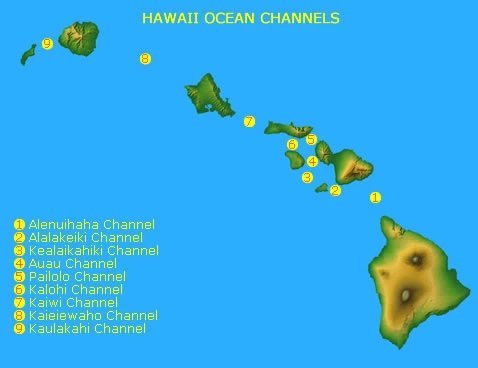
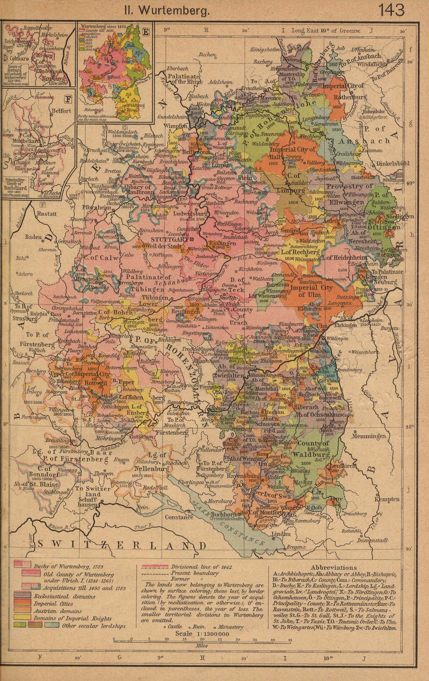
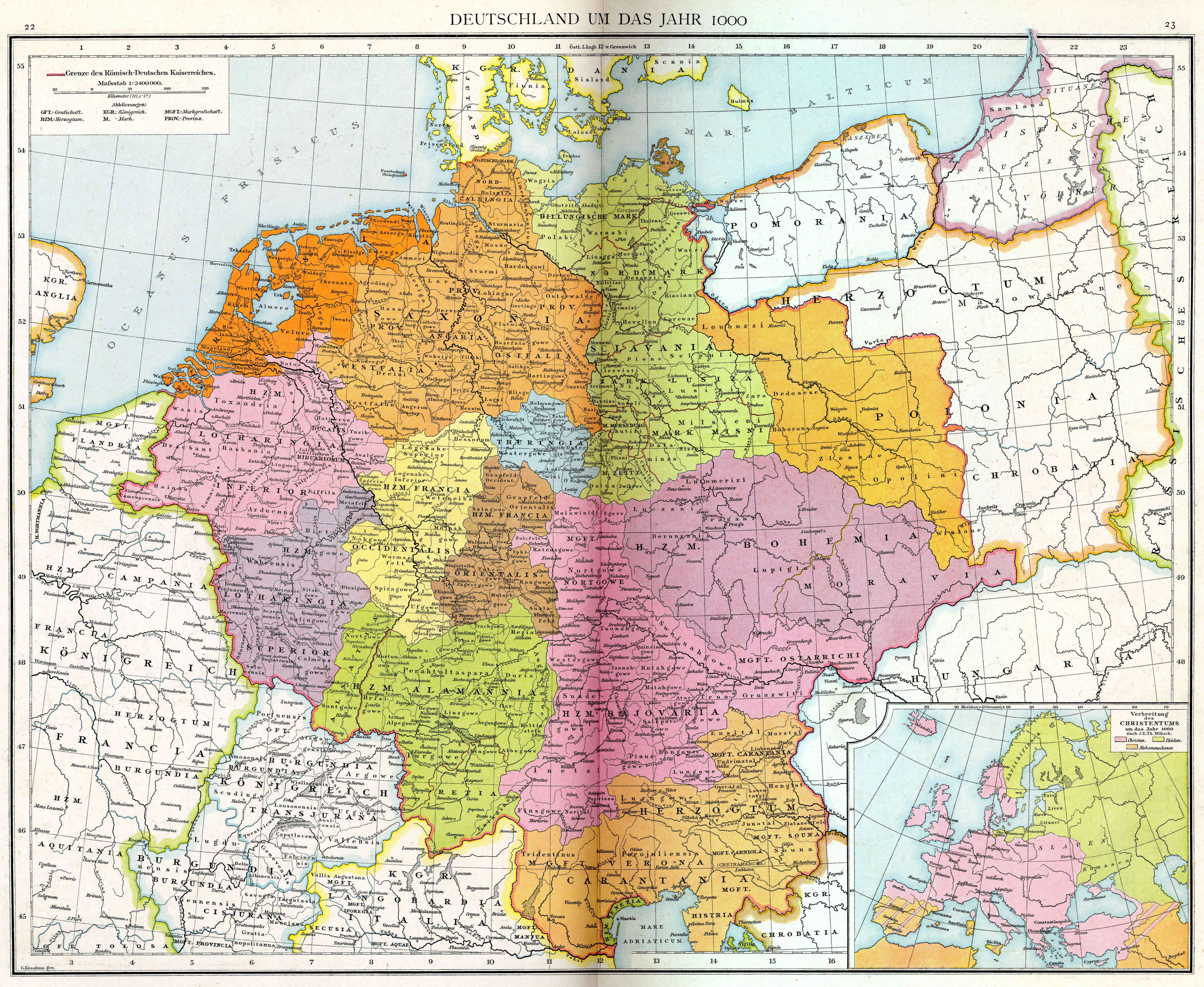
.svg)
- Article(s)
- en:Template:Location map Sri Lanka
- en:Module:Location map/data/Sri Lanka Northern Province
- (more modules to be created)
- Request
- Replace the topography detail of the existing relief map (2nd file), with that of the more accurate and detailed NASA map (3rd file). (recolouring will be needed)
- Sharpen the provincial and district borders with those as shown on
files 4 and 5file 6. These two files are samples only, and are to be deleted. - Fix borders on the relief map (top area - 2nd file).
- Make provincial borders thicker than district borders.
- Remove the two rivers and reservoirs from the first two maps (see also), and
- If needed, you may visit this page to test the accuracy of the country's borders. The placemark's coordinates are very accurate (taken from Google Earth), and shows the extreme ends of the country. Thanks! Rehman 05:33, 25 March 2016 (UTC)
- Graphist opinion(s)
Sri Lanka adm location map.svg and Sri Lanka rel location map.svg are available now. NNW 21:20, 18 May 2016 (UTC)
- Thank you, NNW! Looks great! Just a few changes, would you be able to remove all the rivers and waterbodies from both new maps, and make the 2nd level (district) borders more lighter (lighter grey)? And instead of just trashing the river details which I just mentioned, would you be able to upload it to a completely new svg file using the topographic background, and including only rivers and 1st level/province borders, but no waterbodies. This will be very useful for the river articles which I am currently working on. Thank you so much for your help. Cheers, Rehman 01:30, 21 May 2016 (UTC)
- Deleting all lakes? Some rivers flow through lakes. Sri Lanka adm location map.svg and Sri Lanka rel location map.svg are showing only 1st level borders now, Sri Lanka adm-2 location map.svg and Sri Lanka rel-2 location map.svg 2nd level borders, too, with these borders with a thiner line. All these maps are part of a set of maps which all have to look the same. I can upload further files but they won't have file names related to location maps but you can use them as alternative maps for the template maps. NNW 16:58, 23 May 2016 (UTC)
@NNW: Sorry for the late reply. Please ignore my previous comment. Instead, would you be able to replace File:Sri Lanka location map.svg with File:Sri Lanka adm-2 location map.svg, but removing all the rivers while retaining the water bodies? This is because the current default map:
- does not have the waterbodies marked properly
- has no distinction between provinces and district borders
- and has less sharper borders when compared to the map you created.
Removal of rivers is because:
- the current map doesn't have rivers
- not all rivers are mapped
- having rivers will confuse viewers for borders, and looks too cluttered as well.
Similarly, the same applies to the relief maps (File:Sri Lanka relief location map.jpg and File:Sri Lanka rel location map.svg), but to add district borders as well. Please let me know if this is possible. Thank you, Rehman 14:00, 7 July 2016 (UTC)
- This section was archived on a request by: Yann (talk) 20:06, 5 July 2018 (UTC)
Sri Lankan province and district location maps
Article(s): Numerous Sri Lankan articles
- Request
- Currently only two of the nine provinces and one of the twenty five districts have location maps. It would be great if the remainder also had location maps. I appreciate this is a big ask but anything would be appreciated.--Obi2canibe (talk) 12:24, 8 September 2016 (UTC)
- Graphist opinion(s)
- Non-graphist comment: The same outcome is requested in part of the #Location maps of Sri Lanka section above. Rehman 13:10, 8 September 2016 (UTC)
- That request relates to island wide maps - my request is for province/district specific maps.--Obi2canibe (talk) 13:14, 8 September 2016 (UTC)
- Obi2canibe and Rehman This may not answer all your map needs but there is now a way of using and annotating Open Street Maps, which can provide a different way of showing map data without each map having to be made specially. It won't integrate into info-boxes and uses a template at en:template:OSM Location map which might need porting across to non-en wiki's. But as an example, I have added a map at en:Sabaragamuwa Province to show an example of what is possible. It could also be used to add red locator dots etc to show specific features. (Unfortunately the Open Street Map version available does not currently show Sri Lanka district boundaries}. RobinLeicester (talk) 21:31, 2 January 2017 (UTC)
- Thanks RobinLeicester, that's great news! Rehman 14:52, 3 January 2017 (UTC)
- This section was archived on a request by: Yann (talk) 20:06, 5 July 2018 (UTC)
Browser Market Map
Article(s): en:Usage share of web browsers
- Request
- May you please do an updated map from Statcounter data? The July 2016 file is corrupt.--Kopiersperre (talk) 15:19, 9 November 2016 (UTC)
- Graphist opinion(s)
@Kopiersperre: Do you want a new map for July 2016?
The time span you linked to say something different and other type of map. Is this what you want gs.statcounter.com please ping me, thanks. --Goran tek-en (talk) 14:49, 29 January 2018 (UTC)
- This section was archived on a request by: --Goran tek-en (talk) 17:25, 16 March 2019 (UTC) Stale