Category:Utah State Route 35
Jump to navigation
Jump to search
 | number: | (thirty-five) |
|---|---|---|
| State highways in Utah: | 15 · 16 · 17 · 18 · 19 · 20 · 21 · 22 · 23 · 24 · 25 · 26 · 27 · 28 · 29 · 30 · 31 · 32 · 33 · 34 · 35 · 36 · 37 · 38 · 39 · 40 · 41 · 42 · 43 · 44 · 45 · 46 · 47 · 48 · 49 · 50 · 51 · 52 · 53 · 54 · 55 |
state highway in Summit, Wasatch, and Duchesne counties in Utah, United States | |||||
| Upload media | |||||
| Instance of | |||||
|---|---|---|---|---|---|
| Located in protected area |
| ||||
| Location |
| ||||
| Transport network | |||||
| Connects with | |||||
| Owned by |
| ||||
| Maintained by |
| ||||
| Inception |
| ||||
| Length |
| ||||
| Terminus |
| ||||
 | |||||
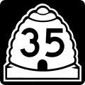
English: Media related to Utah State Route 35 (SR-35), a 61.8662-mile (99.5640 km) state highway in Summit, Wasatch, and Duchesne counties in Utah, United States, that connects Utah State Route 32 in Francis with Utah State Route 87 in Duchesne County (north of Duchesne).
Until 1969 the northern terminus of SR-35 was at Utah State Route 2 (later also designated Interstate 80) in Wanship.
Until 1969 the northern terminus of SR-35 was at Utah State Route 2 (later also designated Interstate 80) in Wanship.
Subcategories
This category has the following 4 subcategories, out of 4 total.
Media in category "Utah State Route 35"
The following 2 files are in this category, out of 2 total.
-
 Utah 35.svg 600 × 600; 12 KB
-
 Utah SR 35.svg 385 × 385; 9 KB
