Category:Utah State Route 87
Jump to navigation
Jump to search
 | number: | (eighty-seven) |
|---|---|---|
| State highways in Utah: | 67 · 68 · 69 · 70 · 71 · 72 · 73 · 74 · 75 · 76 · 77 · 78 · 79 · 80 · 81 · 82 · 83 · 84 · 85 · 86 · 87 · 88 · 89 · 90 · 91 · 92 · 93 · 94 · 95 · 96 · 97 · 98 · 99 · 100 · 101 · 102 · 103 · 104 · 105 · 106 · 107 |
state highway in Duchesne County, Utah, United States  | |||||
| Upload media | |||||
| Instance of | |||||
|---|---|---|---|---|---|
| Location | Uintah and Ouray Indian Reservation, Uintah County, Utah | ||||
| Transport network | |||||
| Owned by | |||||
| Maintained by | |||||
| Inception |
| ||||
| Length |
| ||||
| Terminus | |||||
| |||||
English: Media related to Utah State Route 87, a 38.159-mile (61.411 km) state highway in central Duchesne County, Utah, United States, that connects U.S. Route 40/U.S. Route 191 (US‑40/US‑191) in Duchesne with US‑40/US‑191 southwest of Roosevelt, forming a northern loop off of US‑40/US‑191 by way of Altamont.
Subcategories
This category has only the following subcategory.
Media in category "Utah State Route 87"
The following 4 files are in this category, out of 4 total.
-
 Looking south on Utah State Route 87 in Upalco, Utah Dec 2008.jpg 3,264 × 2,448; 2.08 MB
-
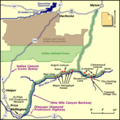 NineMileCanyon map.png 400 × 400; 28 KB
-
 Utah 87.svg 600 × 600; 12 KB
-
 Utah SR 87.svg 385 × 385; 9 KB

