Category:SVG maps of India
Jump to navigation
Jump to search
Countries of Asia: Afghanistan · Armenia‡ · Azerbaijan‡ · Bahrain · Bangladesh · Bhutan · Brunei · Cambodia · People's Republic of China · Cyprus‡ · East Timor · Egypt‡ · Georgia‡ · India · Indonesia‡ · Iran · Iraq · Israel · Japan · Jordan · Kazakhstan‡ · Kuwait · Kyrgyzstan · Laos · Lebanon · Malaysia · Maldives · Mongolia · Myanmar · Nepal · North Korea · Oman · Pakistan · Philippines · Qatar · Russia‡ · Saudi Arabia · Singapore · South Korea · Sri Lanka · Syria · Tajikistan · Thailand · Turkey‡ · Turkmenistan · United Arab Emirates · Uzbekistan · Vietnam · Yemen
Limited recognition: Abkhazia‡ · Taiwan · State of Palestine · South Ossetia‡ – Other territories: Macau
‡: partly located in Asia
Limited recognition: Abkhazia‡ · Taiwan · State of Palestine · South Ossetia‡ – Other territories: Macau
‡: partly located in Asia
| NO WIKIDATA ID FOUND! Search for SVG maps of India on Wikidata | |
| Upload media |

States of India: Andhra Pradesh · Arunachal Pradesh · Assam · Bihar · Chhattisgarh · Goa · Gujarat · Haryana · Himachal Pradesh · Jharkhand · Karnataka · Kerala · Madhya Pradesh · Maharashtra · Manipur · Meghalaya · Mizoram · Nagaland · Odisha · Punjab · Rajasthan · Sikkim · Tamil Nadu · Telangana · Tripura · Uttar Pradesh · Uttarakhand · West Bengal
Union territories: Andaman and Nicobar Islands · Chandigarh · Dadra and Nagar Haveli and Daman and Diu · Delhi · Jammu and Kashmir · Ladakh · Lakshadweep · Puducherry
Former states of India: Jammu and Kashmir ·
Former union territories:
Union territories: Andaman and Nicobar Islands · Chandigarh · Dadra and Nagar Haveli and Daman and Diu · Delhi · Jammu and Kashmir · Ladakh · Lakshadweep · Puducherry
Former states of India: Jammu and Kashmir ·
Former union territories:
Subcategories
This category has the following 16 subcategories, out of 16 total.
!
*
- SVG maps of the history of India (63 F)
B
- SVG blank maps of India (11 F)
E
F
- SVG flag maps of India (8 F)
L
- SVG linguistic maps of India (37 F)
N
P
S
T
- SVG transport maps of India (18 F)
Media in category "SVG maps of India"
The following 64 files are in this category, out of 64 total.
-

-
 Andaman and Nicobar Islands Wikivoyage map.svg 550 × 750; 384 KB
-
 Baiga distribution.svg 1,500 × 1,615; 3.14 MB
-
 Bharat (India) Map with Full Kashmir By Devilal.svg 512 × 509; 52 KB
-
 BIMARU.svg 1,643 × 1,856; 837 KB
-
 Distribution map of horse breeds in India.svg 1,519 × 1,773; 321 KB
-
 Főbb indiai helynevek.svg 1,639 × 1,852; 368 KB
-
 Ganesh Chaturthi in India.svg 1,643 × 1,856; 838 KB
-
 GST Ratification.svg 1,476 × 1,680; 227 KB
-
 Hindu temples map.svg 1,639 × 1,852; 374 KB
-
 India annual rainfall map en.svg 1,639 × 1,852; 338 KB
-
 India annual rainfall map.svg 1,639 × 1,852; 268 KB
-
 India average annual temperature map es.svg 1,639 × 1,852; 380 KB
-
 India COVID-19 confirmed cases scheme A.svg 512 × 583; 404 KB
-
 India cow slaughter map.svg 1,500 × 1,615; 1.37 MB
-
 India disputed w1 countrymap.svg 1,000 × 1,000; 57 KB
-
 India flood zone map-de.svg 827 × 938; 419 KB
-
 India flood zone map.svg 1,639 × 1,852; 383 KB
-
 India literacy rate map de.svg 825 × 929; 878 KB
-
 India Map Protection.svg 1,594 × 1,868; 225 KB
-
 India southwest summer monsoon onset map-es.svg 1,639 × 1,852; 566 KB
-
 India southwest summer monsoon onset map-fr.svg 1,639 × 1,852; 621 KB
-
 India urbanization rate map.svg 1,500 × 1,615; 1.39 MB
-
 India VOA New.svg 512 × 583; 158 KB
-
 India wind zone map en.svg 1,639 × 1,852; 349 KB
-
 India wind zone map.svg 1,639 × 1,852; 266 KB
-
 Indian bases worldwide.svg 863 × 443; 1.21 MB
-
 Indian WhatsApp Lynchings (July 2018).svg 1,643 × 1,856; 849 KB
-
 Indian world contour.svg 300 × 290; 50 KB
-
 Indianrailwayzones-numbered-bn.svg 500 × 563; 98 KB
-
 Indianrailwayzones-numbered.svg 500 × 563; 96 KB
-
 Indien physisch-politische Karte.svg 1,408 × 1,712; 4.77 MB
-
 Islam in India (2011).svg 1,643 × 1,856; 257 KB
-
 Jungle-Book-locator-map.svg 1,486 × 1,734; 340 KB
-
 Ka-endemicdistrictIndia.svg 1,643 × 1,856; 820 KB
-
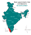 Kerala Flood Relief States.svg 1,594 × 1,772; 310 KB
-
 Koppen-Geiger Map IND present.svg 1,361 × 850; 2.11 MB
-
 Languages of Odisha.svg 512 × 362; 2.52 MB
-
 LocationIndia.svg 1,000 × 500; 2.52 MB
-
 Map of Yogini Temples in India.svg 1,293 × 1,420; 296 KB
-
 Naval bases of India as.svg 1,486 × 1,734; 460 KB
-
 Naval bases of India-gu.svg 1,486 × 1,734; 325 KB
-
 Naval bases of India-hi.svg 1,486 × 1,734; 459 KB
-
 Naval bases of India-kn.svg 1,557 × 1,838; 371 KB
-
 Naval bases of India-mr.svg 1,486 × 1,734; 481 KB
-
 Naval bases of India-pa.svg 1,486 × 1,734; 459 KB
-
 Naval bases of India-te.svg 1,486 × 1,734; 460 KB
-
 Naval bases of India.svg 1,486 × 1,734; 557 KB
-
 Naxal Left-wing violence or activity affected districts of India 2018.svg 1,649 × 1,858; 772 KB
-
 Religion in India.svg 1,440 × 1,685; 1.07 MB
-
 SITE-map-locations.svg 1,486 × 1,734; 450 KB
-
 Sivallik Hills map.svg 3,099 × 2,868; 6.99 MB
-
 South Asia Rivers.svg 1,639 × 1,852; 581 KB
-
 South India altitudes-opt.svg 800 × 807; 2.08 MB
-
 South Indian territories de.svg 693 × 748; 697 KB
-
 South Indian territories.svg 672 × 746; 306 KB
-
 States of India (Survey of India).svg 794 × 1,123; 603 KB
-
 Stroke-dasharray chromium bug full.svg 500 × 492; 4.26 MB
-
 Support for NSG India.svg 2,560 × 1,314; 1.21 MB
-
 Support for UNSC India.svg 2,560 × 1,314; 1.21 MB
-
 Territorial waters - India.svg 800 × 400; 528 KB
-
 Vice-Presidents of India (by state of birth).svg 1,180 × 1,398; 445 KB
-
 Visa Policy of India - New.svg 2,756 × 1,399; 814 KB
-
 কেরল বন্যা ত্রাণকার্যে অবদান রাখা রাজ্যসমূহ.svg 1,594 × 1,772; 581 KB


_Map_with_Full_Kashmir_By_Devilal.svg)


.svg)


.svg)


.svg)


.svg)

