Category:SVG topographic maps of India
Jump to navigation
Jump to search
Countries of Asia: Afghanistan · Armenia‡ · Azerbaijan‡ · Bangladesh · Bhutan · Brunei Darussalam · Cambodia · People's Republic of China · Cyprus‡ · East Timor · Egypt‡ · Georgia‡ · India · Indonesia‡ · Iran · Iraq · Israel · Japan · Jordan · Kazakhstan‡ · Kuwait · Kyrgyzstan · Laos · Lebanon · Malaysia · Mongolia · Myanmar · Nepal · North Korea · Oman · Pakistan · Philippines · Qatar · Russia‡ · Saudi Arabia · Singapore · South Korea · Sri Lanka · Syria · Tajikistan · Thailand · Turkey‡ · Turkmenistan · Uzbekistan · Vietnam · Yemen
‡: partly located in Asia
‡: partly located in Asia
Subcategories
This category has only the following subcategory.
Media in category "SVG topographic maps of India"
The following 13 files are in this category, out of 13 total.
-
 Geografie Indiens-2.svg 750 × 808; 2.77 MB
-
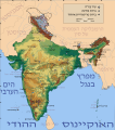 India physical map he.svg 1,639 × 1,852; 1.47 MB
-
 India physical map-es.svg 1,639 × 1,852; 992 KB
-
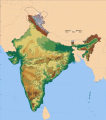 India physical map.svg 1,639 × 1,852; 884 KB
-
 India topographic map (2015.05.15).svg 800 × 887; 6.58 MB
-
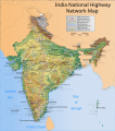 India topographical roadway map.svg 1,639 × 1,852; 1.62 MB
-
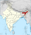 India, Assam locator map (2015).svg 600 × 666; 6.94 MB
-
 India, Mizoram locator map (2015.04.21).svg 600 × 666; 7.81 MB
-
 India, Uttar Pradesh locator map (2015).svg 600 × 666; 7.8 MB
-
 Krishna River basin map.svg 591 × 510; 5.12 MB
-
 Salween River basin map.svg 317 × 518; 12.94 MB
-
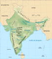
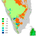 South India altitudes-opt.svg 800 × 807; 2.08 MB
-
 South India altitudes.svg 800 × 807; 6 MB


.svg)

.svg)
.svg)
.svg)


