Category:English-language SVG maps of India
Jump to navigation
Jump to search
Countries of Asia: India
Media in category "English-language SVG maps of India"
The following 28 files are in this category, out of 28 total.
-
 2011 Census India population density map, states and union territories.svg 1,578 × 1,738; 863 KB
-

-
 2019 Lok Sabha Election Schedule.svg 1,350 × 1,545; 8.16 MB
-
 2024 Lok Sabha Election Schedule.svg 512 × 542; 17.7 MB
-
 35 India States and Union Territories GDP per capita on PPP basis in 2011.svg 1,578 × 1,738; 862 KB
-
 Andhra Pradesh districts map from 2 June 2014.svg 4,387 × 3,690; 218 KB
-
 Andhra Pradesh districts map.svg 2,716 × 2,531; 325 KB
-
 Autonomous divisions of India.svg 1,574 × 1,792; 539 KB
-
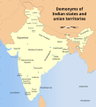 Demonyms of Indian states and union territories.svg 1,574 × 1,738; 982 KB
-
 India Assam COVID-19 Death map.svg 765 × 633; 769 KB
-
 India Assam COVID-19 map.svg 765 × 633; 771 KB
-
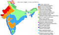
 India climatic zone map en.svg 1,639 × 1,852; 354 KB
-
 India map of Köppen climate classification.svg 2,760 × 1,630; 498 KB
-
 India population density map en.svg 1,639 × 1,852; 1.23 MB
-
 India, Mizoram locator map (2015.04.21).svg 600 × 666; 7.81 MB
-
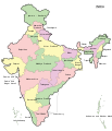 India-map-en.svg 1,519 × 1,773; 277 KB
-
 Karnataka 1956 Reorg.svg 693 × 748; 712 KB
-
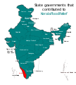 Kerala Flood Relief States.svg 1,594 × 1,772; 310 KB
-
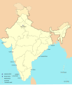 Naval bases of India.svg 1,486 × 1,734; 557 KB
-
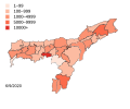
 Percentage of Muslim population in West Bengal.svg 512 × 534; 461 KB
-
 Proposed states and union territories of India.svg 1,643 × 1,856; 805 KB
-
 Punjab 2012 administrativ.svg 900 × 600; 259 KB
-
 Punjab map.svg 955 × 585; 57 KB
-
 South India altitudes.svg 800 × 807; 6 MB
-
 Tehsils of Sri Ganganagar District, Rajasthan, India.svg 3,822 × 3,820; 128 KB
-
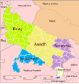 Up-subregions2.svg 2,400 × 2,515; 242 KB
-
 UttarakhandDistricts numbered.svg 1,250 × 1,125; 145 KB
-
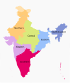 Zonal Councils.svg 1,594 × 1,868; 226 KB


.svg)


