Category:Population density maps of Germany
Jump to navigation
Jump to search
Countries of Europe: Albania · Austria · Belarus · Belgium · Bulgaria · Croatia · Cyprus‡ · Czech Republic · Denmark · Estonia · Finland · France‡ · Georgia‡ · Germany · Greece · Hungary · Iceland · Republic of Ireland · Italy · Kazakhstan‡ · Latvia · Lithuania · Luxembourg · Moldova · Netherlands‡ · North Macedonia · Norway · Poland · Portugal‡ · Romania · Russia‡ · Serbia · Slovakia · Slovenia · Spain‡ · Sweden · Switzerland · Turkey‡ · Ukraine · United Kingdom
‡: partly located in Europe
‡: partly located in Europe
Media in category "Population density maps of Germany"
The following 63 files are in this category, out of 63 total.
-
 1 IÖR-Monitor Einwohnerzahl 2011 Raster 1000 m .png 1,527 × 1,672; 340 KB
-
 1944 Germany Population (30249096763).jpg 2,433 × 3,120; 901 KB
-
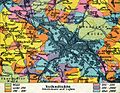
 52 of 'Neumanns Orts-Lexikon des Deutschen Reichs' (11226801986).jpg 1,684 × 2,725; 1.34 MB
-
 53 of 'Neumanns Orts-Lexikon des Deutschen Reichs' (11226166424).jpg 1,756 × 2,725; 841 KB
-
 56 of Longmans' Junior School Geography, etc. (11214144254).jpg 2,704 × 2,001; 1.75 MB
-
 Berlin Bevölkerungsdichte 2002.png 1,325 × 853; 259 KB
-
 Bevoelkerungsdichte OVP.png 299 × 299; 7 KB
-
 Bevölkerungsdichte 2019 mit Legende.svg 946 × 1,253; 862 KB
-
 Bevölkerungsdichte 2019.svg 946 × 1,253; 855 KB
-
 Bevölkerungsdichte deutscher Landkreise und kreisfreier Städte in Einwohner km².png 6,300 × 6,999; 4.63 MB
-
 Bevölkerungsdichte Deutschland 2020.svg 946 × 1,253; 696 KB
-
 Bevölkerungsdichte Deutschland.png 645 × 721; 334 KB
-
 Bevölkerungsdichte Landkreise.PNG 1,350 × 2,000; 531 KB
-
 Braunschweig, Bevölkerungsdichte.png 350 × 430; 68 KB
-
 Cities in Europe Central.png 1,344 × 743; 65 KB
-
 Deutsches Reich Bevölkerungsdichte.jpg 2,388 × 1,862; 1.59 MB
-
 Deutschland Metropolregion-6.png 668 × 910; 45 KB
-
 Deutschland Metropolregion-7.png 668 × 910; 71 KB
-
 Dresden population by km².svg 799 × 689; 1.46 MB
-
 Einwohnerdichte Deutschland.png 3,352 × 4,816; 1.43 MB
-
 Bevölkerungsdichte Erfurt.PNG 1,032 × 916; 54 KB
-
 Erfurt-Bevölkerungsdichte.png 2,000 × 2,000; 453 KB
-
 Gemeinden Thüringen Bevölkerungsdichte.png 3,480 × 2,920; 407 KB
-
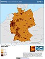 Germany Population Density, 2000 (5457619172).jpg 2,502 × 3,265; 694 KB
-
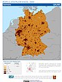 Germany Population Density, 2000 (6171906651).jpg 2,390 × 3,161; 783 KB
-
 Geschlechterverteilung 18-29 2020.svg 946 × 1,253; 693 KB
-
 Geschlechterverteilung 30-39 2020.svg 946 × 1,253; 694 KB
-
 Geschlechterverteilung 30-39 Zensus 2011.png 2,000 × 2,655; 1.66 MB
-
 Geschlechterverteilung Zensus 2011.png 2,000 × 2,655; 1.65 MB
-
 IK Bevölkerungsdichte.PNG 1,298 × 1,606; 102 KB
-
 Karte Deutschland Städte über 50000 Einwohner.png 1,182 × 1,413; 1,013 KB
-
 Karte-des-kammerbezirks-mit-detaildaten-zu-gemeinden.png 1,220 × 1,384; 337 KB
-
 Landkreise Metropolregion Nürnberg Bevölkerungsdichte.svg 1,225 × 1,236; 161 KB
-
 Lange diercke sachsen deutschland dichte der bevoelkerung.jpg 1,248 × 1,054; 570 KB
-
 Lange diercke sachsen dresden volksdichte.jpg 1,272 × 988; 754 KB
-
 Lange diercke sachsen freistaat sachsen volksdichte.jpg 1,714 × 988; 660 KB
-
 Metropolregion Berlin-Brandenburg Einwohnerdichte.svg 1,189 × 1,192; 2.3 MB
-
 Meyers b4 s0812a.jpg 2,048 × 1,728; 573 KB
-
 Landkreise Metropolregion Nürnberg Bevölkerungsdichte Zoom.svg 663 × 1,000; 130 KB
-
 Pop density of Germany blank.png 817 × 1,019; 64 KB
-
 Pop density of Germany-zh-hant.png 817 × 1,019; 103 KB
-
 Pop density of Germany.png 817 × 1,019; 69 KB
-
 Population density in Germany by district, 1925.svg 1,512 × 1,179; 4.32 MB
-
 Population density in Germany.png 1,400 × 1,800; 483 KB
-
 Population density of Germany 2019-es.svg 946 × 1,253; 863 KB
-
 Population density of Germany 2019-fr.svg 946 × 1,253; 863 KB
-
 Population density of Germany 2019-hu.svg 946 × 1,253; 862 KB
-
 Population density of Germany 2019-it.svg 946 × 1,253; 863 KB
-
 Population density of Germany 2019-pl.svg 946 × 1,253; 862 KB
-
 Population density of Germany 2019-pt.svg 946 × 1,253; 862 KB
-
 Population density of Germany 2019-ro.svg 946 × 1,253; 862 KB
-
 Population density of Germany 2019-ru.svg 946 × 1,253; 863 KB
-
 Population density of Germany 2019-tr.svg 946 × 1,253; 862 KB
-
 Population density of Germany 2019-ua.jpg 1,280 × 1,694; 812 KB
-
 Population density of Germany 2019-zh.svg 946 × 1,253; 862 KB
-
 Population density of Germany 2019.svg 946 × 1,253; 862 KB
-
 Population density of Germany by municipality-de.svg 562 × 732; 6.79 MB
-
 Population density of Germany by municipality.svg 562 × 732; 7.47 MB
-
 Population density of Germany states.png 3,870 × 4,669; 740 KB
-
 SiedlungsstrukturelleRaumtypen1996.png 1,669 × 1,157; 628 KB
-

-
 XkDE-BW bevdichte 2007-EMR-Stuttgart-o.svg 1,594 × 1,793; 1.6 MB
-
 XkDE-BW bevdichte 2007.svg 1,594 × 1,793; 1.49 MB

.jpg)
.jpg)
.jpg)
.jpg)


.jpg)
.jpg)


