Category:Near East Side (Columbus, Ohio)
Jump to navigation
Jump to search
human settlement in Columbus, Ohio, United States of America | |||||
| Upload media | |||||
| Instance of | |||||
|---|---|---|---|---|---|
| Location | Columbus, Franklin County, Ohio | ||||
 | |||||
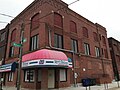
The Near East Side is an area made up several historic neighborhoods on the eastside. Some neighborhoods making up the area include: Mount Vernon, Nelson Park, Eastgate, Beatty Park, Bexley (annexed), Olde Towne East, Old Oaks, Driving Park, and Bryden Road. Today it is bordered by the Contrail railway on the north, Alum Creek on the east, Interstate 70 and Livingston Avenue on the south, and Interstate 71 on the west. It is bisected by Main Street, also known as the National Road.
Subcategories
This category has the following 10 subcategories, out of 10 total.
Media in category "Near East Side (Columbus, Ohio)"
The following 4 files are in this category, out of 4 total.
-
 Columbus - 1233 E. Main (OHPTC).jpg 2,016 × 1,512; 891 KB
-
 E.O. Snyder Grocer.jpg 1,875 × 1,406; 559 KB
-
 Frederick A. Miller House-Broad Gables.JPG 2,544 × 1,696; 1.65 MB
-
 Wolfe Park suspension bridge, Columbus, OH.jpg 4,000 × 2,250; 4.72 MB
.jpg)


