Category:Old Oaks (Columbus, Ohio)
Jump to navigation
Jump to search
human settlement in Columbus, Ohio, United States of America  | |||||
| Upload media | |||||
| Instance of | |||||
|---|---|---|---|---|---|
| Location | Columbus, Franklin County, Ohio | ||||
 | |||||
Old Oaks is a historic district that is located just east of Downtown Columbus. The neighborhood is bounded on the north by Mooberry Street, on the east by the homes on Kimball Place, on the south by Livingston Avenue, and on the west by the homes on Ohio Avenue.
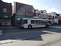
It neighbors many notable areas including Livingston Park, Bryden Road Historic District and Driving Park, all with the common thread of the notable Livingston Avenue Corridor which was part of one of Columbus' first street car suburbs.
Architecture styles include American Four-Squares in Mission and Neoclassical Revival styles, as well as Modified Queen Anne’s.
Subcategories
This category has only the following subcategory.
Media in category "Old Oaks (Columbus, Ohio)"
The following 7 files are in this category, out of 7 total.
-
 Chic harley.jpeg 4,000 × 3,000; 9.86 MB
-
 Cota livingston avenue.jpeg 4,000 × 3,000; 4.89 MB
-
 Old oaks home.jpeg 2,636 × 2,246; 2.14 MB
-
 OOave.jpg 1,232 × 1,632; 547 KB
-
 OOhouse.jpg 1,632 × 1,232; 460 KB
-
 OOohio.jpg 1,232 × 1,632; 389 KB
-
 Welcome to Old Oaks Historic District.JPG 3,264 × 2,448; 3.63 MB


