Category:Maps showing 1956
Jump to navigation
Jump to search
| ← 1950 1951 1952 1953 1954 1955 1956 1957 1958 1959→ |
English: Maps showing the year 1956 (i.e. history maps)
See also category: 1956 maps. and 1950s maps for old maps created in this time.
See also category: 1956 maps. and 1950s maps for old maps created in this time.
Subcategories
This category has only the following subcategory.
Media in category "Maps showing 1956"
The following 3 files are in this category, out of 3 total.
-
 Pirin 1956.png 1,024 × 768; 172 KB
-
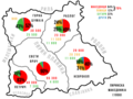
 Pirin Macedonians in 1956 census.jpg 741 × 556; 86 KB
-
 מבצע קדש- מפה.jpg 250 × 310; 74 KB


